


- Brief description
-
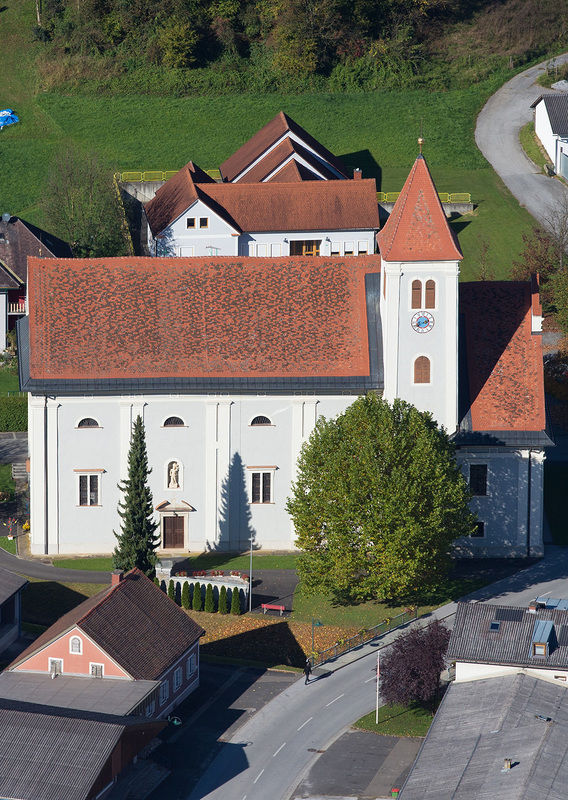
The Salvator Mundi Circuit Breitenfeld is the most important devotional and faith path in the region.
- Difficulty
-
medium
- Rating
-
- Starting point
-
Dorfplatz (Ortsmitte) bei Pfarrkirche Breitenfeld
- Route
-
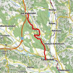
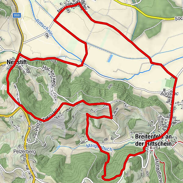
Breitenfeld an der RittscheinPfarrkirche zum Heiland0.0 kmBuschenschank Raidl3.2 kmKlausberg3.2 kmHöherberg3.8 kmNeustift5.0 kmSankt Kind7.4 kmBreitenfeld an der Rittschein10.2 kmPfarrkirche zum Heiland10.3 km
- Best season
-
JanFebMarAprMayJunJulAugSepOctNovDec
- Description
-
Salvator Mundi is the patron saint of the magnificent pilgrimage church and means Savior of the World. The size of the church alone suggests that it has an impact beyond the village of Breitenfeld, and the opulent Baroque furnishings confirm the importance of the pilgrimage church. Already after the plague in 1634, a chapel was built at the plague cemetery, which was expanded into a large pilgrimage church after the second wave of the plague in 1681. The altarpiece of the "Salvator Mundi" by Simon Echter is still from the first chapel and was inserted in the new church in the magnificent high altar with the 12 apostles and the altar gallery typical for pilgrimage churches. Also noteworthy is the copper portal by Prof. Franz Weiß. This is the starting point for the circular route of the same name, which also includes a modern Way of the Cross with works by the artist Roswitha Dautermann as well as the 3-Chapel Path. The Breitenfeld Way of the Cross dates back to the early 18th century and is one of the most important devotional and religious paths in the region. On the Salvator Mundi circular route, the "Way of the Cross" as well as the "3-Chapels-Way" are also located in parallel.
- Directions
-
Das Kupferportal von Prof. Franz Weiß ist der Ausgangspunkt für den gleichnamigen Rundweg, der auch einen modernen Kreuzweg mit Werken der Künstlerin Roswitha Dautermann einbindet. Der Breitenfelder Kreuzweg stammt aus dem frühen 18. Jhdt. und ist einer der bedeutendsten Andachts- und Glaubenswege der Region. Mit der modernen Darstellung gelang eine Übersetzung der Leidensgeschichte Jesu in die heutige Zeit. An jeder Station ist eine ausführliche Beschreibung angebracht. Damit bietet der knapp einen Kilometer lange Weg die Möglichkeit der Auseinandersetzung mit dem eigenen Kreuz, es abzuladen und neue Lebenskraft zu schöpfen. Als Kreuzweg (Weg des Kreuzes, lateinisch via crucis) bezeichnet man einen der Via Dolorosa (schmerzensreiche Straße) in Jerusalem, dem Leidensweg Jesu Christi nachgebildeten Wallfahrtsweg wie auch eine Andachtsübung, bei der der Beter den einzelnen Stationen dieses Weges folgt. Seit der Zeit um 1600 wurden Kreuzwege mit vierzehn bebilderten Stationen errichtet.
Kurz der Landesstraße entlang geht es über einen Waldweg stetig bergab, bis man im Maigental auf die Straße links einbindet.Ab dort führt der Weg parallel zum 3-Kapellen-Weg (drei liebevoll gepflegte Kapellen säumen den Weg) hinauf auf den Höherberg und am Grat entlang eine Zeitlang mit tollen Aussichten Richtung. Über den malerischen Weinhügel führt der "Salvator-Mundi - Weg" hinunter nach Neustift, auf ebenen Wegen neben Äckern und Wiesen weist ein Stichweg zur Stieleiche (Quercus robur). Die Eiche hat einen Stammumfang von knapp 5 Meter, eine geschätzte Höhe von rund 25 Meter und der Kronendurchmesser beträgt durchschnittlich 20 Meter. Sie ist "nur" etwa 100 Jahre alt, der mächtige Wuchs erklärt sich durch die gute Wasser- und Nährstoffversorgung des Standortes. Diese hervorragende Einzelschöpfung der Natur ist wegen ihrer Schönheit und ihres besonderen Gepräges für das Landschaftsbild erhaltenswürdig und einer spirituellen Rast würdig. Ein Stück weiter erreicht man St. Kind. In der Filialkirche zum "Heiligen Andreas" sind zwei seltene Votivbilddarstellungen: "Die Kümmernis von St. Kind - die vom Kummer Befreiende". Seit der Mitte des 15. Jhdts. erzählen Heiligenlegenden von ihr, sie sei die zum Christentum bekehrte Tochter eines heidnischen Königs gewesen, die sich gegen die vom Vater erzwungene Heirat wehrte. Ihre inständigen Gebete um Verunstaltung wurden erhört: ihr wuchs ein Bart. Der erboste Vater ließ sie daraufhin ans Kreuz schlagen. Bevor sie dort starb, verkündete sie noch drei Tage lang ihren Glauben und bekehrte so viele zum Christentum, unter anderen ihren Vater, der reuevoll eine Gedächtniskirche errichtete und darin ein kostbar ausgestattetes Bildwerk aufstellen ließ. Vor dem Bilde geigte einst ein in Not geratener Spielmann, den die Heilige mit ihrem herab geworfenen kostbaren Schuh entlohnte. Der daraufhin des Diebstahls angeklagte Geiger bewies seine Unschuld, indem er erneut vor dem Bilde bittend, von der Heiligen den zweiten Schuh zugeworfen bekam. Ihr Gedenktag ist der 20. Juli. Weiter geht der Weg entlang der Gemeindestraße bis zur Sportanlage Breitenfeld. Von dort kommt man dem Gehweg entlang durch den Ort wieder zum Ausgangspunkt am Dorfplatz mit der wunderschönen Wallfahrtskirche zum Heiland der Welt (Salvator Mundi).
- Highest point
- 379 m
- Endpoint
-
Dorfplatz (Ortsmitte) bei Pfarrkirche Breitenfeld
- Height profile
-

- Equipment
-
Proper backpack packing makes many things easier: Pack heavy things first. The water bottle should always be within reach in a side pocket. All the things that are often needed, such as sunglasses, camera or hiking map, belong on top. An emergency kit, including blister plasters, belongs in every rucksack and it is always advisable to dress in layers.
- Safety instructions
-
Emergency call mountain rescue: 140
ambulance: 144
European emergency call: 112
firefighters: 122
police: 133Tips when reporting an emergency – Answer these six WH questions: What happened? How many people are injured? Where did the accident happen (are there GPS coordinates)? Who is reporting the incident (callback number)? When did the accident happen? What is the weather like at the site of the incident?
- Tips
-
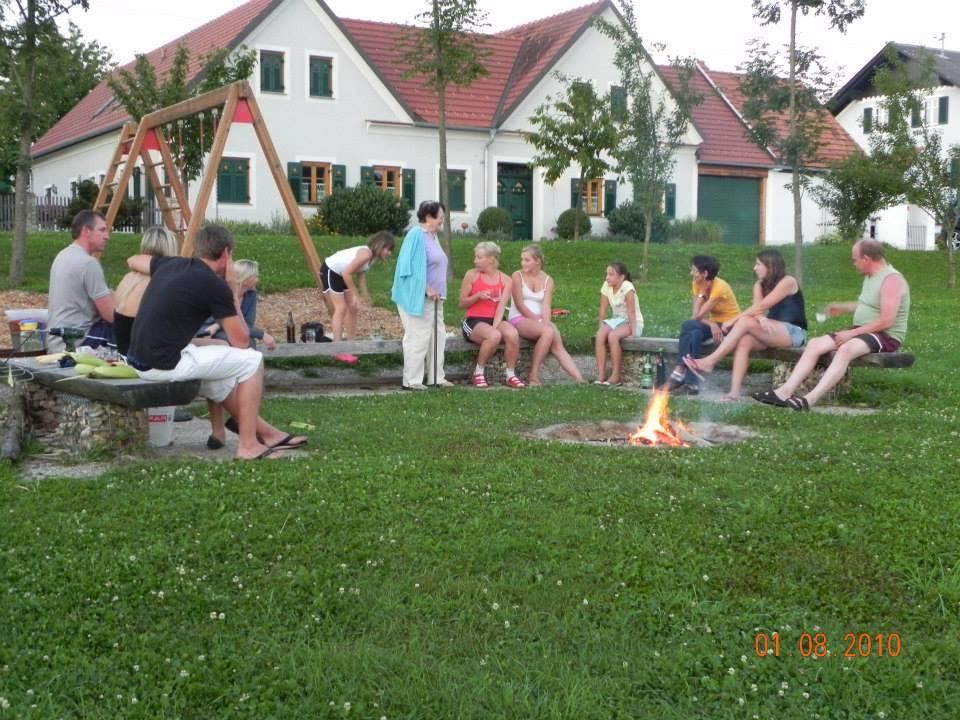
Stop at the various refreshment stops to recharge your batteries for the continuation.
- Additional information
- Directions
- Public transportation
-
Detailed information about arriving by ÖBB (Austrian Federal Railways) can be found at www.oebb.at or on the Verbundlinie Steiermark website www.busbahnbim.at
With Verbundlinie’s BusBahnBim route planner app, planning your journey has never been easier: simply enter towns and/or addresses, stop names or points of interest to check all bus, train and tram connections in Austria. The app is available free of charge for smartphones – on Google Play and in the App Store
- Parking
-
Parking available.


-

-
AuthorThe tour Round trip Salvator Mundi (Salvator Mundi Rundweg) Breitenfeld is used by outdooractive.com provided.


General info
-
Thermen- & Vulkanland
1324
-
Loipersdorf bei Fürstenfeld
463
-
Riegersburg
123