- Brief description
-
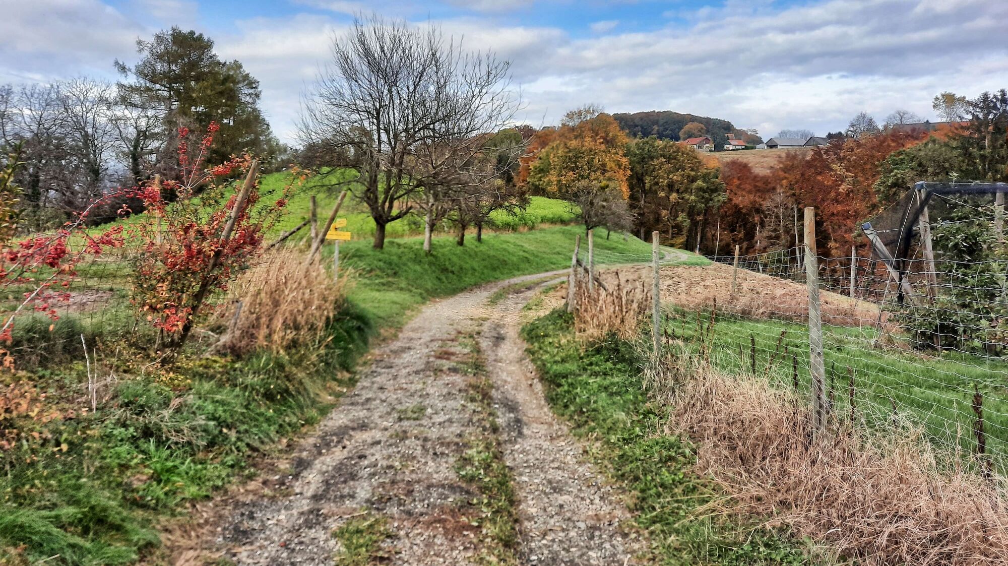
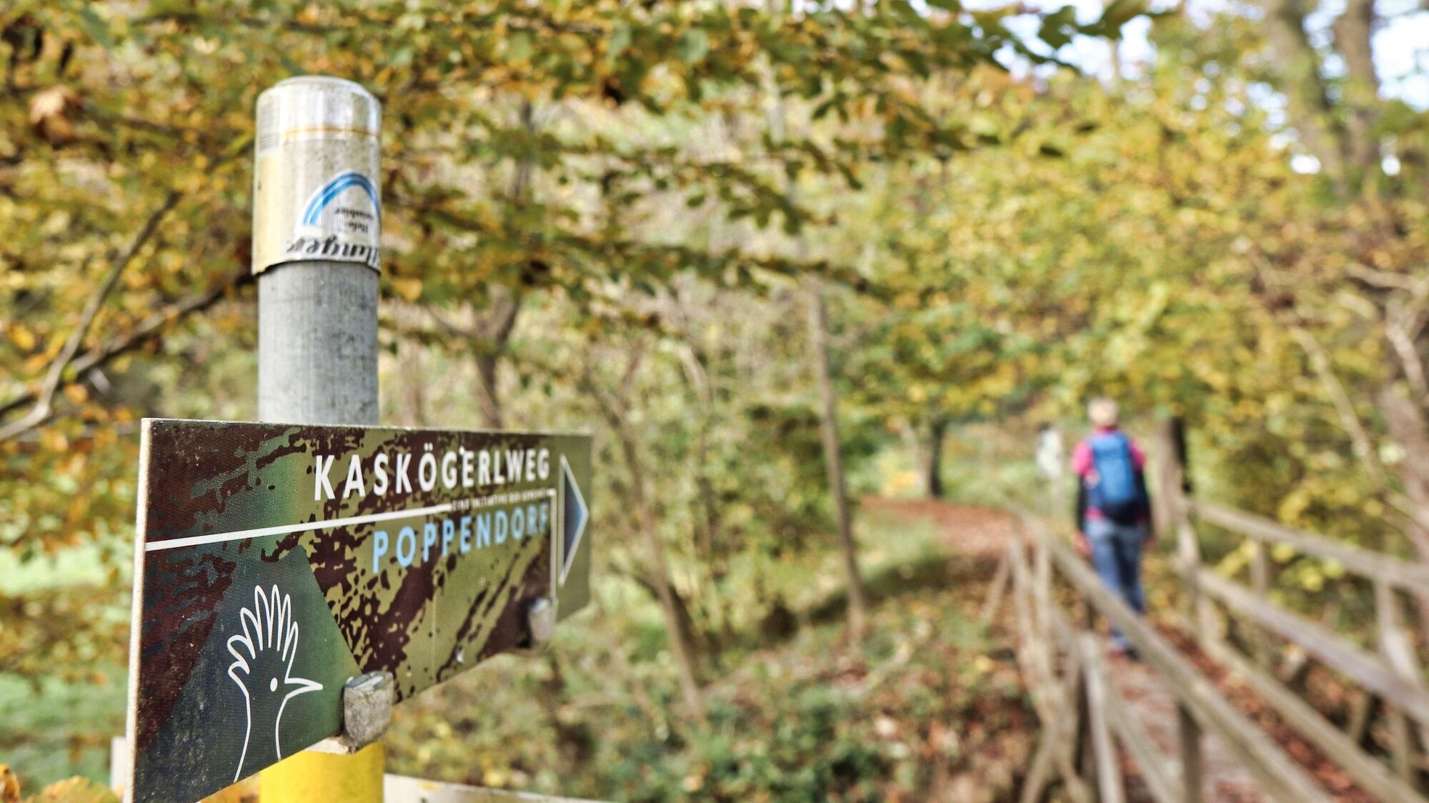
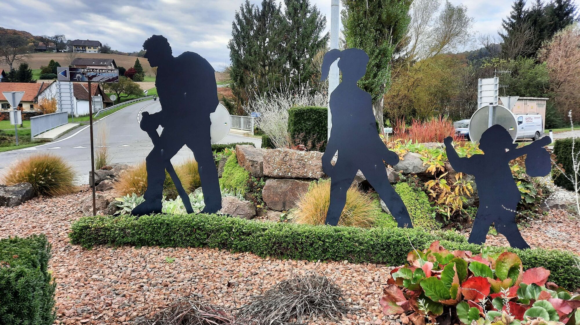
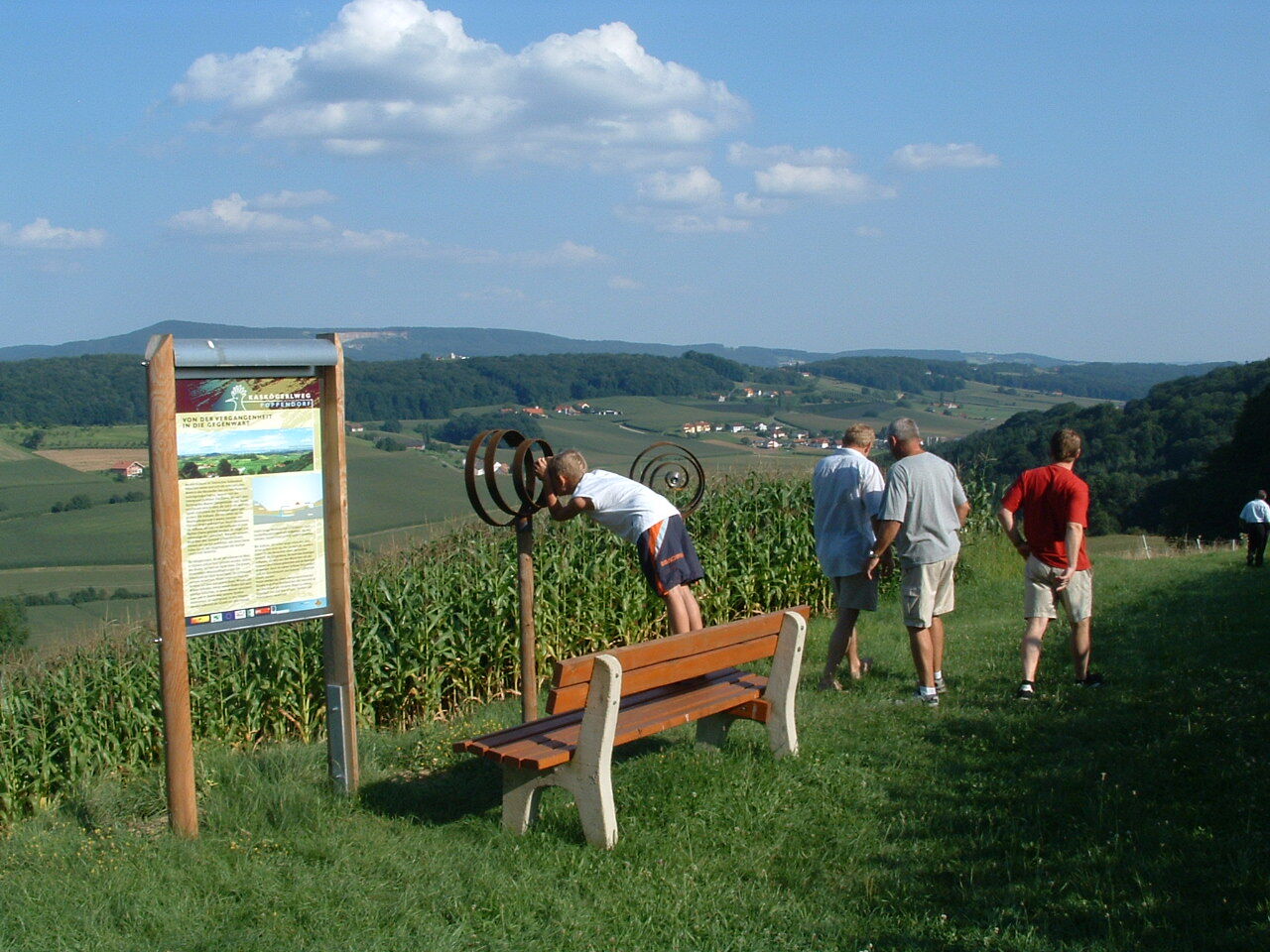
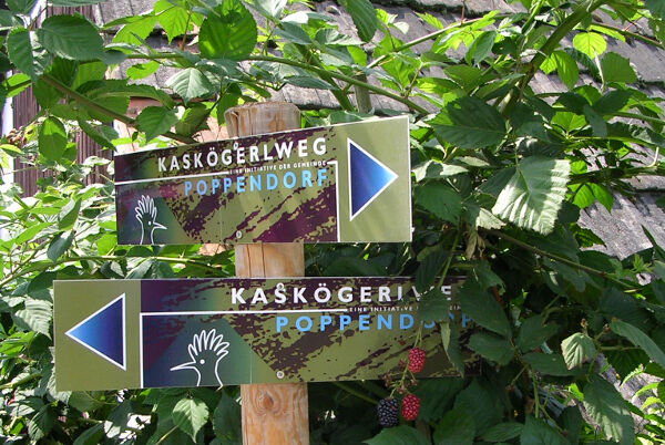
This well-marked hiking trail leads over rolling hills, beautiful forests and meadows, as well as through well-tended orchards - numerous information boards and rest stops invite you to linger.
- Difficulty
-
easy
- Rating
-
- Starting point
-
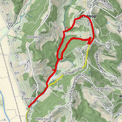
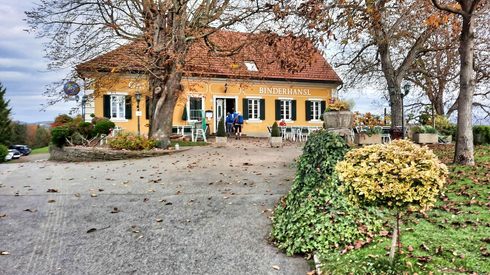
Parkplatz Gasthaus Binderhansl
- Route
-
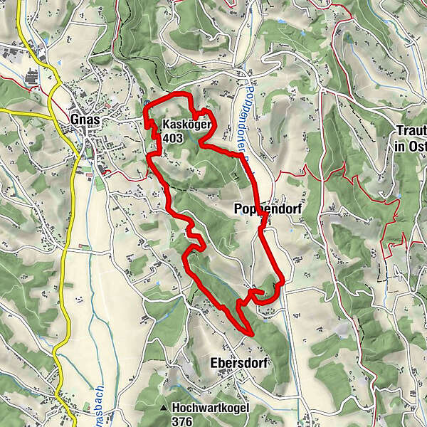
Binderhansl0.1 kmTofferlegg0.7 kmPoppendorf2.6 kmEbersdorf5.3 kmKleindörfl5.9 kmGnaseggberg7.7 kmKaskögerl (403 m)9.0 kmKalvarienbergkirche9.3 km
- Best season
-
JanFebMarAprMayJunJulAugSepOctNovDec
- Description
-
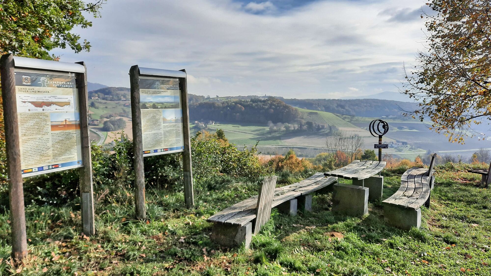
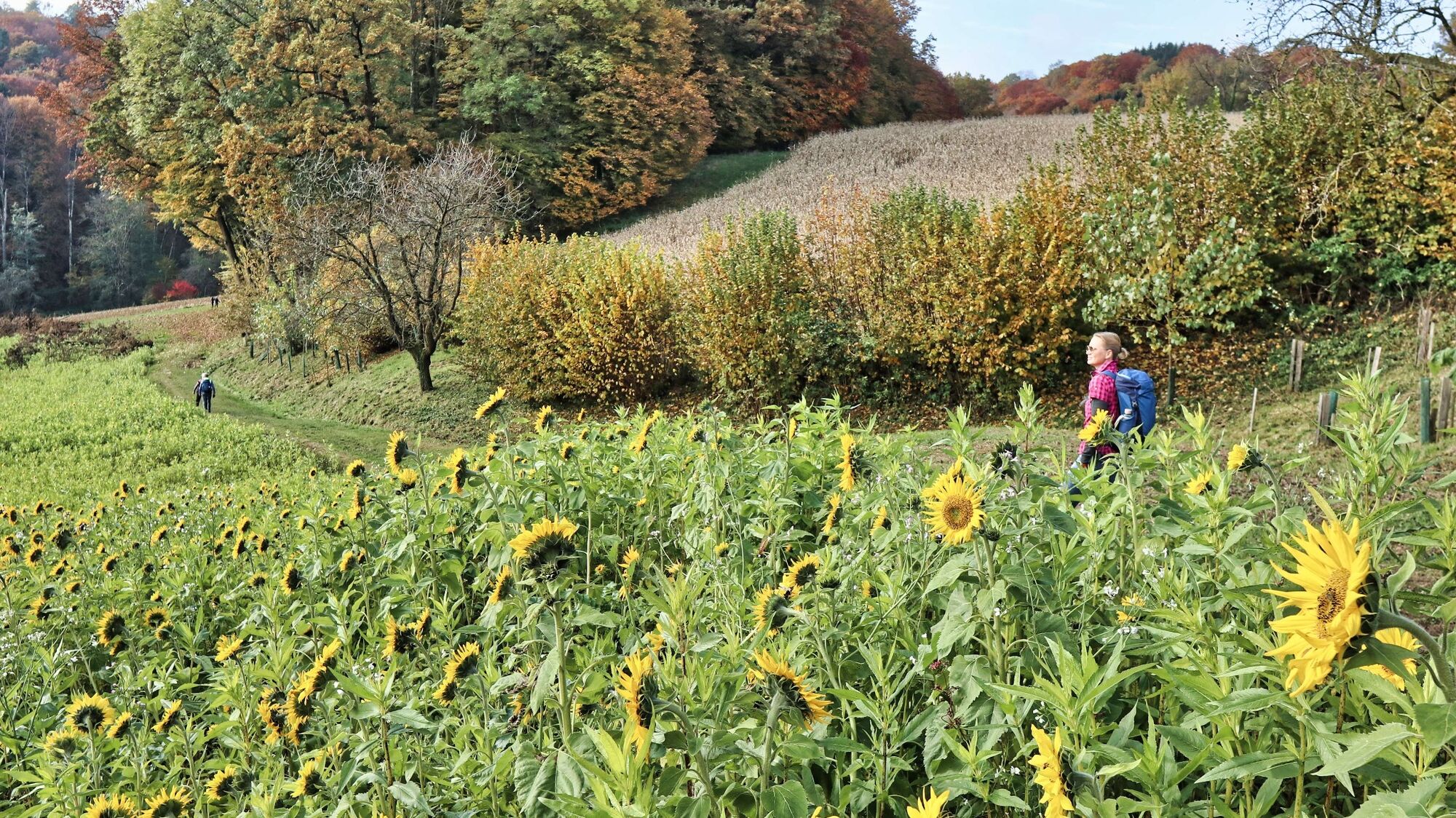
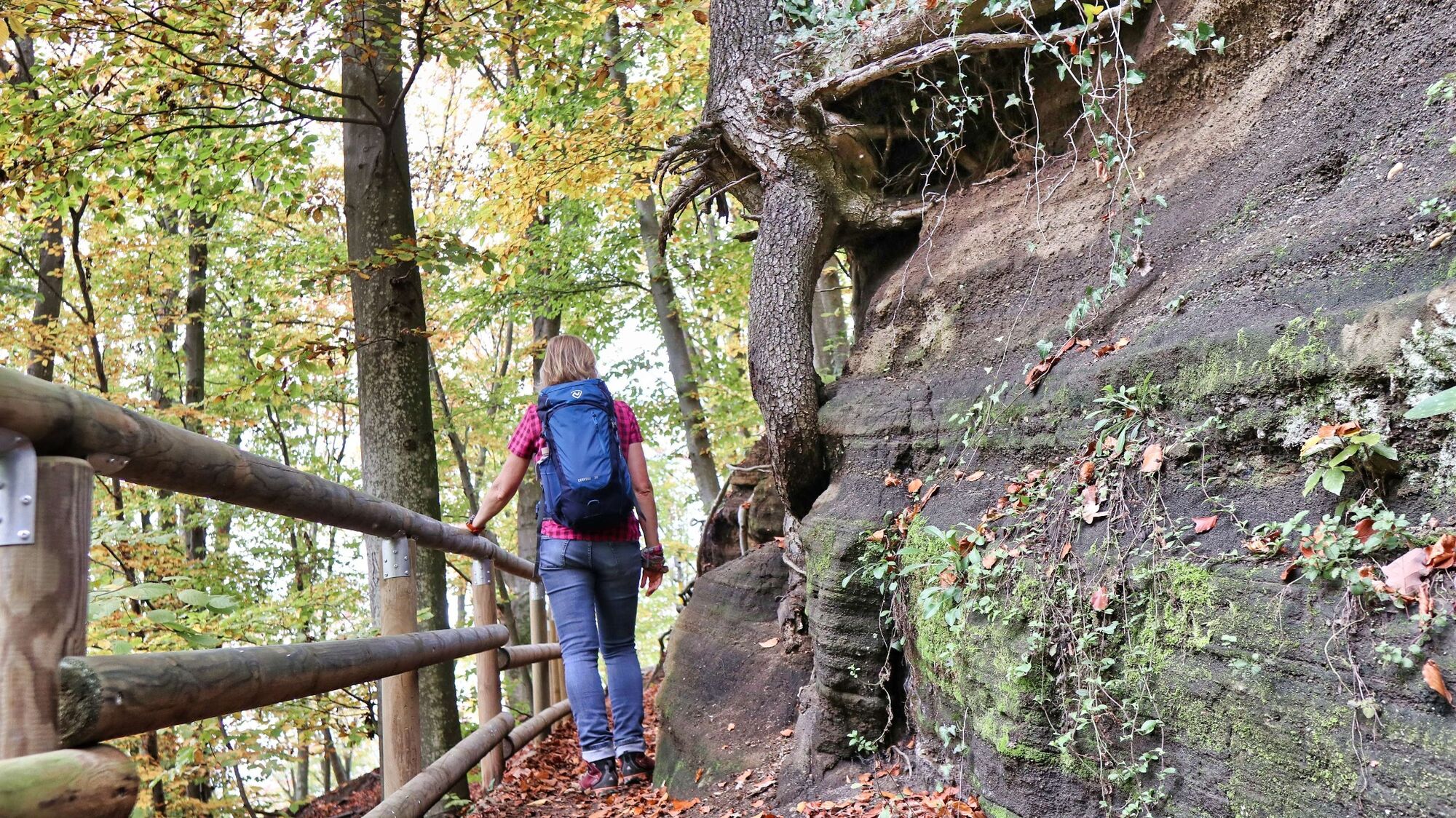
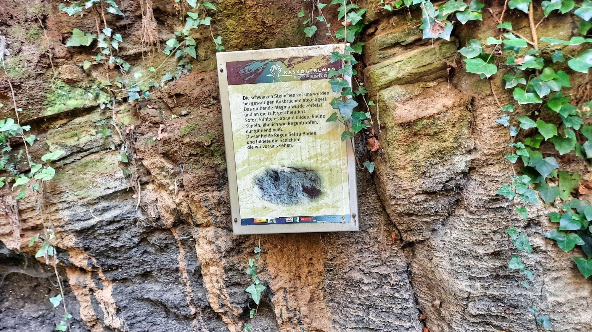
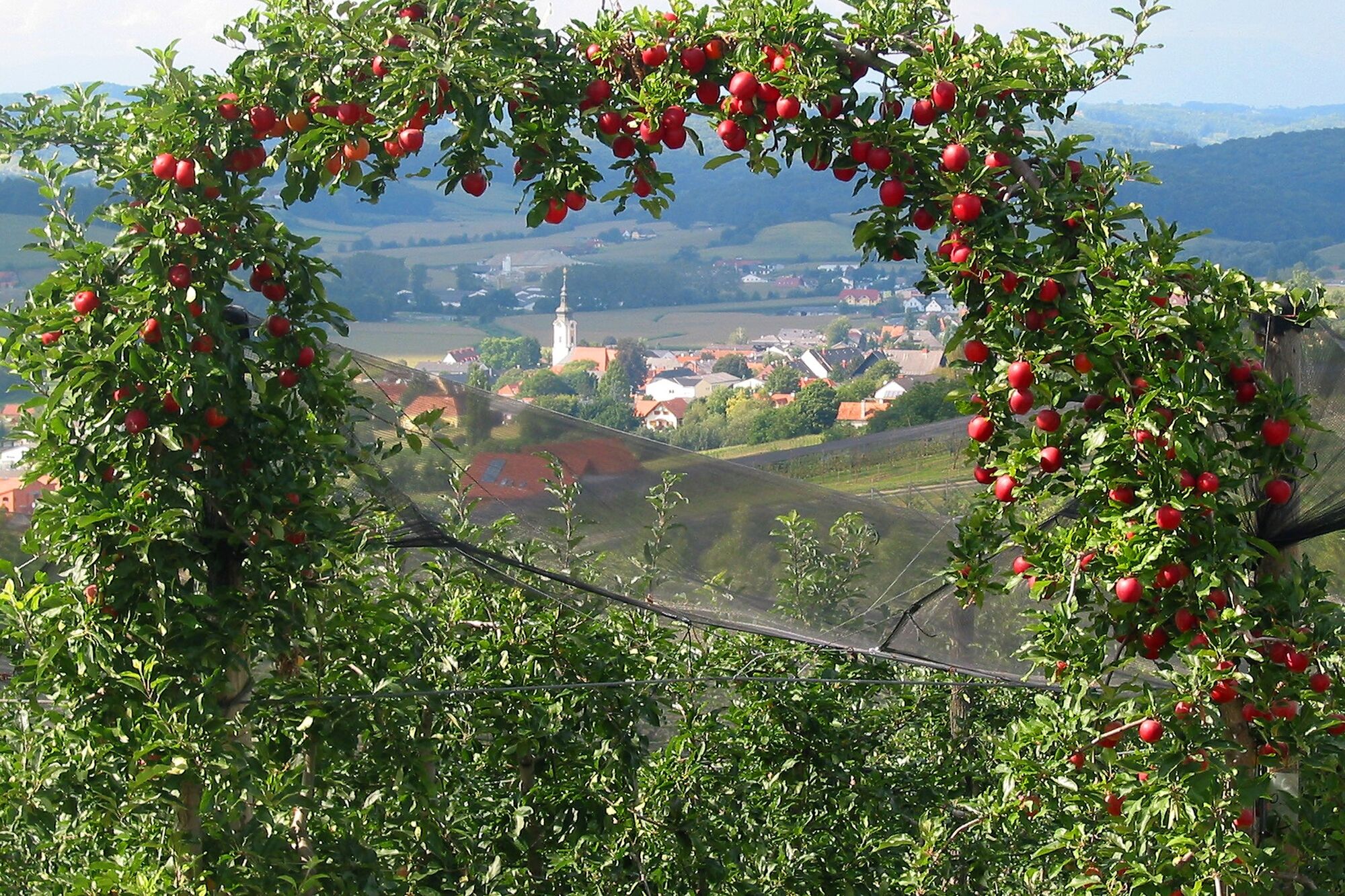
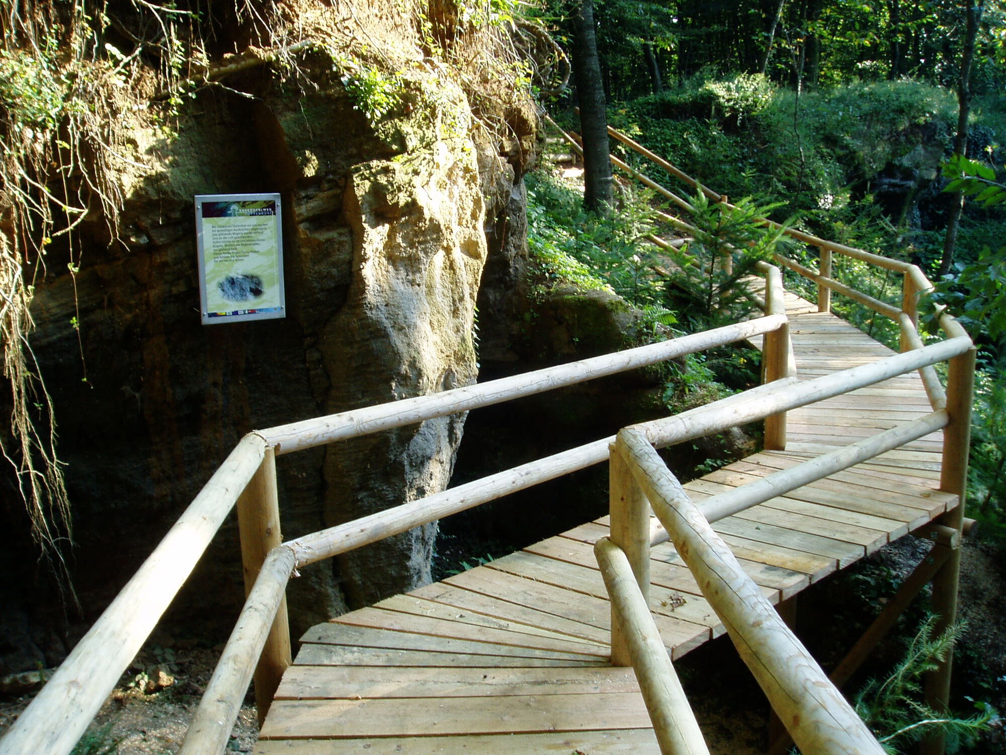
The circular hiking trail leads along gentle, mostly natural paths through the typical landscape around Poppendorf near Gnas. The Kaskögerlweg is part of the hiking trail network "In the footsteps of volcanoes", and the Kaskögerl is one of the 40 extinct volcanoes near Bad Gleichenberg. In an old abandoned gravel pit, the differently deposited layers can be seen as an outcrop that the volcano threw out during its eruption. A strikingly beautiful, and above all species-rich mixed forest forms the backdrop of this theme trail together with the fertile meadows and fields, with sweet chestnuts, scattered fruit trees, apple orchards and vineyards testifying to the small-scale diversity of the region. In addition, information boards at numerous stations explain the origins of the region, and magic telescopes allow visitors to look back millions of years into the past. Conclusion: Around the Kaskögerl, an easy and leisurely hike for families with children who can go on an exciting geological search for clues.
- Directions
-
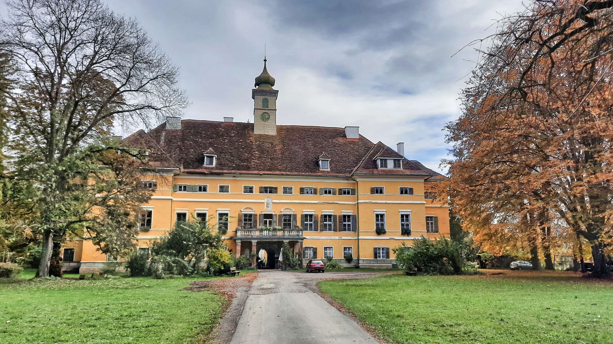
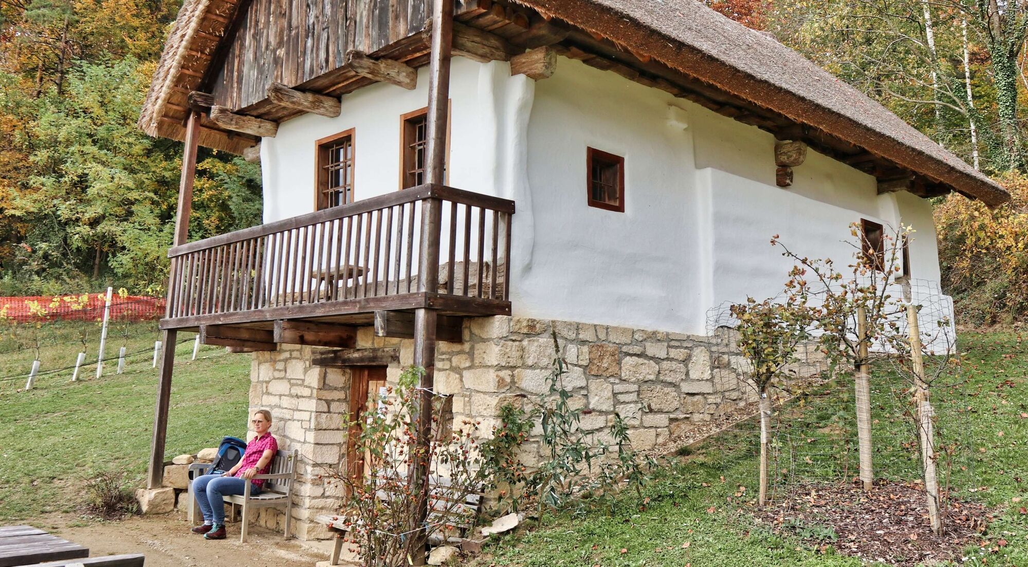
We start directly at the parking lot behind the Binderhansl inn and walk slightly uphill along the edge of the forest. After a few minutes we already reach the first station with information boards and a resting place. Slightly downhill we walk along meadow and forest paths, past farms and further across fields and forests until we reach a small pond at the bottom of the valley. From now on we walk along the brook, past a barn with old agricultural equipment and continue to Poppendorf. Passing the sports ground and the playground, we continue along the through road until we turn right in the direction of Poppendorf Castle. We go over the road bridge and immediately left along the stream. The path leads over wooden bridges, past resting places and information boards, before it continues slightly uphill through the forest again. We pass a few houses and keep to the right, continuing slightly uphill, until we branch off to Poppendorf Castle. After the short detour to Poppendorf Castle, we go back to the turnoff and then turn right across the fields downhill and through the woods uphill again. Along the edge of the forest, with beautiful views, the hiking trail leads us to the rest area Sandstöckl. At this small neat little house you will find a self-service possibility in the cellar. Immediately afterwards, the trail continues through the forest and past vineyards. In the distance you can see the Frutten-Gieselsdorf lookout. The trail continues through orchards to the farm of the Haas fruit farm. Here we also have the possibility of self-service and a cozy resting place. Now we go on an asphalt road slightly downhill to the crossing, then on the gravel road slightly uphill, passing by the wayside shrine. Soon we come back to an asphalt road, which we follow continuously until we have to pay attention to the turnoff to the left at a sparsely populated area. We leave the road and follow the path across farmland and woodland. Leisurely we go along until we go downhill over a few wooden steps and in succession we pass on a wooden footbridge next to an outcrop of the Kasköger crater. The display boards inform about the rock and the history of its formation. Now a few more meters downhill over steps and we reach the edge of the forest, which we follow to the right and after a short time we reach our starting point again.
- Highest point
- 397 m
- Endpoint
-
Parkplatz Gasthaus Binderhansl
- Height profile
-

- Equipment
-
Proper backpack packing makes many things easier: Pack heavy things first. The water bottle should always be within reach in a side pocket. All the things that are often needed, such as sunglasses, camera or hiking map, belong on top. An emergency kit, including blister plasters, belongs in every rucksack and it is always advisable to dress in layers.
- Safety instructions
-
Emergency call mountain rescue: 140
ambulance: 144
European emergency call: 112
firefighters: 122
police: 133Tips when reporting an emergency – Answer these six WH questions: What happened? How many people are injured? Where did the accident happen (are there GPS coordinates)? Who is reporting the incident (callback number)? When did the accident happen? What is the weather like at the site of the incident?
- Tips
-
Take the regional train from Bad Gleichenberg to Gnas and from there change directly to the beautiful hiking trail.
- Additional information
-
Einkehrmöglichkeiten in Gnas und Poppendorf
Gasthaus Catering Kurzweil, Tel.: +43 664 9952 1244, 8342 Gnas 19, www.gasthaus-kurzweil.at
Cafe-Konditorei Wagner, Tel.: +43 3151 2248, 8342 Gnas 17, www.cafe-wagner.at
Pizzeria Gnas, Tel.: +43 664 201 8150, 8342 Gnas, Hauptplatz 12
Schlosstaverne Schloss Poppendorf, Tel.: +43 3151 2555, 8342 Gnas, www.schlosspoppendorf.at
Gasthaus Binderhansl, Tel.: +43 3151 2365, 8342 Gnas, Katzendorf 39, www.gasthaus-binderhansl.at
Selbstbedienungsstationen (Getränke und etwas für den kleinen Hunger) entlang des Weges (Sportplatz Poppendorf und Obstbau Haas).
Buschenschank Fink, Tel.: +43 3151 2657, 8342 Gnas, Ebersdorf 20
Tourist Office Thermen- und Vulkanland
Gästeinfo Bad Gleichenberg
Kaiser-Franz-Josef-Str. 1/top 4
8344 Bad Gleichenberg
Tel: +43 3382 55 100-44
badgleichenberg@thermen-vulkanland.at
www.thermen-vulkanland.at - Directions
- Public transportation
-
Detailed information about arriving by ÖBB (Austrian Federal Railways) can be found at www.oebb.at or on the Verbundlinie Steiermark website www.busbahnbim.at
With Verbundlinie’s BusBahnBim route planner app, planning your journey has never been easier: simply enter towns and/or addresses, stop names or points of interest to check all bus, train and tram connections in Austria. The app is available free of charge for smartphones – on Google Play and in the App Store
- Parking


- Author
-
The tour Kaskögerl track (Kaskögerlweg) - Poppendorf/Gnas is used by outdooractive.com provided.


General info
-
Oststeiermark
2126
-
Bad Gleichenberg
372
-
Gnas
141
 Pauritsch_Tourismus Saßtal")