- Brief description
-
Welcome to the VIA NATURA - a long-distance hiking trail with a length of around 130 km.
- Difficulty
-
easy
- Rating
-
- Starting point
-
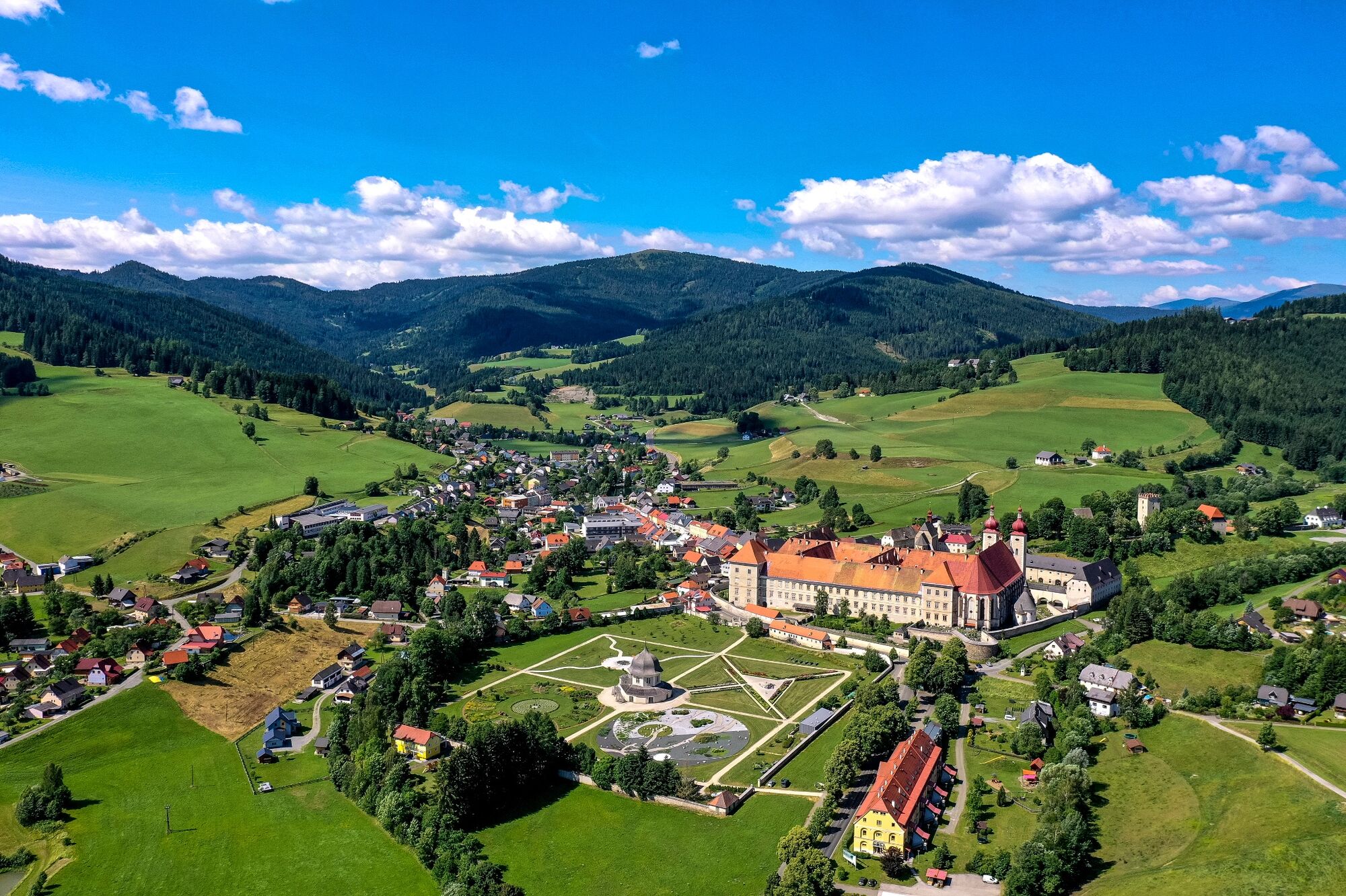
Abbey Gate St. Lambrecht
- Route
-
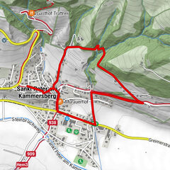
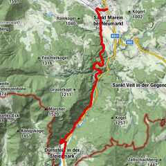
Sankt LambrechtStifterl0.0 kmMarktcafé0.0 kmTorwirt0.0 kmHeiligenstadt1.8 kmStraussenhof Wallner2.7 kmVorderbach3.0 kmSankt Blasen3.4 kmFilialkirche hl. Blasius3.7 kmKirchmoar3.7 km
- Best season
-
JanFebMarAprMayJunJulAugSepOctNovDec
- Description
-
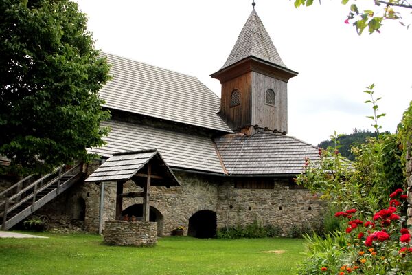
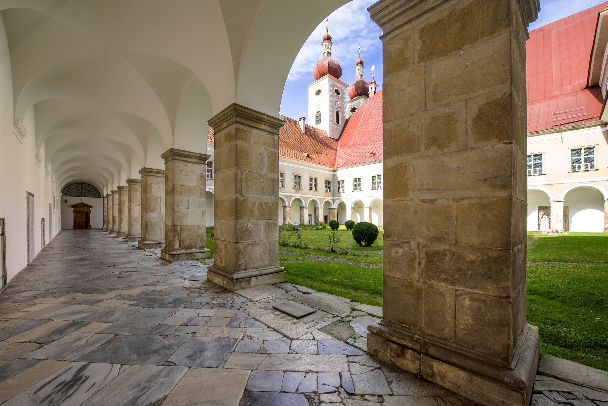
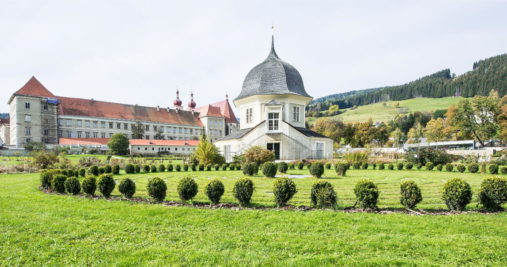
Forms of nature are also reflected in all eras of architecture. On the 4th stage of the VIA NATURA we learn to recognize these, walking through the monastery garden, which is divided into the four elements of fire, water, air and earth and belongs to the 900-year-old Benedictine monastery of St. Lambrecht, and further into the idyllic village of St. Bubbles.
For thousands of years, wise people have taught us that nature is a great book from which we can learn infinitely much. But instead of reading the book of nature, we listened to everything else and spurned the infinite intelligence of Mother Earth. Via Natura wants to bring people closer to nature and nature to people again.
- Directions
-
The starting point of the hike is at the time-honored Benedictine monastery of St. Lambrecht, which tells a 900-year history. At the end of the town, a quiet hiking trail leads through the well-kept abbey gardens to the "Schönen Kreuz", we continue to the Heiligenstadt church and the farm "Wirt am Pichl". The last part of the route leads through cool forest to the reading garden at St. Blasner Church. Along the way the story of the local artist "Lois Steiner" is told, wonderful views towards Kalkberg, Mühlsteinboden and Zirbitzkogel, benches always invite you to rest, linger and reflect.
- Highest point
- 1,068 m
- Endpoint
-
Reading Garden, St. Blasen
- Height profile
-

- Equipment
-
Good shoes
Sun protection
Sufficient food - Additional information
-
The ideal time for this tour is from April to October.
- Directions
-
By car from Germany
From Munich via the A8 towards Salzburg. From Salzburg on the A10 Tauernautobahn to St. Michael im Lungau. On the B 96 to Tamsweg, then on the B 95 to Predlitz. The B 97 leads via Stadl/Mur to Murau. There at the roundabout towards St. Lambrecht to Murauer train station and further towards St. Lambrecht. You reach St. Lambrecht via Laßnitz near Murau. The monastery is located in the town center.Arrival from Eastern Austria/Hungary
At the motorway junction in St. Michael near Leoben, take the S 36 towards Klagenfurt. Past Knittelfeld and Judenburg to Scheifling. In Scheifling continue towards Klagenfurt to Neumarkt, via Unzmarkt and Perchau am Sattel you reach Neumarkt. Turn right there towards Mariahof and St. Lambrecht. In Mariahof, after the railway crossing, turn left towards St. Lambrecht. The monastery is located in the center of St. Lambrecht.Arrival from southern Austria/Italy
Via Klagenfurt on the S 37 past St. Veit/Glan, Treibach and Friesach. In Friesach continue towards Vienna, via Dürnstein and Wildbad to Neumarkt. After the town center of Neumarkt turn left towards Murau, in Mariahof turn left after the railway crossing towards St. Lambrecht. The monastery is located in the center of St. Lambrecht. - Public transportation
-
With the BusBahmBim app from the composite line, timetable information is easier than ever before: all bus, train and tram connections in Austria can be queried by entering locations and/or addresses, stops or important points. The app is available as a free app for smartphones (Android, iOS) - on Google Play and in the App Store.
- Parking
-
Public parking spaces are available near the town entrance sign, the monastery entrance/pharmacy and at the market pond.
- Author
-
The tour Via Natura Stage 4: Sound in nature and architecture is used by outdooractive.com provided.