- Brief description
-
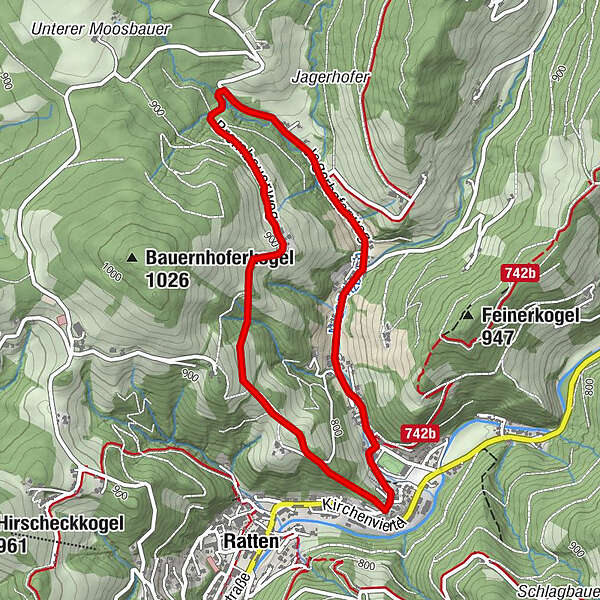
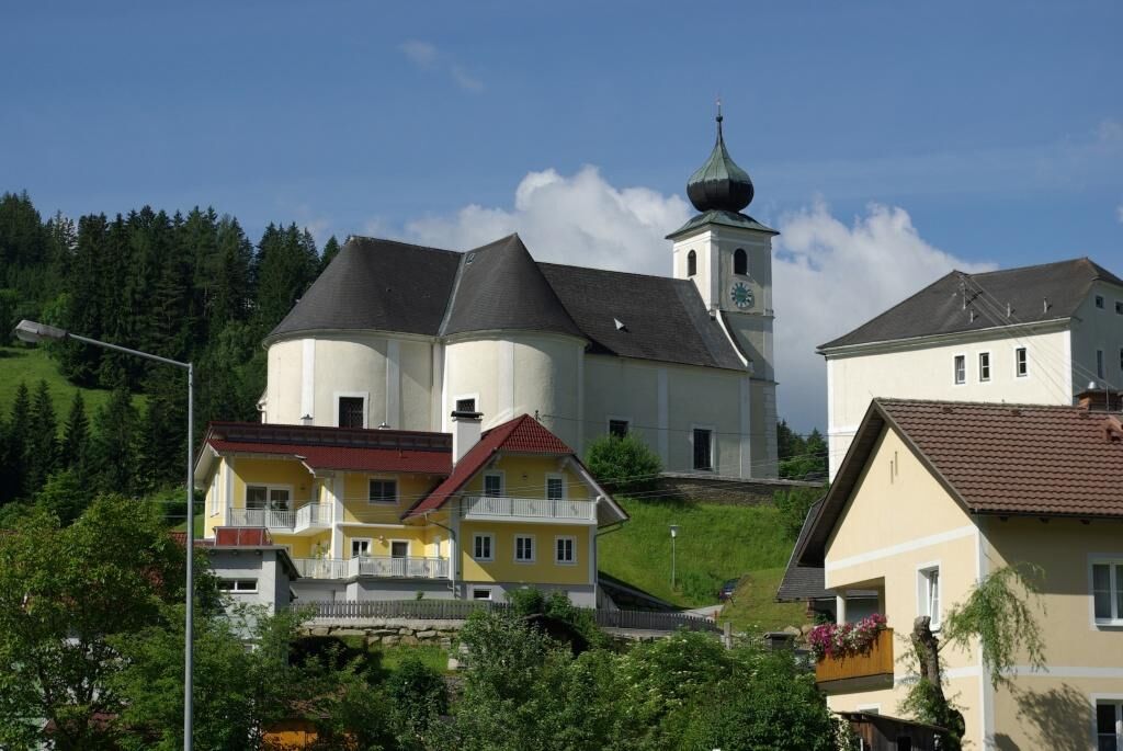
On this circular route you can always enjoy the view of the village and the St. Nicholas Church of Ratten.
- Difficulty
-
medium
- Rating
-
- Starting point
-
Church Square/ St. Nicholas Church Ratten
- Route
-
KirchenwirtRosenkranzkapelleRatten0.2 kmPfarrkirche St. Nikolaus4.5 kmKirchenwirt4.5 kmRosenkranzkapelle4.6 km
- Best season
-
JanFebMarAprMayJunJulAugSepOctNovDec
- Description
-
After overcoming a steep section of the trail on hiking path 03, you can look at rats from above for the first time. The Christian signs along the way, with texts by Martin Gutl, invite you to linger and reflect.
At the vulgo "Röckhofer" not only the view, but also the remarkable lime tree, is worth a mention.
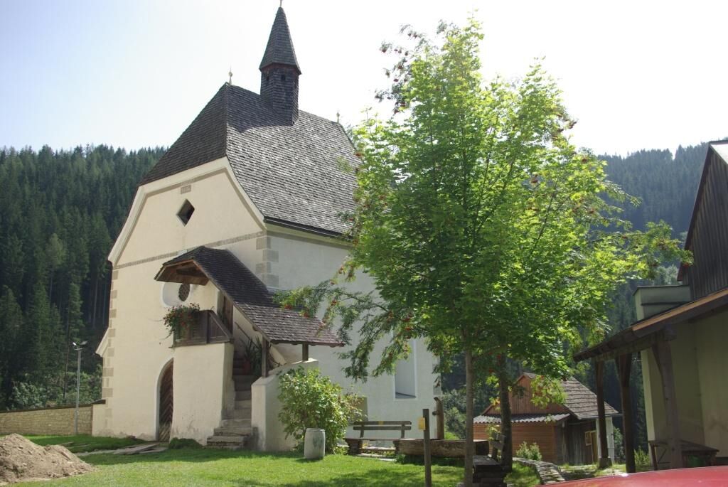
The existing wayside crosses and monuments lead one further to the "Prembauer" and down to the Nießnitz. Following the road along the stream, the path leads back to the parish church. This section is easily passable with a wheelchair as well as with a baby carriage. Along the way, more texts await contemplation and meditation.
The tranquility of the path through woods and meadows, the texts and also the walking and lingering let you push aside everyday life and achieve relaxation for body and soul.
- Directions
-
We start at the church square in Ratten
Between the parsonage and the parish home we hike the hiking trail 03 upwards
As soon as we reach an access road to the farm, we leave the path
After a short ascent over a meadow we reach the first meditation place
We walk along the hiking trail further down to the "Röckhofer".
Then we turn right down the path and follow it until we reach the "Prembauer".
We follow the access road downhill to the Hammergraben
We turn right and walk on the asphalt road back to the parish church - Highest point
- 907 m
- Endpoint
-
Church Square/ St. Nicholas Church Ratten
- Height profile
-

- Equipment
-
Small backpack with water bottle (+ provisions)
Sturdy shoes
Appropriate clothing - if possible several layers - "onion principle".
Rain and sun protectionWalking sticks as required
Mobile phone
Small first aid kit
Route description
Before starting the hike, check the possibilities for refreshments, including opening times, or pack appropriate food and drink.
- Safety instructions
-
European emergency call: 112
Emergency call mountain rescue: 140 (if possible please provide GPS data)
Rescue: 144
Fire brigade: 122
Police: 133
A few tips on correct and fair behaviour in the forest: (Source: www.bundesforste.at )
Hikers should avoid visits to the forest about 1.5 hours before sunrise and after sunset, as wild animals are particularly active during this time.
Plastic bottles, handkerchiefs, cigarette butts etc. have no place in the forest! Please make sure that you do not leave any rubbish in the forest.
Camping and lighting fires are strictly forbidden in the forest!
In principle, every person is allowed to pick 2 kg of mushrooms and berries per day for personal use. It is only prohibited if the forest owner expressly forbids it.
- Tips
-
The tranquility of the path through woods and meadows, the texts and also the walking and lingering at the individual stations allow the everyday life to be pushed aside and relaxation for body and soul to be achieved.
- Additional information
- Directions
- Public transportation
- Parking
-
Parking lot at the church in Ratten.

- Author
-
The tour Spiritual path is used by outdooractive.com provided.


General info
-
Hochsteiermark
4066
-
Joglland - Waldheimat
1506
-
Ratten
332