
- Brief description
-
- Learn to read in the big book of nature!
Welcome to the VIA NATURA - a long-distance hiking trail with a length of around 130 km.
- Difficulty
-
medium
- Rating
-
- Starting point
-
Main square, Neumarkt
- Route
-
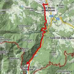
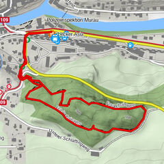
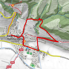
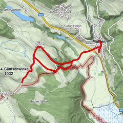
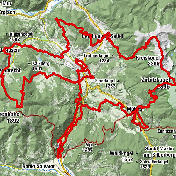
Gasthaus HaasNeumarkterhof0.0 kmNeumarkt in der Steiermark0.0 kmStrimitzen3.1 kmNeumarkt in der Steiermark4.4 kmSankt Georgen bei Neumarkt6.4 kmSankt Marein bei Neumarkt7.5 kmPfarrkirche Mariä Himmelfahrt7.6 kmUrsprungbach10.4 kmZeckis Spielplatz10.5 kmZecki's Hütte10.5 kmGraslupp11.8 kmFischerwirt12.1 kmZeutschach13.9 kmGasthaus Schönanger17.1 kmGrebenzenhaus19.2 kmGrebenzen (1,870 m)21.1 kmDreiwiesenhütte21.6 kmMarktkreuz27.6 kmMarktcafé27.8 kmStifterl27.8 kmSankt Lambrecht27.9 kmTorwirt27.9 kmHeiligenstadt29.7 kmStraussenhof Wallner30.6 kmVorderbach31.0 kmSankt Blasen31.4 kmFilialkirche hl. Blasius31.6 kmKirchmoar31.7 kmKreuztal33.5 kmOberdorf38.2 kmVockenberg39.4 kmGasthof Jera40.4 kmHoferdorf42.1 kmGasthof Knappenwirt - Familie Lohr42.2 kmNikolauskapelle42.4 kmMariahof42.8 kmSteinschlosshütte46.8 kmSteinberg (1,320 m)47.7 kmKreuzeck (1,459 m)49.5 kmGotthardsdorf56.4 kmPfarrkirche hl. Gotthard56.5 kmGasthaus Neuwirt57.1 kmGasthof Löcker57.2 kmPerchau am Sattel57.2 kmWenzelalpe (2,151 m)69.9 kmOberberger Kogel (2,173 m)70.4 kmKreiskogel (2,306 m)72.6 kmScharfes Eck (2,364 m)74.9 kmZirbitzkogel Schutzhaus76.2 kmZirbitzkogel (2,396 m)76.3 kmTonnerhütte80.4 kmSchmellingkogel (1,482 m)82.1 kmMühlen87.3 kmMondorf88.6 kmNoreia89.6 kmGasthaus Gössler93.9 kmMühlen93.9 kmOrtskapelle hll. Maria und Rochus94.0 kmAich96.8 kmSankt Veit in der Gegend102.7 kmPfarrkirche hl. Veit102.7 kmUnterviertel103.6 kmWildbad Einöd107.5 kmOman109.7 kmGuldendorf113.8 kmHerz-Jesu-Kapelle115.3 kmDürnstein in der Steiermark115.3 kmGasthaus Leitner119.1 kmWildbad Einöd120.2 kmSankt Marein bei Neumarkt127.0 kmPfarrkirche hl. Katharina128.5 kmNeumarkt in der Steiermark128.7 kmNeumarkterhof128.7 kmGasthaus Haas128.7 km
- Best season
-
JanFebMarAprMayJunJulAugSepOctNovDec
- Description
-
Via Natura invites all visitors to get involved in the adventure of nature, to take a closer look and thus learn what nature wants to tell us with all its colors, shapes and phenomena. Humans nature and the interaction between man and nature is an essential part of Via Natura.
The Via Natura is divided into 10 stages of different length and different levels that tell the following themes:
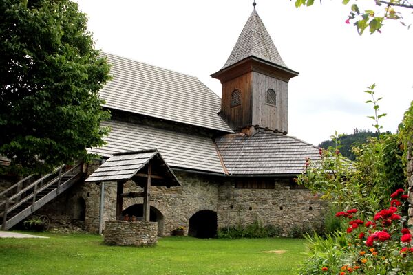
Stage 1: NatureLearning (Neumarkt-St. Marein)
Stage 2: Nature as a source of inspiration - bionics (St. Marein - Zeutschach)
Stage 3: The essence of water (Zeutschach - St. Lambrecht)
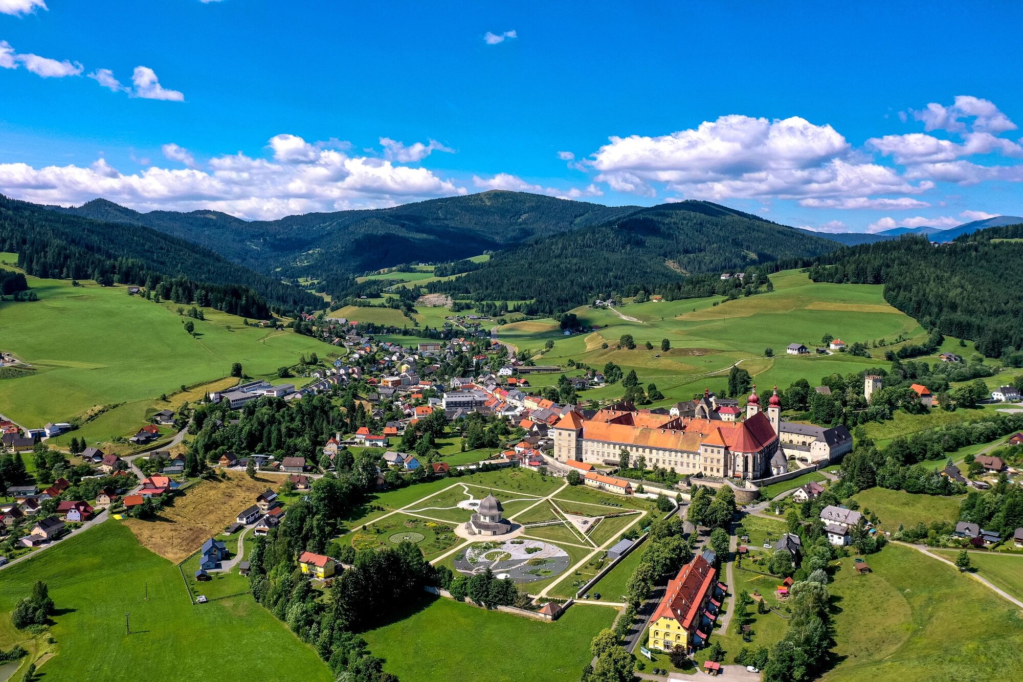
Stage 4: Sound in nature and architecture (St. Lambrecht - St. Blasen)
Stage 5: The biography of the earth (St. Blasen - Mariahof)
Stage 6: Human and plants (Mariahof - Perchau)
Stage 7: Weather and climate (Perchau - Mühlen)
Stage 8: Working in harmony with nature (Mühlen - Kulm)
Stage 9: Energy fields in nature (Kulm - Dürnstein)
Stage 10: Power points in human and landscape (Dürnstein - Neumarkt)
- Directions
-
From Neumarkt follow the signs (yellow signs - path no. NL1).
From Neumarkt main square you go to Mariahof, through the Neumarkt community forest to the Green Classroom, to the NaturLesePark and on to St. Marein. From there the path leads through the Graggerschlucht to Zeutschach, on to the Zeutschach source and via Maria Schönanger to the Grebenzen (1,870m). From the Grebenzen you continue to St. Lambrecht. An easy climb leads to St. Blase and from here towards Dürnberger Moor/Mariahof. The path leads over the stone castle towards the Perchauer Sattel and further over the Oberberger Alm to the Zirbitzkogel (2,396 m). The descent takes place via the Tonnerhütte to Mühlen and on to Kulm and Dürnstein. From Dürnstein, the last stage leads back towards the starting point to Neumarkter Hauptplatz.
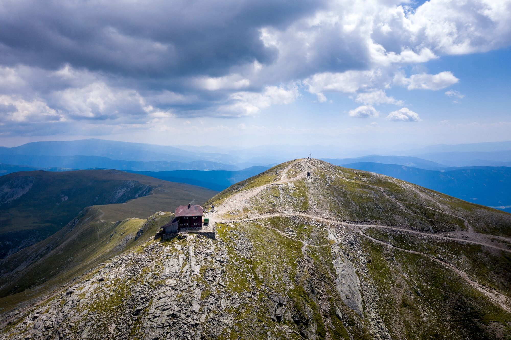
- Highest point
- 2,371 m
- Endpoint
-
Main square, Neumarkt
- Height profile
-

- Equipment
-
Good shoes
Sun protection
Sufficient food - Additional information
-
The ideal time for this tour is from April to October.
- Directions
-
By car from Germany
From Munich via the A8 in the direction of Salzburg. From Salzburg on the A10 Tauern freeway to St. Michael im Lungau. Take the B96 to Tamsweg, then continue on the B95 tp Predlitz. The B97 leads via Stadl/Mur to Murau. There in the traffic circle direction St. Lambrecht to the Murau train station and further direction St. Lambrecht. Via Laßnitz near Murau you reach St. Lambrech, which is already in the nature park. There continue in the direction of Mariahof and Neumarkt. In Mariahof turn right towards Neumarkt, the road leads directly to the main square.Arrival from East Austria/Hungary
At the freeway junction in St. Michael bei Leoben take the S36 towards Klagenfurt. Pass Knittelfeld and Judenburg until Scheifling. In Scheifling continue in the direction of Klagenfurt to Neumarkt, via Unzmarkt and Perchau am Sattal you reach Neumarkt.Arrival from sout Austria/Italy
Via Klagenfurt on the S37 past St. Veit/Glan, Treibach and Friesach. In Friesach continue in the direction of Vienna, via Dürnstein and Wildbach, to Neumarkt, In the middle of the main square you will find the starting point for the hike. - Public transportation
-
With the BusBahnBim app from Verbundlinie, timetable information has never been easier: all bus, train and streetcar connections in Austria can be queried by entering locations and/or addresses, stops or important points. The app is available as a free app for smartphones (Android, iOS) - on Google Play and in the App Store.
- Parking
-
Public parking spaces are available on the main square, directly at the hiking start point.

- Author
-
The tour Via Natura entire route is used by outdooractive.com provided.