


- Brief description
-
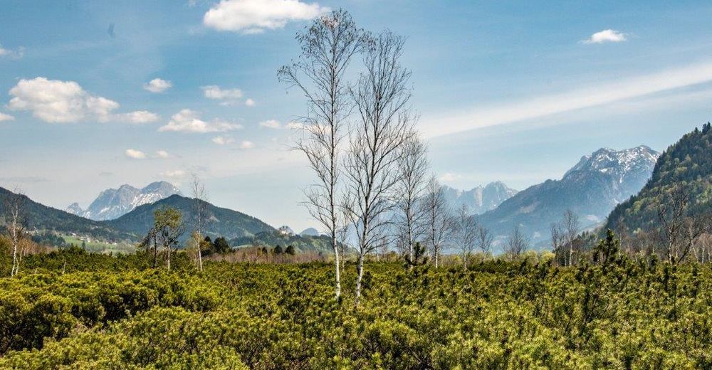
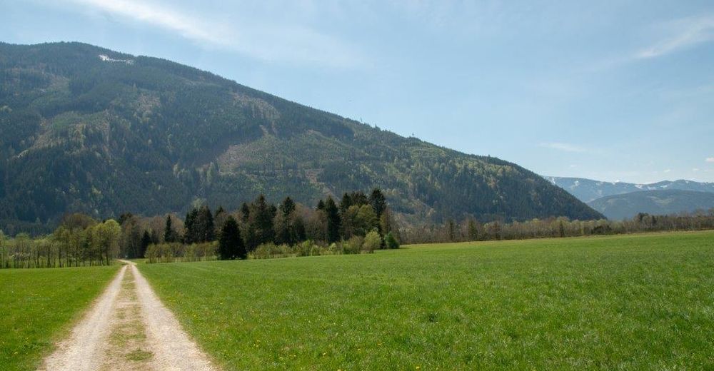
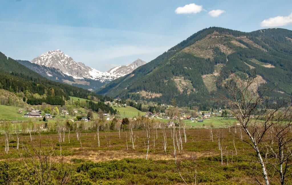
Between Admont and Liezen lies one of the most beautiful high moors in the country
- Difficulty
-
easy
- Rating
-
- Route
-
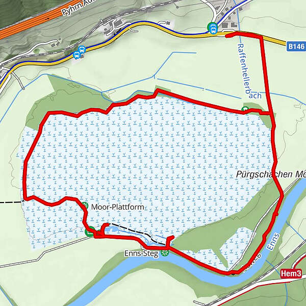
Moor-Turm1.6 kmEnns-Steg1.6 kmMoor-Plattform2.3 km
- Best season
-
JanFebMarAprMayJunJulAugSepOctNovDec
- Description
-
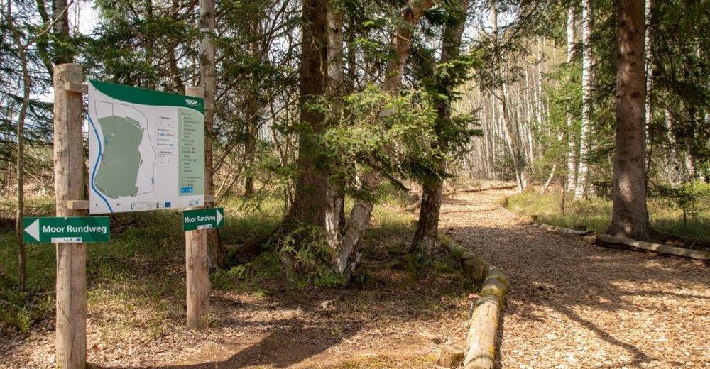
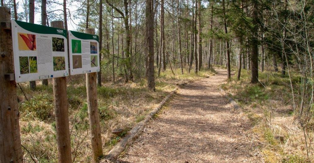
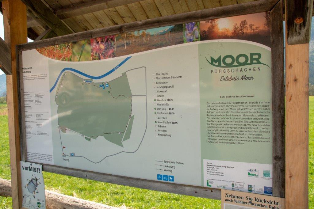
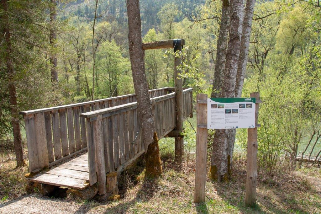
On a circular hiking trail with 13 stations you can explore fauna and flora between Moor & Enns. Highlights are the dragonfly pond, the moor tower and the floating Enns footbridge.
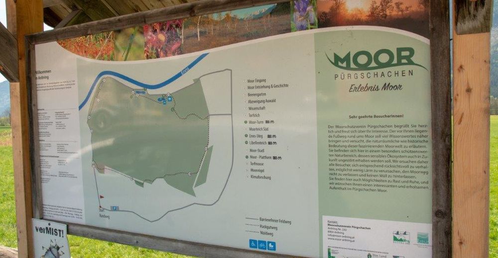
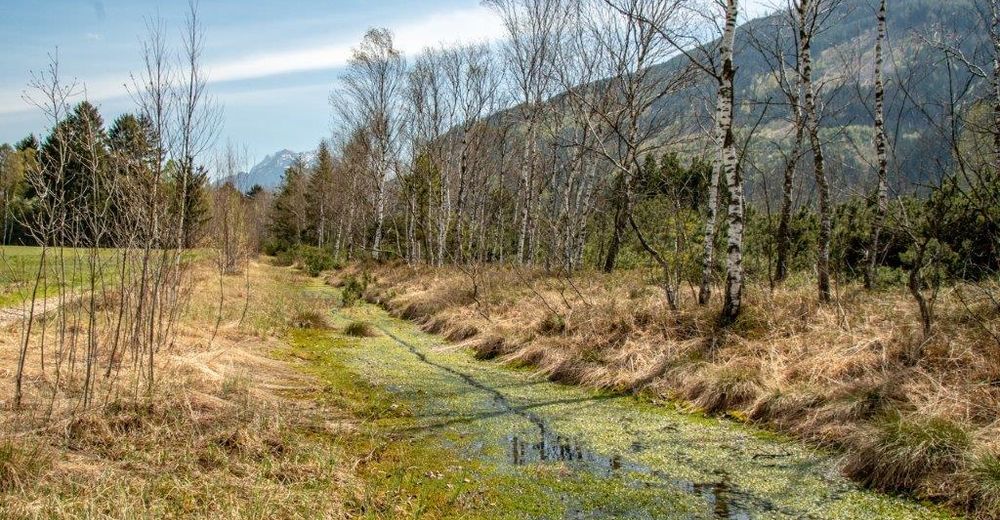
The Pürgschachen Moor Trail leads around a RAMSAR protected area and informs about the formation of a raised bog, which vaults over the ground like a watch glass, as well as about the rare fauna and flora in this protected area.
- Directions
-
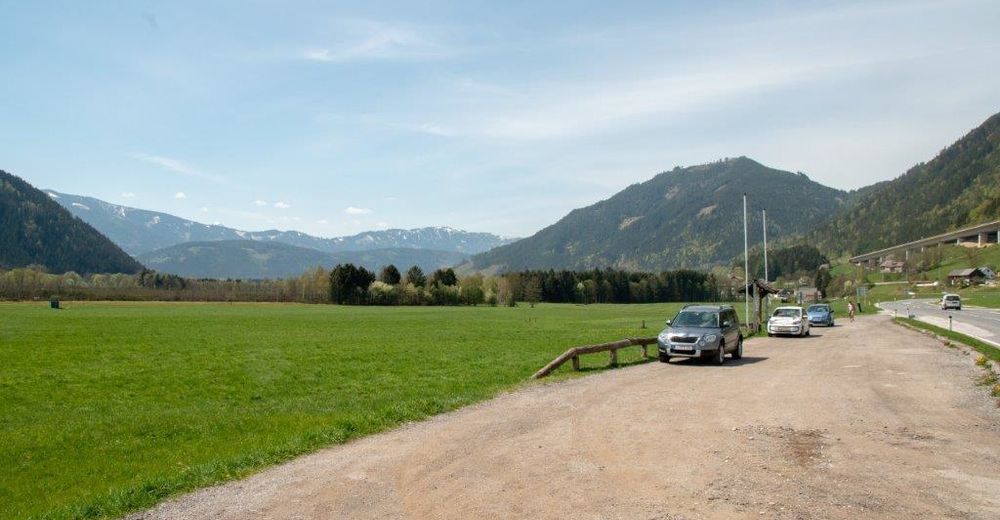
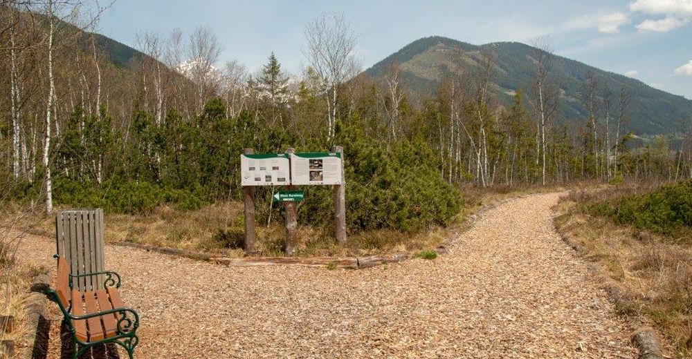
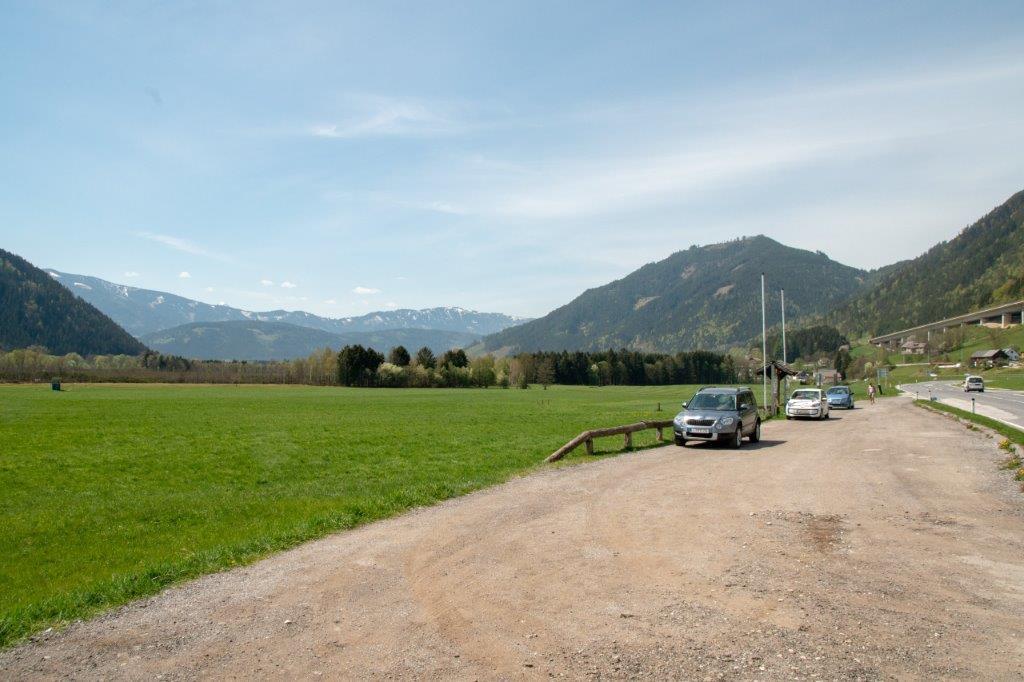
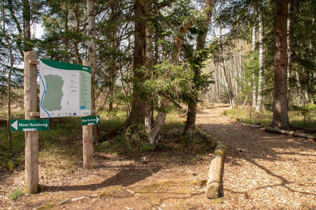
We walk from the parking lot, where we could already get an overview of the Pürgschachen Moor on a panorama board, on a path next to the main road for a few meters until we turn right onto the Moorweg and walk down towards the Enns.
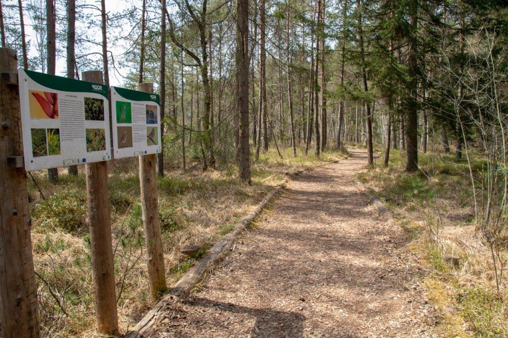
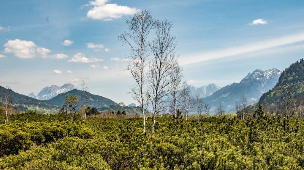
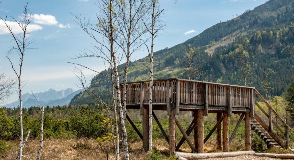
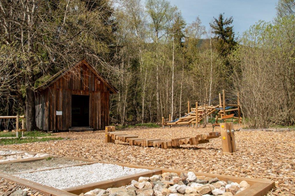
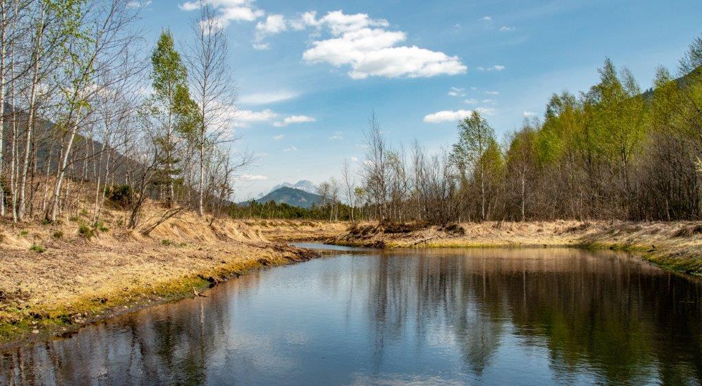
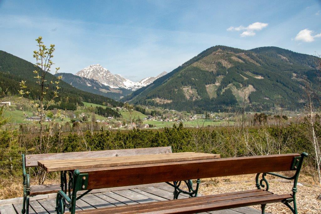
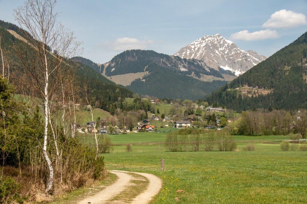
Soon we have a first glimpse of the moor on the right, which arches over the ground like a watch glass. Topic boards tell us at regular intervals about everything worth knowing and the special features of this upland moor protected by the EU. Fauna and flora are similar to those in tundra and taiga. The moor is particularly attractive when the cotton grass is in bloom. So we march on a field path down to the Enns, where we experience the silence and power of the water on a floating footbridge above the river. On the other side of the path we make a short detour and climb a small lookout tower, from where we already get a first overview of the Pürgschachen moor. Now we leave the alluvial forest and come to open meadows, our field path leads us to a dragonfly pond and on a board we learn more about the different species of dragonflies that hover through the air here. An earth wall with benches invites us to stay and enjoy the silence of the landscape. In the hut next to it we again receive interesting information about the moor in general and the Pürgschachen Moor in particular. Right after the hut we leave the field path and "float" on a soft carpet of wood chips to the large viewing platform. Here we rest on the benches and study the peaks of the Gesaeuse mountains, which are precisely marked, from the Großer Buchstein to the Scheiblingstein, the Hochtorgruppe, etc. Afterwards we continue our round trip, still feeling the soft bog soil, and arrive at a part of the bog where the mountain pines predominate and a small water trickle runs alongside the path. Here we also have wonderful views of the moor and views of the high gate group that crowns the Frauenberg pilgrimage church. After crossing a wooden bridge, we soon come out of the mountain pine and birch forest and onto a meadow. Now we continue on a gravel path and meet our access path again, which we follow to the car park.
- Highest point
- 637 m
- Endpoint
-
Parkplatz Pürgschachen Moor
- Height profile
-

- Equipment
-
comfortable shoes, rain protection, drinks
- Safety instructions
-
no special difficulties
- Tips
-
After the moor round in the GH Pürgschachnerhof at the Gesäuse-Bundesstraße towards Liezen or stop at the Dorfwirt in Ardning (village centre)!
- Additional information
-
Tourismusverband Gesäuse
Hauptstraße 35, 8911 Admont, Österreich
Tel. +43 (0) 3613 21160 10
Email: info@gesaeuse.at
www.gesaeuse.at
www.moor.ardning.at
www.ardninger-dorfwirt.at
www.puergschachnerhof.at
- Directions
-
B 146 Gesaeuse federal road from Admont or Liezen to the Westeinfacht of Ardning
- Public transportation
-
Postbus Linie 910 und 912, Haltestelle Hollinger KreuzFahrplan unter www.busbahnbim.at
- Parking
-
Moor car park at the west entrance to Ardning on the Gesaeuse federal road B 146


-

-
AuthorThe tour Pürgschachen Moor Circuit is used by outdooractive.com provided.


General info
-
Gesäuse
2225
-
Urlaubsregion Pyhrn - Priel
1440
-
Ardning
355