Habsburg Mile - On the tracks of the Habsburgs in Radmer


- Brief description
- Difficulty
-
easy
- Rating
-
- Starting point
-
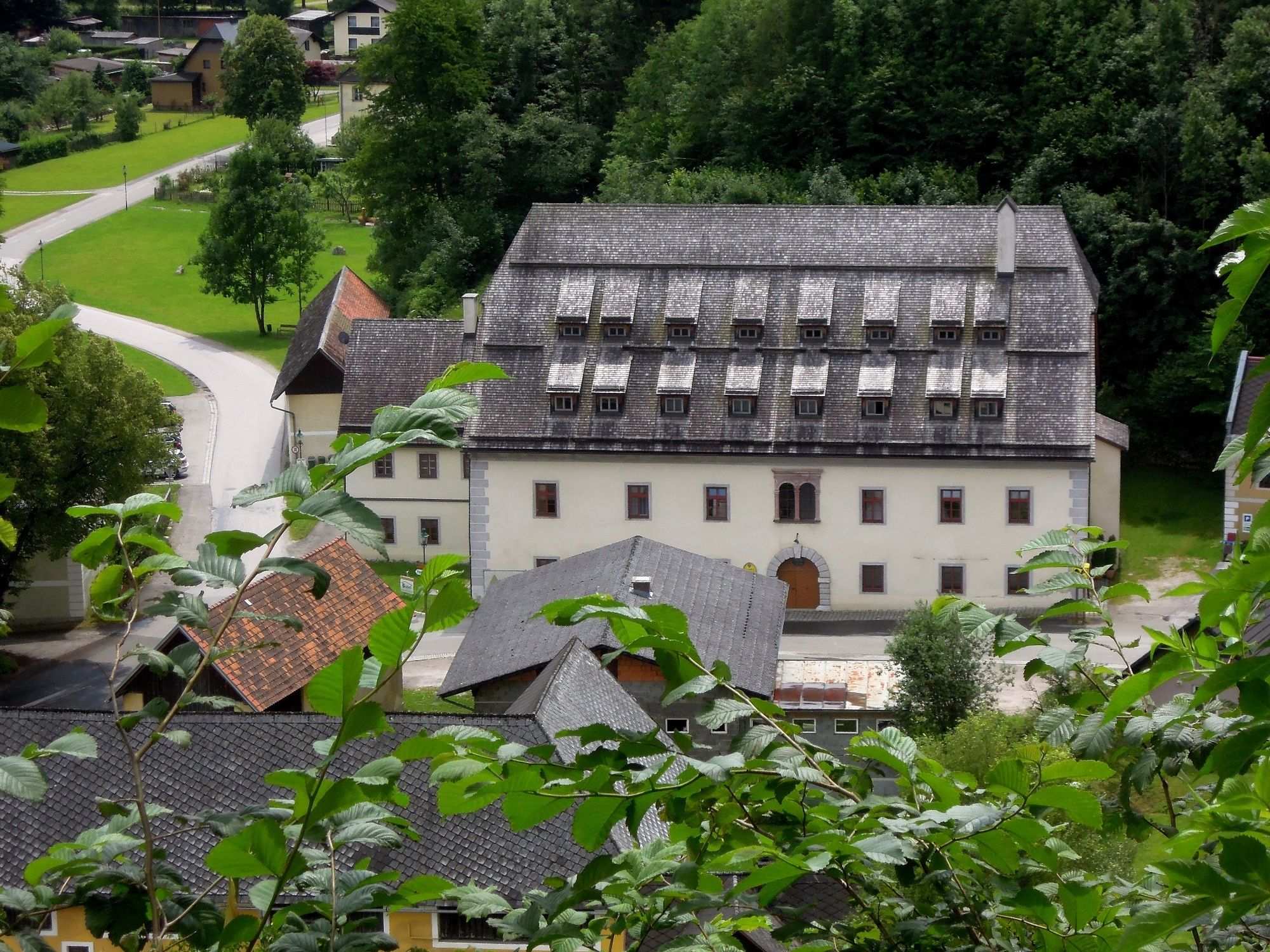
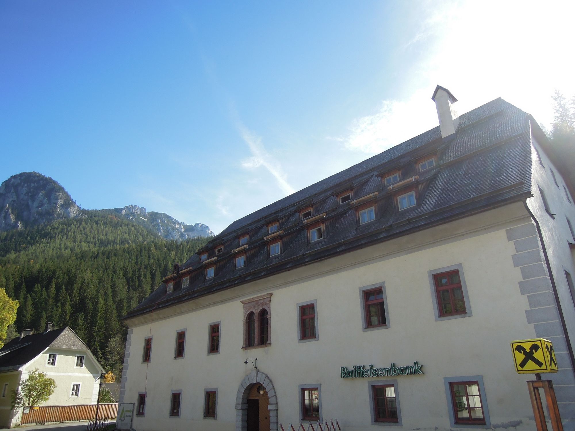
Village center of Radmer at the Großhaus
- Route
-
Wallfahrtskirche zum heiligen Antonius von Padua1.9 kmRadmer an der Stube2.0 km
- Best season
-
JanFebMarAprMayJunJulAugSepOctNovDec
- Description
-
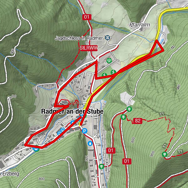
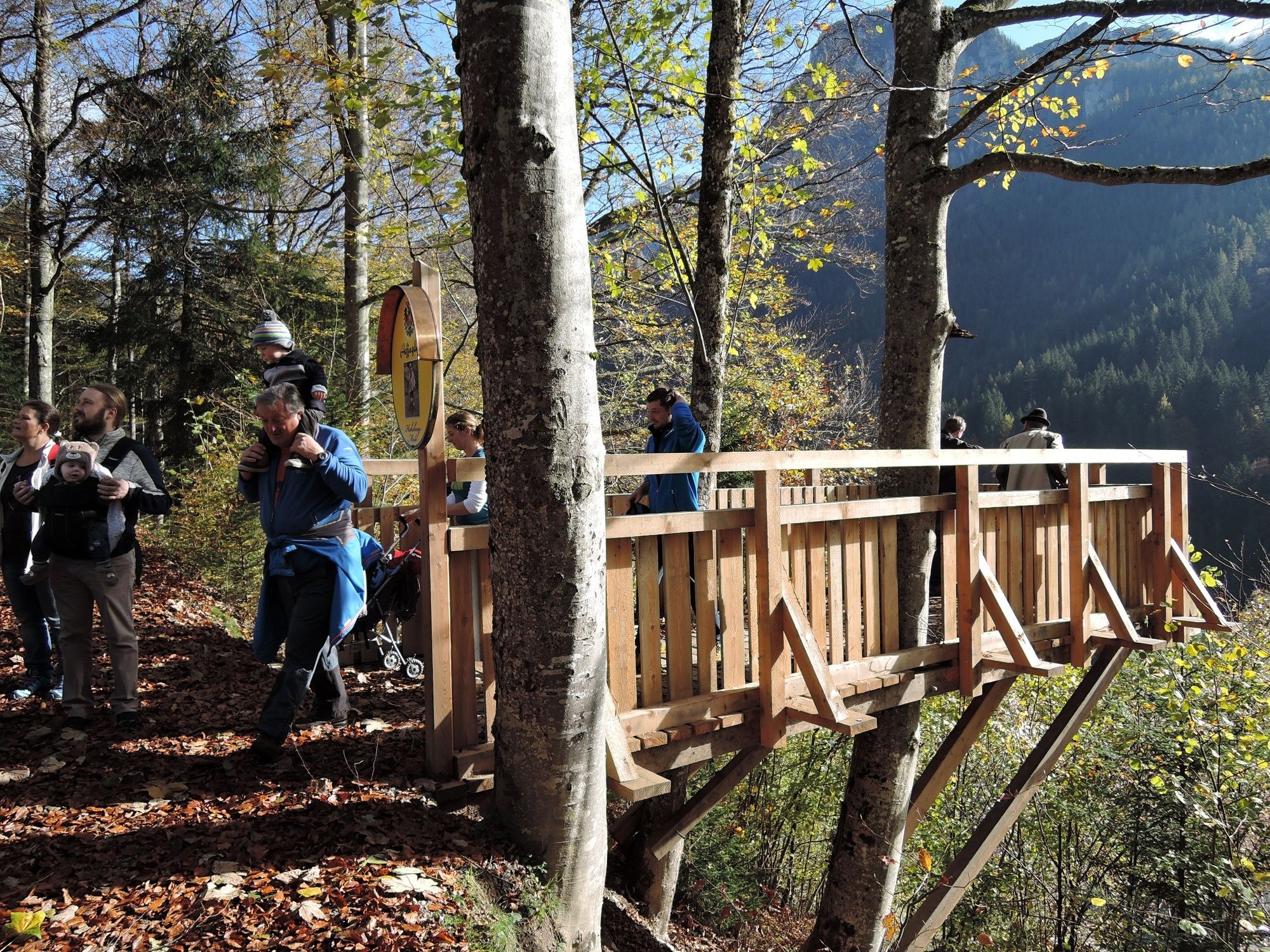
The "Habsburg Mile" is a circular hiking trail that starts in the center of the village at the Großhaus, leads through a forest to the church and from there back to the center of the village.
With the Habsburg Mile we want to invite you to a walk, on which you can get to know or hike the centuries-long connection of the House of Habsburg with the village of Radmer.
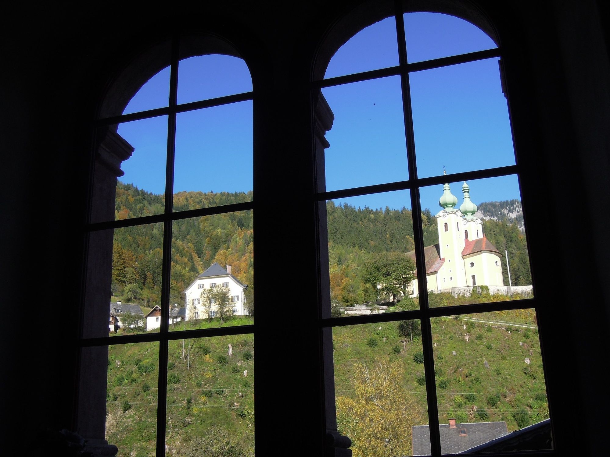
The tour starts at the Großhaus and leads via the hunting lodge to the pilgrimage church of St. Anthony of Padua.
The route is 2300m long and has only a few steep sections, which are easily manageable even for children and older people.
Historically, the Habsburg Mile begins precisely in the 16th century when Emperor Maximilian I discovered the Radmer Valley as a hunting region. From then on, the high lords came again and again to the lovely high valley to indulge in hunting and recreation.
- Directions
-
The Habsburg Mile is a circular hiking trail that starts in the center of the village at the Großhaus and leads from the hunting lodge back to the church (pilgrimage church to St. Anthony of Padua). From here a beautiful footpath leads back to the starting point.
- Highest point
- 721 m
- Endpoint
-
Center of the village
- Height profile
-

- Equipment
-
Solid shoes
Proper backpacking makes many things easier: pack heavy things first. The water bottle should always be within easy reach in a side pocket. All things that are often needed such as sunglasses, camera or hiking map belong on top. An emergency kit including blister plaster belongs in every backpack.
Clothing according to the "onion system" is always recommended! - Safety instructions
-
Proper planning is a must before any tour.
Emergency call rescue: 144 Tip on reporting an emergency - give answers to the six W-questions: What happened? How many injured? Where did the accident happen (possibly GPS coordinates)? Who is reporting (callback number)? When did the accident happen? Weather at the accident site?
There are only a few steeper trail sections.
- Tips
-
Church tour possible by appointment with Mr. Karlheinz Schober +43(0)3635/2226.
Visit to the copper mine in Hinterradmer. Here you ride the smallest tunnel railroad into the mountain.
- Additional information
- Directions
-
from Liezen to Admont and further through the Gesäuse to Hieflau. Continue in the direction of Eisenerz here is the turnoff on the right side to Radmer an der Stube.
Or coming from the south Leoben towards Eisenerz and continue towards Hieflau. A few kilometers before Hieflau is on the left side the exit direction Radmer
- Public transportation
-
By train to Leoben - change to bus NR 820 to bus station Eisenerz - change to bus NR 920/921
or call cab phone number: 0664/3328610 or 03848/3095
Timetables and travel information can be found directly at: Österreichische Bundesbahnen (ÖBB), Steiermärkische Landesbahnen (STLB), www.busbahnbim.at
With the BusBahnBim app of the Verbundlinie, timetable information has never been easier: all bus, train and tram connections in Austria can be queried by entering locations and/or addresses, stops or important points. The app is available as a free app for smartphones (Android, iOS) - on Google Play and in the App Store
- Parking
-
Radmer at the parlor department store street or inn to the mill

- Author
-
The tour Habsburg Mile - On the tracks of the Habsburgs in Radmer is used by outdooractive.com provided.