
- Brief description
-
The hike leads along the Sebastiani - Rosary Way, at the last part of the Via Sacra.
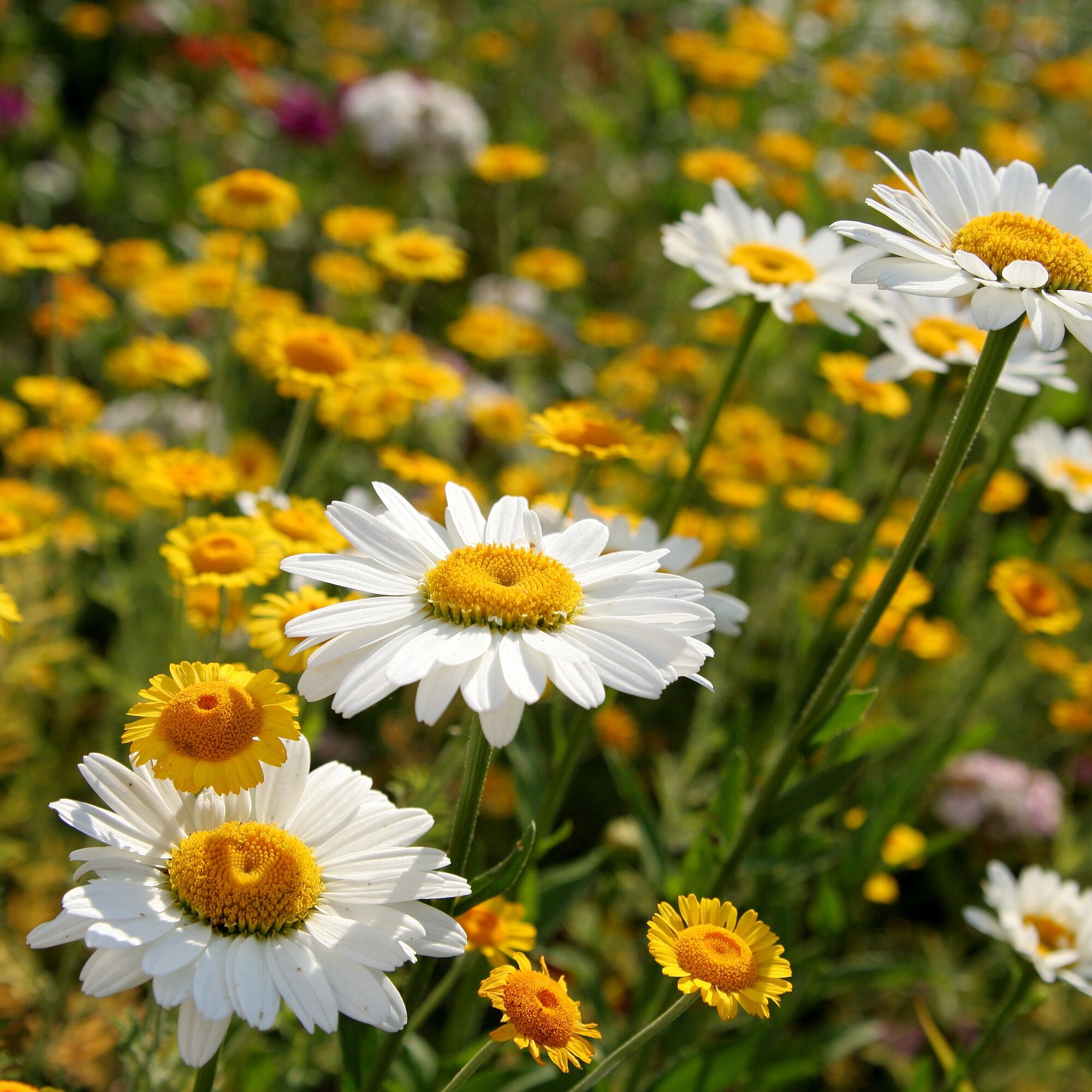
Here you can find small herb gardens at the individual stations of the cross.
- Difficulty
-
easy
- Rating
-
- Starting point
-
St. Sebastian Church in St. Sebastian
- Route
-
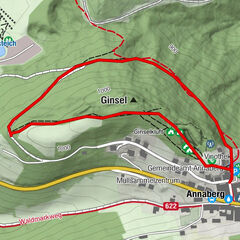
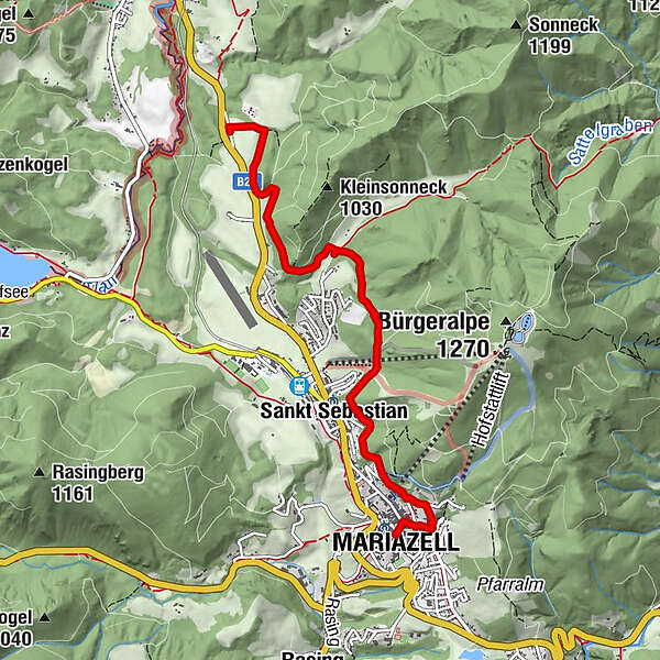
St. Sebastian0.1 kmSankt Sebastian3.7 kmMariazell5.3 km
- Best season
-
JanFebMarAprMayJunJulAugSepOctNovDec
- Description
-
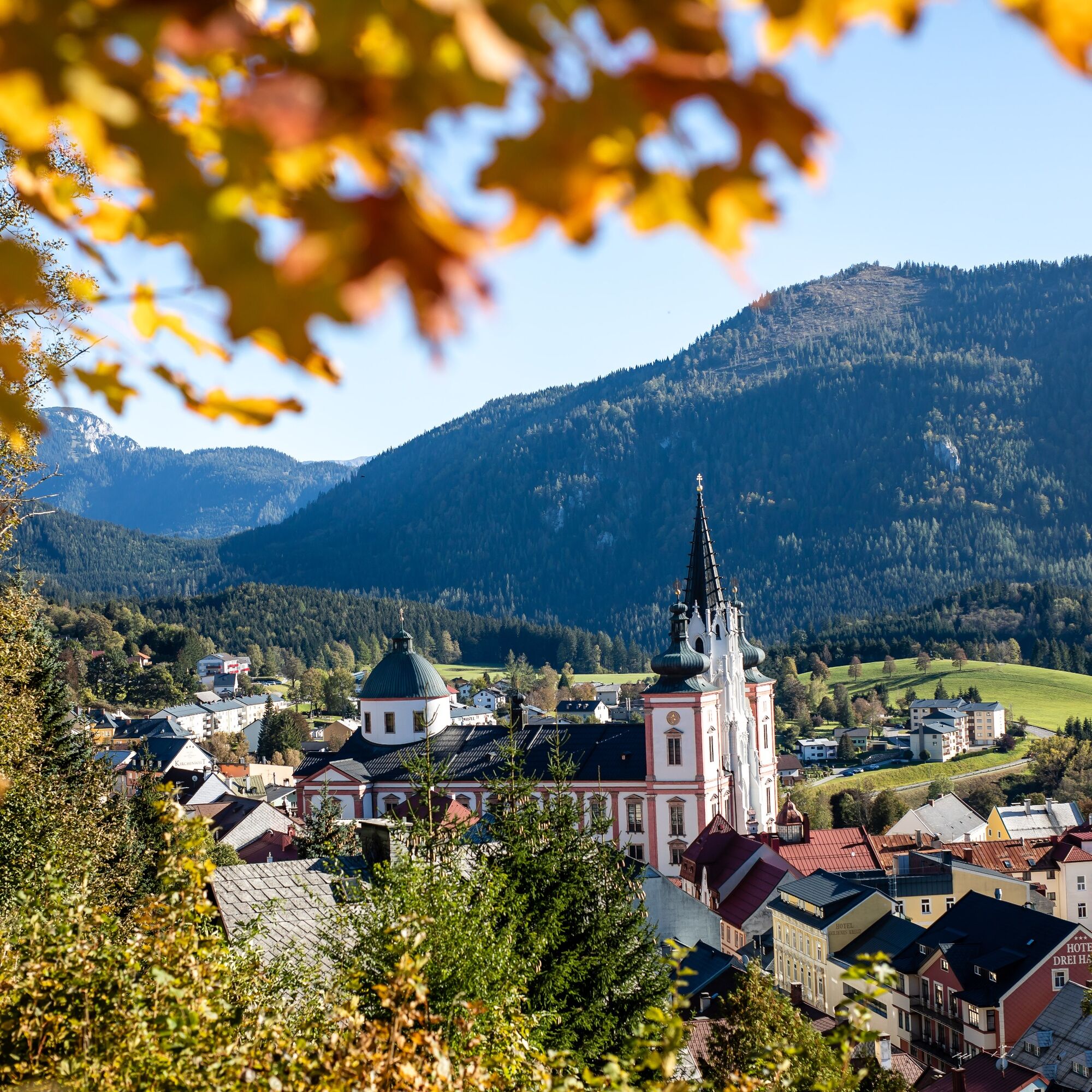
The pharmacy and drugstore Zur Gnadenmutter and the well-known place of pilgrimage Mariazell live a centuries-old tradition of pilgrimage and healing of body, mind and soul. Along the famous Sebastiani Rosary Way, on the last section of the pilgrimage route "Via Sacra", small herb gardens can be found at the individual stations of the cross. These are laid out according to ancient custom, with well-known, native medicinal plants from traditional European medicine. During guided walks, visitors learn interesting facts about the effect and application of these medicinal herbs according to ancient knowledge of natural healing. Finally, the path leads over the Calvary to the pharmacy and drugstore Zur Gnadenmutter, where visitors can fortify themselves with a pleasant glass of Mariazeller Wurzelklauber and experience the effects of the medicinal plants for themselves.
You can find out the current dates at the pharmacy Zur Gnadenmutter.
- Directions
-
From the Sebastianikirche we walk across meadows and along the edge of the forest along the Rosenkranzweg until we come to the crossroads in the Habertheuer. Here we continue straight ahead, always along the rosary stations with the herb gardens. At the last part of the Sebastianiweg we already have a wonderful view of Mariazell and the basilica (Mariazeller AUGENblicke - Buschniggweg)
At the crossroads Viktor-Lang-Gasse/Schießstattgasse we turn left and after a short steep ascent we reach the Kalvarienberg (Mariazeller AUGENblicke - Kalvarienberg).
From the Kalvarienberg we now descend via the Kreuzweg and the Hl.-Brunn-Gasse to the Hauptplatz Mariazell and further to the Apotheke zur Gnadenmutter, where we can immediately experience the effect of the medicinal herbs for ourselves :-)
And here you can read the blog report of Fred Lindmoser.
- Highest point
- 934 m
- Endpoint
-
Pharmacy "Zur Gnadenmutter" in Mariazell
- Height profile
-

- Equipment
-
Proper backpacking makes many things easier: pack heavy things first. The water bottle should always be within easy reach in a side pocket. All things that are often needed, such as sunglasses, camera or hiking map, belong on top. An emergency kit including blister plaster belongs in every backpack and a clothing according to the "onion system" is always recommended!
- Safety instructions
-
Emergency call mountain rescue: 140
Emergency reporting tip - provide answers to the six W questions: What happened? How many injured? Where did the accident happen (possibly GPS coordinates)? Who is reporting (callback number)? When did the accident happen? Weather at the accident site?
- Tips
-
This hike can be done in winter with snowshoes - see website!
- Additional information
- Directions
-
By car from Mariazell via the B20 in the direction of Mitterbach, St. Sebastian's Church is just before Mitterbach on the right side. Parking space is available.
- Public transportation
- Parking
- Author
-
The tour Saints and Healing Ways to Mariazell is used by outdooractive.com provided.


General info
-
Mostviertel
2470
-
Mariazellerland
1506
-
St. Sebastian
380