- Brief description
-
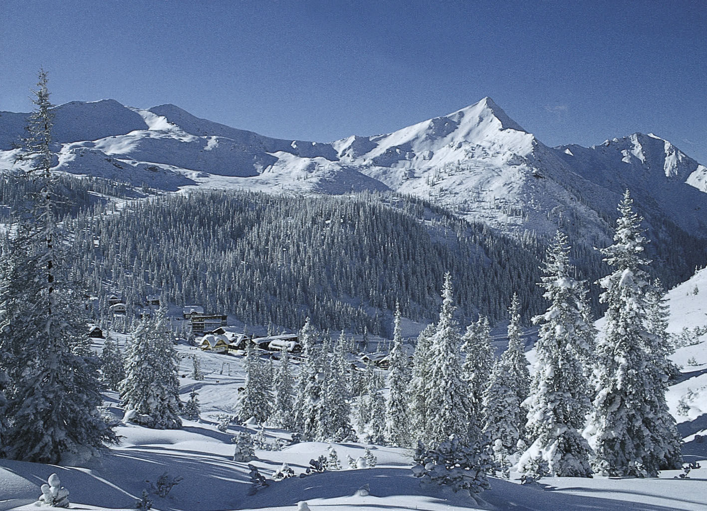
Fantastic ski tour with the best panoramic view of the Planneralm area.
- Difficulty
-
medium
- Rating
-
- Starting point
-
Kinderland
- Route
-
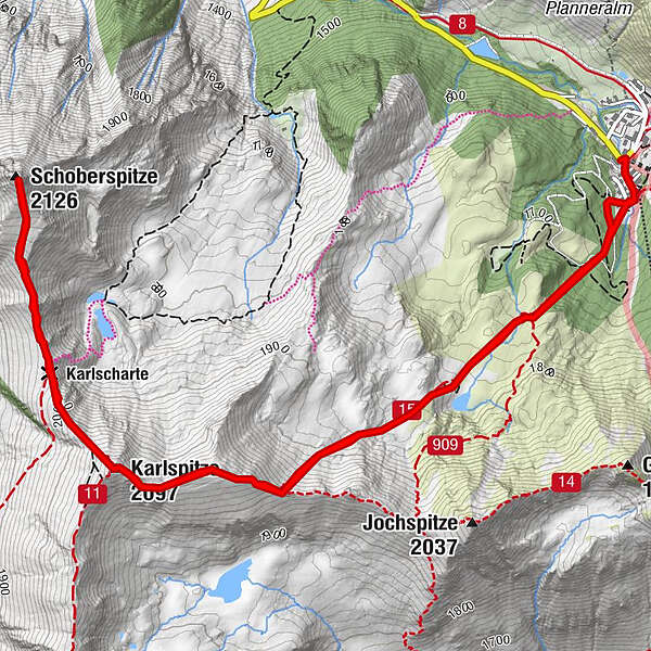
Karlspitze (2,097 m)2.9 kmSchoberspitze (2,126 m)4.1 kmKarlscharte5.0 km
- Best season
-
AugSepOctNovDecJanFebMarAprMayJunJul
- Description
-
On this moderately difficult ski tour you conquer the dominant mountain of the highest ski village in Styria. Past snow-covered mountain lakes, the route takes you via Karlspitz and Karlscharte along hilly terrain up to 2,126 m, where the summit cross of the striking Schoberspitze is enthroned.
- Directions
-
On this ski tour you start at the Kinderland and follow the markings, first flat, then a short piece steeper before it goes over the mountain pine field again flatter towards the south. Now you are on the high plateau and already have the striking mountain shape of the Schoberspitze in view. Enjoy this section before you continue uphill to the ridge. Once you are there, turn west towards the now already visible summit cross of the Karlspitze. Once you reach the summit, you descend to the Karlscharte. Then the skins come back up and you climb the last 150 meters to the summit of the Schoberspitze. All around you now see a magnificent mountain panorama. Be it the nearby mountains of the Planneralm or those in Donnersbachwald. You also have a clear view of the mighty Grimming and the Schladminger Tauern to the Tote Gebirge. Resting is now the order of the day before you start your descent.The descent follows the same route as the ascent.
- Highest point
- 2,113 m
- Endpoint
-
At the starting point
- Exposition
- Height profile
-

- Equipment
-
Avalanche beacon, probe and shovel are essential in open terrain.
Ski touring equipment consisting of skis/splitboard, skins, poles and possibly crampons.
Food, warm drinks, spare clothing and a first aid kit.
Choose your clothing according to the onion layer principle.
Maps and/or tour descriptions. GPX tracks on your mobile phone or GPS device are also helpful.
Ski touring and safety equipment can be rented at Sport Scherz and Sport Schöttl. - Safety instructions
-
Mountain sports and the assessment of the situation on site are - even more so in winter - primarily subject to personal responsibility. Tourism associations or avalanche warning services do not assume any liability based on the information provided.
Check the weather and avalanche situation at www.lawine-steiermark.at before each ski tour. The use of the tour description is at your own risk and responsibility. Do not go on a ski tour alone. It's more fun together anyway! Always behave risk-conscious and react to danger signs! Respect existing regulations, such as hunting and game protection areas, reforestation or young growth areas. You should always have your cell phone well charged. Do you have the emergency numbers saved?
Mountain rescue: 140. If you have no reception, take out the sim card and dial 112. - Tips
-
On your return, huts and inns on the Planneralm invite you to stop for a bite to eat.
- Additional information
-
Tourism information:
T: +43 3687 23310
Garbage on meadows and paths can not smell mountain and valley. Please take it with you. Agriculture and forestry are important partners for Berg und Tal. They allow you to walk and drive on many of their paths. Be aware that only good cooperation will guarantee your recreational enjoyment in the future.
Sport Scherz
At Riesneralm, Planneralm and in Wörschach
+43 (0)3682 22383
sport-scherz.atSport Schöttl
At Planneralm and in Irdning
+43 (0)3682 22952 0
sport.schoettl.atAvalanche workshops are offered by the local ski school:
Ski & Freeride School Planneralm
+43 (0)660 7445538
www.freeski.school - Directions
-
Turn off the Ennstalbundesstraße (B320) at the crossing Trautenfels in direction Irdning, Donnersbach, Donnersbachwald. In Donnersbach after the center of the village turn left towards Planneralm. 12 km long driveway over the toll-free mountain road up to the Planneralm.
- Public transportation
- Parking
-
Free parking at the large parking lot on the Planneralm. Please park in the lower area of the parking lot on busy days as tourers.
- Author
-
The tour Ski tour to the Schoberspitze is used by outdooractive.com provided.