- Brief description
-
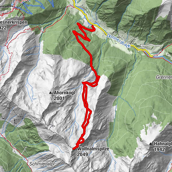
Over forest roads, fine soils and steep climbs you pull your track up to the panoramic ridge.
- Difficulty
-
medium
- Rating
-
- Starting point
-
Schaupphof
- Route
-
Wolfnalmspitze (2,049 m)7.2 km
- Best season
-
AugSepOctNovDecJanFebMarAprMayJunJul
- Description
-
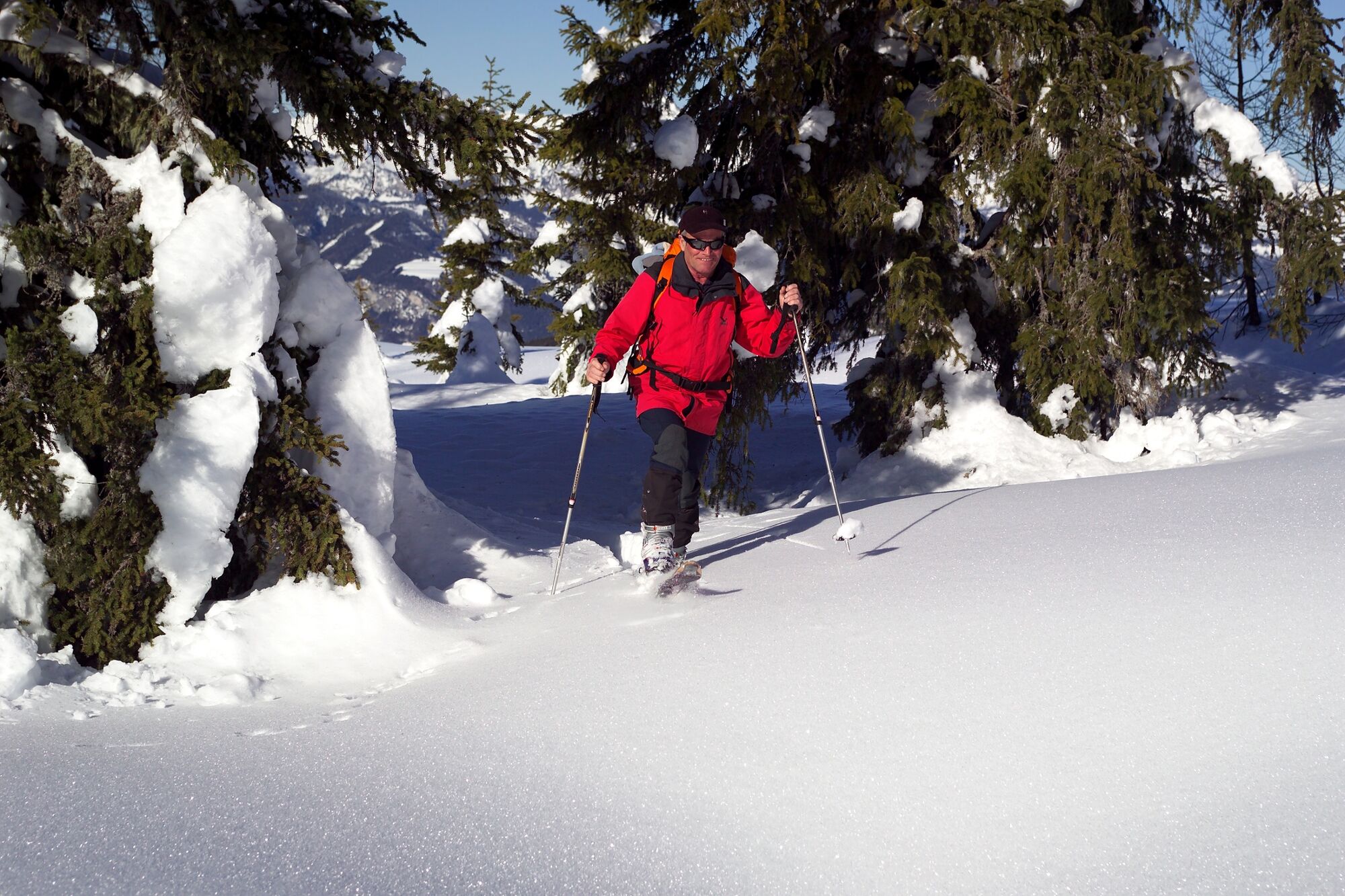
With nature on you and you: On this challenging tour, it is quite possible that you will only see the inhabitants of the forest. The little-used route takes you initially over the forest road and then over several floors and steep climbs to the ridge of the Wolfnalmspitze at 2,049 m. Once you have arrived at the summit, the Ahornkogel, Dachstein and the Ennstal will give you a warm welcome.
- Directions
-
The ski tour starts directly at the parking lot. You follow the cleared forest road up to the 5th bend. Now you track long and flat on the not cleared forest road to a stream and cross it. A short distance later you climb up to the right through the high forest and come back to the forest road, which you follow to the Wolfnalmhütte, a hunting lodge. Here you turn south to the left side of the wide valley before it gets steeper at a prominent boulder. Be careful - there it can be dangerous for avalanches. Via individual short ascents and small floors you finally reach the summit block, which can only be reached on foot. There is no summit cross or summit book here, but a magnificent panorama that shows you the nearby Ahornkogel, the Schreinl and the mountains of the Planneralm behind it.
The descent follows the ascent track.
- Highest point
- 2,033 m
- Endpoint
-
Schaupphof
- Exposition
- Height profile
-

- Equipment
-
In addition to food and warm drinks, pack spare clothing and a first aid kit in your backpack.
Choose your clothing according to the onion layer system.
An avalanche transceiver, probe and shovel are a prerequisite in alpine terrain.
You should also pack maps and/or tour descriptions. GPX tracks on your cell phone or GPS device will also help.
Ski touring and safety equipment can be rented at Sport Scherz and Sport Schöttl. - Safety instructions
-
Mountain sports and the assessment of the situation on site are - even more so in winter - primarily subject to personal responsibility. Tourism associations or avalanche warning services do not assume any liability based on the information provided.
Check the weather and avalanche situation at www.lawine-steiermark.at before each ski tour. The use of the tour description is at your own risk and responsibility. Do not go on a ski tour alone. It's more fun together anyway! Always behave risk-conscious and react to danger signs! Respect existing regulations, such as hunting and game protection areas, reforestation or young growth areas. You should always have your cell phone well charged. Do you have the emergency numbers saved? Mountain rescue: 140. If you have no reception, take out the sim card and dial 112. - Tips
-
As a downhill option, you can cross the Wolfnalmbach at the Wolfnalmhütte. Then you follow the forest road to the 7th bend of the ascent path and follow this before closing the circle at the 5th bend and descending to the starting point.
- Additional information
-
Tourism information: www.schladming-dachstein.at
Tourism blog: www.derbergdastal.at
Tourist Office Schladming-Dachstein
Ramsauerstrasse 756
8970 Schladming
T: +43 3687 23310
Garbage on meadows and paths can not smell mountain and valley. Please take it with you. Agriculture and forestry are important partners for Berg und Tal. They allow you to walk and drive on many of their paths. Be aware that only good cooperation will guarantee your recreational enjoyment in the future.
Sport Scherz
At Riesneralm, Planneralm and in Wörschach
+43 (0)3682 22383
sport-scherz.atSport Schöttl
At Planneralm and in Irdning
+43 (0)3682 22952 0
sport.schoettl.atGuided ski tours and freeride courses also at www.magicsnow.at
- Directions
-
From the Ennstalbundesstraße (B320) turn off at the Trautenfels junction in the direction of Irdning, Donnersbach, Donnersbachwald. Through the village of Donnersbach and another 12 km to Donnersbachwald. Past the Riesneralm and another approx. 2 km to the Schaupphof on the right side of the road.
- Public transportation
-
Unfortunately, there is no public transport to the starting point of the ski tour.
- Parking
-
Parking at the starting point.
- Author
-
The tour Ski tour to the Wolfnalmspitze is used by outdooractive.com provided.