Sonntagskogel, also an enjoyable tour from Monday to Saturday!


- Brief description
-
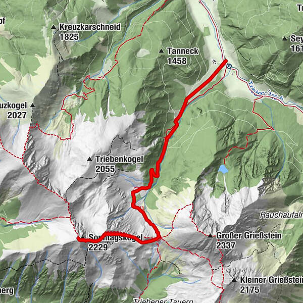
A varied ski tour summit rises between Grießstein and Geierkogel. Accessible from the Triebental valley via the Steiner Alm and the Triebener Törl.
- Difficulty
-
medium
- Rating
-
- Starting point
-
Parking lot 3- Seyfried, Triebental
- Route
-
Sonntagskogel (2,229 m)5.7 km
- Best season
-
AugSepOctNovDecJanFebMarAprMayJunJul
- Description
-
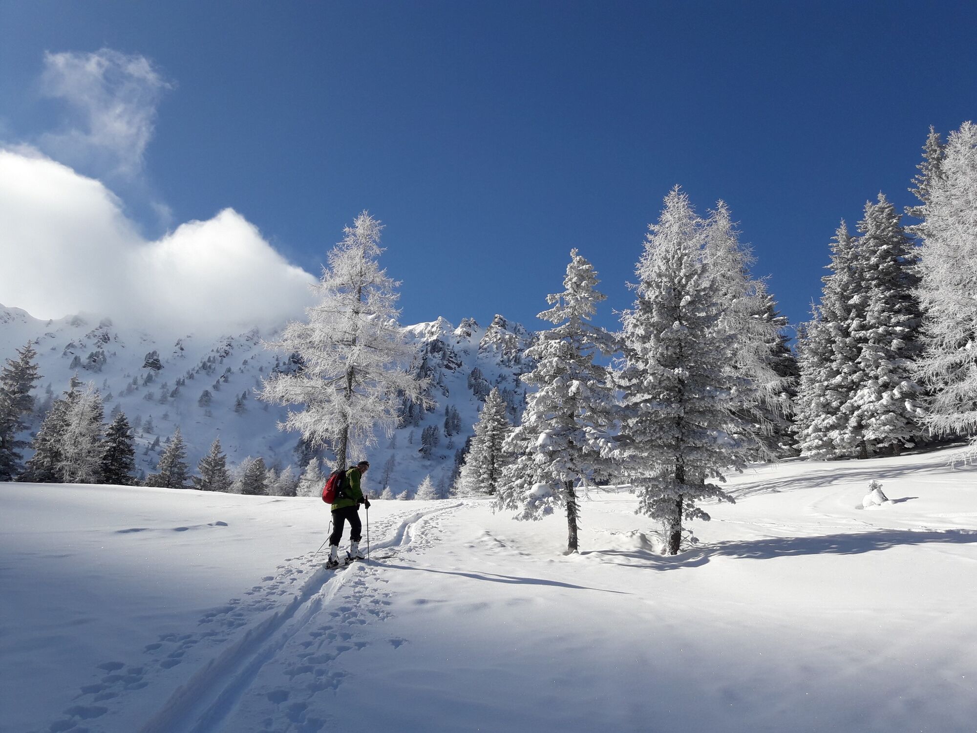
As with all ski tours in the Triebener Tauern, the first ascent is via a forest road. Once past the forest belt, an impressive landscape opens up. The rugged Grießstein, the foothills of the Sonntagskogel and the Triebenkogel rise above the gentle alpine pastures. The Steiner Alm (Triebener Hütte, 1,446m) is one of the most beautiful places in the Triebental and invites you to take a break.
The ascent track is harmoniously laid into the slopes to the Triebener Törl, 2,009m. The saddle is reached with just a few hairpin bends. The view is overwhelming. An overview of the peaks of the Trieben Valley, strung together like a string of pearls!
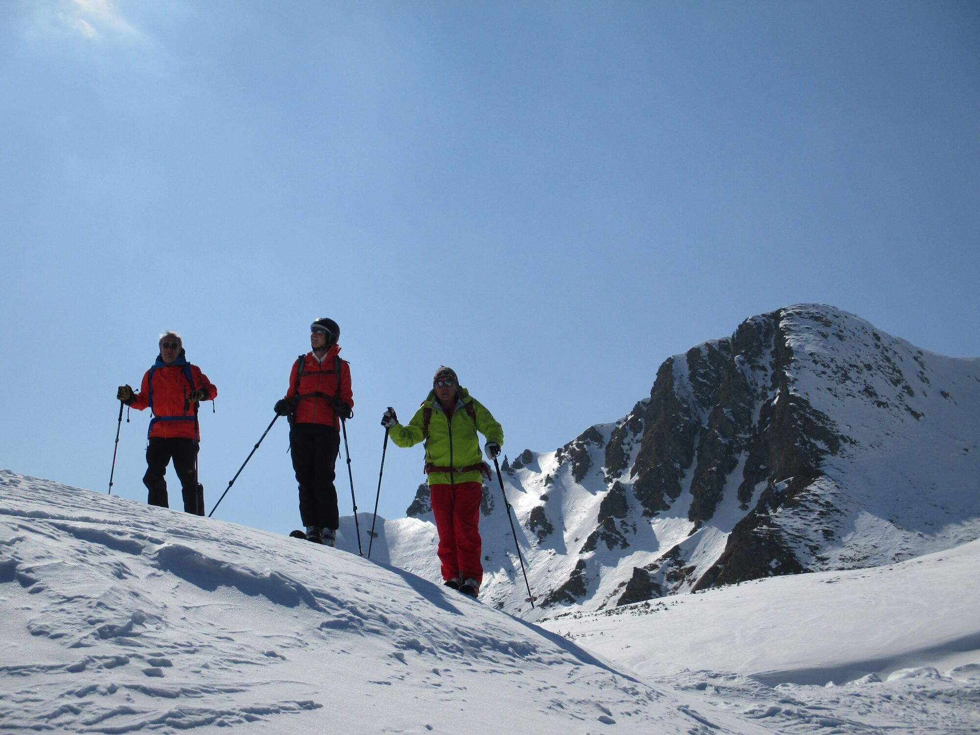
Now we climb up the wide slopes to the summit. The last few meters to the highest point are steep. Either we don't make it to the summit or we tackle this section without skis.
The descent is via the wide slopes in the area of the ascent track.
- Directions
-
The tour starts at parking lot 3 - Seyfried, just 2 km behind the former Braun inn in Triebental.
We follow the large meadow in a SW direction to the edge of the forest, where we meet the forest road. Now we follow the forest road (marked S5) to the Steiner Alm (Triebener Hütte, 1,646m).
Behind the hut, the route leads us across the slopes in a south-westerly direction towards Triebener Törl. Triebener Törl is the saddle between Griesstein and Sonntagskogel. Once at the Törl, we first follow the ridge/ridge to the Sonntagskogel. We make a good track in the flank that leads to the summit of the Sonntagskogel. The last, very steep section to the summit can be tackled without skis.
The descent follows the ascent track.
- Highest point
- 2,205 m
- Endpoint
-
Sonntagskogel
- Exposition
- Height profile
-

- Equipment
-
Emergency equipment: Burial tool, shovel, probe. First aid kit, 2 man bivy sack, tape, headlamp Signal cartridges, storm fuse, candle Tools (Leatherman) Wax for skis and/or skins
crampons Thermos bottle or normal drinking bottle Clothes, suitable for the weather Gloves, spare gloves Hood sunscreen, sunglasses, goggles topographic map of the area GPS drink, food - Safety instructions
-
You are in alpine terrain on every ski tour, therefore alpine dangers must be taken into account.
Consistent tour planning is required for every tour:
Weather report: www.zamg.at , www.alpenverein.at , www.yr.no
Avalanche situation report: www.lawine.at
The avalanche situation always depends on the current conditions. Ascent and descent tracks must be carefully planned and selected.
Avalanche seminars, ski technique courses for ski tourers and guided tours:
Pay attention to possible information boards on site, observe wildlife rest zones!
Let someone know your tour destination and the planned return.
- Tips
-
After the tour, stop off at Bergerhube or GH Brotjäger (pre-order your meal!).
- Additional information
- Directions
-
From the north
On the A9, the Pyhrnautobahn, take the Trieben exit. From there take the B 114 in the direction of Judenburg to Hohentauern. After 6 km turn left into the Triebental valley. Follow the road to the Seyfried parking lot, about 2 km behind the former GH Braun.
From the south
Via the S36, the Murtalschnellstraße to Judenburg, continue on the B 317 to the junction with the B114 towards Liezen. Follow the road to Hohentauern (approx. 35 km). Drive 3 km in the direction of Trieben. Turn right into the Triebental valley. Follow the road to the Seyfried parking lot, just 2 km behind the former Braun inn.
- Public transportation
- Parking
-
Parking lot for ski tourers at parking lot 3 - Seyfried with large ski tour overview board.
- Author
-
The tour Sonntagskogel, also an enjoyable tour from Monday to Saturday! is used by outdooractive.com provided.


General info
-
Gesäuse
190
-
Hohentauern
38