- Brief description
-
The tour to the Krugkoppe is technically easy. With good tracking we get to the saddle before the summit without a hairpin bend.
- Difficulty
-
medium
- Rating
-
- Starting point
-
Bergerhube
- Route
-
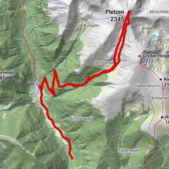
BergerhubeHasene Törl (1,960 m)4.7 kmKrugkoppe (2,042 m)4.8 km
- Best season
-
AugSepOctNovDecJanFebMarAprMayJunJul
- Description
-
From Bergerhube the route leads us through the forest in the direction of Mödringhütte, 1,467m. For part of our way, a small stream accompanies us on the right side.
Once you have overcome the forest belt on narrow paths, you will find yourself in an impressive environment. The imposing backdrop of the Gamskögel and the Mödringkogel can be marveled at.
Passing the Mödringkogel we enter the paradise. Paradise is the name given to the cirque that stretches between Mödringkogel, Krugkoppe, Speikleitenberg and Kettentalkogel.
The gentle cirque of Paradise, the flat and wide valley floor, bordered by the steep flanks with the steep gullies, make the heart of the ski tourer beat faster.
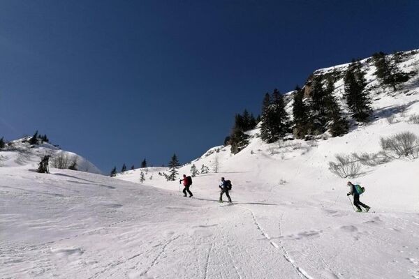
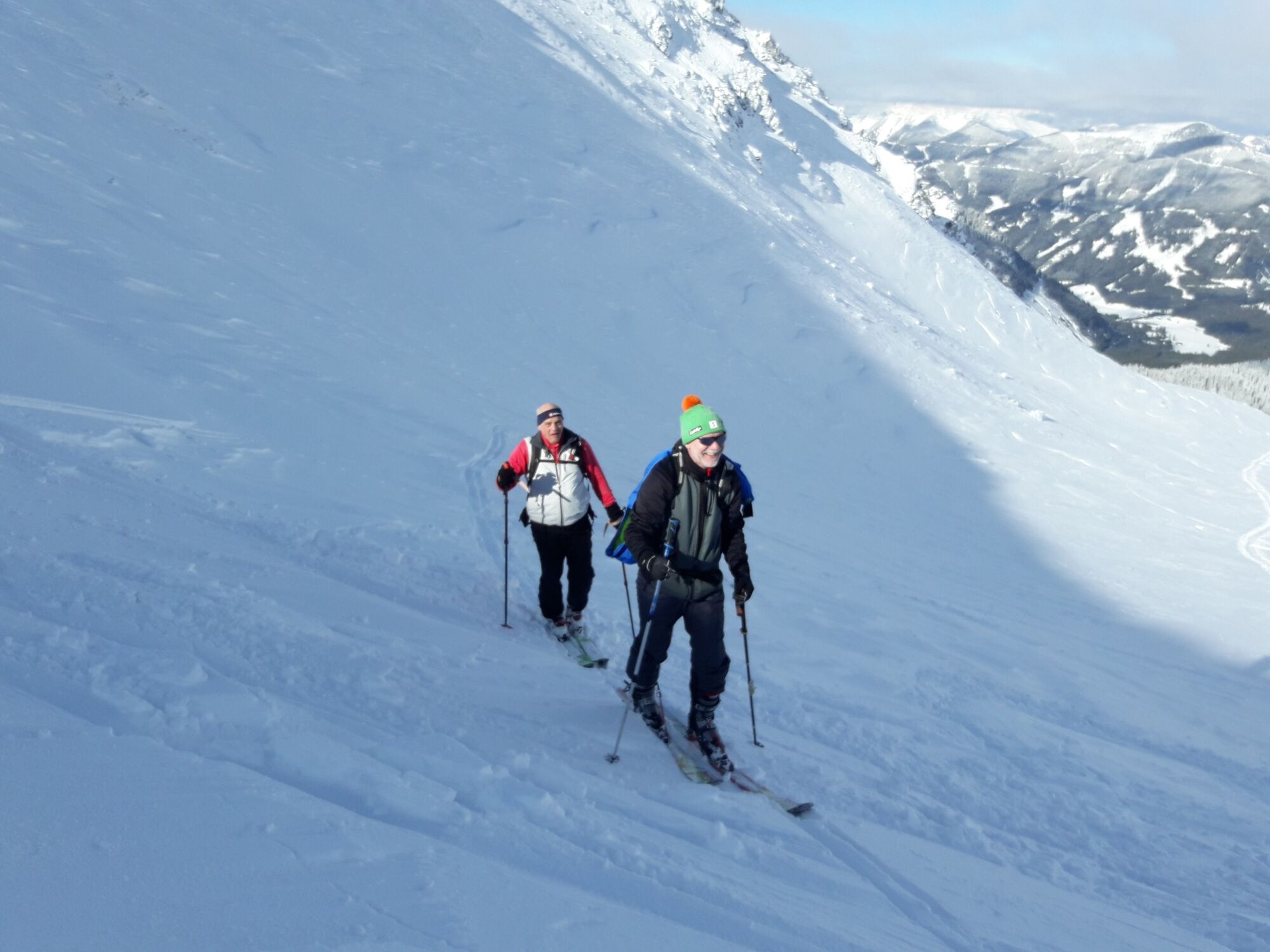
On the flat floor of the cirque we climb into the valley. A small steep step forms the ascent to the saddle. From there we continue to the top of Krugkoppe. The view of the surrounding mountains from the Zirbitzkogel and up to the Koralm is overwhelming.
The descent to the valley takes place over the wide slopes.
- Directions
-
From the Bergerhube we choose the path either across the large meadow (south of the Bergerhube) or the marked path towards Gamskögel. At the end of the meadow you meet the marked path again. Follow this path and pay attention at the turnoff to the Kettentörl, so as not to choose the wrong path (keep right in the direction of Gamskögel).
At about 1400 m you have to pay attention to the avalanche corridors of the Kleiner Griesstein. You reach this area, which is easily recognizable, when you leave the forest at about 1400m and before you reach the forest road.
After the avalanche line about 200m further on the forest road, passing under the Mödring hut, our route branches off to the SW (right) towards Mödringkogel. First on a clearing, then through forest we meet an open area at the foot of the Mödringkogel.
Now we turn to the southeast. After a smaller steep step (
- Highest point
- 2,034 m
- Endpoint
-
Krugkoppe, Bergerhube
- Exposition
- Height profile
-

- Equipment
-
Emergency equipment: Burial tool, shovel, probe. First aid kit, 2 man bivy sack, tape, headlamp Signal cartridges, storm fuse, candle Tools (Leatherman) Wax for skis and/or skins crampons Thermos bottle or normal drinking bottle Clothes, suitable for the weather Gloves, spare gloves Hood sunscreen, sunglasses, goggles topographic map of the area GPS drink, food
- Safety instructions
-
You are in alpine terrain on every ski tour, therefore alpine dangers must be taken into account.
Consistent tour planning is required for every tour:
Weather report: www.zamg.at , www.alpenverein.at , www.yr.no
Avalanche situation report: www.lawine.at
The avalanche situation always depends on the current conditions. Ascent and descent tracks must be carefully planned and selected.
The steep avalanche corridors from the Kleinen Griesstein and the steep gullies from the Mödringkogel must be taken into account. In poor visibility, orientation in paradise is not easy.
Crampons should be in your backpack for the last ascent to the saddle.
Avalanche seminars, ski technique courses for ski tourers and guided tours: www.alpinschuleamtauern.at
- Tips
-
Bergerhube, soup and pastries not to be missed!
- Additional information
- Directions
-
from the north
On the A9, the Pyhrnautobahn, take the Trieben exit. From there take the B114 in the direction of Judenburg to Hohentauern. After 6 km turn left into the Triebental. Follow the road to the end towards Bergerhube.
From the south
Via the S36, the Murtalschnellstraße to Judenburg, continue on the B 317 to the turn-off for the B114 in the direction of Liezen. Follow the road until Hohentauern (about 35 km). Drive 3 km in the direction of Trieben. Turn into the Triebental on the right side. Follow the road to the end until Bergerhube.
- Public transportation
- Parking
-
Parking lot Bergerhube, fee required!


- Author
-
The tour Krugkoppe, beginner's tour with magnificent scenery! is used by outdooractive.com provided.


-
Gesäuse
193
-
Hohentauern
38