- Brief description
-
The Galsterberg has developed from an insider tip to an absolute highlight among ski tourers.
- Difficulty
-
medium
- Rating
-
- Starting point
-
Start portal from the touring parking lot
- Route
-
amadeus Alm0.0 kmGalsterbergalmhütte3.2 kmJagdhütte3.3 kmGipfelbahn Vorderkahr4.2 kmKalteck (1,978 m)4.3 km
- Best season
-
AugSepOctNovDecJanFebMarAprMayJunJul
- Description
-
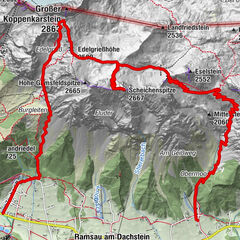
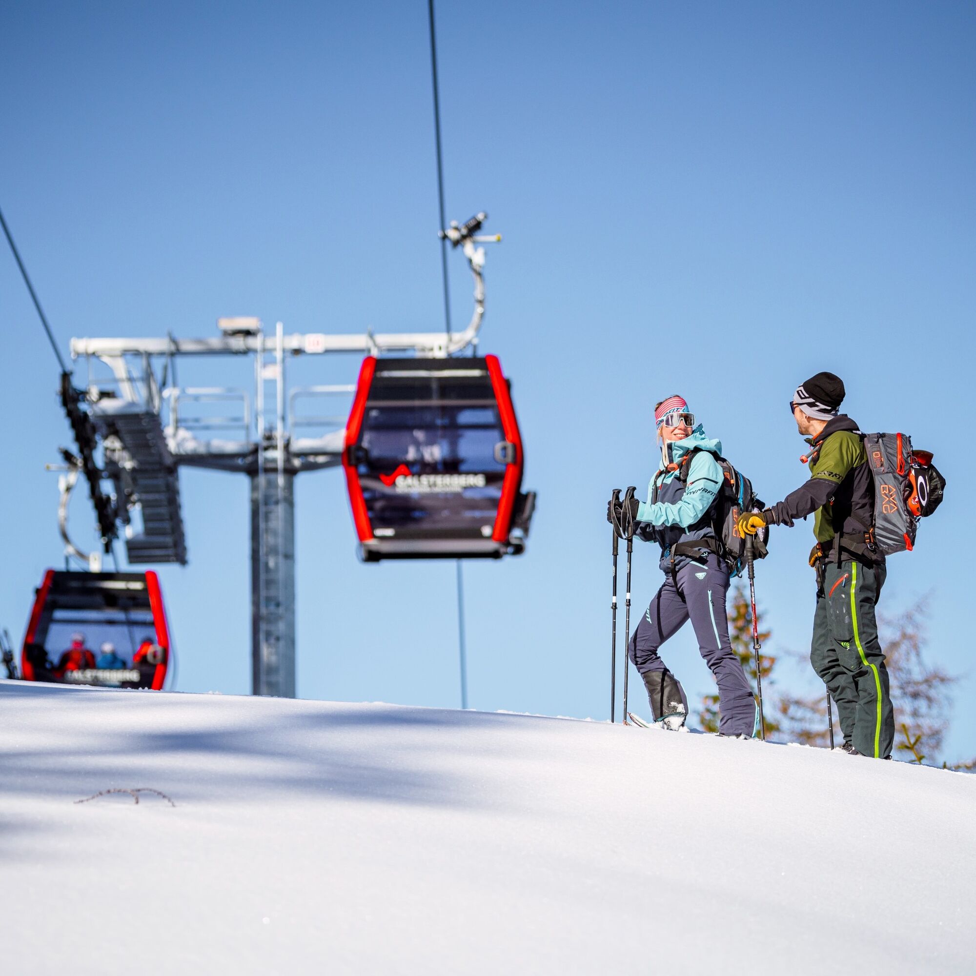
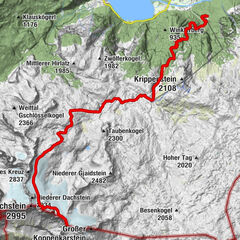
From the start portal, the tour takes you into the forest after a short stretch on the piste. The signposted route now runs alternately on piste sections and forest passages to the gondola mountain station. Finally, the ascent track takes you along the piste, past the Galsterbergalmhütte, to the Vorderkar chairlift mountain station at 1,984m. Do you want to go higher? Then you can also add the Pleschnitzzinken at 2,112 m in open terrain, but only during the day and in good weather. Please note that the ski tour is only possible during the opening hours of the pistes.
Subject to charge - ticket required!
Ticket price: € 11.00 day ticket (also valid on the Hochwurzen and Planai)
Piste Tour Card Winter: € 140.00 (valid Galsterberg, Planai, Hochwurzen, Fageralm, Rittisberg)
- Directions
-
Ski touring on the Galsterberg is only allowed during the opening hours of the slopes (8:30 to 17:00)! The ski tour Galsterberg starts at the valley station GUB Galsterberg directly at the start portal and leads after a short stretch on the slope into the forest, where a signposted route continues. Idyllic through snow-covered trees, it continues up towards the GUB mountain station, with partly piste sections and forest passages. From then on, the ascent trail runs along the piste, past the Galsterbergalmhütte to the top station of the Vorderkahr chairlift at 1,984m.
Downhill
During the opening hours of the piste (8:30 to 17:00) you can ski along the piste down to the valley. Skiing as well as entering the closed slopes is not allowed then.
- Highest point
- 1,975 m
- Endpoint
-
Top station chairlift Vorderkahr 1.984m
- Height profile
-

- Equipment
-
Ski touring equipment consisting of skis/splitboard, skins and poles
Avalanche transceiver (LVS), shovel and probe
Change of bodysuit & bonnet
Sunglasses for the ascent, ski goggles & helmet for the descent
Warm gloves, possibly light gloves for the ascent
Thermos flask with a warm drink, e.g. tea and muesli bar
- Safety instructions
-
Outside the opening hours of the ski slopes (from 8:30 a.m. to 5:00 p.m.) there is a general closure of the ski slopes due to the risk of serious accidents during the preparation of the ski slopes (winch, etc.). It is forbidden to drive on and enter the closed ski slopes. Climbing along the ski slope outside the operating hours is not allowed. There is danger to life due to preparation with the help of winches!
Please take the warnings seriously and use a headlamp in the evening for your own safety! Mountain sports are - even more so in winter - above all subject to personal responsibility. Tourism associations, mountain railroads or avalanche warning services do not assume any liability based on the information provided. The Planai-Hochwurzen lifts and the Schladming Tourist Association thank you for your understanding!
Basically, the following applies: Before every ski tour or snowshoe hike, it is essential to check the current weather and avalanche report - which can be found at www.lawine-steiermark.at.
- Tips
-
Tuesday, Thursday and Saturday from 7 p.m. to 11 p.m. skiable and floodlit
For experienced hikers, the tour can be continued on the Pleschnitzzinken at your own risk.
- Additional information
-
Safety information
Safety on the mountainside: changes in the weather, sudden fall in temperature, thunder storms, wind, fog and snow fields are all objective dangers and require the correct behaviour whilst underway. the landlords of the huts are all very knowledgeable about the mountains and can give you good tips about the weather and the routes. Insufficient equipment, exaggerated opinion of ones capabilities, frivolousness, poor health condition and a false evaluation of the situation can lead to a critical situation. In thunder storms: summits, crest-sites and safety rope aids are to be avoided.
If something should happen call following emergency numbers:
No. 140 - the number for all Alpine Emergencies in all of Austria
No. 112 - European emergency call GSM emergency-call-service - Directions
-
Take the Ennstal road (B320) from Radstadt or Liezen to Pruggern and from there follow the signs to the Galsterberg valley station.
- Public transportation
-
The free ski bus takes you from Niederöblarn - Gröbming - Michaelaberg-Pruggern to the Galsterberg cable car.
you can find the bus timetable.
- Parking
-
There are dedicated tourer parking spaces at the GUB Galsterberg valley station.


- Author
-
The tour Ski tour Galsterbergalm - Pleschnitzzinken is used by outdooractive.com provided.


")