- Brief description
-
Medium-difficulty ski tour with double summit happiness! Wide slopes and wonderful descents, which are still possible in spring.
- Difficulty
-
medium
- Rating
-
- Starting point
-
Planneralm - Kinderland
- Route
-
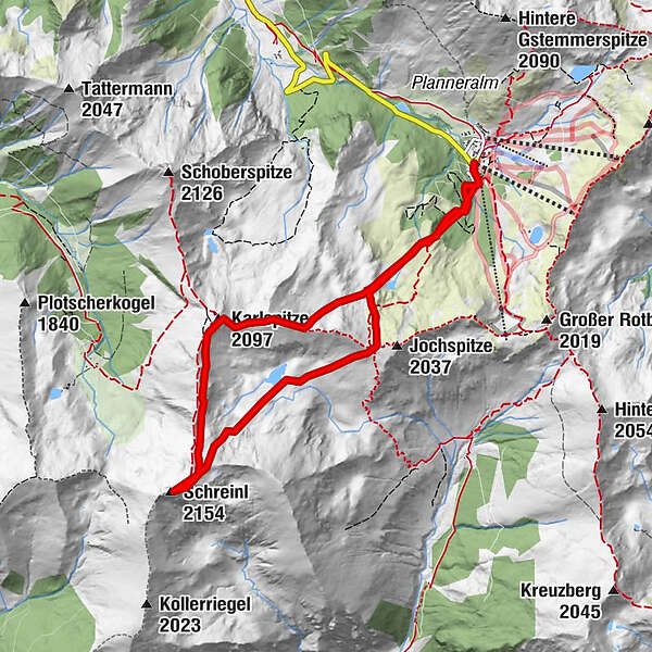
Karlspitze (2,097 m)2.8 kmSchreinl (2,154 m)4.4 kmGoldbachscharte (1,960 m)6.3 km
- Best season
-
AugSepOctNovDecJanFebMarAprMayJunJul
- Description
-
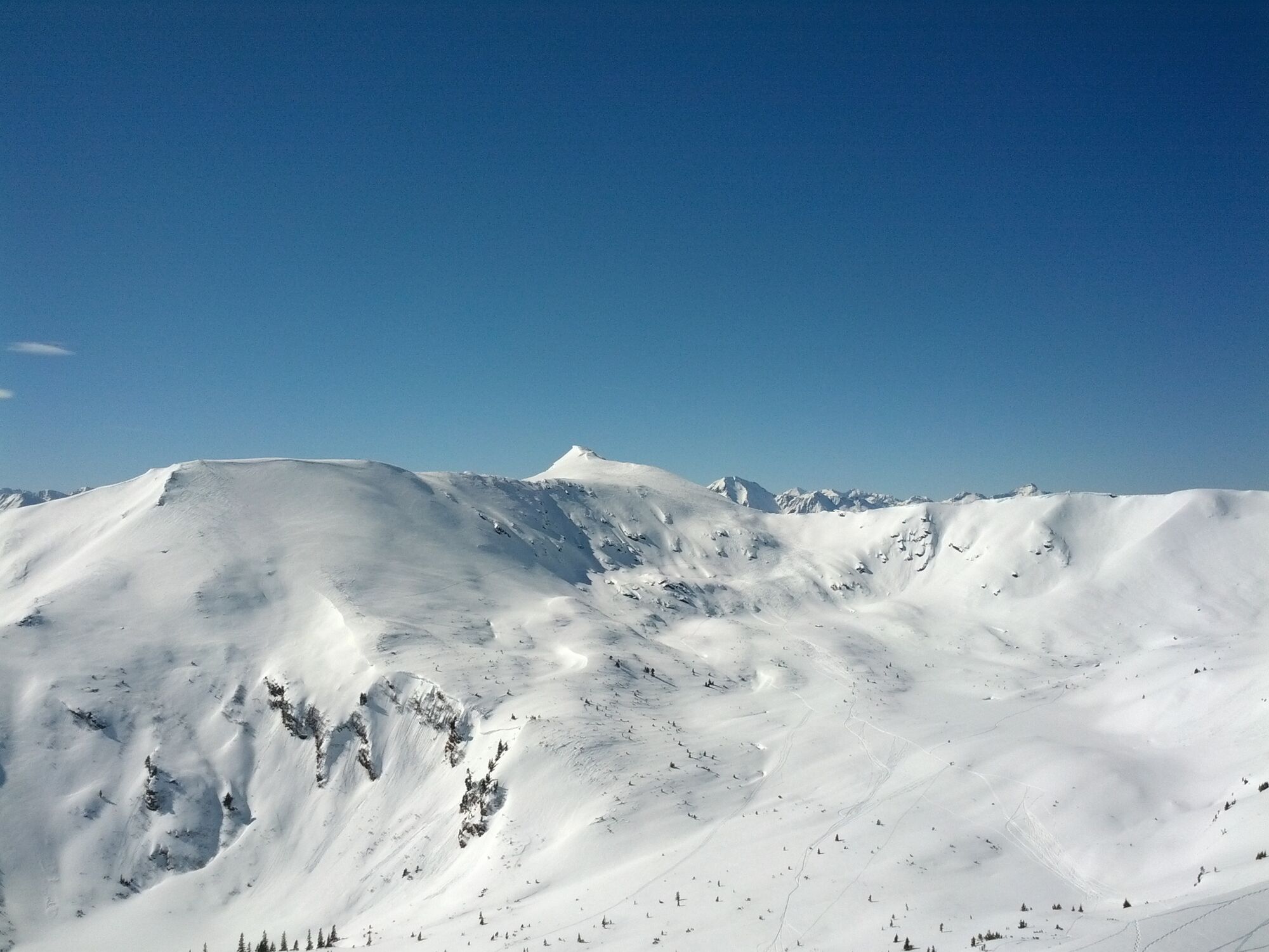
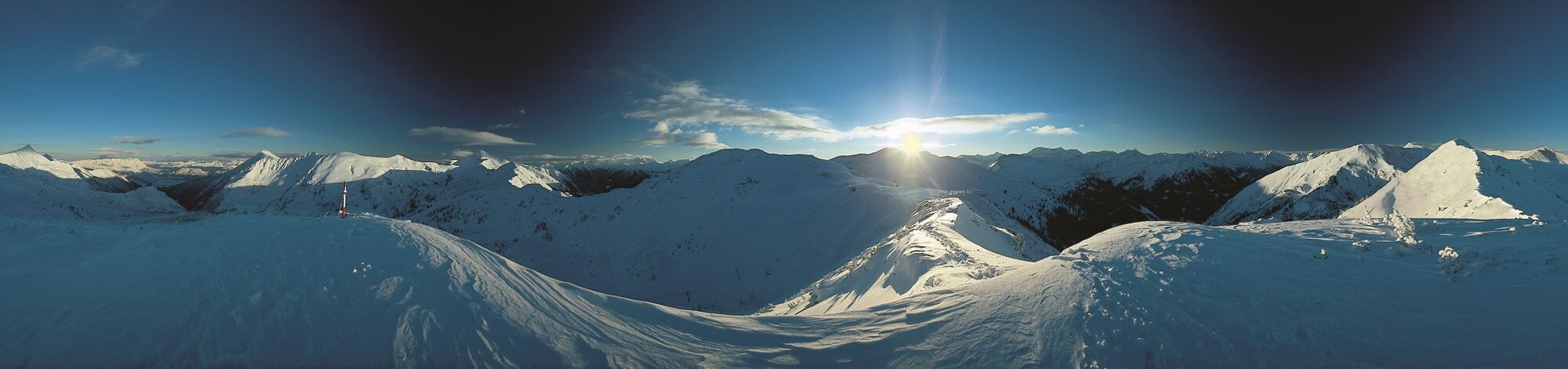
A classic ski tour that takes you high above the Planneralm. Wide slopes and magnificent views are guaranteed. For many, the Karlspitz is also the destination of this tour. Another plus point - you can also do it in spring. The altitude of the Planneralm makes it possible.
- Directions
-
You start this ski tour at Kinderland and follow the markings to the southwest, past the Kothüttensee on the pronounced ridge and on or next to it to the Karlspitze with summit cross. Continue on the flat ridge to the south and finally moderately steep to the Schreinl, where you are also welcomed by a summit cross. Up to here you can estimate about 2.5 hours walking time. This is followed by the descent to the Goldbachsee, where you skin up again to ascend the Goldbachscharte. Here you can take off your skins and enjoy the final descent to the starting point Planneralm.
- Highest point
- 2,151 m
- Endpoint
-
At the starting point
- Exposition
- Height profile
-

- Equipment
-
In addition to food and warm drinks, pack spare clothing and a first aid kit in your backpack.
Choose your clothing according to the onion layer system.
An avalanche transceiver, probe and shovel are a prerequisite in alpine terrain.
You should also pack maps and/or tour descriptions. GPX tracks on your cell phone or GPS device will also help.
Ski touring and safety equipment can be rented at Sport Scherz and Sport Schöttl. - Safety instructions
-
Mountain sports and the assessment of the situation on site are - even more so in winter - primarily subject to personal responsibility. Tourism associations or avalanche warning services do not assume any liability based on the information provided. Check the weather and avalanche situation at www.lawine-steiermark.at before each ski tour. The use of the tour description is at your own risk and responsibility. Do not go on a ski tour alone. It's more fun together anyway! Always behave risk-conscious and react to danger signs! Respect existing regulations, such as hunting and game protection areas, reforestation or young growth areas. You should always have your cell phone well charged. Do you have the emergency numbers saved? Mountain rescue: 140. If you have no reception, take out the sim card and dial 112.
- Tips
-
At the Goldbachscharte you can still take the short, steep climb to the Jochspitze. If the conditions are right, you will experience a great descent there!
- Additional information
-
Tourism information: www.schladming-dachstein.at
Tourism blog: www.derbergdastal.at
Tourist Office Schladming-Dachstein
Ramsauerstrasse 756
8970 Schladming
T: +43 3687 23310
Garbage on meadows and paths can not smell mountain and valley. Please take it with you. Agriculture and forestry are important partners for Berg und Tal. They allow you to walk and drive on many of their paths. Be aware that only good cooperation will guarantee your recreational enjoyment in the future.
Sport Scherz
At Riesneralm, Planneralm and in Wörschach
+43 (0)3682 22383
sport-scherz.atSport Schöttl
At Planneralm and in Irdning
+43 (0)3682 22952 0
sport.schoettl.atAvalanche workshops are offered by the local ski school:
Ski & Freeride School Planneralm
+43 (0)660 7445538
www.freeski.school - Directions
-
Turn off the Ennstalbundesstraße (B320) at the crossing Trautenfels in direction Irdning, Donnersbach, Donnersbachwald. In Donnersbach after the center of the village turn left towards Planneralm. 12 km long driveway over the toll-free mountain road up to the Planneralm.
- Public transportation
- Parking
-
Free parking at the large parking lot on the Planneralm. Please park in the lower area of the parking lot on busy days as tourers.

-

-
AuthorThe tour Skitour to the Karlspitz & Schreinl is used by outdooractive.com provided.