- Brief description
-
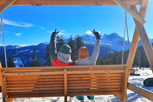
A ski touring experience in the middle of an untouched natural landscape.
- Difficulty
-
medium
- Rating
-
- Starting point
-
Gasthof Edelbrunn
- Route
-
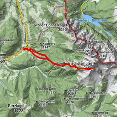
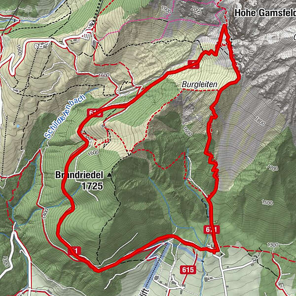
Alpengasthaus Edelbrunn0.1 kmDachsteinhaus0.8 kmBrandalm2.8 kmJungfrauen5.8 kmAlpengasthaus Edelbrunn7.0 km
- Best season
-
AugSepOctNovDecJanFebMarAprMayJunJul
- Description
-
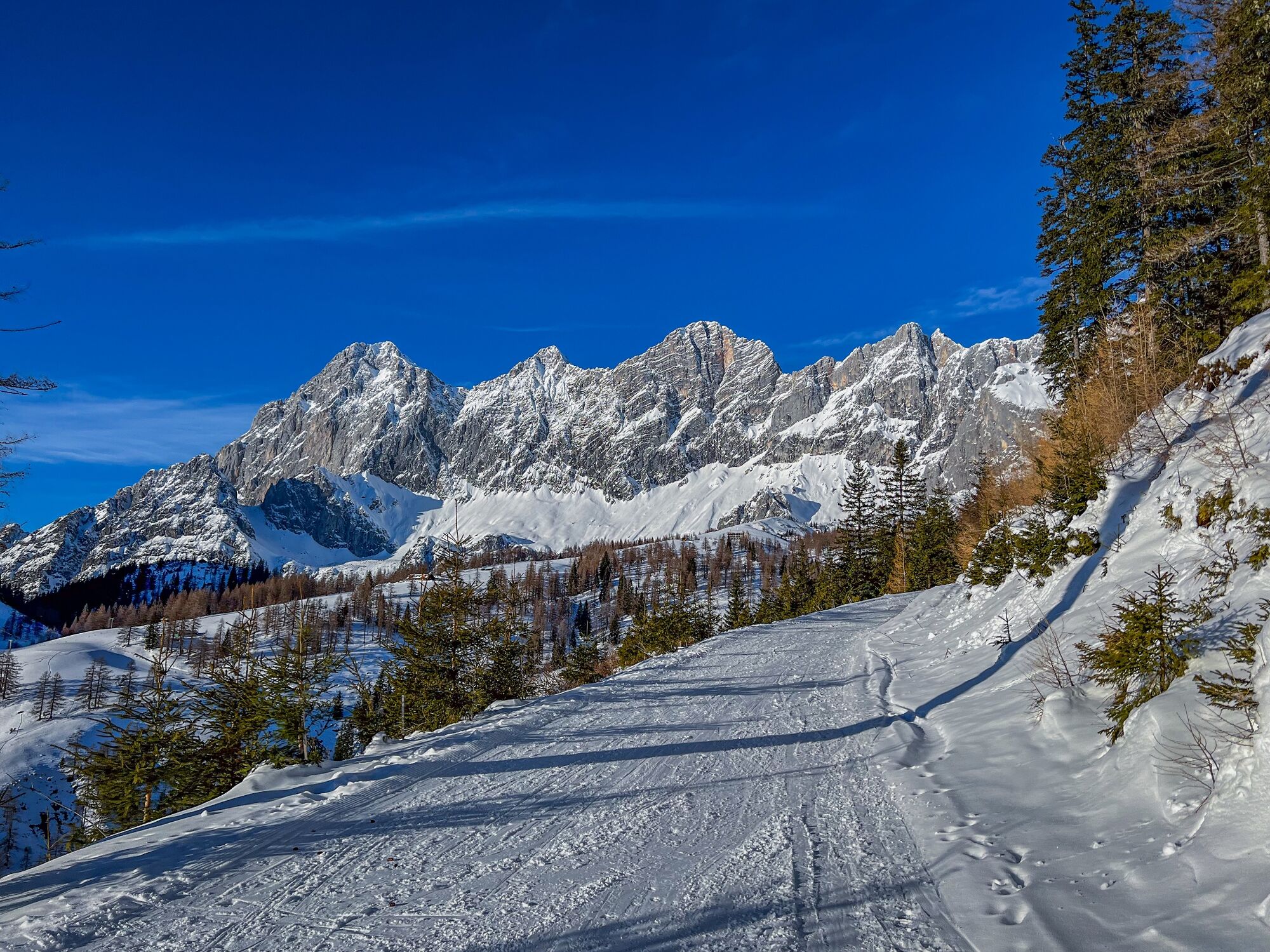
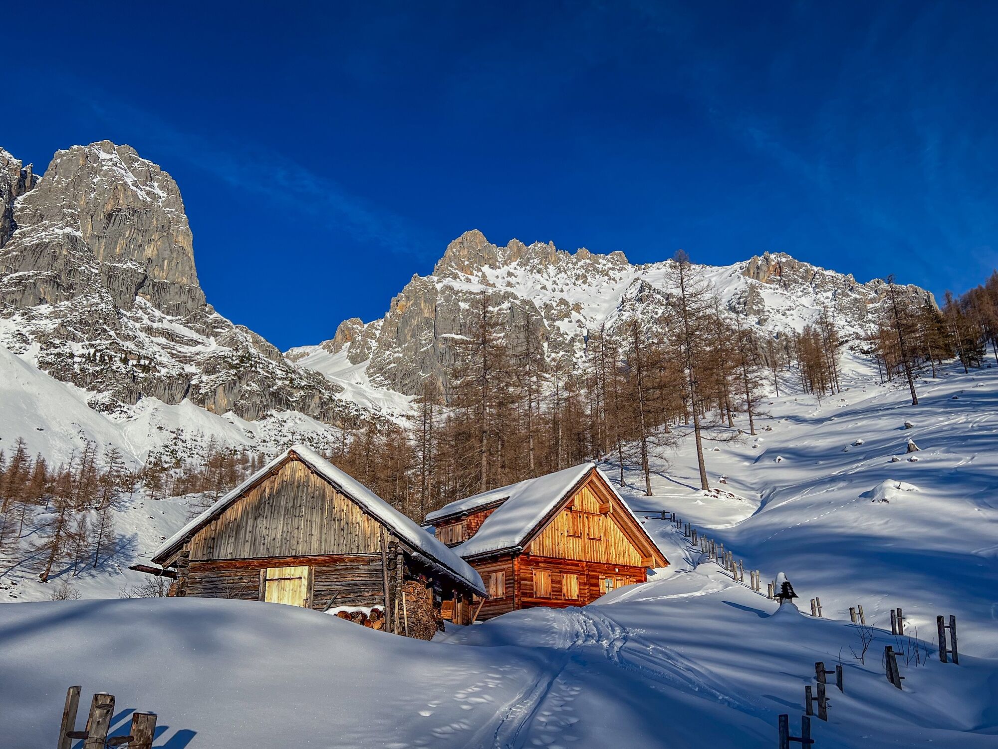
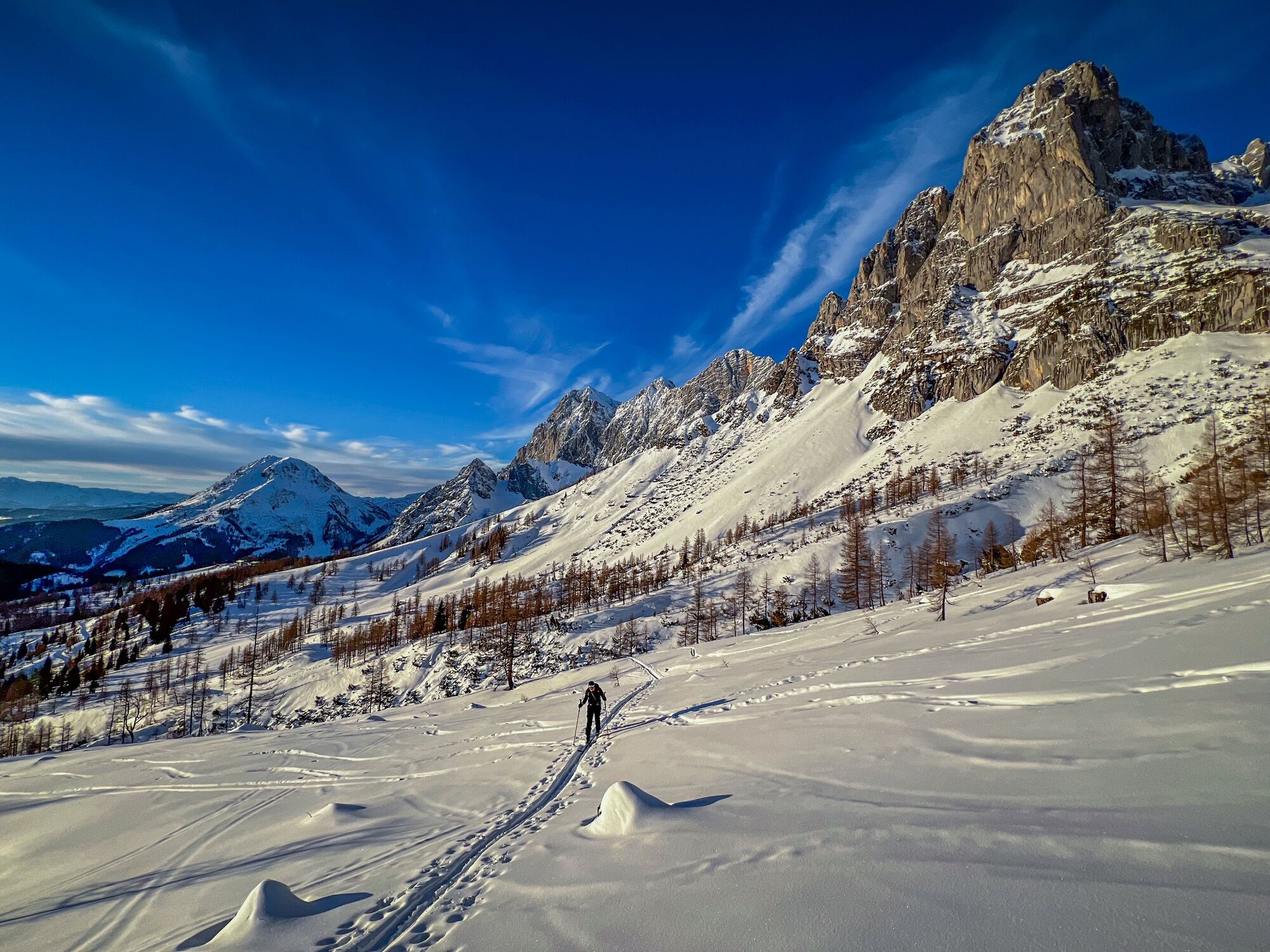
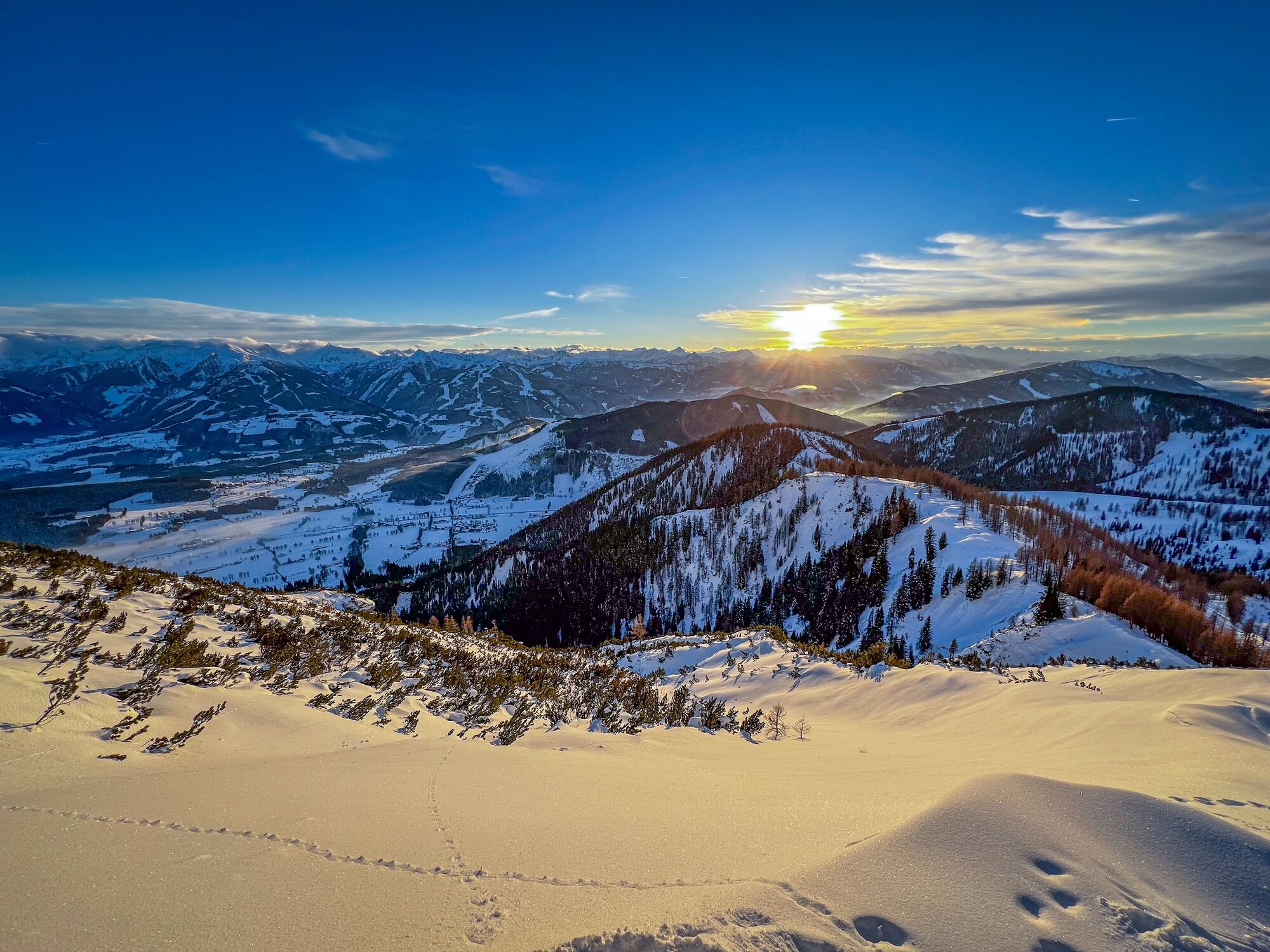
There is a reason why the Dachstein is also called "Austria's Touring Eldorado". Over 20 ski tours, crossings, and steep descents can be tackled from the Dachstein Gondola Mountain Station and Ramsau.
- Directions
-
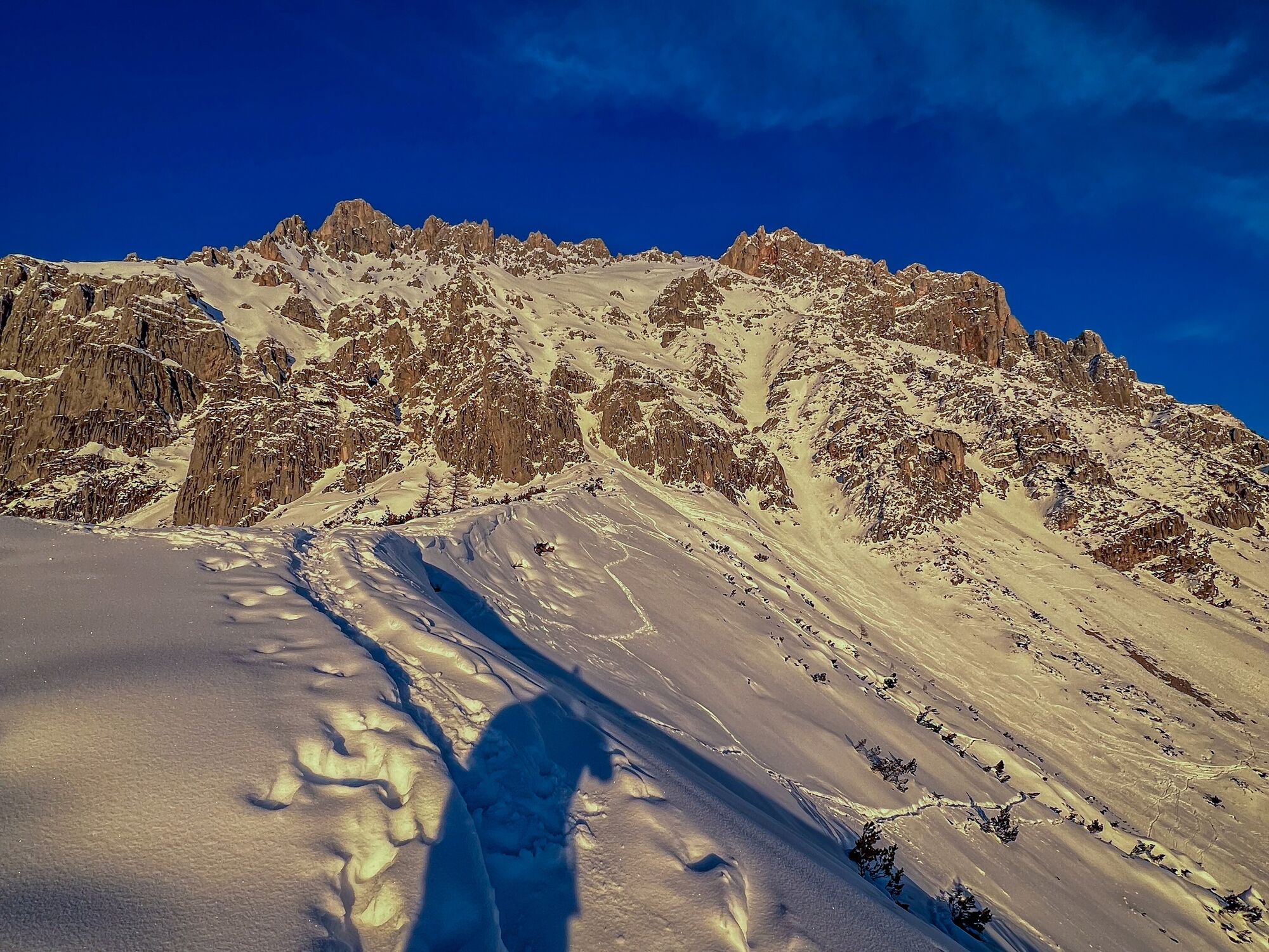
Ascent: take the ski trail to the top, past Dachsteinhaus and Brandalm and enjoy breathtaking views of the Dachstein Südwand on the way. Leave the ski trail about 300 metres after Brandalm and walk through the overgrown alpine pasture up to the Brandriedel (ridge). From there, via Kraml-Lahn/"Gamsfeldgassl" back to your starting point. Descent: same as ascent or via the Kraml-Lahn (note: steep, backcountry terrain, snow conditions and danger of avalanches!) back to Gasthof Edelbrunn.
Variant: take the ski trail up to Türlwandhütte/Dachstein Gondola Bottom Station and onwards to Lehnachriedel.
- Highest point
- 1,950 m
- Endpoint
-
Gasthof Edelbrunn
- Exposition
- Height profile
-

- Equipment
-
To go on a tour without proper preparation and equipment is reckless. Not only your own life is easily risked, but also that of your fellow mountaineers in the same region.
Must-haves: avalanche transceiver, mobile phone, shovel, avalanche probe, first aid kit, sufficient food and drinks, possibly additional clothing to change.
On the day of the tour: Read the avalanche situation report and weather forecast and check what effects it will have on your planned ski tour: possibly adjust or cancel the ski tour. Are all participants fit and healthy enough to go on the tour? If not, change or cancel the ski tour.
- Safety instructions
- Additional information
- Directions
-
From the west:
Tauern Autobahn (A 10) to Knoten Ennstal - turnoff direction Graz/Schladming - stay on the Ennstal-Bundesstraße (B320) for approx. 20 km until Schladming - take the turnoff for Ramsau.
From the north:
Pyhrn Autobahn (A 9) direction Liezen - take the Ennstal-Bundesstraße (B320) to Schladming - turnoff Ramsau.
- Public transportation
- Parking
-
Gasthof Edelbrunn

-
-
AuthorThe tour Ski Tour Kraml-Lahn via Ski Trail and Brandriedel is used by outdooractive.com provided.