- Brief description
-
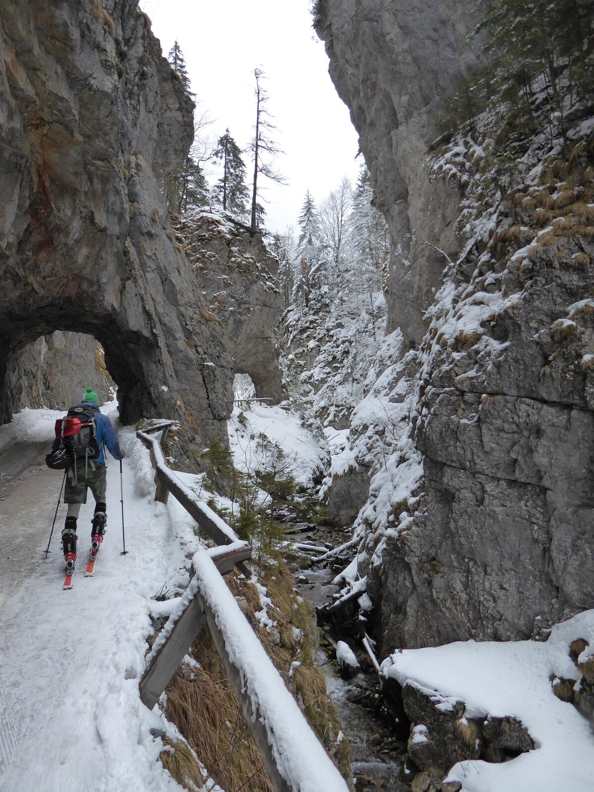
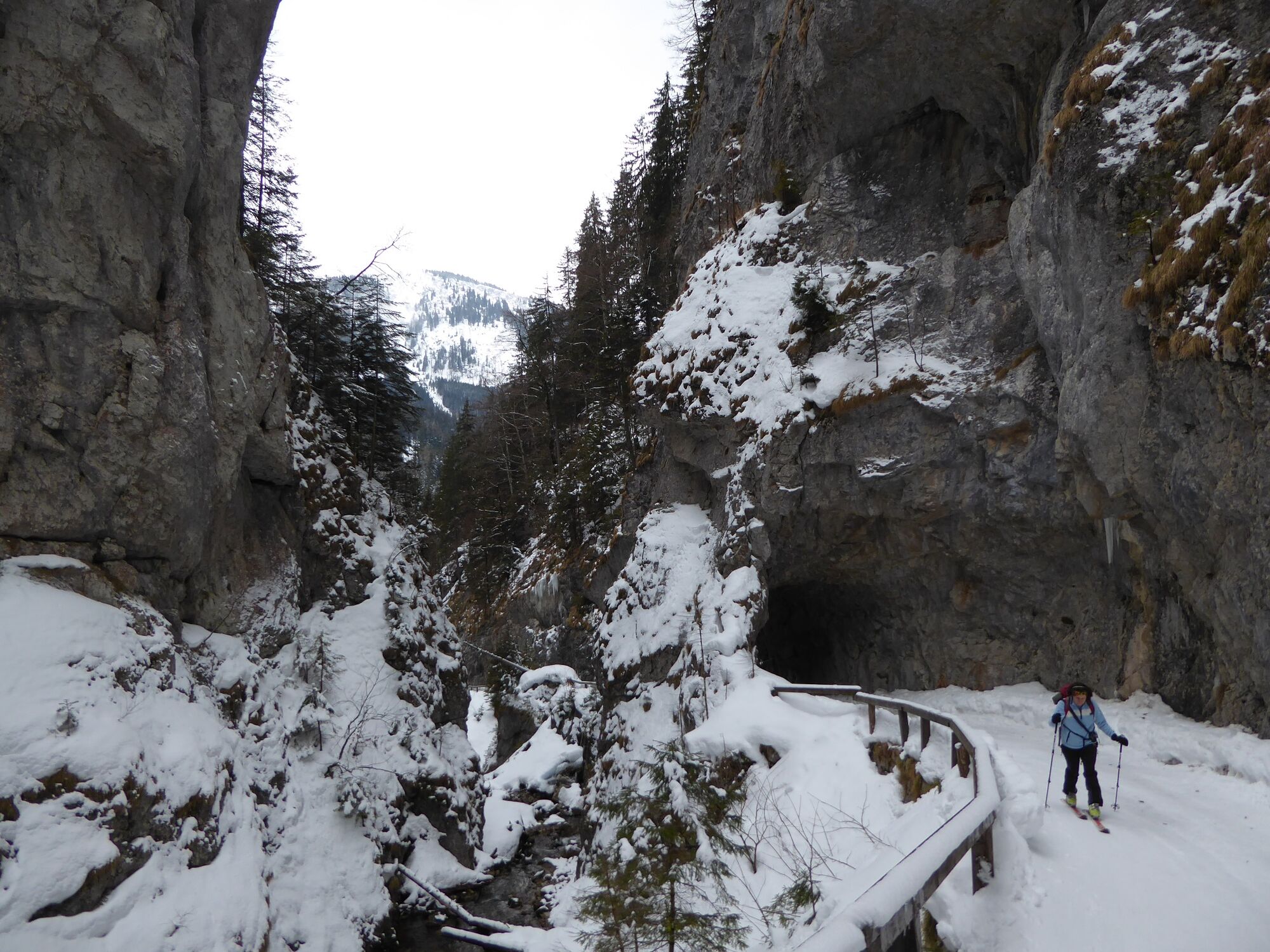
This beautiful ski tour impresses especially with a varied route and the Devil's Gorge.
- Difficulty
-
medium
- Rating
-
- Starting point
-
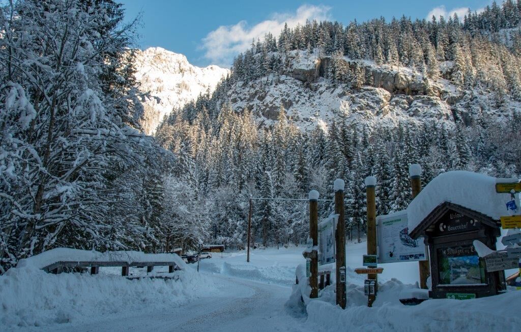
Parkplatz Ebnerklamm
- Route
-
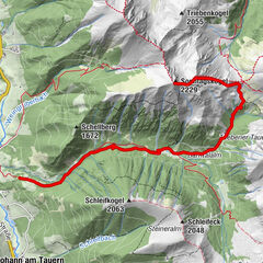
Gscheideggkogel (1,788 m)5.3 km
- Best season
-
AugSepOctNovDecJanFebMarAprMayJunJul
- Description
-
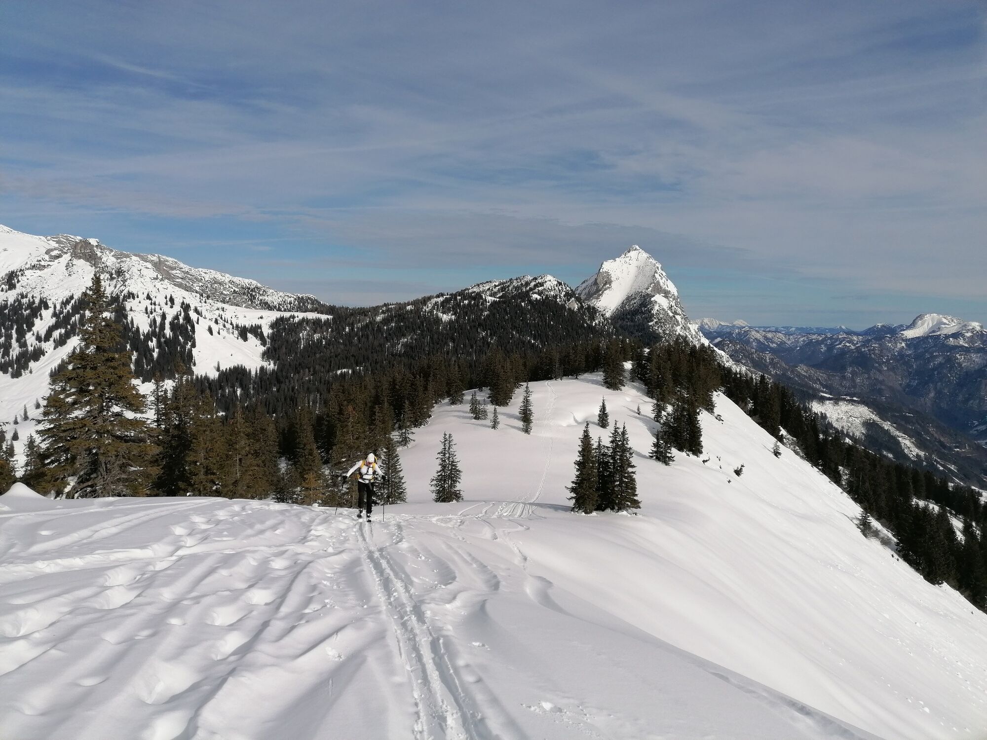
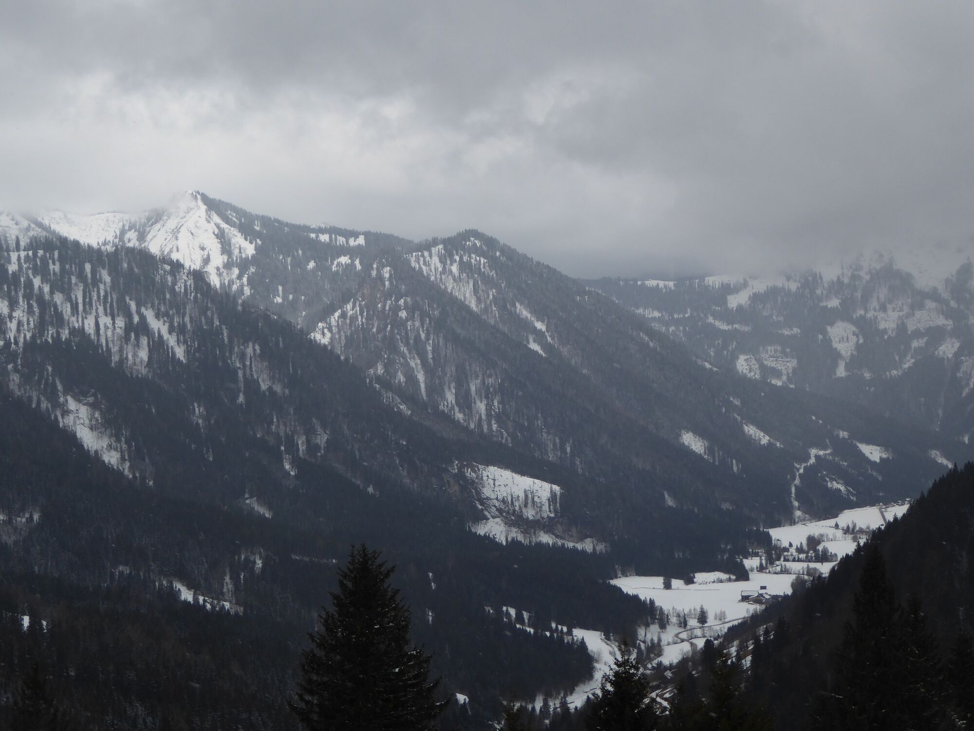
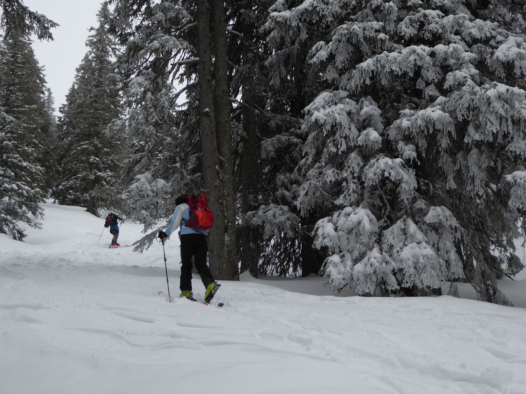
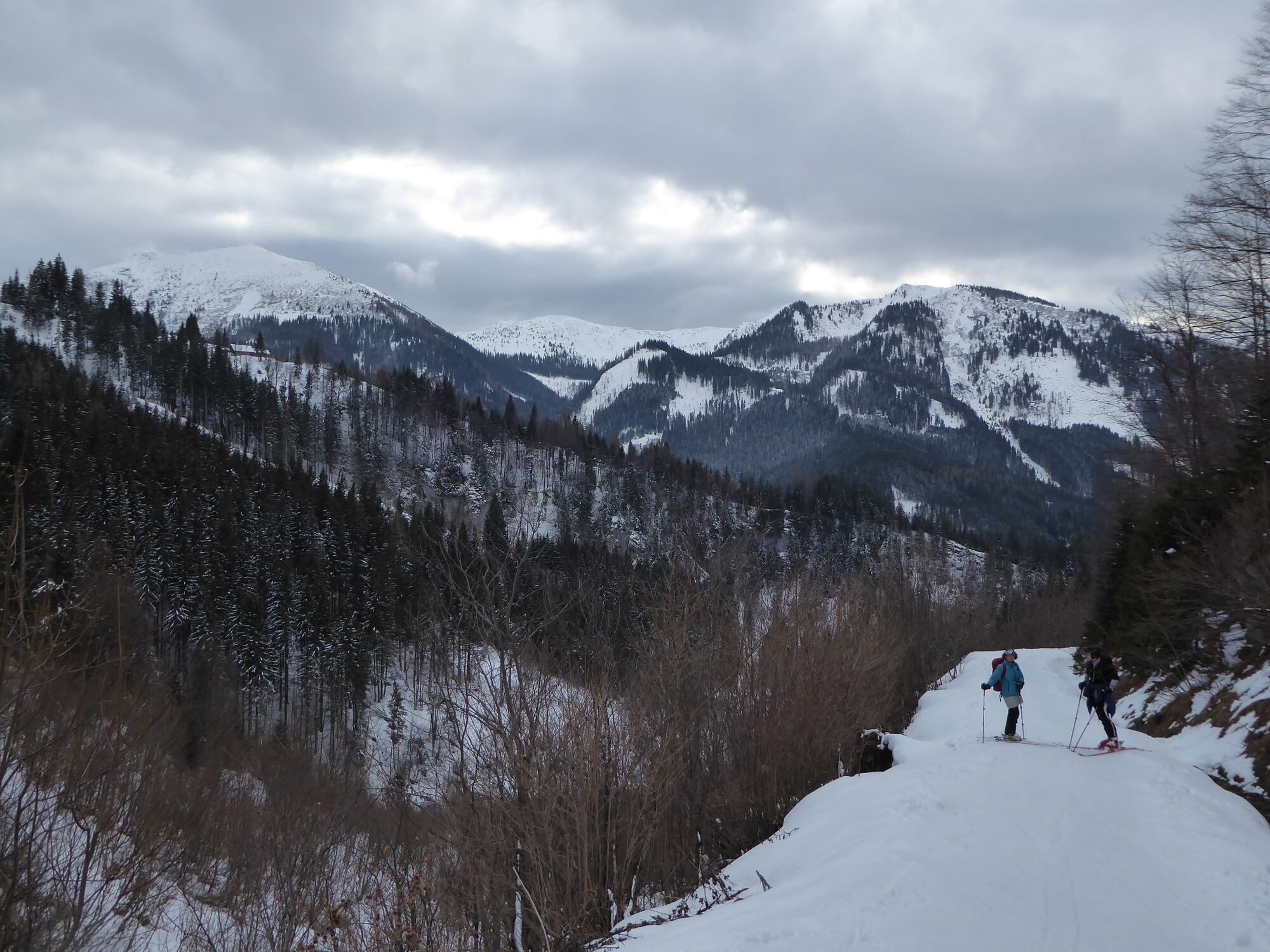
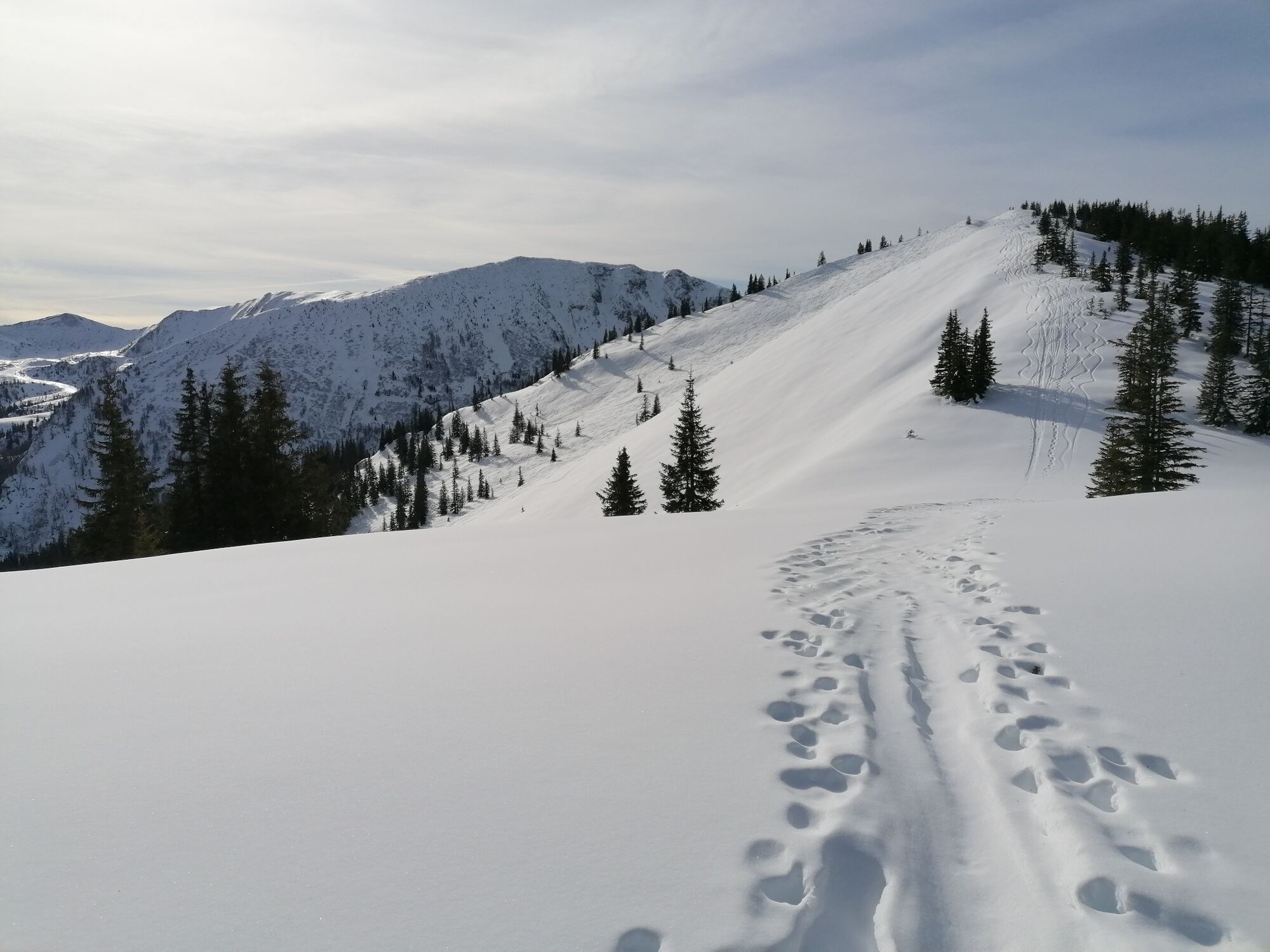
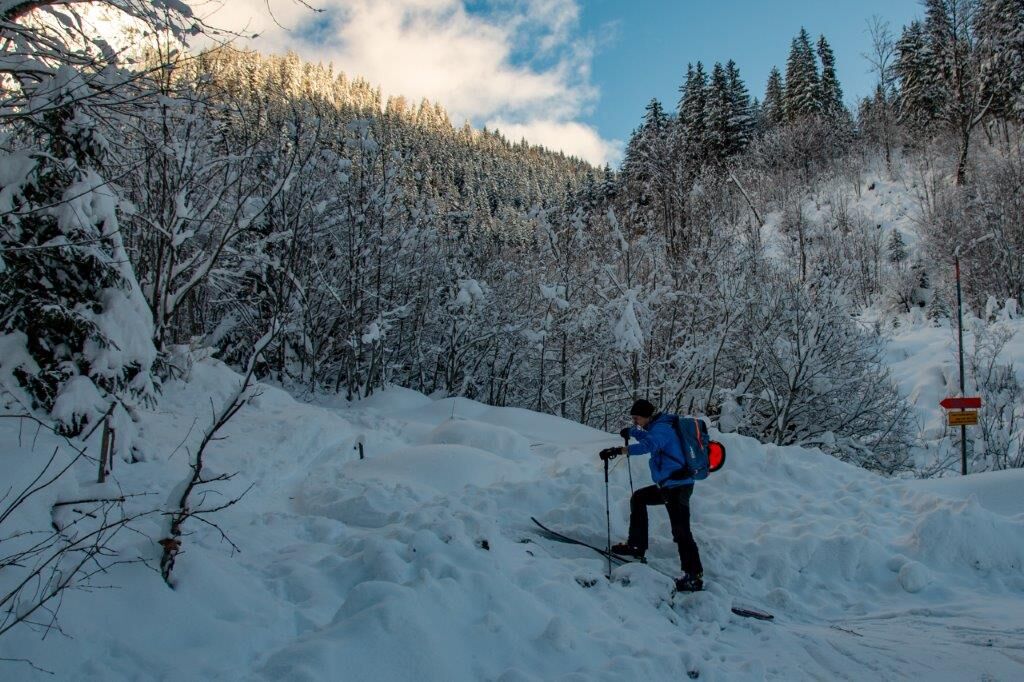
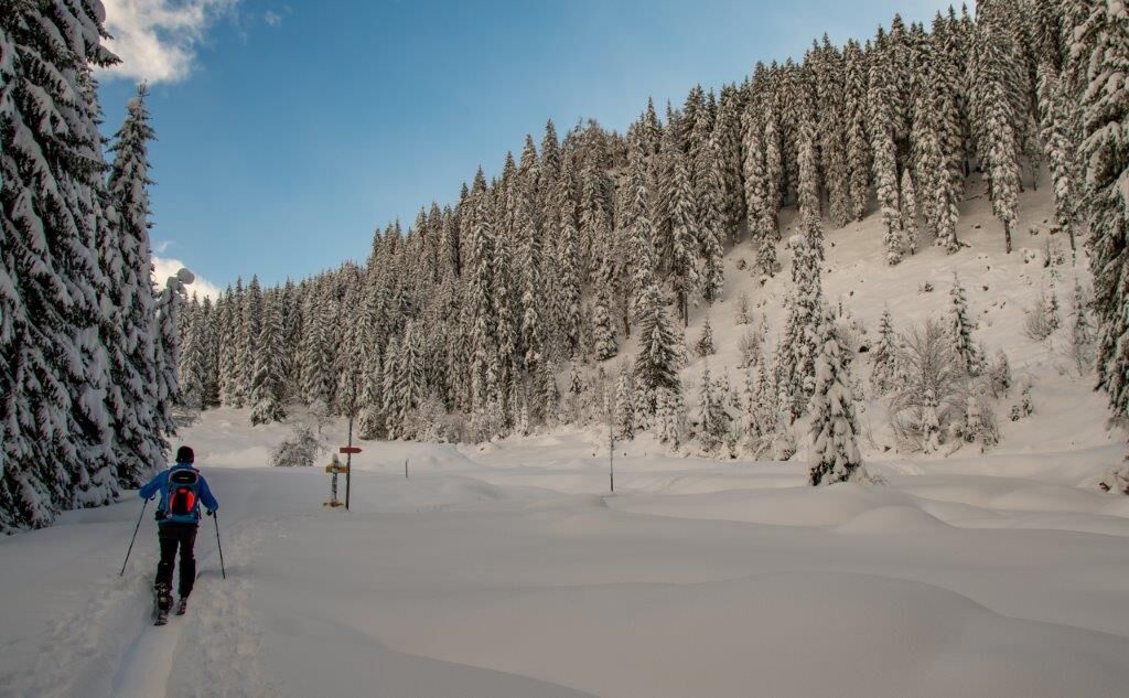
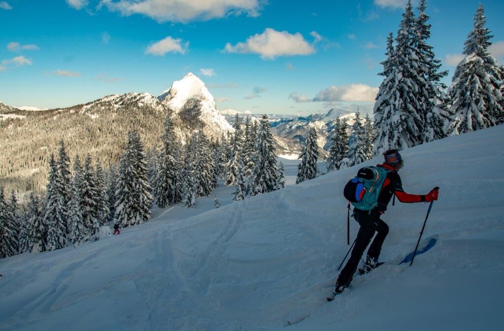
In the rear Johnsbachtal valley, north-east of the Leobner, there is a rather inconspicuous but promising ski touring mountain - the Gscheideggkogel. From the Ebnerklamm car park, which is the starting point of the famous Johnsbacher Almenrunde in summer, the mostly continuously groomed ascent route first leads along the forest road through the famous and worth seeing Ebner or Teufelsklamm gorge. Behind the gorge, the route leads over the toboggan run, soon we turn left and it goes alternately through the forest and in sections again on forest roads towards the summit. The last 200 metres of the summit slope are quite demanding, but they are worth it for the view of the snow-covered Gesäuse mountains and the guaranteed fun on the way down.
- Directions
-
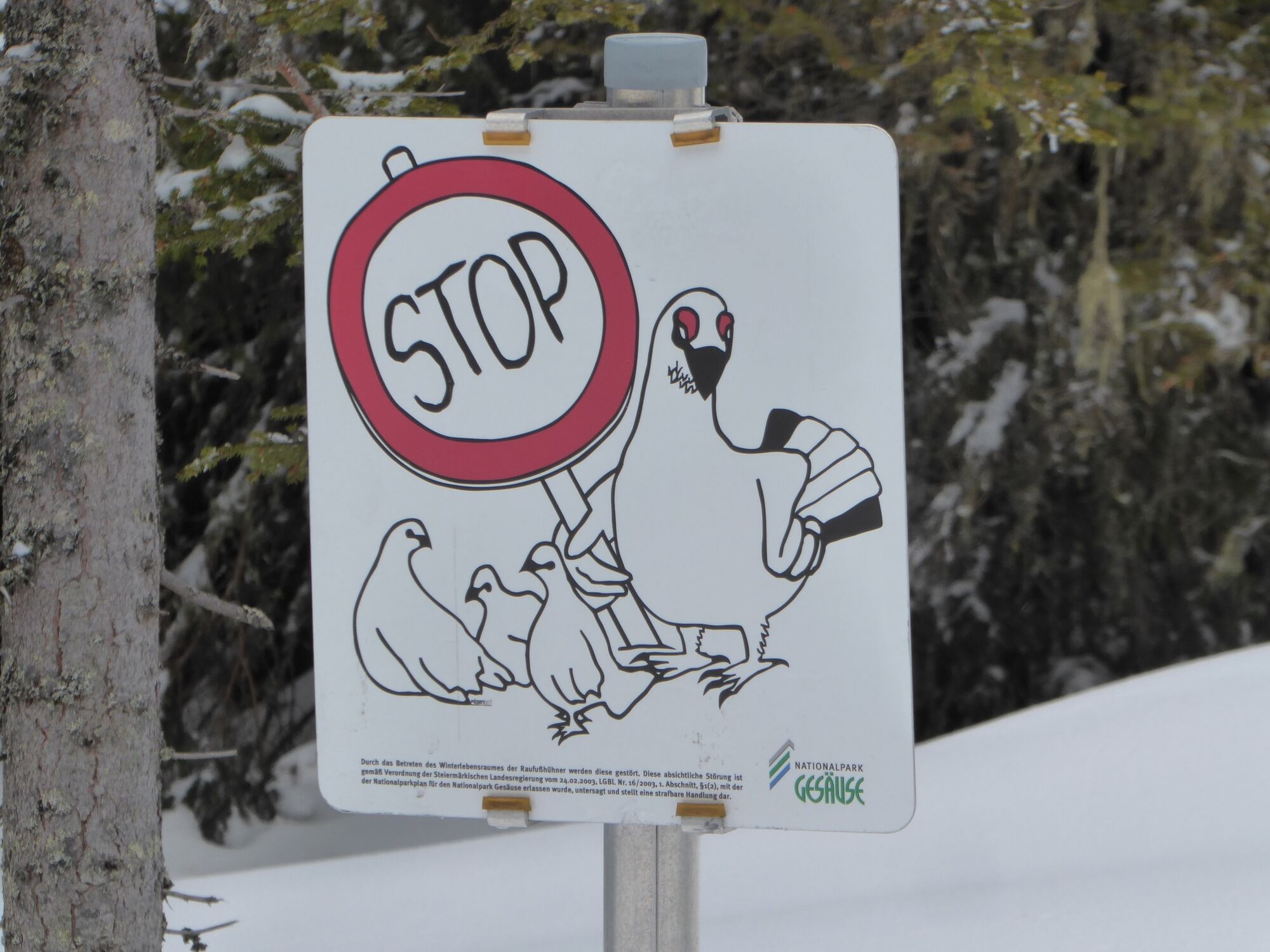
At the beginning of the forest road and in sections in the area of the gorge, you should be prepared for rough spots that can cause unnecessary scratches on the skiing surface during the subsequent descent. First you follow the forest road through the famous and worth seeing Ebner or Devil's Gorge. Behind the gorge, the route leads over the toboggan run, soon we turn left and it goes alternately through the forest and in sections again on forest roads towards the summit. If you follow the signs into the forest, you will soon reach a clearing via a small steep step. A little later, the tracked path follows a forest road for a longer section, whose forest areas on the left (east) are habitat for grouse and therefore may not be entered (corresponding signs clearly indicate this). At the end of the forest road, you reach a flat ridge in a short steep section and come directly to the beginning of the summit slope. Follow the tracks in a south-easterly direction past a weather station and up several hairpin bends to the summit cross (1788 m).
- Highest point
- 1,769 m
- Endpoint
-
Parkplatz Ebnerklamm
- Exposition
- Height profile
-

- Equipment
-
Ski touring and avalanche equipment, as well as a ski touring backpack with appropriate contents (water bottle, hiking map, snack, etc.). You should also be well prepared for a change in the weather.
Certain passages are steep and require the use of hairpin bends. And despite the low altitude and the route through the forest, it is imperative that you observe the avalanche warning levels!
- Safety instructions
-
Emergency call mountain rescue: 140
Safety in alpine terrain
The usual dangers of the mountains - falling rocks, falling in bad weather, risk of falling - are exacerbated in winter, especially by the risk of avalanches. This poses a challenge for beginners and professionals alike. Being able to assess the avalanche situation requires thorough preparation and years of experience. Therefore, please observe the principles of safe touring. Respect the rules of nature conservation and protect the sensitive nature in the Gesäuse National Park!
The tour is undertaken at your own risk! No liability is assumed for any alpine dangers (avalanches, weather, etc.). Important note: Before every ski tour or snowshoe hike, it is essential to check the current avalanche report - available at www.lawine-steiermark.at.
Mountain sports and the assessment of the situation on site is - even more so in winter - primarily your own responsibility. Tourism associations or avalanche warning services can therefore not accept any liability based on the information provided.
- Tips
-
At the starting points of the NP ski tours there are devices to check the function of your avalanche transceiver!
There are also information boards and flyers with the exact route description at the starting points!
Toureninfos auf NP-Gesäuse
- Additional information
-
Webcam Gscheideggkogel
Measurement data Gscheideggkogel (snow depths, wind speed, etc.)
Gesäuse Tourist Office
Hauptstraße 35, 8911 Admont, Austria
Phone +43 (0) 3613 21160-10
Email: info@gesaeuse.at
www.gesaeuse.at
Gesaeuse National Park GmbH
Weng 2, AT-8913 Admont, Austria
Tel. +43(0) 3613 211 60-20
Email: info@nationalpark-gesaeuse.at
www.nationalpark-gesaeuse.at
- Directions
- Public transportation
- Parking


-

-
AuthorThe tour Gscheideggkogel is used by outdooractive.com provided.


General info
-
Gesäuse
190
-
Wald am Schoberpass
46