
- Brief description
-
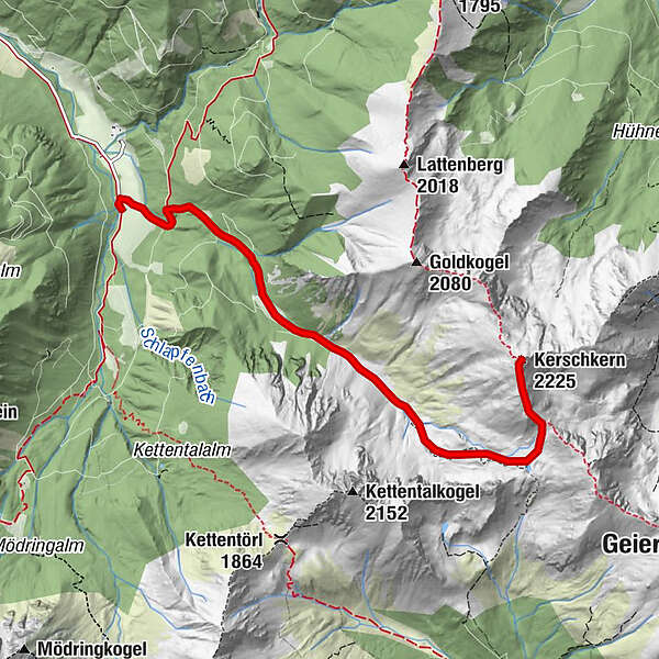
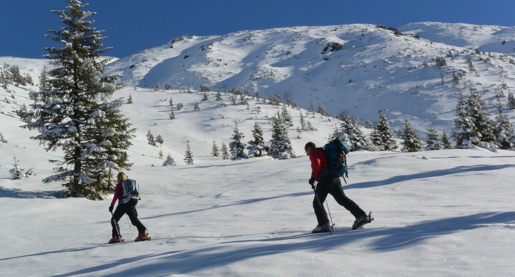
The Kerschkern is one of the most popular ski touring areas in the Niedere Tauern due to its rather gentle ascent. With the start and finish at the Bergerhube, the Styrian culinary delights are not neglected after the ski tour.
- Difficulty
-
medium
- Rating
-
- Starting point
-
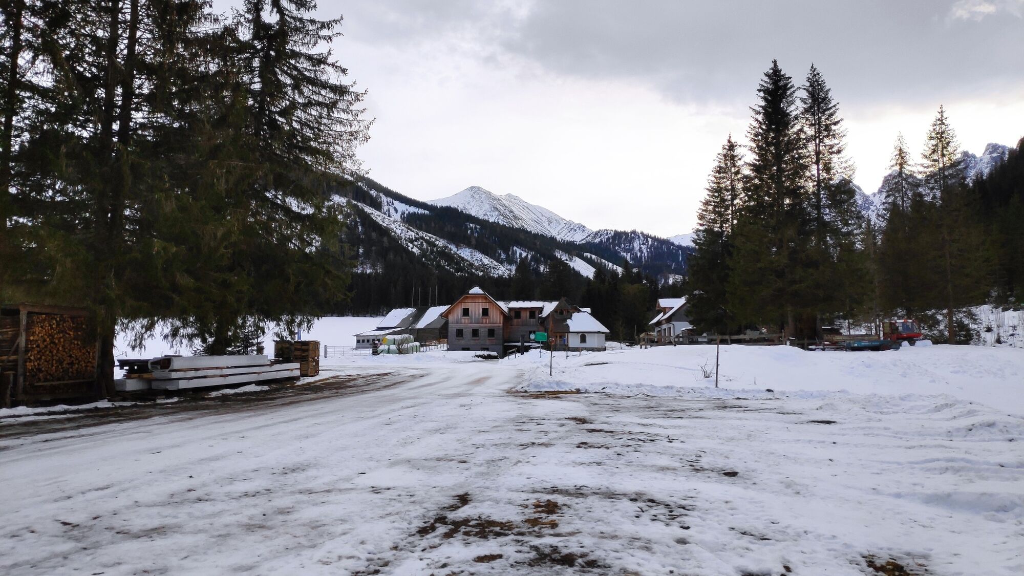
parking lot Bergerhube, fee required
- Route
-
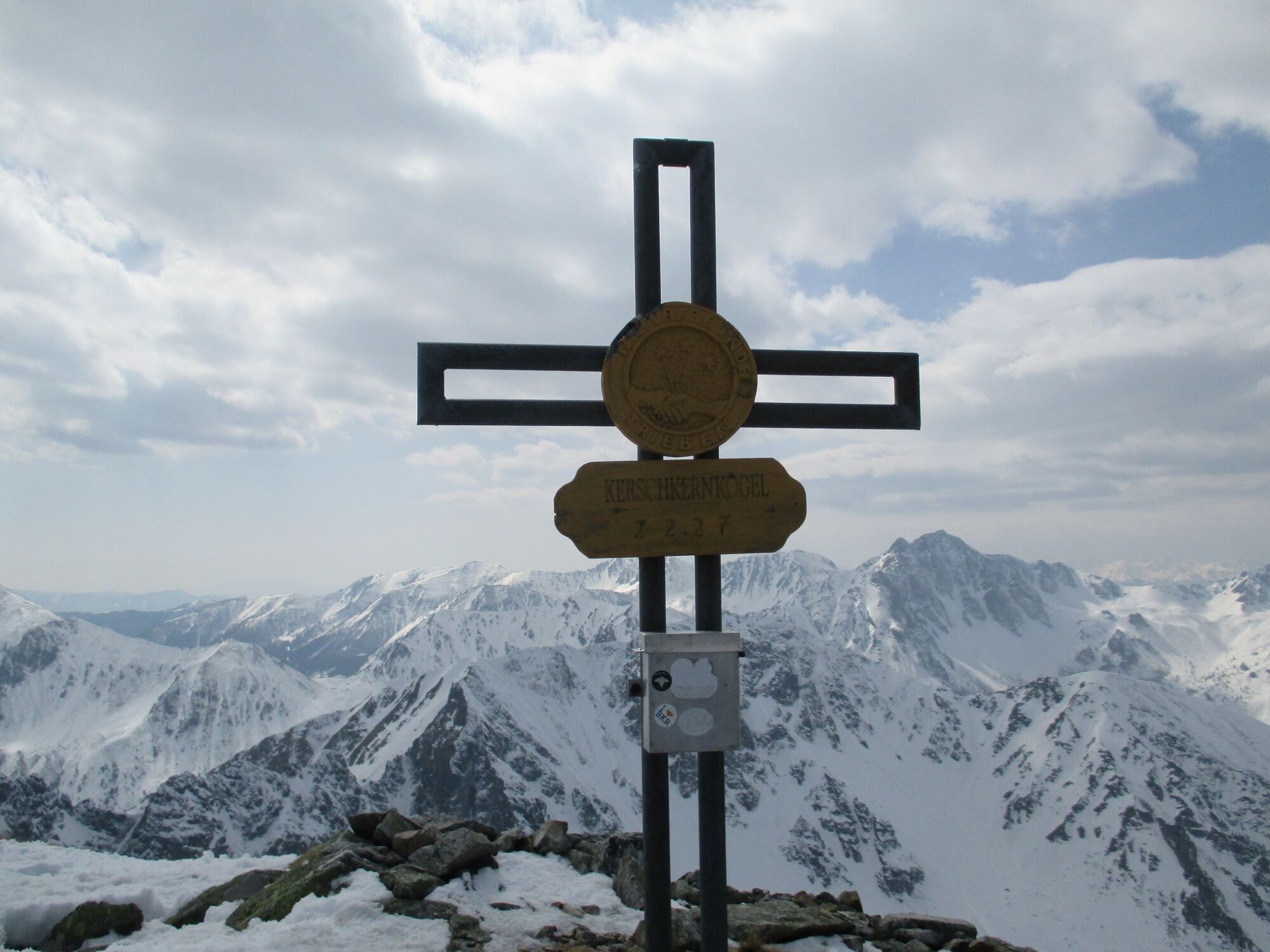
Bergerhube0.0 kmKerschkern (2,225 m)5.3 km
- Best season
-
AugSepOctNovDecJanFebMarAprMayJunJul
- Description
-
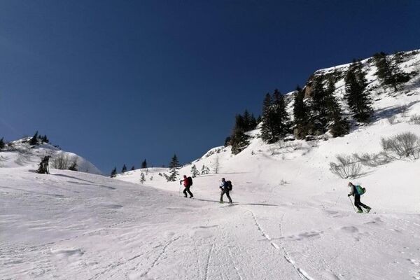
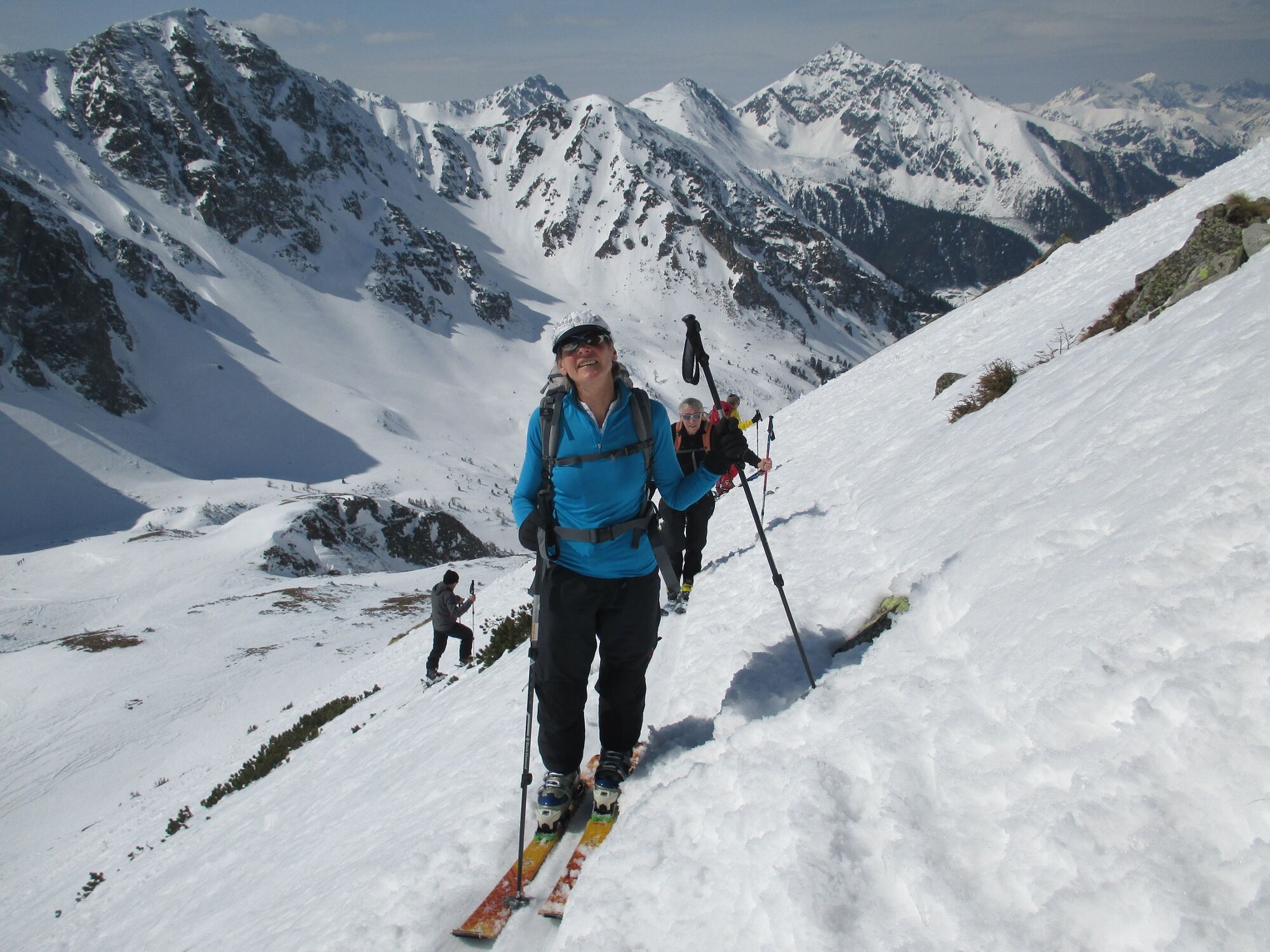
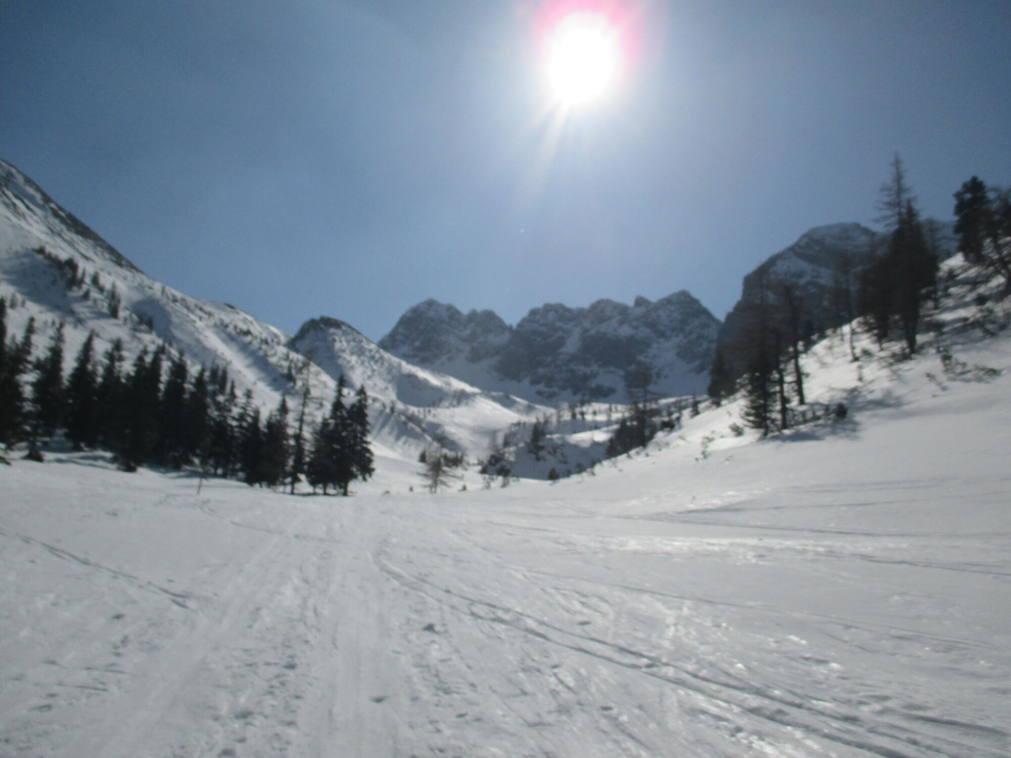
This ski tour also offers numerous variations and is very popular for this reason. In the area of the Hahnenkamm, nature enchants us on the ascent with the white decoration of the mountain scenery by the Anraum, also known locally as frost.
- Directions
-
From the Bergerhube, we first follow a forest road that leads us in a south-easterly direction. After the first bridge, we branch off to the right and walk along a hollow path through the forest along the Grünbach stream. We soon reach a forest road again, which takes us to the idyllically situated and unmanaged Schaunitzalm.
The ascent continues slightly uphill to Schaunitztörl, where we keep left towards Krugtörl, where a short, rocky step awaits us. From here, we continue along the ridge with wonderful panoramic views up to the summit cross of the 2,225 m high Kerschkern. The descent is via the ascent route. Please note the winter markings!
- Highest point
- 2,196 m
- Endpoint
-
parking lot Bergerhube, fee required
- Exposition
- Height profile
-

- Equipment
-
Emergency equipment: Burial tool, shovel, probe. First aid kit, 2 man bivy sack, tape, headlamp Signal cartridges, storm fuse, candle Tools (Leatherman) Wax for skis and/or skins crampons Thermos bottle or normal drinking bottle Clothes, suitable for the weather Gloves, spare gloves Hood sunscreen, sunglasses, goggles topographic map of the area GPS drink, food
- Safety instructions
-
Participants attempt the tour at their own risk! No liability is accepted for any alpine dangers (avalanches, weather, etc.) that may occur. Important note: Before every ski tour or snowshoe hike, it is essential to check the current avalanche report - available at www.lawine-steiermark.at .
Mountain sports and the assessment of the situation on site is - even more so in winter - primarily your own responsibility. Tourism associations or avalanche warning services can therefore not accept any liability based on the information provided.
- Tips
-
a stop at the Bergerhube for a warm soup after the tour is definitely recommended
- Additional information
-
Murtal region www.murtal.at
The Styria Tours app, which is available free of charge on Google Play and in the App Store (Android, iOS), offers detailed first-hand information: short facts (length, duration, difficulty, ascent and descent in meters of altitude, ratings), map, route descriptions, altimeter, compass, summit finder, navigation along the tour. You can also create your personal favorites list of favorite tours and points, save tours and excursion destinations offline, use social media channels and more.
Please also note the recommendations of the Alpine Club "Safe on ski tours: 10 recommendations"
- Directions
-
Coming from Trieben or Judenburg on the B114, take the Triebental entrance. Follow the road for approx. 8 km to the Bergerhube parking lot
- Public transportation
-
ÖBB www.oebb.at or Verbundlinie Steiermark www.busbahnbim.at
With the BusBahnBim app from Verbundlinie, timetable information has never been easier: all bus, train and streetcar connections in Austria can be queried by entering locations and/or addresses, stops or important points. The app is available as a free app for smartphones (Android, iOS)
- Parking
-
A parking lot is available directly at Gasthof Bergerhube (parking fees apply)
-

-
AuthorThe tour Kerschkern - The favorite in the Triebener Tauern is used by outdooractive.com provided.