
- Brief description
- Difficulty
-
medium
- Rating
-
- Starting point
-
Hirschegger saddle / Salzstiegelhaus (1543 m)
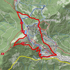
- Route
-
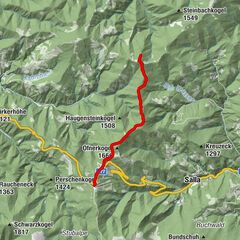
SalzstiegelhausRappoldkogel (1,928 m)4.5 kmHirschegger Sattel9.0 kmSalzstiegelhaus9.0 km
- Best season
-
AugSepOctNovDecJanFebMarAprMayJunJul
- Description
-
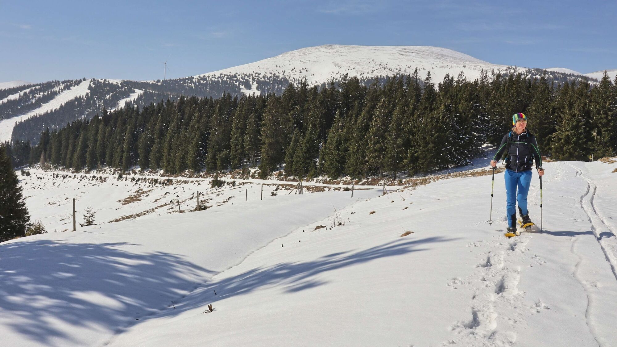
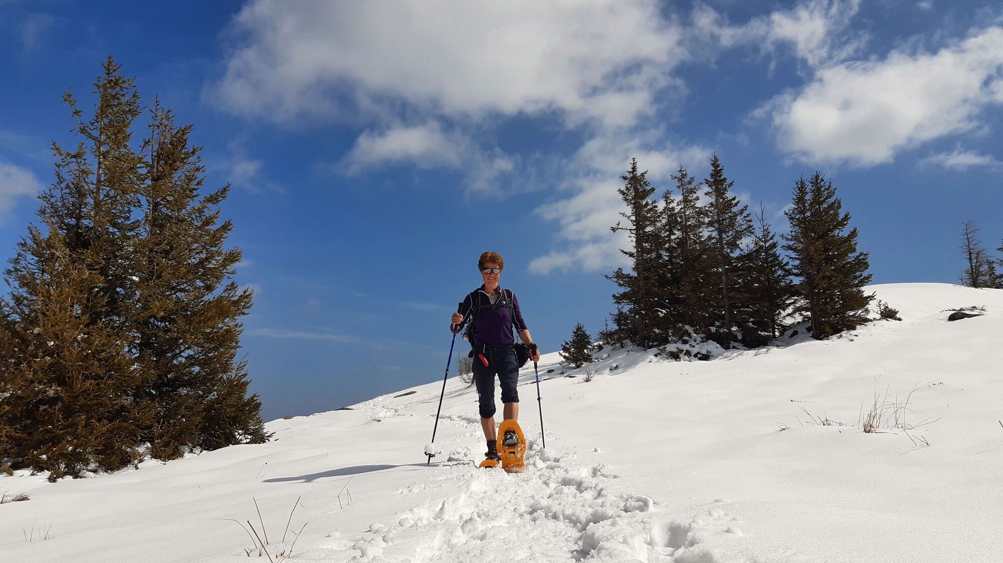
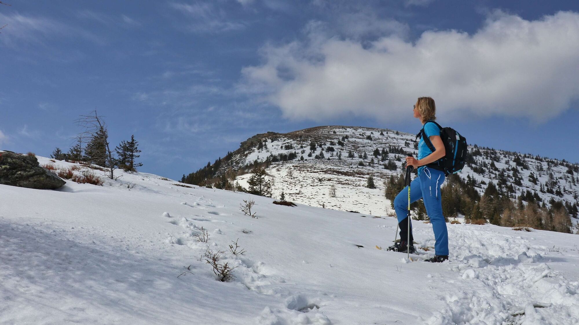
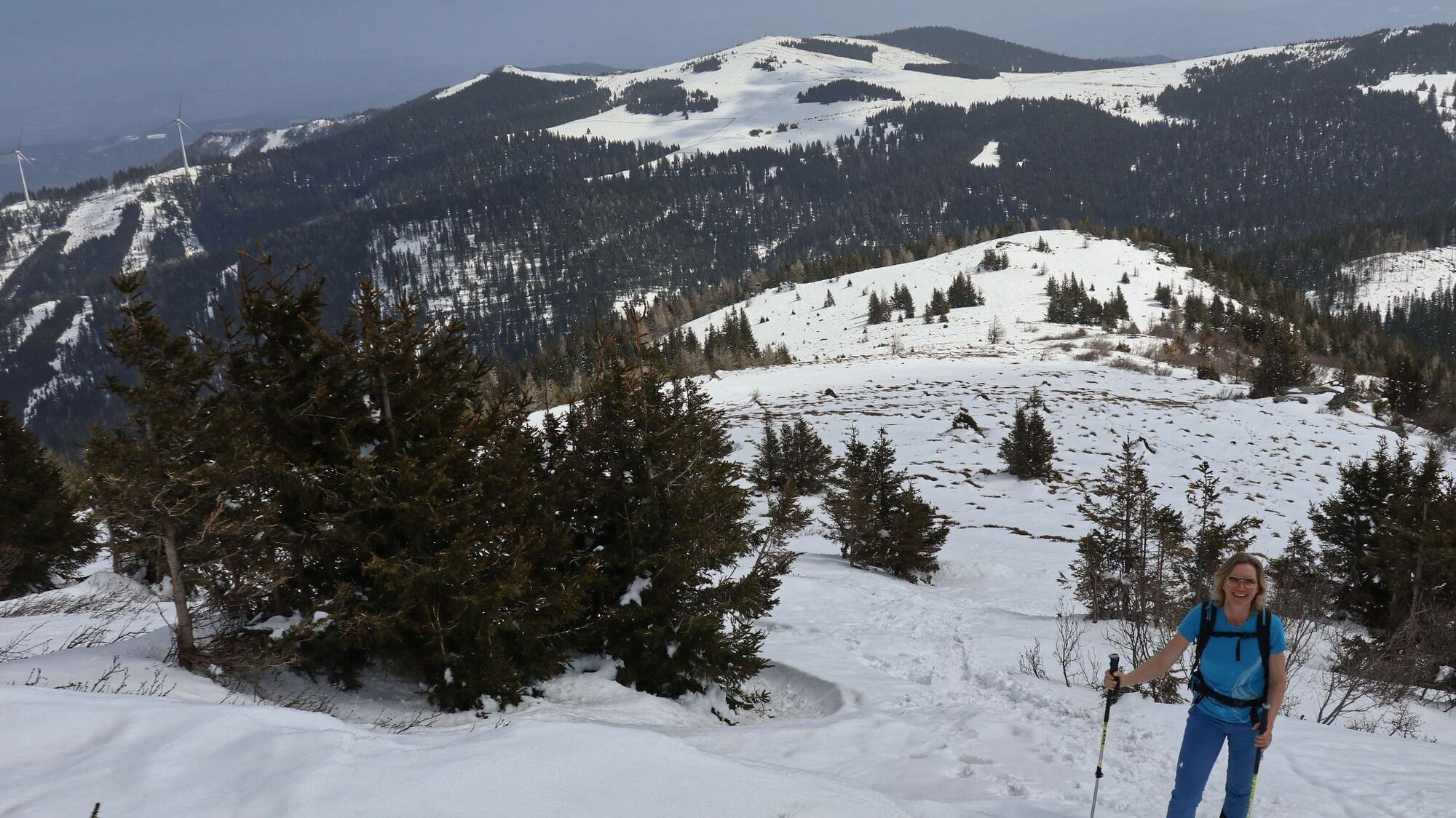
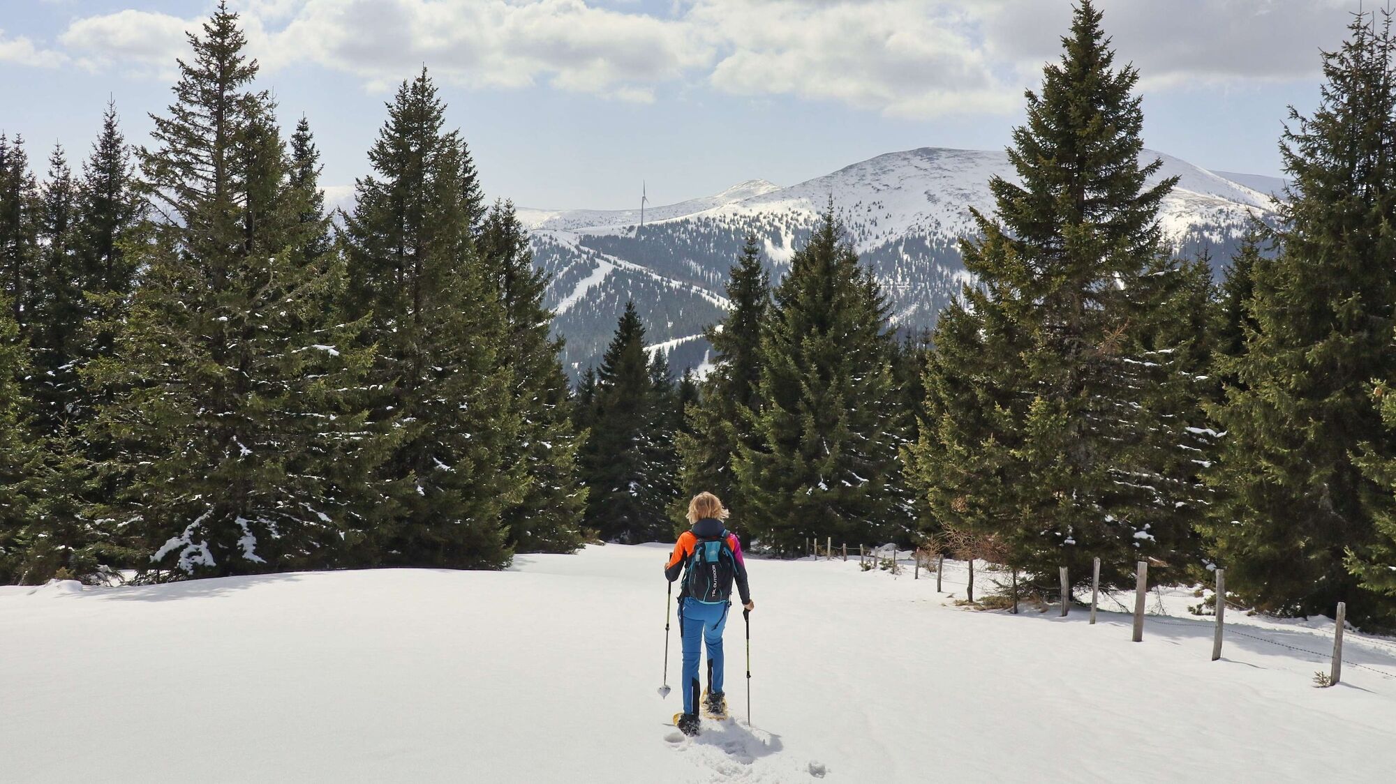
The starting point of this snowshoe hike is familiar to many winter sports enthusiasts, the Salzstiegelhaus on the Hirschegger Sattel. Around 1900, there was a small self-catering hut here, which later served as a rest stop for changing horses on the salt transports from the Salzkammergut to the south. Today, the inn is considered a popular stop for all snowshoe hikers, skiers, cross-country skiers or sledders, so especially on beautiful winter days you will see a lot of activity around the parking lot of the Salzstiegelhaus. The first part of the tour leads us along the Weitwanderweg 05 (north-south long-distance hiking trail) in the direction of the Altes Almhaus. On the easy path, be aware of the avalanche danger of the Rappoldrinne - signs along the way. The ascent to the broad summit area of the Rappoldkogel is somewhat steeper in between, otherwise moderately ascending and convinces with a wonderful view. Basically we recommend the way back via the ascent route, as the descent via the hiking trail to the west is partly quite steep and is reserved for experienced snowshoe hikers only.
- Directions
-
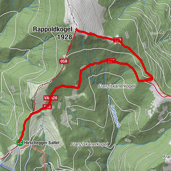
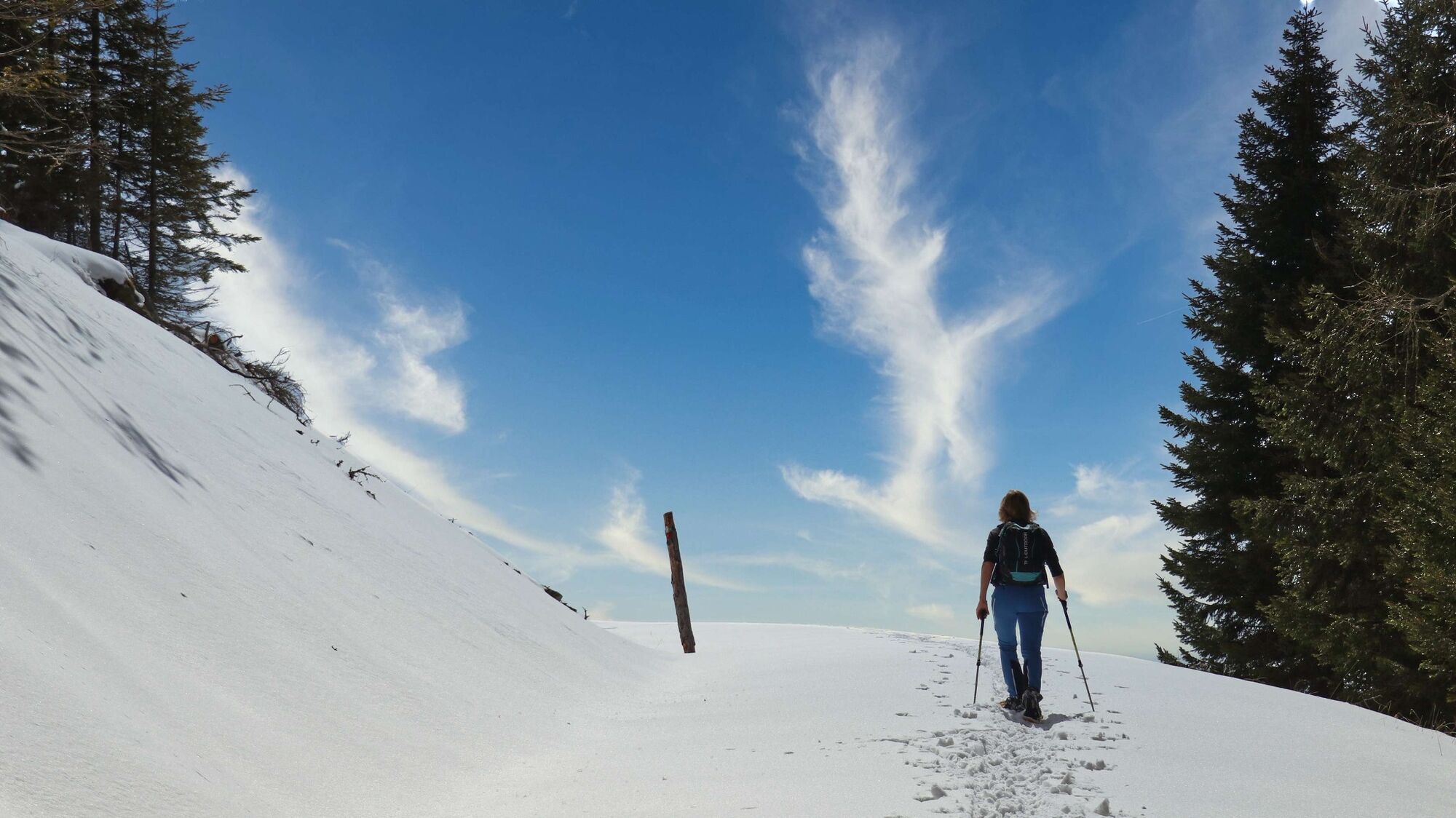
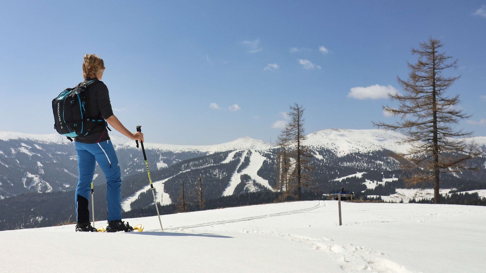
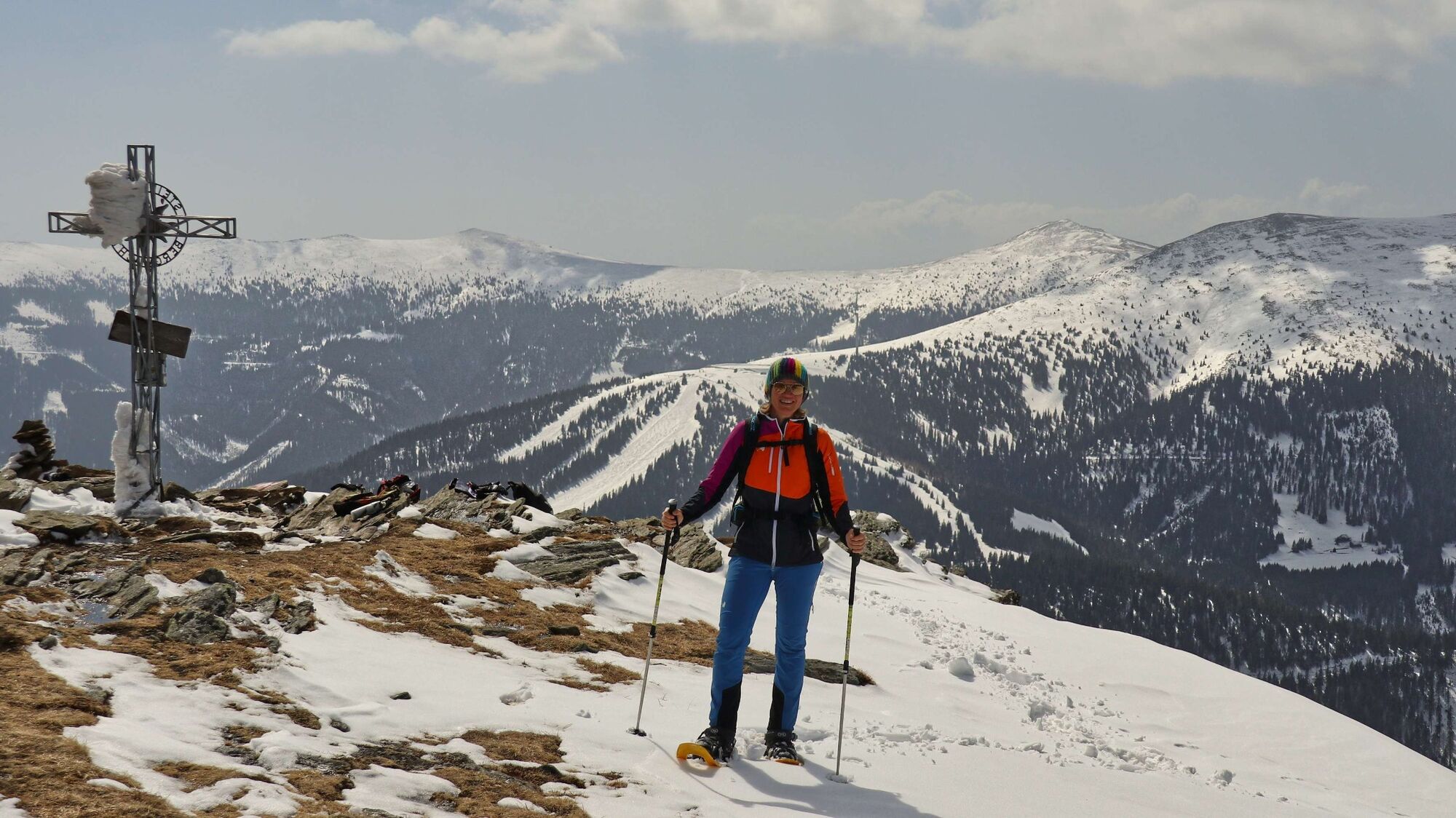
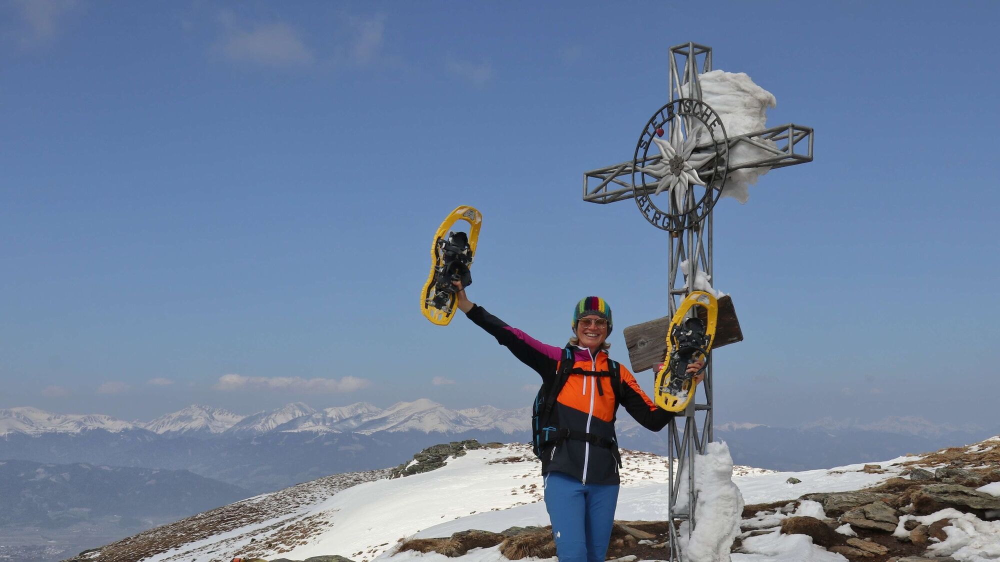
At the parking lot Salzstiegelhaus (1), 1543 m, we go to the other side of the road and see there the entrance to the hiking trail. We follow the yellow signs with the inscription "Altes Almhaus" No. 505. It goes slightly uphill through a piece of forest until we reach the open alpine pastures. From now on, we always orient ourselves along the forest road in the direction of the Altes Almhaus, whereby the path is easy to recognize even in winter. It goes continuously uphill and after about 2 km we come to the information boards (2), 1597 m, avalanche danger Rappoldrinne. From here we continue for about 1 km along the forest road or the cross-country ski trail until we come to a crossroads (3), 1615 m. The crossroads can be recognized by the fact that the road continues to the right to the Alte Almhaus and we now continue slightly uphill to the left. We stay on the road, which after a short time leads slightly downhill to a small depression. Here we keep to the right towards the forest and see the hiking trail and the red-white-red markings on the trees. From now on the path goes uphill through the forest, in between a little steeper, so that the ascending aid with the snowshoes comes into use. The path through the forest is very well marked and also easy to find due to mostly numerous tracks. At the forest border we then reach a small saddle (4), 1762 m. From here on we are in a protected landscape area (information board) and orient ourselves in the middle of the wide ridge in front of us, which leads to the summit cross (do not go too far to the right, as snowdrifts are possible). At the summit cross of the Rappoldkogel (5), 1928 m, a very beautiful view opens up into Upper Styria, with the Judenburg-Knittelfeld basin (Aichfeld) lying to the northwest. From here we can also see the snowshoe tour to the Speikkogel, which lies to the southwest. The way back is via the ascent route.
Variant: the descent via the summer trail to the west is partly steep and reserved for experienced snowshoe hikers only.
- Highest point
- 1,922 m
- Endpoint
-
Hirschegger saddle / Salzstiegelhaus (1543 m)
- Height profile
-

- Equipment
-
Apart from the most necessary equipment, such as snowshoes, poles, etc., we recommend that you bring orientation aids (bus pole, map, GPS), avalanche transceiver, probe and shovel. We have taken this checklist from the Rother Snowshoe Guide Styria and summarized it for you, so that it will be helpful for your next snowshoe hike.
SnowshoesTelescopic poles with snow plateWaterproof mountain boots or lined winter mountain bootsBackpack: If the snowshoes have to be carried, a backpack with a lid buckle is necessary.Gloves: waterproof and warmingHeadgearGaiters: If there are no closable leg cuffs on the pants.Pants: Ski pants are rather not recommended, because they are often too warm, but we need waterproof and warming pants.Warming outerwear: Onion layering system, t-shirt, sweater, jacket and winter jacket with hood.Sunglasses: Very important, as snow reflects up to 95% of the light.Creams: Protective measures for the skin are important against both the sun and the cold.Headlamp: In winter it gets dark early, especially in the forest it can often be very dark when dusk begins.Thermos: On cooler days a warming drink is pleasant.Snack or snackFirst aid kit
Other important equipment
Cell phoneTour descriptionMap: For overview a map in scale 1:50.000 of the respective region and a detailed plan of the hikeGPS deviceAvalanche transceiver (avalanche transceiver), shovel and probe.
- Safety instructions
-
When choosing a snowshoe tour, weather, snow and avalanche situation are essential criteria. Basically, the decision of the tour depends on your own experience and basic physical condition. In advance, factors such as weather, avalanche situation report and equipment must be clarified in detail. A clear description of how to prepare for a snowshoe hike can be found in the Rother Snowshoe Guide Styria from page 14 to 20. Even if you have prepared perfectly, you must also take into account the given weather and snow conditions and the physical condition of the day during the hike itself. Thus, there is one important basic rule: please turn around if the hike becomes too strenuous or if the external conditions require it.
Walking times: The indicated walking time is to be understood as a guideline, as it depends on the snow conditions, the terrain and the presence of a trail. The individual condition and the stamina for strenuous trail work also play an important role. Sometimes the duration of the tour can change significantly due to large amounts of new snow, broken slush, soft sulzing snow, etc.
Alpine emergency call:
Mountain rescue emergency number: 140
EU emergency number: 112
Avalanche info:
Weather service:
Direct link mountain weather Styria:
https://www.zamg.ac.at/cms/de/wetter/produkte-und-services/bergwetter/steiermark
- Tips
-
If you like the area around the Hirschegger Sattel, you can also hike from the Salzstiegelhaus to the Speikkogel (1993 m) in the west.
- Additional information
- Directions
-
From St. Michael in Upper Styria via the Murtal expressway S36 (toll sticker required) to Zeltweg (30 km, approx. 25 minutes) and on via Großfeistritz to the Salzstiegelhaus (total 52 km, approx. 50 minutes).
From Graz via the A2 highway to Modriach and L344 via Hirschegg to the Salzstiegelhaus (76 km, approx. 85 minutes)
Snowshoeing by car - a few things to look out for!
- Good winter tires are an absolute MUST!
- Ice scraper, snow broom, de-icer for the door locks and a small shovel are part of the basic equipment.
- Put snow chains and a tow rope in the car, even if you are not good with them yourself. There are always helpful and knowledgeable hikers on the mountain!
- Clear all snow and ice from the car, especially the roof.When parking, make sure that you also leave space for other drivers.
- Always park in such a way that the rest of the road remains clear for cars, timber trucks and snow clearing vehicles.
- Find out about the snow situation on the access road or parking facilities before setting off. (Hüttenwirt, webcams)
- Public transportation
-
There is no public transport connection to the starting point of the tour.
General information about public transport in the region: www.verbundlinie.at
Murtal Taxi, Tel.: +43 660 1018101, 8740 Zeltweg, www.murtal-taxi.at
Cab Jäger, Tel.: +43 3512 44833, 8720 Knittelfeld
Cab Steiner, Tel.: +43 3512 71718, 8720 Knittelfeld
- Parking
-
There are numerous parking spaces in the immediate vicinity of the Salzstiegelhaus.


- Author
-
The tour Snowshoe tour from the Salzstiegelhaus to the Rappoldkogel is used by outdooractive.com provided.


")