- Brief description
- Difficulty
-
medium
- Rating
-
- Starting point
-
Parking directly at the Waldheimhütte (1614 m).
- Route
-
WaldheimhütteZirbitzkogel Schutzhaus5.8 kmZirbitzkogel (2,396 m)5.9 km
- Best season
-
AugSepOctNovDecJanFebMarAprMayJunJul
- Description
-
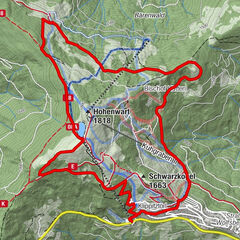
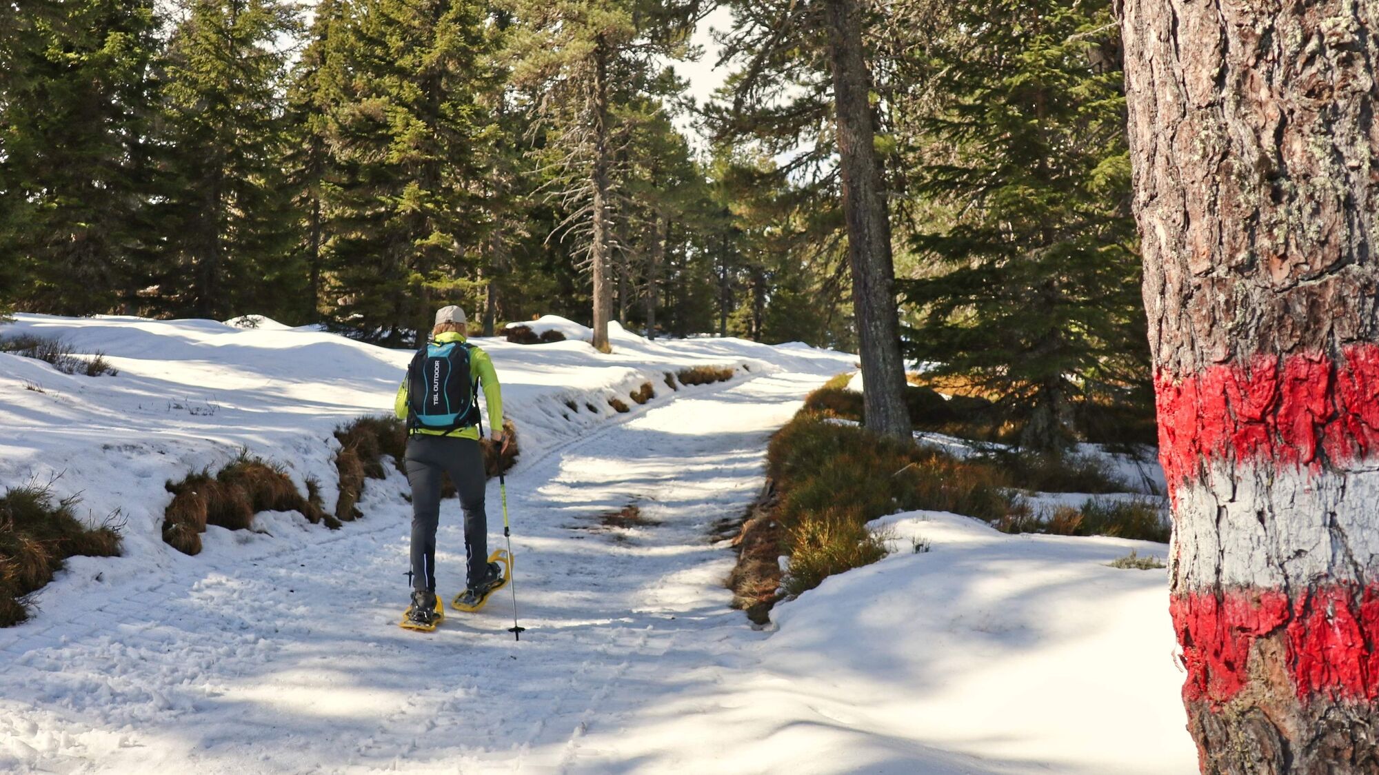
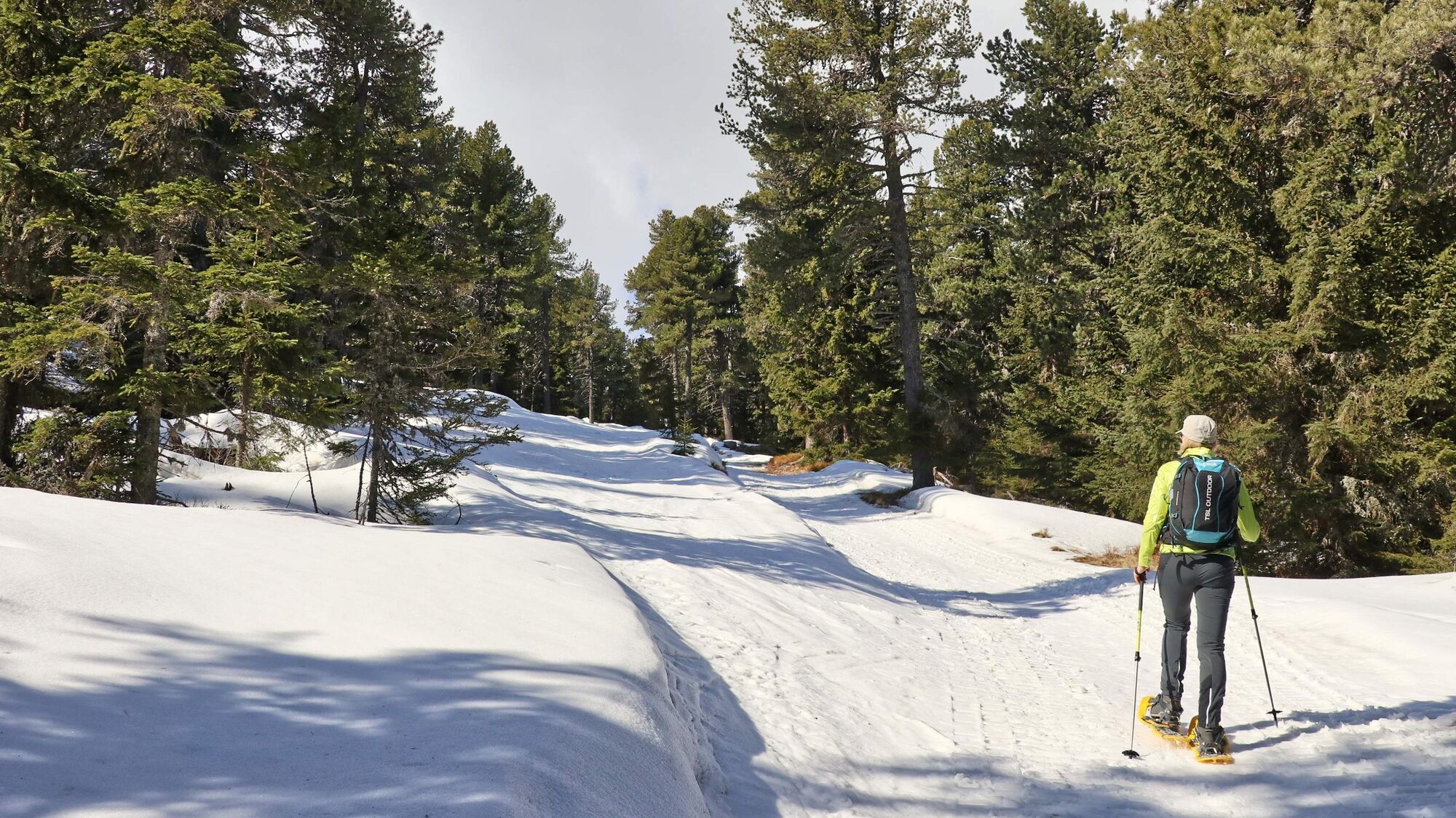
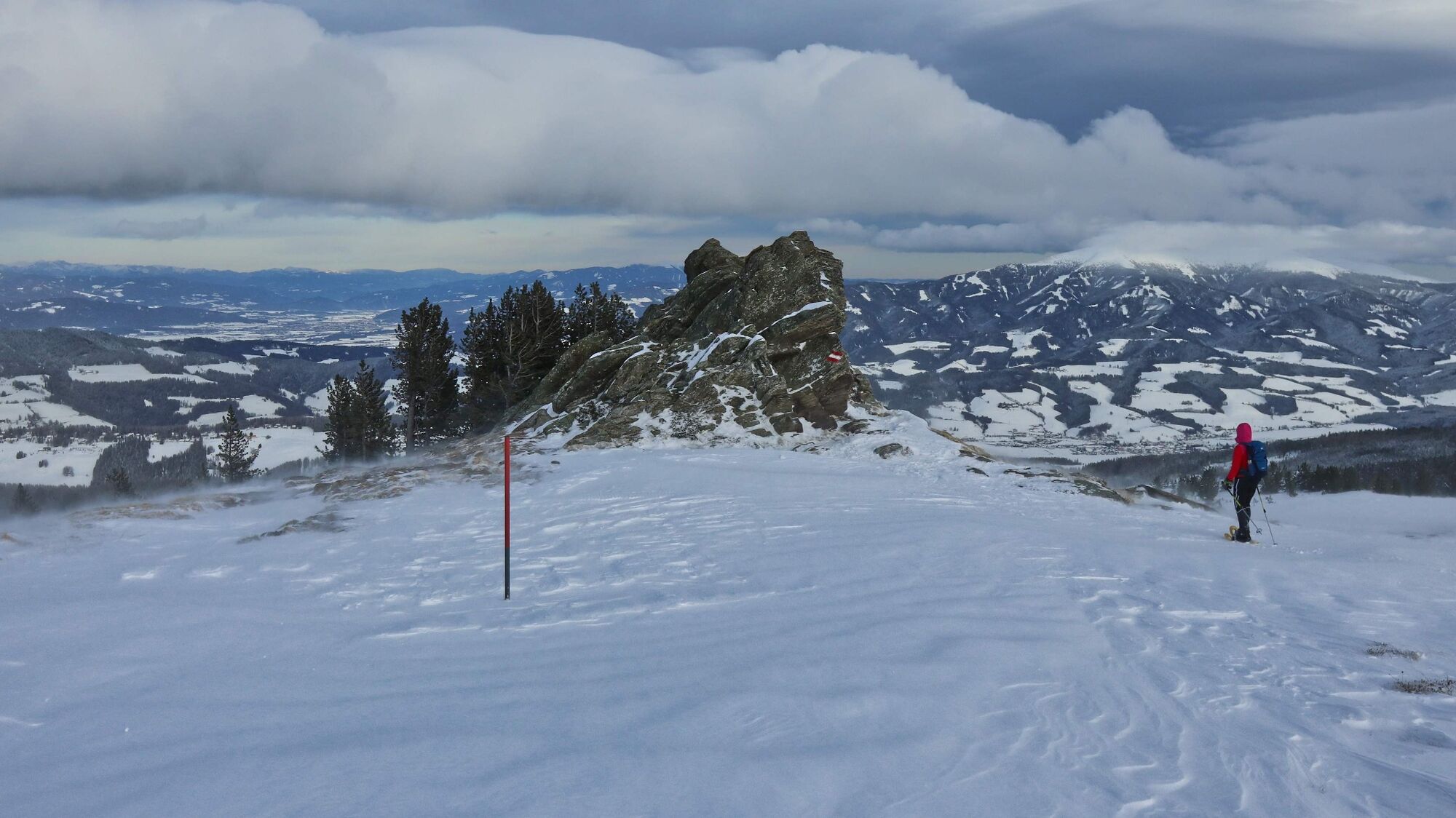
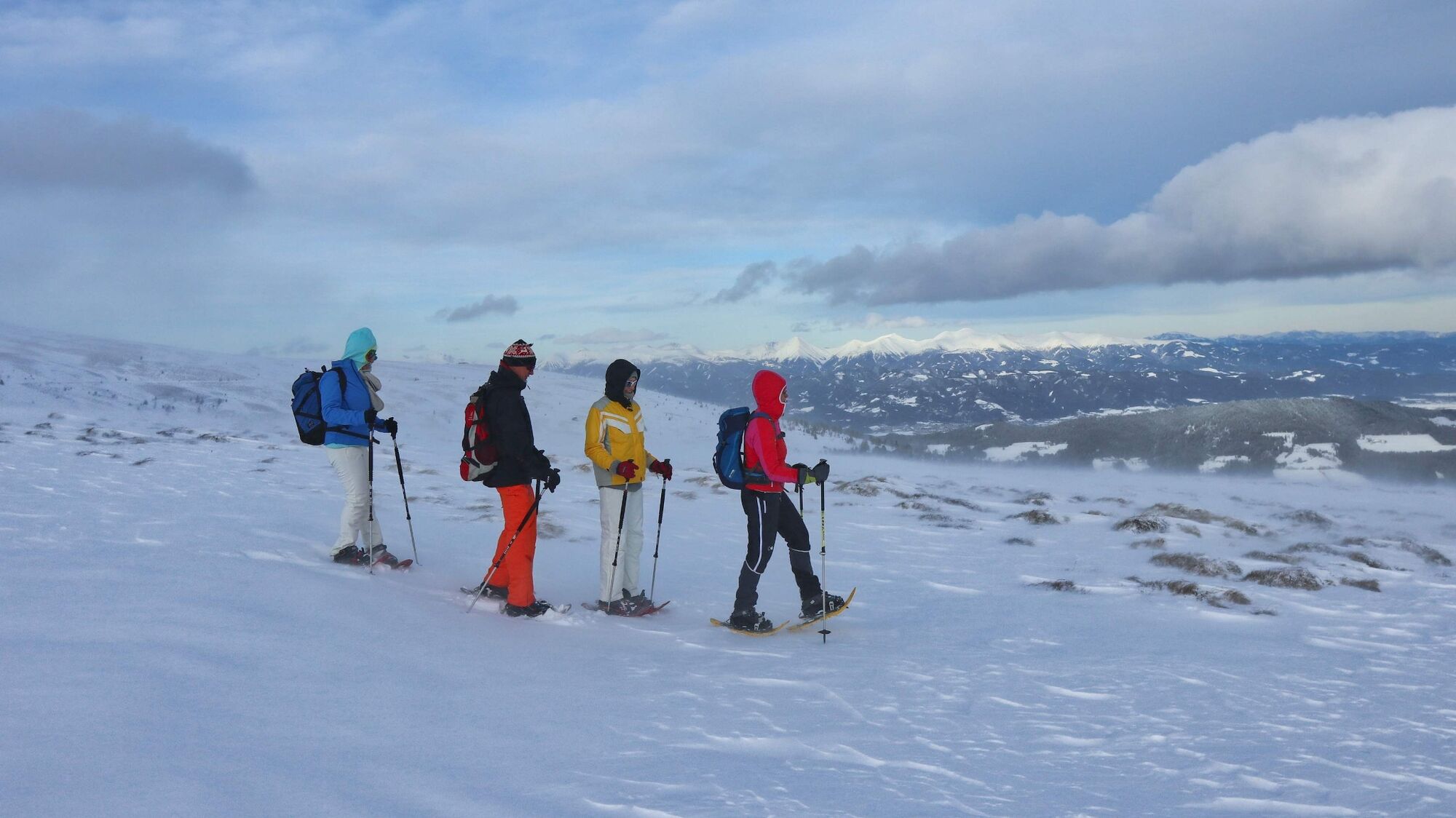
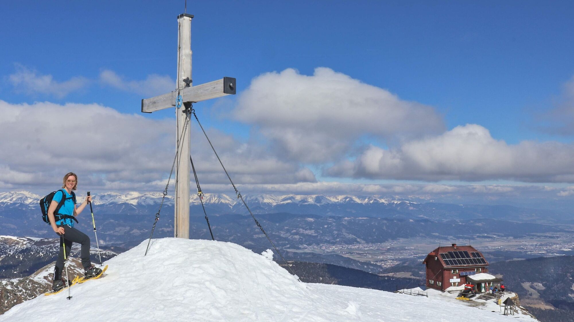
The Seetaler Alps in the adventure region Murtal are, with the Zirbitzkogel (2396 m) as the highest peak and the Zirbitzkogel-Schutzhaus (officially Helmut-Erd-Schutzhaus), (2376 m) just below, a popular summer and winter hiking destination. Starting from the Waldheimhütte, the groomed trail is a great way to get to the Zirbitzkogel on snowshoes. The path is clear and indicated by snow poles, so you can expect a sporty but basically technically easy hike. The 360° view from the summit is fabulous, and with the orientation plate near the summit cross, the peaks in the distance are easy to determine. By the way, the name Zirbitz is derived from the Slovenian word "crvenica", which means "red area" and is due to the common alpine rose in the region. The Swiss stone pine (bot. Pinus cembra), also called the "Queen of the Alps", in turn gave the region its name, "Zirbenland". Name or not, to put it in a nutshell: Zirbe, Zirbitz, Zirbenland - a wonderful area that promises a lot and keeps it.
- Directions
-
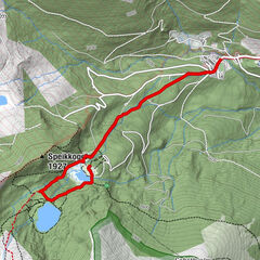
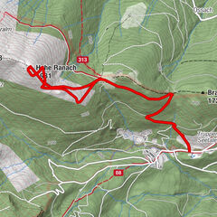
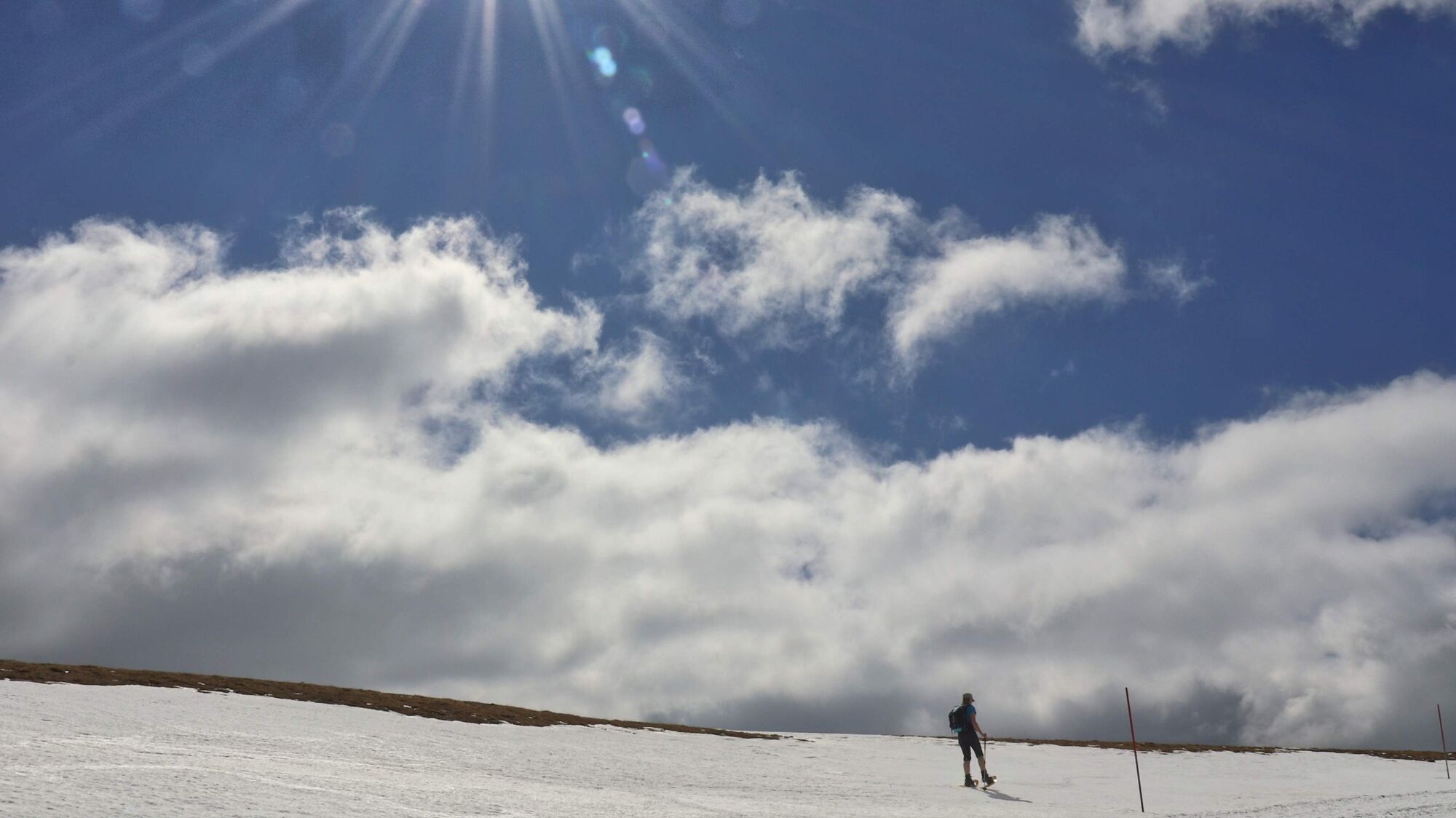
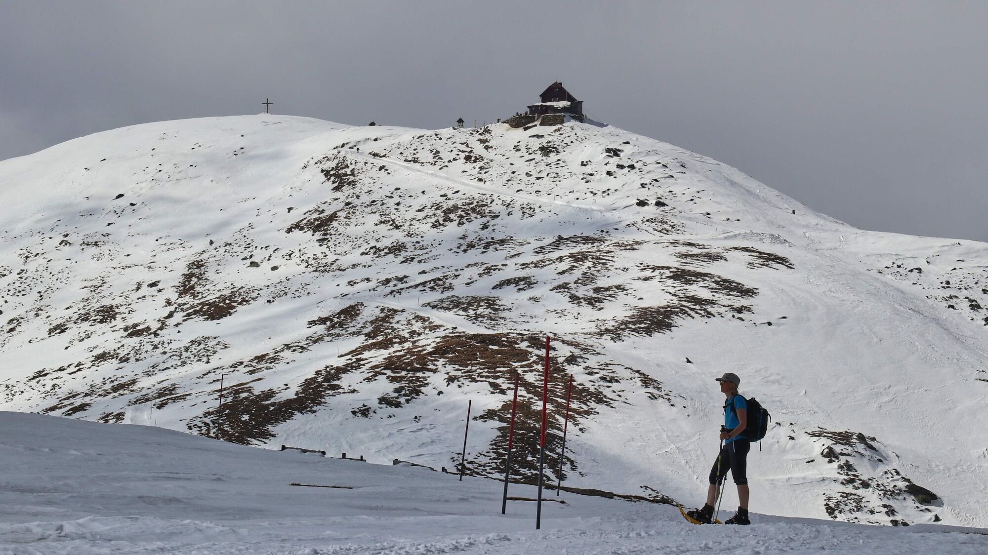
From the Waldheimhütte (1), 1614 m, we follow the path with the number 320 in the direction of the Zirbitzkogel, which is clearly recognizable by yellow signposts (in the immediate vicinity of the parking lot). At the edge of the ski slope we go slightly uphill, passing the head station of the drag lift on the left and then along the wide path through the stone pine forest. Above the tree line we come to a crossing point (2), 1900 m, which leads to the right to the Rothaidenhütte, which is unmanned in winter, and further on to the Alpengasthof Sabathy. During the ascent you can see the Rothaidenhütte well. The further course of the path is clear through the Radrakspur with the snow poles. Soon we recognize our goal, the Zirbitzkogel with the Schutzhaus, in the distance. The slope becomes less and less and before it becomes almost flat, we still see the crossing point Rothaidenweg (3), 2140 m, which is recognizable by a yellow hiking sign and would be an alternative for the descent. Furthermore, the prepared track leads us past the waypoint Kote (4), 2181 m, and then we are only facing about 200 meters of altitude difference. After seven turns and a pleasantly laid out trail, we reach the Helmut-Erd-Schutzhaus or Zirbitzkogel-Schutzhaus (5), 2376 m, as it is also called. The summit cross and orientation board of the Zirbitzkogel (6), 2396 m, is only a few minutes away. The descent takes us to the waypoint Kote (4), 2181 m, along the ascent route. Here we have the possibility to hike back over snow-filled gullies. It is important to consider these descent options only in fair weather. As soon as we reach our ascent track again, we follow it back to the Waldheimhütte (1).
- Highest point
- 2,390 m
- Endpoint
-
Parking directly at the Waldheimhütte (1614 m).
- Height profile
-

- Equipment
-
Apart from the most necessary equipment, such as snowshoes, poles, etc., we recommend that you bring orientation aids (bus pole, map, GPS), avalanche transceiver, probe and shovel. We have taken this checklist from the Rother Snowshoe Guide Styria and summarized it for you, so that it will be helpful for your next snowshoe hike. Snowshoes Telescopic poles with snow plate Waterproof mountain boots or lined winter mountain boots Backpack: If the snowshoes have to be carried, a backpack with a lid buckle is necessary. Gloves: waterproof and warming Headgear Gaiters: If there are no closable leg cuffs on the pants. Pants: Ski pants are rather not recommended, because they are often too warm, but we need waterproof and warming pants. Warming outerwear: Onion layering system, t-shirt, sweater, jacket and winter jacket with hood. Sunglasses: Very important, as snow reflects up to 95% of the light. Creams: Protective measures for the skin are important against both the sun and the cold. Headlamp: In winter it gets dark early, especially in the forest it can often be very dark when dusk begins. Thermos: On cooler days a warming drink is pleasant. Snack or snack First aid kit Other important equipment Cell phone Tour description Map: For overview a map in scale 1:50.000 of the respective region and a detailed plan of the hike GPS device Avalanche transceiver (avalanche transceiver), shovel and probe
This list and also the safety instructions have been summarized by the authors of the Rother Snowshoe Guide Styria. You are welcome to use these texts, but we kindly ask you to mention the copyright "Rother Schneeschuhführer Steiermark".
- Safety instructions
-
When choosing a snowshoe tour, weather, snow and avalanche situation are essential criteria. Basically, the decision of the tour depends on your own experience and basic physical condition. In advance, factors such as weather, avalanche situation report and equipment must be clarified in detail. A clear description of how to prepare for a snowshoe hike can be found in the Rother Snowshoe Guide Styria from page 14 to 20. Even if you have prepared perfectly, you must also take into account the given weather and snow conditions and the physical condition of the day during the hike itself. Thus, there is one important basic rule: please turn around if the hike becomes too strenuous or if the external conditions require it.
Walking times: The indicated walking time is to be understood as a guideline, as it depends on the snow conditions, the terrain and the presence of a trail. The individual condition and the stamina for strenuous trail work also play an important role. Sometimes the duration of the tour can change significantly due to large amounts of new snow, broken slush, soft sulzing snow, etc.
Alpine emergency call:
Mountain rescue emergency number: 140
EU emergency number: 112
Avalanche info:
Weather service:
Direct link mountain weather Styria:
https://www.zamg.ac.at/cms/de/wetter/produkte-und-services/bergwetter/steiermark
- Tips
-
Another hike from Alpengasthof Sabathy to the Waldheimhütte can be found in the snowshoe guide Styria under tour 13 "Hüttenwanderung Seetaler Alpen". The book is available at the Waldheimhütte.
- Additional information
-
Waldheimhütte, Tel.: +43 3578 8205, 8742 St. Anna am Lavantegg, Lavantegg 57,
Zirbitzkogel-Schutzhaus (officially Helmut-Erd-Schutzhaus), Tel: +43 3578 8205 or +43 664 9140283, 8742 Obdach, Granitzen 41
Open in winter with appropriate snow and weather conditions on weekends and during winter holiday weeks. The innkeeper will be happy to provide information about opening hours by telephone. A winter room is open all year round, but does not offer heating and cooking facilities.
- Directions
-
From Judenburg via the B78 and L540 to St. Anna am Lavantegg and then on a forest road to the signposted Waldheimhütte (31 km, approx. 35 minutes).
From Wolfsberg via the B78 past Reichenfels to the L540. Follow this and after St. Anna am Lavantegg on a forest road to the posted Waldheimhütte (43 km, approx. 45 minutes).
By car to snowshoe hiking - a few things to watch out for!
- Good winter tires are an absolute MUST!
- Ice scraper, snow broom, de-icer for the door locks and a small shovel belong to the basic equipment.
- Put snow chains and a tow rope in the car, even if you are not good with them yourself. Helping and knowledgeable hikers are always available on the mountain!
- Clear the car completely of snow and ice, especially sweep off the roof of the car completely.
- When parking, make sure you leave room for other motorists.
- Always park so that the rest of the roadway remains clear for cars, logging trucks, and snow removal vehicles.
- Find out about the snow situation on the access road or parking facilities before setting off. (hut host, webcams)
- Public transportation
- Parking
-
There are enough parking spaces at the Waldheimhütte.


- Author
-
The tour Snowshoe tour from the Waldheimhütte to the Zirbitzkogel is used by outdooractive.com provided.