
- Brief description
-
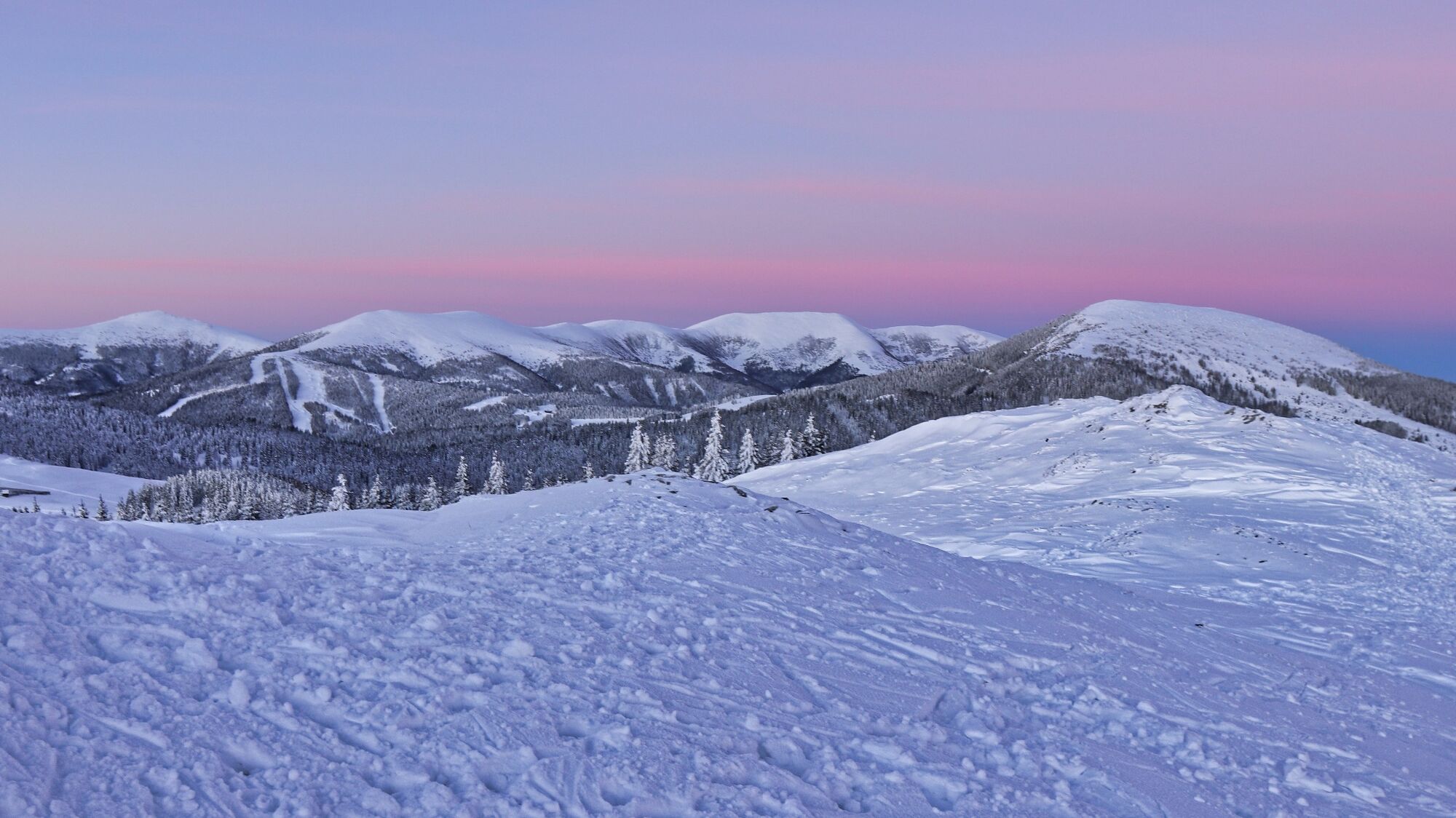
A "must hike" for every Murtaler in the heart of the Styrian Randgebirge.
- Difficulty
-
medium
- Rating
-
- Starting point
-
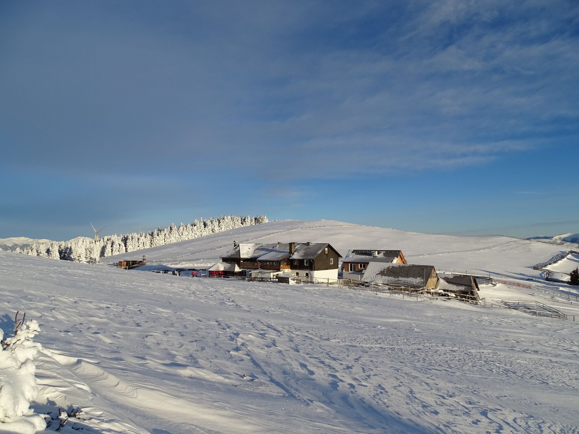
Parking lot at the old Almhaus, 1649 m
- Route
-
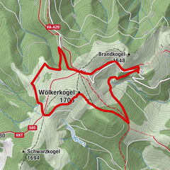
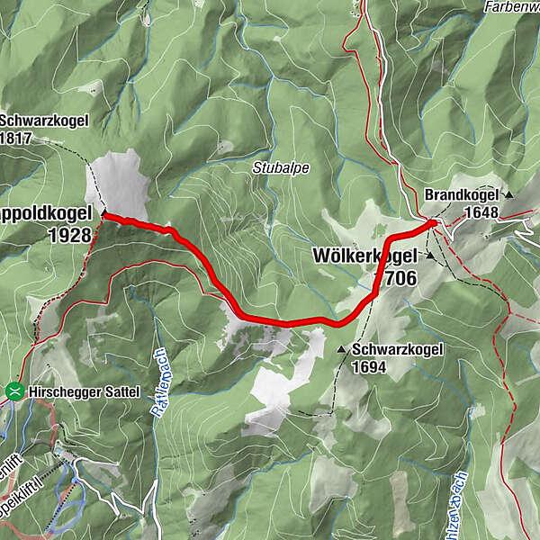
Altes Almhaus0.0 km15802.0 kmRappoldkogel (1,928 m)4.2 km15806.4 kmAltes Almhaus8.3 km
- Best season
-
AugSepOctNovDecJanFebMarAprMayJunJul
- Description
-
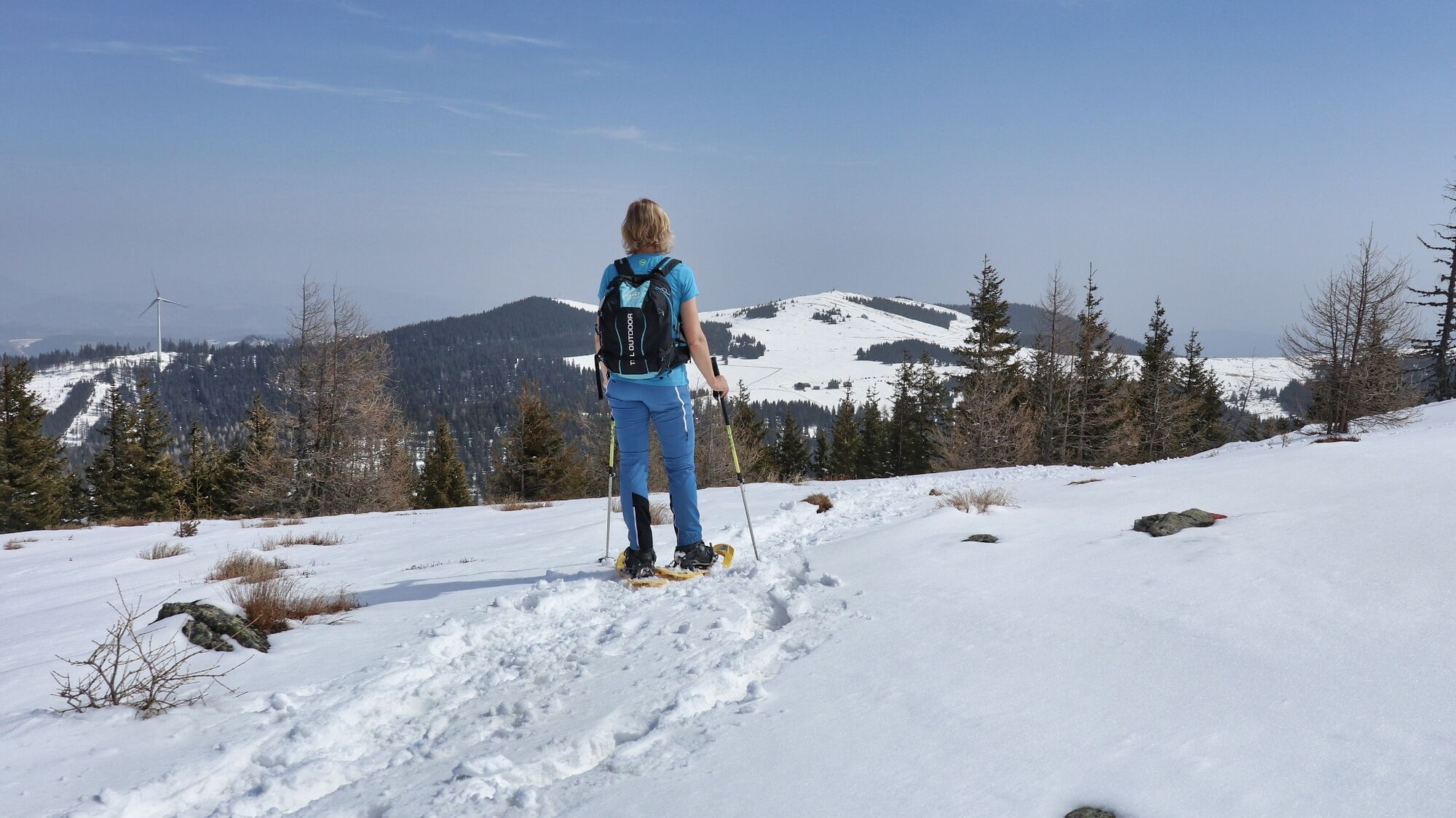
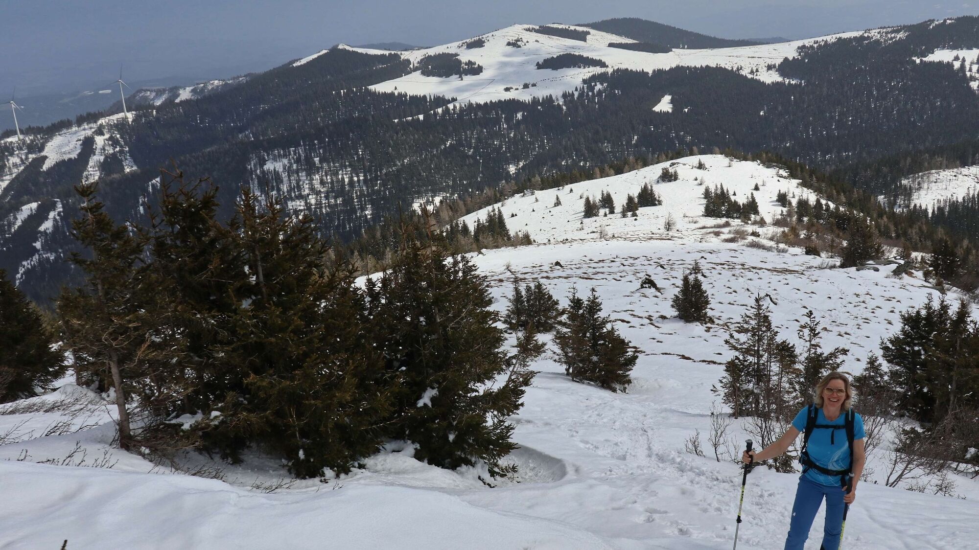
The Rappoldkogel literally towers over the soft landscape of the Stubalpe, which as a low mountain landscape is predestined for snowshoe hiking. From beginner to summit tours, there is something for everyone. If you want to try out the snowshoes for the first time, there is a perfect area for it around the Alte Almhaus. The ascent to the wide summit area of the Rappoldkogel is a bit steeper in between, otherwise moderately ascending. The hike is thus technically simple and can be classified as "easy", although one must not forget the necessary basic condition and endurance for an approx. 3 ½ hour tour. Once you get to know this wonderful snowshoe area, you will understand if you have the feeling here that you want to hike on and on.
- Directions
-
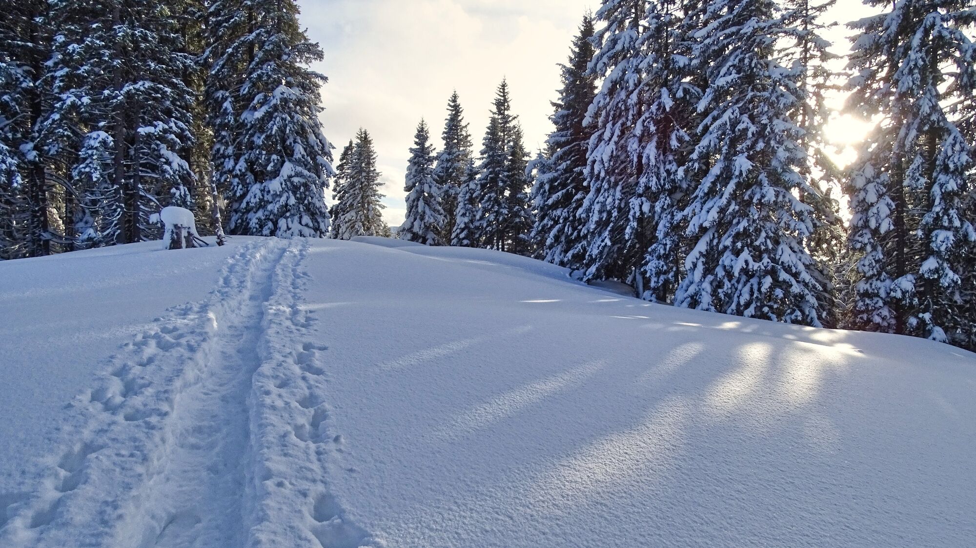
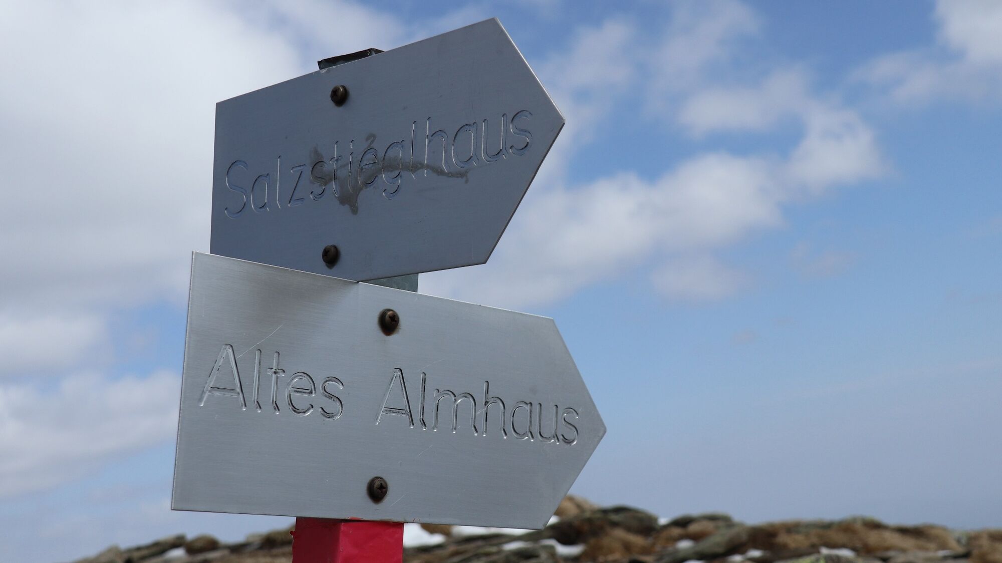
We start our tour at the parking lot at the Alter Almhaus (1), 1649 m, and head for trail 505, which is a wide, groomed cross-country skiing or winter hiking trail. It goes very slightly downhill until we come to the signpost Salzstiegel over Rappoldkogel and to Gerti Törl (2), 1570m. We branch off to the right and follow the well-marked path uphill through the forest to a saddle (3), 1762 m, from where - as a sign informs us - we are in the protected landscape area. We climb the ridge in front of us, preferably in the middle, in order to avoid any snow cornices and soon reach our destination, the Rappoldkogel (4), 1928m. To the north we now have the Murtal valley at our feet and to the southwest we can see the Speikkogel, another attractive "snowshoe mountain" in the Murtal region. The way back leads us via the ascent route back to the Alte Almhaus.
- Highest point
- 1,918 m
- Endpoint
-
Parking lot at the old Almhaus, 1649 m
- Height profile
-

- Equipment
-
Apart from the most necessary equipment, such as snowshoes, poles, etc., we recommend that you bring orientation aids (bus pole, map, GPS), avalanche transceiver, probe and shovel. We have taken this checklist from the Rother Snowshoe Guide Styria and summarized it for you, so that it will be helpful for your next snowshoe hike.
SnowshoesTelescopic poles with snow plateWaterproof mountain boots or lined winter mountain bootsBackpack: if the snowshoes have to be carried, a backpack with a lid buckle is necessary.Gloves: waterproof and warmingHeadgearGaiters: If there are no closable leg cuffs on the pants.Pants: ski pants are rather not recommended because they are often too warm, but we need waterproof and warming pants.Warming outerwear: Onion layering system, t-shirt, sweater, jacket and winter jacket with hood.Sunglasses: Very important, as snow reflects up to 95% of the light.Creams: Protective measures for the skin are important against both the sun and the cold.Headlamp: In winter it gets dark early, especially in the forest it can often be very dark when dusk begins.Thermos: On cooler days a warming drink is pleasant.Snack or snackFirst aid kit Other important items of equipment:
Cell phoneTour descriptionMap: For overview a map in scale 1:50.000 of the respective region and a detailed plan of the hikeGPS deviceavalanche transceiver (LVS), shovel and probeThis list and also the safety instructions have been summarized by the authors of the Rother Snowshoe Guide Styria. You are welcome to use these texts, but we kindly ask you to mention the copyright "Rother Schneeschuhführer Steiermark".
- Safety instructions
-
When choosing a snowshoe tour, weather, snow and avalanche situation are essential criteria. Basically, the decision of the tour depends on your own experience and basic physical condition. In advance, factors such as weather, avalanche situation report and equipment must be clarified in detail. A clear description of how to prepare for a snowshoe hike can be found in the Rother Snowshoe Guide Styria from page 14 to 20. Even if you have prepared perfectly, you must also take into account the given weather and snow conditions and the physical condition of the day during the hike itself. Thus, there is one important basic rule: please turn around if the hike becomes too strenuous or if the external conditions require it.
Walking times: The indicated walking time is to be understood as a guideline, as it depends on the snow conditions, the terrain and the presence of a trail. The individual condition and the stamina for strenuous trail work also play an important role. Sometimes the duration of the tour can change significantly due to large amounts of new snow, broken slush, soft sulzing snow, etc.
Alpine emergency call:
Mountain rescue emergency number: 140
EU emergency number: 112
Avalanche info:
Weather service:
Direct link mountain weather Styria:
https://www.zamg.ac.at/cms/de/wetter/produkte-und-services/bergwetter/steiermark
- Tips
-
On the way back, the detour via the Großebenhütte is recommended, as here you can immerse yourself in a particularly beautiful snowshoe landscape. For more information, see the Rother snowshoe guide Tour 50.
- Additional information
- Directions
-
From Judenburg via the B77 (28 km, approx. 40 minutes).
From St. Michael in Upper Styria via the Murtal expressway S36 (subject to vignette) to the Zeltweg-Ost exit and on via Zeltweg and the B77. (53 km, approx. 50 minutes).
By car to snowshoe hiking - a few things to watch out for!
Good winter tires are an absolute MUST!Ice scraper, snow broom, de-icer for the door locks and a small shovel are part of the basic equipment.Put snow chains and a tow rope in the car, even if you are not good with them yourself. Helping and knowledgeable hikers are always available on the mountain!Clear the car completely of snow and ice, especially sweep off the roof of the car completely.When parking, make sure you leave room for other motorists.Always park so that the rest of the roadway remains clear for cars, logging trucks, and snow removal vehicles.Find out about the snow situation on the access road or parking facilities before setting off. (hut host, webcams).
- Public transportation
-
There is no public transport connection to the starting point of the tour.
General information about public transport in the region: www.verbundlinie.at
Murtal Taxi, Tel.: +43 660 1018101, 8740 Zeltweg, www.murtal-taxi.at
Cab Jäger, Tel.: +43 3512 44833, 8720 Knittelfeld
Cab Steiner, Tel.: +43 3512 71718, 8720 Knittelfeld
- Parking
-
Large parking lot at the Alter Almhaus, 1649 m,


- Author
-
The tour Snowshoe hike Rappoldkogel from the Old Almhaus is used by outdooractive.com provided.