


- Brief description
-
On the Lobmingtaler Rundtour we start in Großlobming in the Murtal, climbing gently along the Lobmingbach stream to Kleinlobming. Directly at Gasthof Hubmann, the trail climbs steeply up the asphalted Meranstrasse in the direction of Gaberl. Turn right downhill to the turnoff down to Kleinfeistritz. There we have the possibility to ascend the Salzstiegel, where our (Hike & Bike Station) is located and where we can make a mountain tour to the Rappoldkogel.
- Difficulty
-
medium
- Rating
-
- Starting point
-
Großlobming
- Route
-
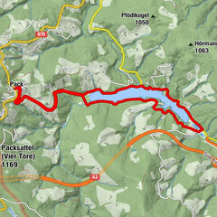
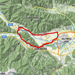
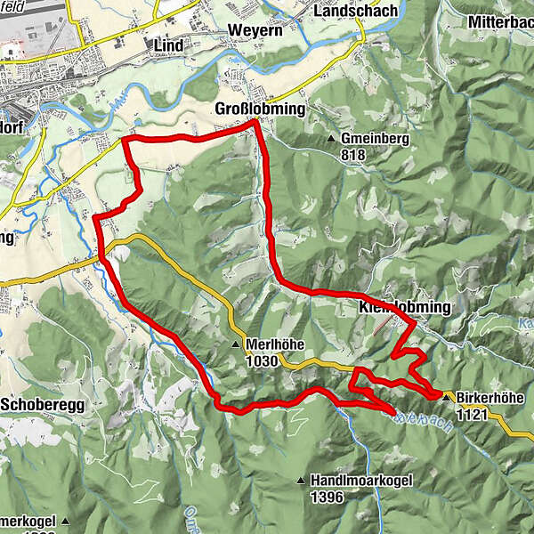
GroßlobmingMitterlobming2.0 kmKleinlobming5.6 kmKleinfeistritz13.5 kmKohlplatz16.6 kmHopfgarten17.5 kmGroßfeistritz20.0 kmPichling21.0 kmOberthann22.3 kmFeldkreuz24.5 kmGroßlobming25.6 km
- Best season
-
JanFebMarAprMayJunJulAugSepOctNovDec
- Description
-
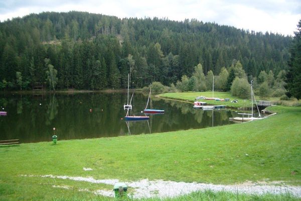
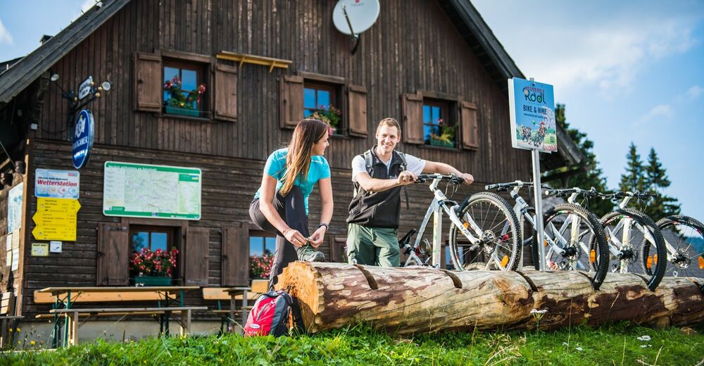
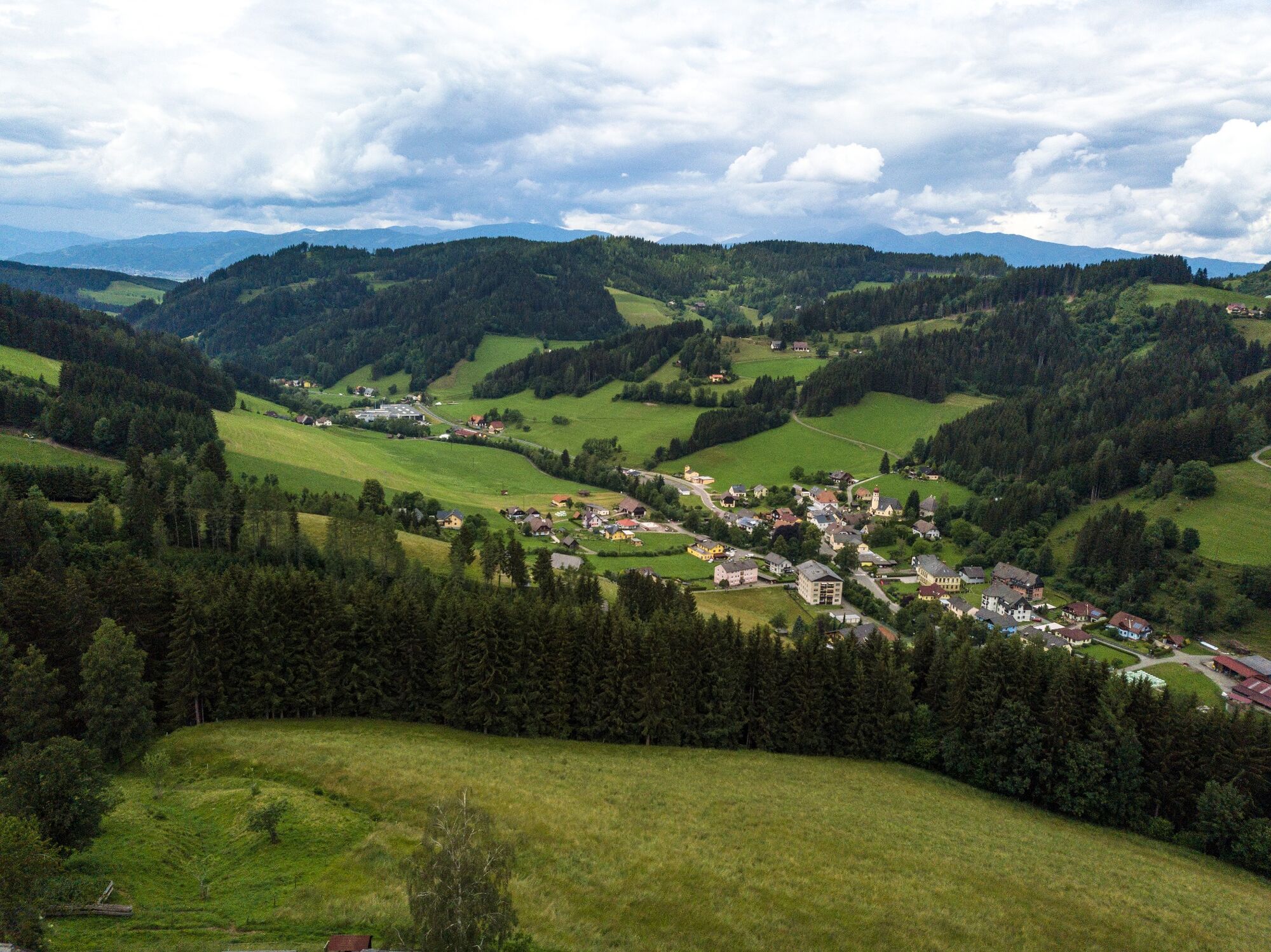
This circular tour starts directly in the centre of Großlobming in the adventure region murtal. After the Wulz Inn, there is a car park on the left-hand side after the bridge, where we turn right. Shortly before we leave Großlobming in the direction of Kleinlobming, we turn right after the park of the Großlobming technical school and ride via Mitterlobming past farms, slightly uphill along the Lobmingbach stream to Kleinlobming where the outdoor swimming pool is also located. At the end of Kleinlobming we turn right to Gasthof Hubmann, from now on it is really steep (average gradient 12%) on the asphalted Meranstrasse uphill to Reisstrasse, which also leads to the Gaberl. Now we have climbed the altitude metres and it's all downhill. We now ride a few kilometres on the federal road 77 before we turn left towards Kleinfeistritz. Now it's a fun ride down a steep, winding road without traffic to the small village of Kleinfeistritz. If the short metres in altitude were not enough for you, you can now turn left in the village and ride up to the Salzstiegel, a popular excursion destination. There is also one of many Bike & Hike stations, i.e. you could park your bike and take a short hike to the Rappoldkogel 1928m with a great view. There are two different ways to ascend over the rocks or the easier way towards the old Almhaus, just follow the signs. From Kleinfeistritz we drive slightly downhill on asphalt road to Großfeistritz and briefly cross the federal road 77 again to the Gaberl. Drive straight on and at the Pichling village sign we turn right, past the horse farm and Thann Castle. Here we have a beautiful view as far as the Tauern, Seckau Alps and Zeltweg. We come to the cycle path and continue right to Großlobming. At the Großlobming technical college, we have the option of visiting the herb competence centre or taking a short detour to the G'schlössl Murtal with its beautiful gardens.
- Directions
-
Asphalt and gravel road,
- Highest point
- 1,087 m
- Endpoint
-
Großlobming
- Height profile
-

- Equipment
-
E-Bike: E-Bike, change battery, charger, bicycle helmet, day bicycle backpack (approx. 20 liters) with rain cover, comfortable sport shoes, if necessary bicycle shoes, weather-adapted and durable clothes in the multi-layer principle, if necessary bicycle jersey, if necessary Bicycle gloves, air pump, bicycle tools, sun and rain protection, provisions and drinking water, water bottle and suitable holder, first aid kit, pocket knife, cell phone, cell phone holder for the handlebars if necessary, headlamp and reflectors if necessary, maps.Sufficient provisions and liquids as well as a bicycle helmet should always be taken along on a bicycle tour. When cycling in the evening or on autumn tours, make sure that your clothing is highly visible and reflective. It is also advisable to take a small first-aid kit, cycling tools, cycling maps and GPS devices.
Backpack & bike lock for possible Bike & Hike Tour
- Safety instructions
-
We drive a short distance on the Gaberl Bundestraße 77, we ask for special caution.
Especially on the mountains, many bends are in the shade and the road can be slightly frozen all day.
If you get into an emergency situation, dial the general emergency number 112.
The W-questions are particularly important for the emergency services:
WHERE did it happen? If possible, give the GPS location or an exact description of the position.
WHAT happened?
HOW MANY people are injured?
WHAT kind of injuries do the people have?
- Tips
-
The Lobmingtaler round tour could be extended with a Bike & Hike Tour to the Rappoldkogel at the Salzstiegel. After the tour relax in the beautiful garden of the G'schlössl Murtal.
- Additional information
- Directions
-
Exit the S 36 at Knittelfeld Ost, follow the signs via Apfelberg to Großlobming.
- Public transportation
-
Train station Knittelfeld and the bus to Großlobming
- Parking
-
After Gasthof Wulz and the bridge on the left side along the Lobmingbach.

-

-
AuthorThe tour Lobmingtaler round tour is used by outdooractive.com provided.