- Brief description
-
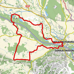
A tour to the center of the Goricko Landscape Park.
A tour that surprises with views, through the landscape park Goricko.
- Difficulty
-
medium
- Rating
-
- Starting point
-
Information Office am Hauptplatz Bad Radkersburg
- Route
-
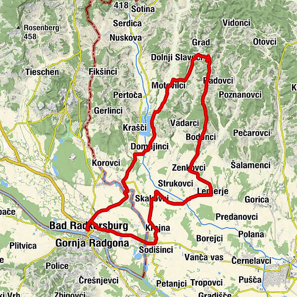
FrauenkircheBad Radkersburg0.0 kmChristuskirche Bad Radkersburg0.2 kmOberlaafeld1.3 kmRadkersburg Umgebung2.9 kmWaldstube3.7 kmZelting3.8 kmKaltenbrunn5.2 kmGostilna-Picerija Ajda5.5 kmTodtmannsdorf (219 m)8.7 kmMotovilci (231 m)13.7 kmOkrepčevalnica pri belem križu15.4 kmOberlimbach17.4 kmOkrepčevalnica Pri veselem Goričancu20.7 kmKamenšček (347 m)23.3 kmNA JASI23.7 kmBodonci (240 m)24.9 kmZenkovci (220 m)27.4 kmSankt Leonhard (202 m)30.0 kmPuževci (205 m)30.8 kmSkakofzen (206 m)35.2 kmOkrepčevalnica Püngrad35.4 kmKrajna (203 m)37.4 kmGostilna Mencigar37.4 kmGederovci (200 m)38.5 kmGostilna Metuljček38.5 kmGostilna Vöröš38.9 kmSicheldorf40.1 kmBuschenschank Hoamathaus42.1 kmLaafeld42.1 kmChristuskirche Bad Radkersburg44.0 kmBad Radkersburg44.4 km
- Best season
-
JanFebMarAprMayJunJulAugSepOctNovDec
- Description
-
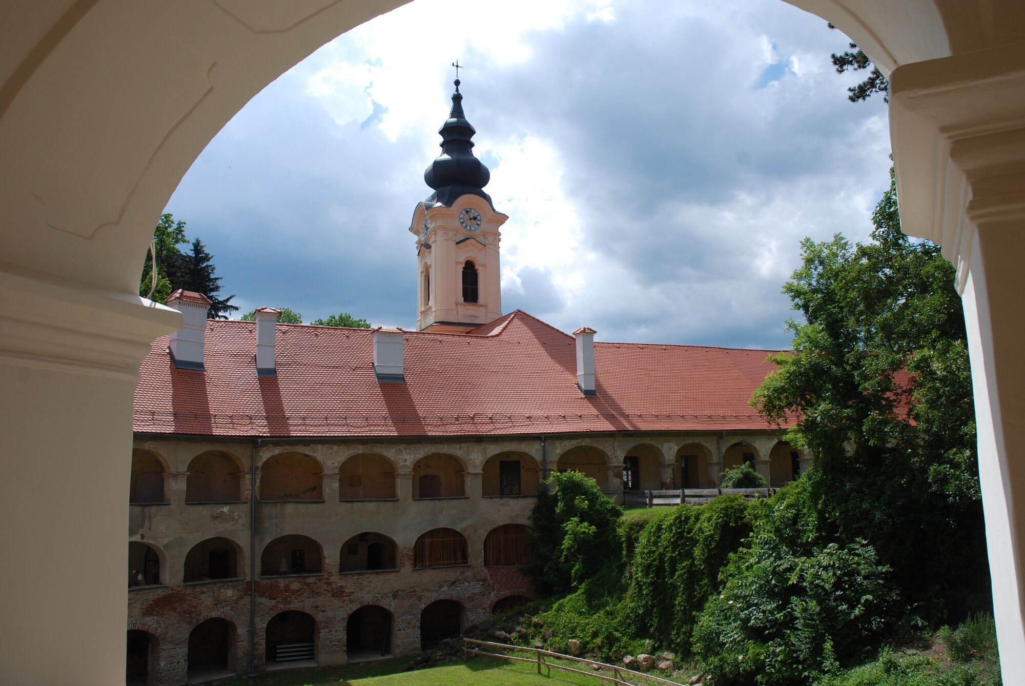
Grad Castle with its 365 rooms is the largest castle building in Slovenia (mandatory bike helmet & passport or ID card). Its core dates back to the 12th century. A beautiful panoramic tour with the transition of the hilly landscape to the Mur plain.
Tour length: 44,6 km
altitude difference: approx. 450 hm
medium difficulty level
- Directions
-
Trail conditions: Asphalt 100%
E-BIKE ready
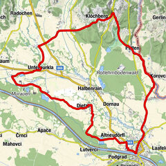
0.0 km - Bad Radkersburg main square guest information office
0,5 km - evangelic church, traffic circle, direction Murska Sobota
0.9 km - Cafe Horvath, turn right in the direction of Zelting, border crossing point
5,1 km - In Cankova direction Kuzma
6,7 km - Straight ahead in the direction of Kuzma
7,1 km - To the right, direction Topolovci
8.1 km - After the bridge, turn left toward Domajinci
10,8 km - To the right, direction
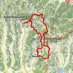
14.9 km - Right, direction Grad (1000 m uphill)
15.9 km - After the climb, left, sign for Grad
18.0 km - direction to Grad Castle (1.4 km uphill)
19.4 km - castle tour 800 m to the left, tour continues to the right in the direction of Bodonci
27.5 km - From Bodonci, 500 m uphill, straight ahead towards Murska Sobota
28.1 km - left, direction Murska Sobota
30.7 km - Right, direction Skakovci
35.9 km - left at the red chapel, direction Murska Sobota, Gederovci
39.3 km - traffic circle, direction Sicheldorf (border crossing), Bad Radkersburg main square
44,7 km - guest information Bad Radkersburg main square
- Highest point
- 358 m
- Endpoint
-
Information Office am Hauptplatz Bad Radkersburg
- Height profile
-

- Equipment
-
obligatory bike helmet & passport or identity card
- Tips
-
Discovery tips along the tour:
-Castle Grad-Panoramic views between Radovci and Vadarsce.
- Additional information
- Directions
- Public transportation
-
Detailed information about arriving by ÖBB (Austrian Federal Railways) can be found at www.oebb.at or on the Verbundlinie Steiermark website www.busbahnbim.at
With Verbundlinie’s BusBahnBim route planner app, planning your journey has never been easier: simply enter towns and/or addresses, stop names or points of interest to check all bus, train and tram connections in Austria. The app is available free of charge for smartphones – on Google Play and in the App Store
- Parking
-
You can find public parking here:
-Altstadt Bad Radkersburg - max. parking duration of 90 minutes
-city park (Hasenheide) and city moat - max. parking duration 180 minutes
-permanent parking - north in Dr. Kamniker-Straße and east near the Thermenarena - max. parking duration one week
- Author
-
The tour Castle-tour - Grad (Schloss-Tour - Grad) is used by outdooractive.com provided.