- Brief description
-
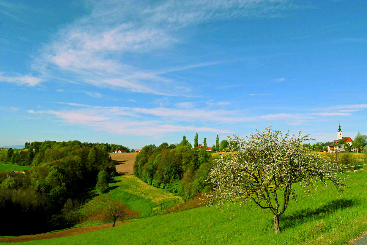
A hill crossing from the Saßbach valley to the Schwarzaubach valley is the focus of the tour.
- Difficulty
-
medium
- Rating
-
- Starting point
-
Train station in Weitersfeld a. d. M.
- Route
-
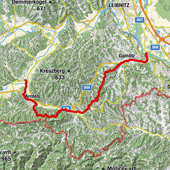
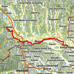
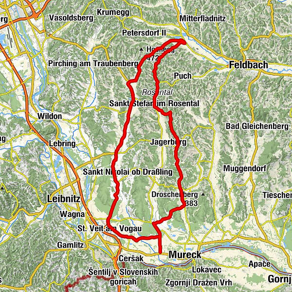
Hainsdorf-Brunnsee2.1 kmPichla bei Mureck3.1 kmSeibersdorf bei Sankt Veit6.9 kmLind bei Sankt Veit am Vogau8.7 kmSt. Veit am Vogau10.2 kmGasthaus zur Weinstube10.4 kmGrabin15.2 kmLabuttendorf15.3 kmLeitersdorf17.6 kmTechensdorf19.3 kmHainsdorf im Schwarzautal21.1 kmSeibuttendorf24.5 kmZiprein28.6 kmGlatzau30.5 kmKapelle Glatzau30.6 kmKirchbach in Steiermark32.9 kmPfarrkirche hl. Johannes der Täufer33.0 kmSchliergraben34.1 kmDörfla34.6 kmMaxendorf35.3 kmOberdorf am Hochegg41.0 kmPfarrkirche hl. Florian44.4 kmKirchberg an der Raab44.5 kmDie Prasserei44.5 kmGasthaus Rodler44.5 kmHof46.8 kmReithgraben48.2 kmReithberg49.6 kmBergschenke Monschein50.0 kmReinhartegg50.4 kmTrössengraben50.5 kmGigging51.9 kmLichendorf53.6 kmMaiersdorf54.8 kmFrauenbacher Stub'n55.7 kmFrauenbach55.9 kmEdelhof56.3 kmRosentaker Pizzeria & Kebap Haus56.3 kmGasthaus Rosenwirt57.0 kmPfarrkirche hl. Stefan57.1 kmSankt Stefan im Rosental57.2 kmAnnis Gasthaus57.3 kmAschau am Ottersbach61.2 kmOberzirknitz63.7 kmPöllau65.4 kmUnterzirknitz67.2 kmWiersdorf68.6 kmEntschendorf am Ottersbach70.1 kmZölling71.2 kmPfarrkirche Sankt Peter am Ottersbach71.7 kmGasthaus Dunkl71.8 kmGasthof Liebmann71.8 kmSankt Peter am Ottersbach71.9 kmWittmannsdorf73.9 kmPriebing77.7 kmWeinburg am Saßbach79.5 kmHainsdorf-Brunnsee82.4 km
- Best season
-
JanFebMarAprMayJunJulAugSepOctNovDec
- Description
-
Simply cycling to the rhythm of the landscape. A hill crossing from the Saßbach valley to the Schwarzaubach valley. Sometimes something for outliers when combined with other rounds.
Tour length: 84,9 km
Altitude difference: 680 hm
- Directions
-
Trail conditions: Asphalt 100%
E-BIKE ready
Route:
0,0 km - station Weitersfeld left, direction Hainsdorf
3,0 km - crossing left, direction Leibnitz cycle path
4,6 km - crossing right, direction Weinburg, Wittmannsdorf
10,3 km - crossing left, direction St. Peter, Jagerberg
19.2 km - crossroads on the right, direction Feldbach, Gnas
20,3 km - crossroad left, direction Aschau
24,8 km - crossroad left, direction St. Stefan
27.5 km - traffic circle, direction Feldbach via the center of St. Stefan
31.4 km - crossroads on the right, direction Hof, Kirchberg
39.9 km - Kirchberg center, past church, left towards Kirchbach
51,2 km - crossing left, direction Leibnitz
62.4 km - traffic circle straight, direction St. Nikola/Draßling, via Labuttendorf/St. Veit
72.8 km - traffic circle, direction St. Veit am Vogau
74.0 km - traffic circle St. Veit, direction Lind, Seibersdorf
74.2 km - Old wine press, direction right
77,3 km- Crossing left, direction Pichla, follow RA22
82,5 km- crossing right, direction Weitersfeld
84.7 km - Weitersfeld train station
- Highest point
- 441 m
- Endpoint
-
Train station in Weitersfeld a. d. M.
- Height profile
-

- Equipment
-
Please make sure you are dressed appropriately for the weather!
- Additional information
- Directions
- Public transportation
-
Detailed information about arriving by ÖBB (Austrian Federal Railways) can be found at www.oebb.at or on the Verbundlinie Steiermark website www.busbahnbim.at
With Verbundlinie’s BusBahnBim route planner app, planning your journey has never been easier: simply enter towns and/or addresses, stop names or points of interest to check all bus, train and tram connections in Austria. The app is available free of charge for smartphones – on Google Play and in the App Store
- Parking
-
You can find public parking here:
-Altstadt Bad Radkersburg - max. parking duration of 90 minutes
-city park (Hasenheide) and city moat - max. parking duration 180 minutes
-permanent parking - north in Dr. Kamniker-Straße and east near the Thermenarena - max. parking duration one week
- Author
-
The tour Weitersfeld round (Weitersfeld Runde) is used by outdooractive.com provided.


General info
-
Südsteiermark
237
-
Bad Gleichenberg
169
-
Jagerberg
46