- Brief description
-
Perspectives for eternity.
- Difficulty
-
difficult
- Rating
-
- Starting point
-
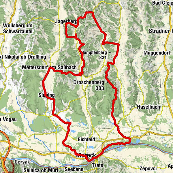
Mureck
- Route
-
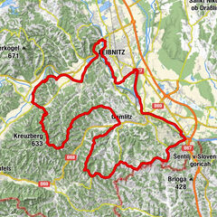
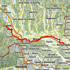
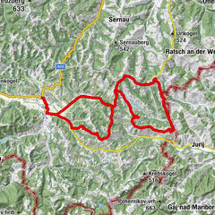
Mureck0.1 kmLandgasthof Mauko5.4 kmOberrakitsch5.5 kmWeinburg am Saßbach8.9 kmHöfla11.2 kmGasthaus Siebingerhof RADL12.0 kmKapelle Maria Trost zu Siebing12.1 kmSiebing12.1 kmRohrbach am Rosenberg13.4 kmRannersdorf am Saßbach14.9 kmKath. Pfarrkirche Hl. Herz-Jesu15.8 kmMettersdorf am Saßbach15.8 kmSasstalerhof Jöbstl15.9 kmGasthof Fauland16.0 kmUrsulaquelle16.2 kmGasthaus Dunkl20.6 kmGasthof Liebmann20.7 kmSankt Peter am Ottersbach20.8 kmPfarrkirche Sankt Peter am Ottersbach21.2 kmWiersdorf24.9 kmUnterzirknitz27.2 kmJagerberg31.2 kmCafe Pizzeria Monte Jawa31.2 kmHaiden31.2 kmNeptun31.8 kmPöllau32.9 kmNieslkapelle34.1 kmGstättenfeld34.2 kmUnterauersbach35.1 kmRadisch37.7 kmAug38.6 kmBierbaum am Auersbach40.4 kmPuchenstein42.3 kmSummer42.9 kmTrössing43.0 kmPfarrkirche Dietersdorf am Gnasbach44.8 kmDietersdorf am Gnasbach44.9 kmPizzeria Heuboden45.2 kmPerbersdorf bei Sankt Peter46.0 kmUnterberg46.8 kmNiederberg47.8 kmHofstättenberg49.8 kmSchröttenberg50.6 kmDeng52.5 kmTax Berg53.4 kmSchildhof53.6 kmMostschenke Pechmanns alte Ölmühle54.0 kmRatschendorf55.0 kmHoferwirt, Gasthaus Fasching55.1 kmDiepersdorf57.5 kmGasthof-Pension Röck61.7 kmGasthof-Pension Fabiani62.0 kmGries62.3 kmMisselsdorf62.6 kmVratji vrh (337 m)63.6 kmMureck65.4 km
- Best season
-
JanFebMarAprMayJunJulAugSepOctNovDec
- Description
-
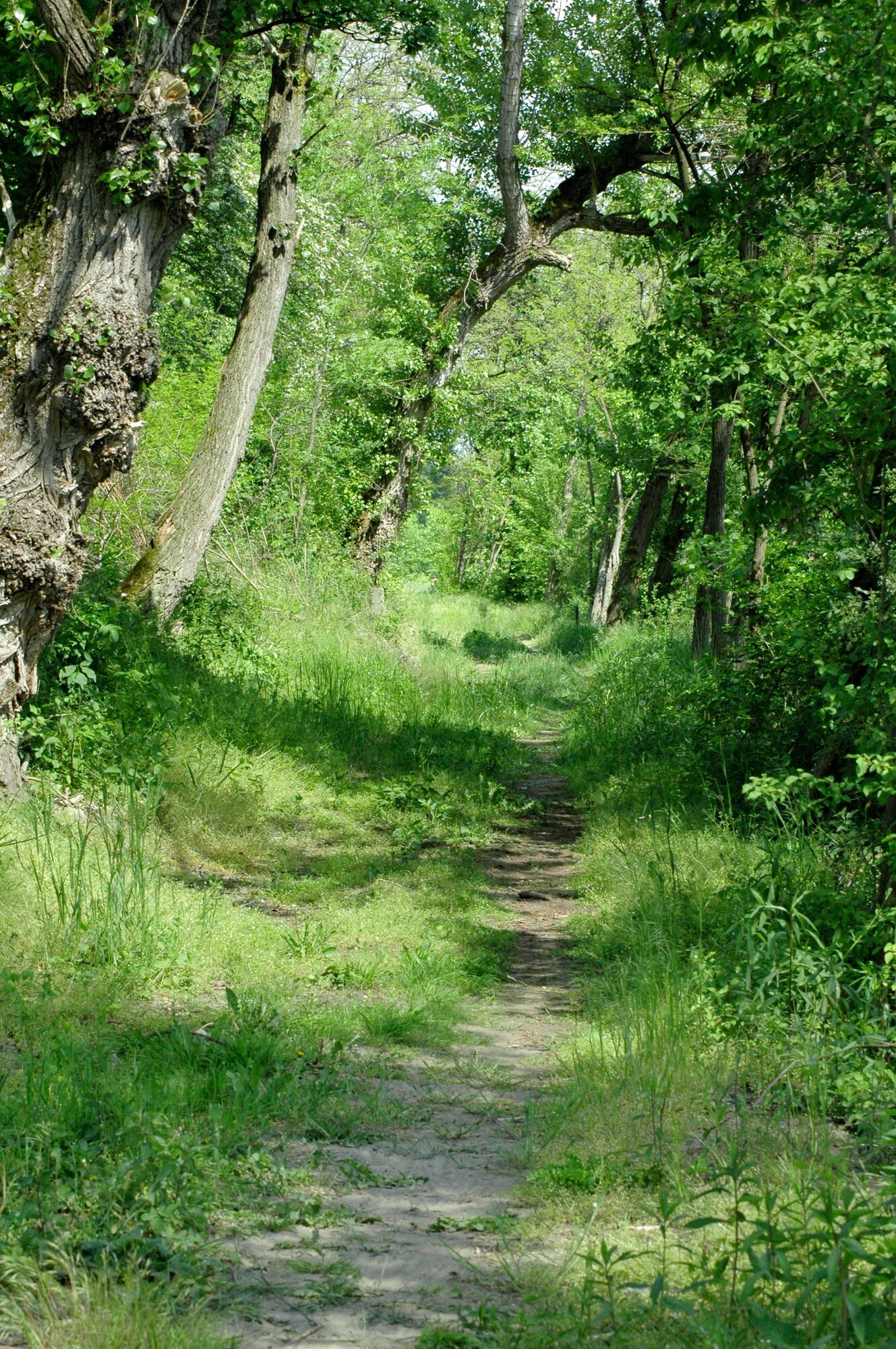
Again Mureck is our starting point. Via the pond landscapes Schwabenteich and Weinburgteich we reach the Sassbach valley via Weinburg Castle. We continue to Siebing, Rannersdorf to Mettersdorf the Sassbach.
From Mettersdorf we leave the first floor of the tour and enjoy the XXL views between Mettersdorfberg and Jagerberg. Continuing to Unterauersbach we reach Bierbaum with the possibility to visit the oasis in the forest - the Fatima Chapel.
Continuing via Dietersdorf, Droschenberg, Schröttenberg we once again forget about everyday life, enjoy the views and cross the Glauningwald. At Ratschendorf we reach the Mostschenke embedded in an old original farming village. Past the pumpkin village Diepersdorf we reach Mureck again via the Murradweg R2.
- Directions
-
Tour length: 61.5 km
The climbs compensate for magnificent parnoramic views. For sporty riders who also take a slope up to 15%.
City exit: Start swimming pool Mureck left - tennis hall right - intersection with traffic lights - church left.
Trail conditions: asphalt 90%, paved goods road 10%.
E-BIKE ready
- Highest point
- 410 m
- Endpoint
-
Mureck
- Height profile
-

- Tips
-
Discovery tips along the tour:
Oberrakitsch , Sixt oil mill; Fatima chapel; Droschenberg viewpoint; Ratschendorf, Roman museum; Diepersdorf, Kürbisdorf.
- Additional information
- Directions
- Public transportation
-
Detailed information about arriving by ÖBB (Austrian Federal Railways) can be found at www.oebb.at or on the Verbundlinie Steiermark website www.busbahnbim.at
With Verbundlinie’s BusBahnBim route planner app, planning your journey has never been easier: simply enter towns and/or addresses, stop names or points of interest to check all bus, train and tram connections in Austria. The app is available free of charge for smartphones – on Google Play and in the App Store
- Parking
-
You can find public parking here:
- Old town Bad Radkersburg - max. parking time 90 minutes
-city park (Hasenheide) and city moat - max. parking duration 180 minutes
-permanent parking - north in Dr. Kamniker-Straße and east near the Thermenarena - max. parking duration one week


- Author
-
The tour Horizon tour RA 21 (Horizonttour RA 21) is used by outdooractive.com provided.