
- Brief description
-
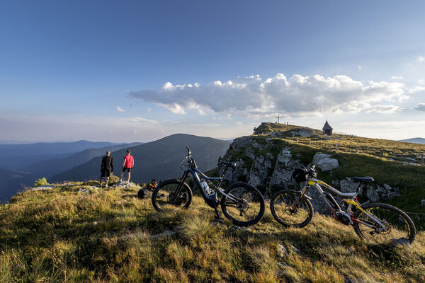
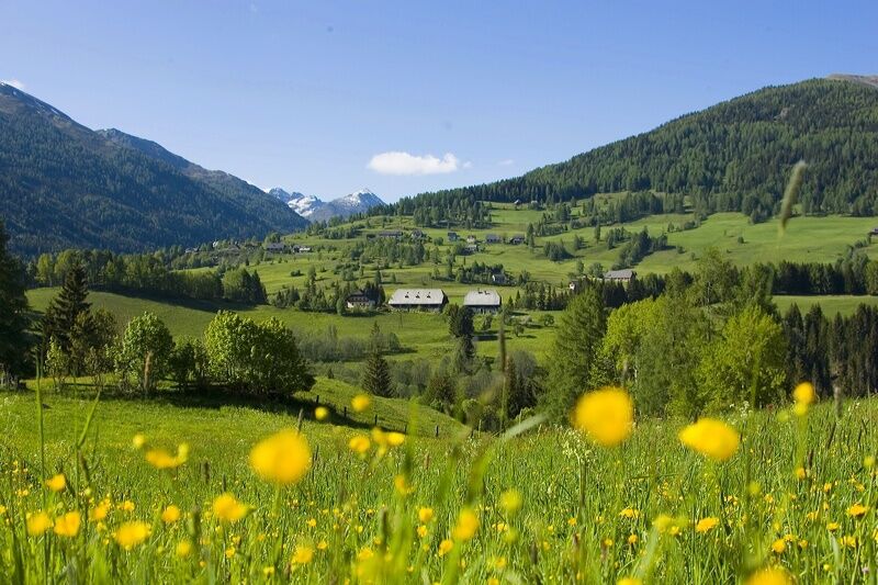
This panoramic bike tour for strong calves is not only good for your health, but also offers a short stop in the rehab and climatic health resort Stolzalpe.
- Difficulty
-
easy
- Rating
-
- Starting point
-
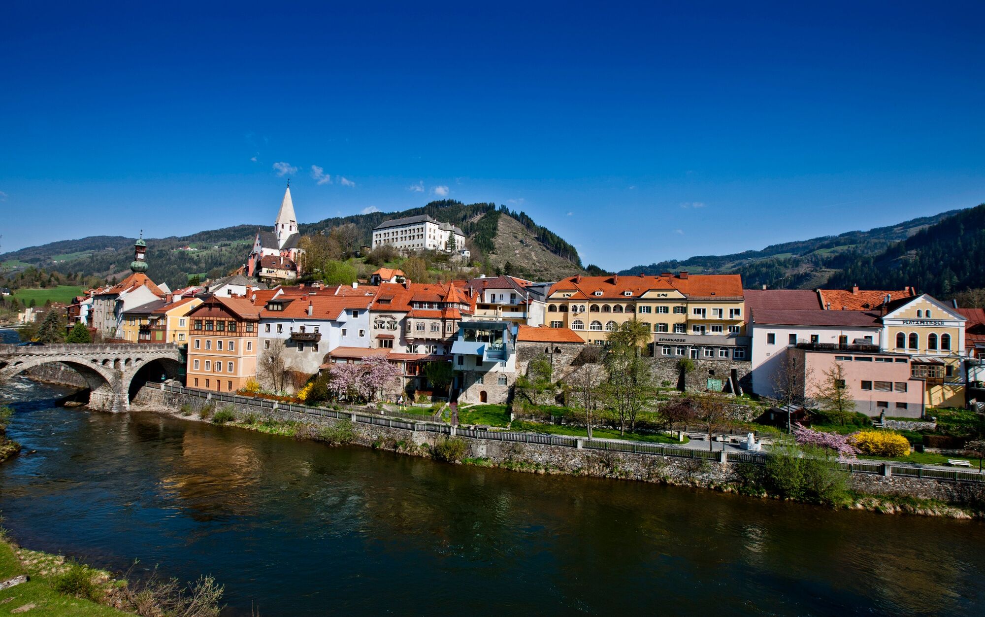
WM-Halle, Murau
- Route
-
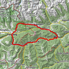
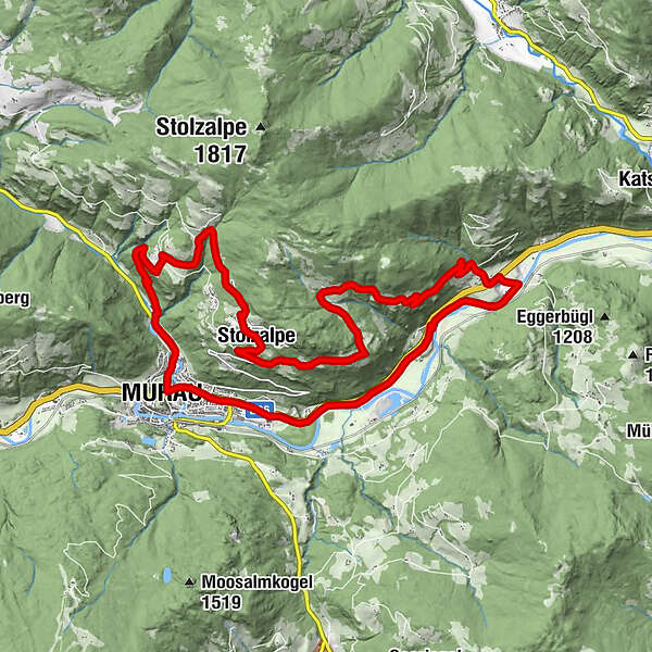
Murau (829 m)0.6 kmStolzalpe8.0 kmMesskapelle zum Hl. Erlöser8.2 kmTriebendorf16.4 kmEgidiwirt22.5 kmEgidikirche22.6 kmSankt Egidi22.6 kmMurau (829 m)23.5 km
- Best season
-
JanFebMarAprMayJunJulAugSepOctNovDec
- Description
-
This is an easier mountain bike tour with a magnificent panoramic view of Murau. Especially at the LKH Stolzalpe invites with its view to Murau to a short stop to linger. Ride and enjoy is the motto of this tour!
- Directions
-
From the starting point, the WM-Halle Murau at the indoor swimming pool, you cycle west to the first double traffic circle, there you turn right in the direction of Ranten and follow the Rantenradway R63 to the local heating plant in Murau. Here you cycle right ovr the bridge, then turn left and follow the gravel road to the farm. At the first crossroads turn left at the chapel and cyle for about 100m on an asphalt road. At the second crossing turn right, again on a gravel road. At the crossing vlg. Neumann, turn right again in the direction of Stolzalpe.
After about 500m the gravel road ends and joins the main road. Here you turn to the left LKH Murtal location Stolzalpe house || (highest point on the tour). From here the descent takes place in the direction of Murau to the crossroads vlg. Steinwender. There you leave the provincial road (follow the signs): at the crossing Lankmaier you turn left. At the crossing vlg. Moser, keep to the right and continue through the Achner farm passage. The descent continues until the Grabenbridge (end of the gravel road). Follow the road until you reach the village of Triebendorf. There you cross the main road and continue in the direction of Karchau/Dürnberg until you reach the Mur bridge. Before the Mur bridge, turn right and follow the Murradway R2 to Murau.
- Highest point
- 1,289 m
- Endpoint
-
WM-Halle, Murau
- Height profile
-

- Equipment
-
Helmet
Suitable footwear
Sportswear
Drinking bootle etc. - Additional information
-
The ideal time for this tour is from May to October.
- Directions
-
Coming from Judenburg via Unzmarkt to Scheifling. Turn right here and drive to Murau. The WM-Halle is located after the second traffic circle on the left side.
Coming from Tamsweg drive via Ranten (or Stadl an der Mur) to Murau. The WM-Halle is located after the double traffic circle on the right side.
- Public transportation
-
With the BusBahnBim app of the Verbundlinie, timetable information has never been easier: all bus, train and streetcar connections in Austria can be queried by enteriing locations and/or addresses, stops or important points. The app is available as a free app for smartphones (Android, iOS) - on Goolge Play and in the App Store.
- Parking
-
There are public parking spaces at the WM-Halle/Swimming area Murau.
- Author
-
The tour Stolzalpen circuit is used by outdooractive.com provided.