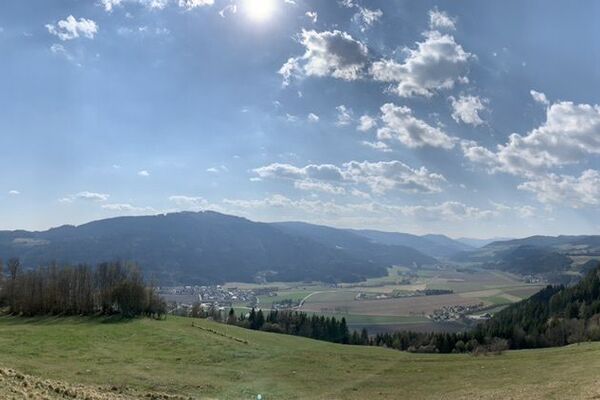


- Brief description
-
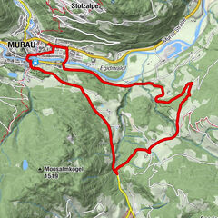
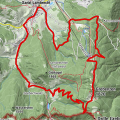
Challenging bike tour with two mountain climbs from Murau via Karchau and St. Bubbles. The route through St. Lambrecht to Auerlingsee is definitely worth it!
- Difficulty
-
medium
- Rating
-
- Starting point
-
WM-Halle Murau
- Route
-
Murau (829 m)Laßnitzbach2.7 kmAlpengasthof Moser9.1 kmKarchau9.2 kmKirchmoar14.6 kmSankt Blasen15.0 kmVorderbach15.2 kmStraussenhof Wallner15.8 kmHeiligenstadt16.6 kmSankt Lambrecht18.4 kmTorwirt18.5 kmMarktcafé18.5 kmStifterl18.5 kmMarktkreuz18.7 kmWieskreuzkapelle20.2 kmAuerling25.1 kmWieskreuzkapelle27.9 kmVorstadt30.2 kmSetz di' nieder Stüberl am Weirerteich33.7 kmTal33.8 kmDer Freizeitwirt35.7 kmFreizeitanlage35.8 kmSteirisch Laßnitz35.9 kmKärntnerisch Laßnitz36.6 kmHl. Jakobus der Ältere36.7 kmWimml41.3 kmMurau (829 m)43.3 kmMurau (809 m)43.5 km
- Best season
-
JanFebMarAprMayJunJulAugSepOctNovDec
- Description
-
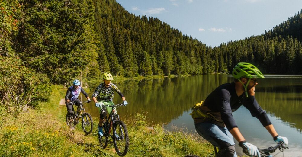
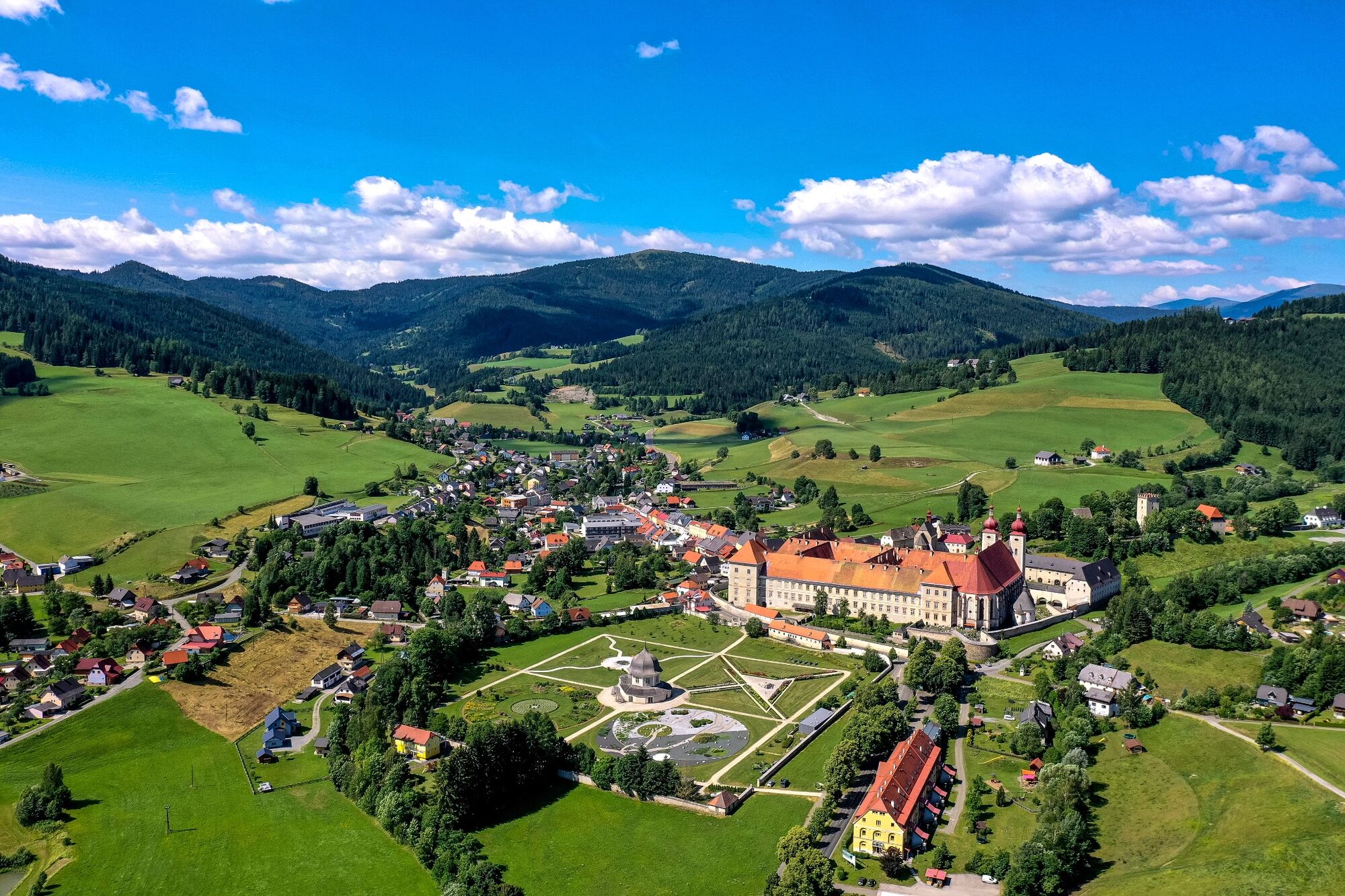
From Murau the route leads via Laßnitzbach, Karchau and St. Blase to the monastery town of St. Lambrecht. The mountain classification now awaits the cyclists from St. Lambrecht, which means that a short break in the beautiful monastery garden is definitely worth it to recharge your batteries. From the St. Lambrechter Vorstadt you start the climb over Auerling towards Carinthia until you reach the Auerlingsee just before the state border. The ambience, the peace and the scenic beauty of this natural pond always reward your efforts.
To cool off, treat yourself to a jump into the Auerlingsee. A true place of power!
- Directions
-
From the starting point, the World Cup hall in Murau, you cycle east to the Stolzalpen roundabout. There you take the second exit towards Scheifling. At the next roundabout, turn right at the first exit and follow the road for about 200 m towards St. Lambrecht. After the Mur bridge, turn left, cross the railway crossing and, after the logistics center, turn left via Laßnitzbach to Wirt am Stein. Here you drive at the intersection cf. Joslbauer continues towards Karchau. We recommend a short stop at the Ransmoarkehre to enjoy the wonderful view. From here we go to the Kleine Tauernbründl (highest point on the tour, 1,335 m) and continue to Seebauer to the town of St. Blase. After about one kilometer, turn right at the “Eiswelt hiking trail” intersection. You cycle via Wirt am Pichl (beginning of the gravel road) via Heiligenstadt straight on to St. Lambrecht; The gravel road ends here. At the beginning of the through town of St. Lambrecht, turn right and follow the state road to Murau to the Auerlingsee intersection. Follow the road over a moderate incline to the Mini am Bach intersection. From here you cycle about 500 m on a gravel road to the second highlight of the tour (1,330 m). A rest area by the lake can be reached on foot in two minutes.
To get back to the starting point of the tour, drive back to the intersection in front of St. Lambrecht, turn left there and follow the state road to Murau.
- Highest point
- 1,340 m
- Endpoint
-
WM Halle Murau
- Height profile
-

- Equipment
-
Helmet Suitable footwear Sportswear Drinking bottle etc.
Even on a short tour, you should have the following basic equipment with you: repair kit, air pump, spare hose, a rag, suitable tools for gears, axles, saddle, stem and handlebar bolts.
- Safety instructions
-
Since some sections of the route are directly on the federal highway, please be careful when driving.
- Tips
-
Be sure to pack your swimming gear for a stop to cool off at Lake Auerling!
- Additional information
-
The ideal time for this tour is from May to October.
- Directions
-
Coming from Judenburg via Unzmarkt to Scheifling. Turn right here towards Murau. In Murau, after the second roundabout, the WM-Halle is on the left.
Coming from Murau via Ranten (or Stadl an der Mur), always drive straight to Murau. The WM-Halle is on the left after the double roundabout.
- Public transportation
-
With the BusBahnBim app from the interconnected line, timetable information is easier than ever before: all bus, train and tram connections in Austria can be queried by entering locations and/or addresses, stops or important points. The app is available as a free app for smartphones (Android, iOS) - on Google Play and in the App Store.
- Parking
-
Public parking spaces are available directly at the World Cup hall in Murau.


- Author
-
The tour Auerlingsee circuit from Murau via St. Lambrecht is used by outdooractive.com provided.