
- Brief description
-
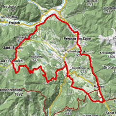
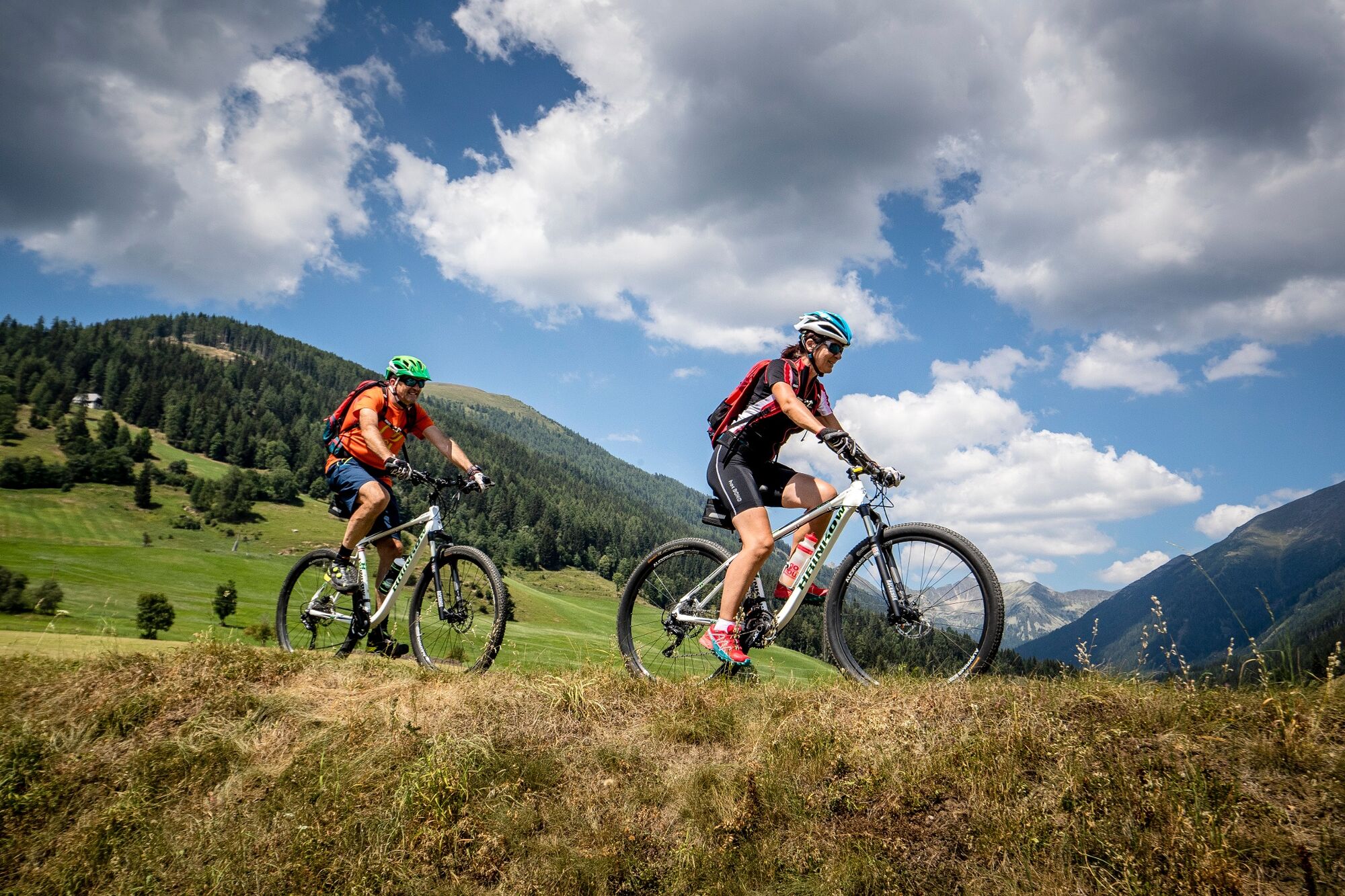
A leisurely round trip takes you from Murau, partly along the Murradweg, into the Katschtal and Rantental valleys.
- Difficulty
-
easy
- Rating
-
- Starting point
-
WM-Halle Murau
- Route
-
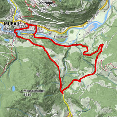
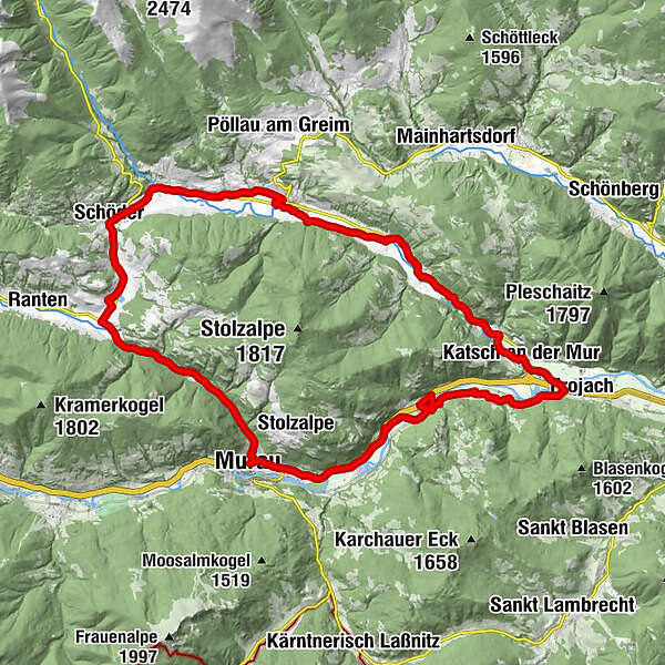
Murau (829 m)Egidikirche0.6 kmEgidiwirt0.7 kmSankt Egidi0.7 kmSaurau10.4 kmUnterdorf14.0 kmKatsch an der Mur14.2 kmFilialkirche hl. Bartholomäus18.8 kmAlthofen18.9 kmPeterdorf20.7 kmSankt Peter am Kammersberg24.2 kmMitterdorf26.3 kmFeistritz am Kammersberg27.1 kmBaierdorf29.6 kmFilialkirche hl. Nikolaus29.7 kmSchöder31.3 kmRottenmann34.4 kmRottenmanner-Kapelle34.4 kmGalgenwiese39.7 kmMurau (829 m)42.1 km
- Best season
-
JanFebMarAprMayJunJulAugSepOctNovDec
- Description
-
Discover the placees around the Stolzalpe on this leisurely bike tour, which is especially popular by locals. From Murau to Frojach you wll cycle along the river Mur in a relaxed way. At Katsch, the tranquil Katsch Valley opens up at the begining of which the ruins of Katsch Castle sit high in the rock.
Through the small towns of Althofen and Peterdorf you reach St. Peter am Kammersberg, from where it is not far to Feistritz Castle in the town nof the same name. Continuing through the horse village of Baierdorf and Schöder, you reach the Rantental valley, where you cycle comfortably through the forest between Ranten and Murau back to the starting point.
- Directions
-
From the starting oint WM Halle Murau drive east to the Stolzalpen traffic circle. Leave the traffic circle at the second ecxit in the direction of Scheifling. From here follow the Murradweg R2 to Frojach. At the Frojach railroad crossing turn right. After abour 100m you cross the main road and turn left
This is where the Katschtalradweg R1 begins. Cross the bridge to Katsch and follow the local cycle path to the Hörbinger department store. Here you turn left again and follow the Dorfstraße until you reach the Landesstraße. There you turn left in the direction of St. Peter am Kammersberg and follow the cycle path until shortly before Althofen. Continue cycling on the Landstreet until the end of Althofen, wehere we turn left over the bridge and then turn right. A gravel road leads one of these to St. Peter am Kammersberg. There you turn left, along the forest road in the direction of Kretzenbründl, until you reach the gravel road. On the gravel road you turn right again until you reach the provincial road, you cross this road until you reach the center of Mitterdorf. In Mitterdorf turn left, past the Brückenwirt inn to Feistritz.
After the end of Feistritz turn right and follow the Katschtalradweg R1 again until shortly before Baierdorf. Continue on the main road to the end of Baierdorf. Here you follow the cycle path R1 again until you reach the village Schöder. From here you cycle along the main road, which leads you to the highest point of the tour. Continue via Rottenmann to the crossroad, where you turn left towards Murau. After a few hundred meters we recommended a rest at the former Humburger saw with the "Waschlrad". Via the Rantenradweg R63 you return to Murau.
- Highest point
- 937 m
- Endpoint
-
WM Halle Murau
- Height profile
-

- Equipment
-
Helmet
Suitable footwear
Sportwear
Drinking bottle etc. - Additional information
-
The ideal time for this tour is from May to October.
- Directions
-
Coming from Judenburg via Unzmarkt to Scheifling. Turn right here in the direction of Murau. In Murau, after the second traffic circular, the WM Halle is located on the left side.
Coming from Murau via Ranten (or Stadl an der Mur), drive straight on to Murau. The WM Halle is located after the double traffic circular on the left side.
- Public transportation
-
With the BusBahnBim app from the Verbundlinie, timetable information has never been easier: all bus, train and streetcar connections in Austria can be queried by entering locations and/or addresses, stops or important points. The app is available as a free app for smartphones (Android, iOS) - on Google Play and in the App Store.
- Parking
-
Sufficient parking spaces are available at the WM Halle Murau.
- Author
-
The tour Circumnavigation of the Stolzalpe is used by outdooractive.com provided.