
- Brief description
-
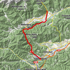
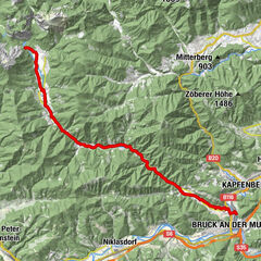
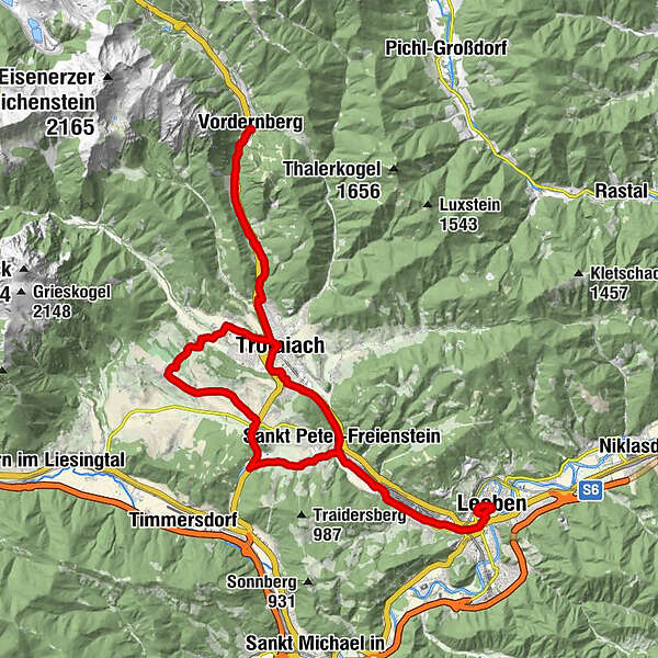
Medium-difficulty route: Leoben - Trofaiach - Vordernberg - Putzenberg - Schardorf - Edling - Trabochersee - Hessenberg - LeobenRoad condition: Asphalt
- Difficulty
-
medium
- Rating
-
- Starting point
-
Leoben main square
- Route
-
LeobenWaasen0.3 kmPfarrkirche Maria am Waasen0.4 kmDonawitz1.9 kmDonawitzer Kirche2.1 kmHalodri2.8 kmGasthof Freiensteinerhof Kohlhuber6.2 kmSankt Peter-Freienstein6.6 kmGmeingrube7.6 kmTrofaiach10.9 kmHafning12.8 kmGasthaus Friedaustüberl15.2 kmZum Schwarzen Adler18.8 kmVordernberg18.9 kmGasthof zur Post19.0 kmGasthaus Friedaustüberl22.5 kmHafning25.2 kmTrofaiach26.5 kmUntergimplach27.1 kmUnterkurzheim27.1 kmJausenstation Gößbachstüberl28.7 kmGimplach29.1 kmPutzenberg30.1 kmSchardorf31.2 kmTöllach32.2 kmGai32.3 kmObergausendorf33.2 kmGausendorf33.5 kmEdling34.7 kmPfarrkirche St. Peter39.4 kmGasthof Freiensteinerhof Kohlhuber39.5 kmSankt Peter-Freienstein39.6 kmHalodri42.7 kmDonawitzer Kirche43.4 kmDonawitz43.8 kmPfarrkirche Maria am Waasen45.3 kmWaasen45.4 kmChristus im Zentrum45.8 kmLeoben46.5 km
- Best season
-
JanFebMarAprMayJunJulAugSepOctNovDec
- Description
-
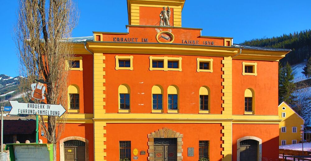
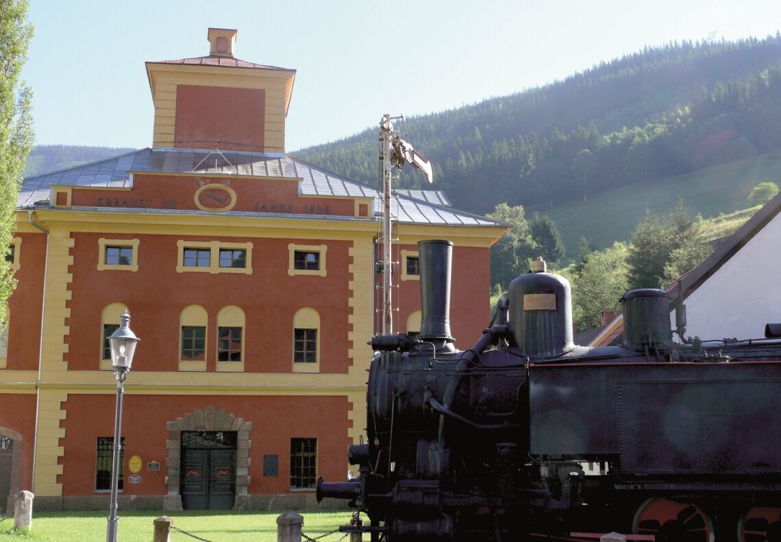
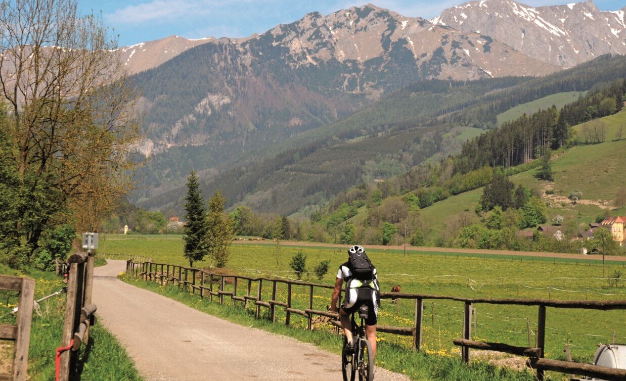
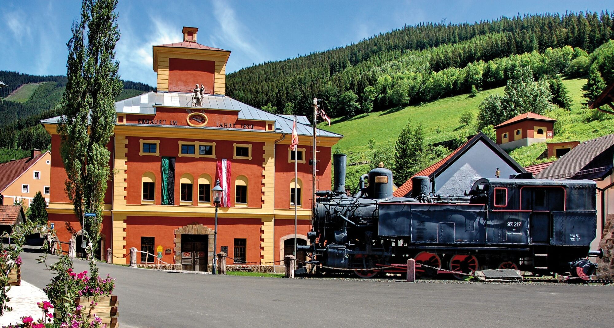
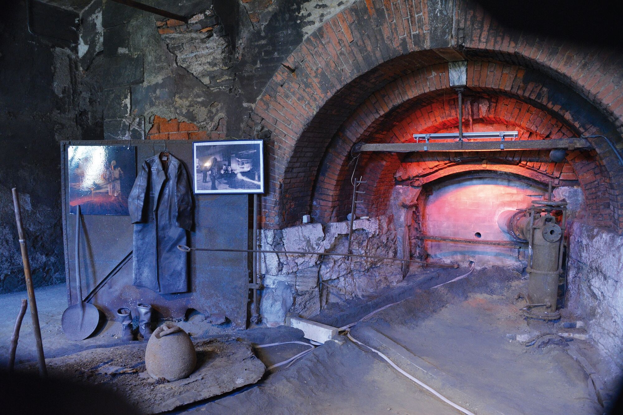
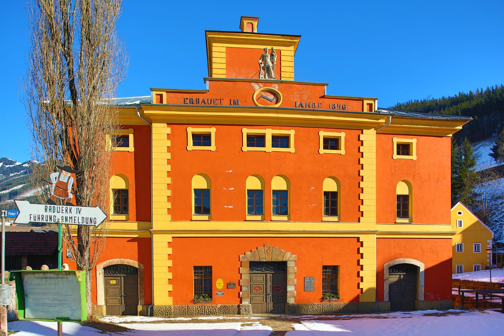
The medium-difficulty route offers a varied riding experience with views of the Trofaicha Basin, Putzenberg and, with the Radwerk IV, a historically very exciting stopover.
- Directions
-
From the main square we start in the direction of Schwammerlturm and Waasenvorstadt, where we turn right at the Waasenkirche into Donawitzerstraße. This leads into Kerpelystraße, which we leave after about 200 meters and turn half-right at the railroad crossing into Pestalozzistraße. At the end of Pestalozzistraße, at the entrance to the voestalpine factory premises, we return to Kerpelystraße on the left via a railroad crossing. First along the steel mill and then along the fine rolling mill, where wire is produced, we ride on the R38 to St. Peter Freienstein, directly past Friedhofen Castle. The route continues almost level next to the railroad line to Trofaiach. After crossing the town, the R38 again runs alongside the railroad line to Hafning and from there uphill to Friedauwerk, the former base of the railroad line over the Präbichl. Today, the trains of the Erzbergbahn, which is an attraction for railroad enthusiasts from all over the world, are housed there. Pass the tractor museum, a must for lovers of old tractors, on the B115. After one kilometer, the destination of this route, the historic market of Vordernberg, a cradle of the Austrian iron industry, is reached. Among the many buildings worth seeing, the Radwerk IV (museum) and the Lehrfrischhütte are particularly noteworthy. Return to Leoben along the same route as far as Trofaiach. At the sports/multi-purpose hall we turn sharply right over the railroad crossing and continue on the Gößgrabenstraße to Kurzheim. In front of us lies the magnificent Reiting massif. Soon after Kurzheim our route turns left to Gimplach, where we turn right at the fire station towards Putzenberg. After a short, steep climb, we go downhill for a few hundred meters before the next climb to Schardorf begins. The route here leads on a public road through the grounds of the golf club. The Landhotel Reitingblick in Schardorf is a good place to take a break. After a slight descent we turn left in Töllach to Gausendorf and cycle from there to Edling. In Edling we meet the B115, which we use for the short stretch to the Trabochersee. On the left shore of the lake, the route branches off to the left at the beginning of the lake in the direction of Hessenberg. This requires crossing the B115. On a gently ascending side road we enjoy a magnificent panorama with the Reiting and the mountains of the Eisenerz Alps as eye-catchers. After reaching the highest point, we descend through a settlement area to St. Peter Freienstein. Here we meet the R38. The cycle path leads directly past the idyllic Friedhofen Castle. In the stylish ambience of the former hammer lord's residence, the mining history exhibition BergWerkZeug can be visited. From the past, the tour continues to the present of the steel industry. The longest rails in the world are produced by voestalpine in Donawitz, as is wire for a wide variety of applications. And all this with steel from the company's own blast furnaces. First along the imposing plant, we then walk through the district of Waasen, past the church of Maria am Waasen, founded in 1149, with Gothic glass windows that are particularly worth seeing, back to the starting point of our tour on the main square.
- Highest point
- 826 m
- Endpoint
-
Leoben main square
- Height profile
-

- Equipment
-
The route is partly on public roads therefore a roadworthy bike should be used.
Tip: A basic equipment of tools and accessories such as spare tube and / or patch kit, wrench, air pump, brake and shift cable and a screwdriver can never hurt.
- Safety instructions
-
Degree of difficulty: medium
Reduce your risk of injury in case of falls and ride with a helmet!
Proper planning is a must before any tour.
Emergency call rescue: 144
Emergency message tip - provide answers to the six W questions:
What happened?
How many injured?
Where did the accident happen (possibly GPS coordinates)?
Who is reporting (callback number)?
When did the accident happen?
Weather at the accident site?
- Tips
-
Places of interest:
Trofaiach City Museum
Wheelworks IV
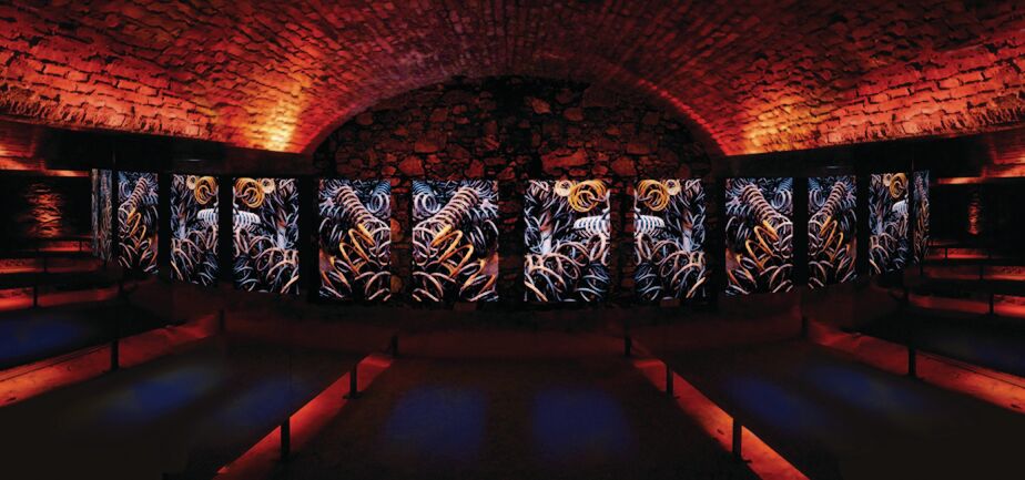
Friedhofen Castle (St. Peter-Freienstein):
Art Gallery Leoben
- Additional information
- Directions
-
By car
Coming from Graz on the A9 exit St. Michael ob Leoben and on the S 35 to Leoben > direction Zentrum/Asia SpaComing from Vienna on the S 6 to Bruck an der Mur and Leoben > direction Zentrum/Asia Spa
- Public transportation
-
ÖBB train station Leoben. Return from Hieflau with ÖBB trains; via Selzthal in the direction of Leoben.
Timetables and travel information can be found directly at: Österreichische Bundesbahnen (ÖBB), Steiermärkische Landesbahnen (STLB), www.busbahnbim.at
With the BusBahnBim app of the Verbundlinie, timetable information has never been easier: all bus, train and tram connections in Austria can be queried by entering locations and/or addresses, stops or important points. The app is available as a free app for smartphones (Android, iOS) - on Google Play and in the App Store
- Parking
-
Free parking: parts of the Gösserstrasse (connecting road center Göss)
-

-
AuthorThe tour Radwerk IV Vordernberg (start Leoben) is used by outdooractive.com provided.


-
Erzberg Leoben
103
-
Hochschwab
35
-
Trofaiach
18