- Brief description
-
Along the Saggau and the Schwarze Sulm you will also explore the corn fields and sunflowers of the region.
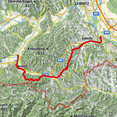
- Starting point
-
Gleinstätten
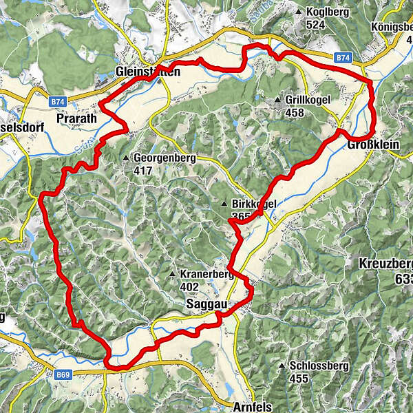
- Route
-
GleinstättenGasthof Brand0.2 kmMantrach4.6 kmWippelsach7.0 kmGroßklein8.8 kmKleinklein9.7 kmMesskapelle Schmerzhafte Mutter9.7 kmRadiga12.7 kmOrtskapelle 'Maria Hilf'12.9 kmHarla14.2 kmPfarrkirche Heiliger Johannes der Täufer16.2 kmSankt Johann im Saggautal16.3 kmSaggau17.2 kmUnterhaag21.1 kmPommeregg24.1 kmObergreith24.9 kmMühlegg26.0 kmWeixelberg26.4 kmPraratheregg28.6 kmHaslach30.1 kmLandhaus Rath32.0 kmGleinstätten32.1 km
- Highest point
- 425 m
- Endpoint
-
Gleinstätten
- Height profile
-

- Author
-
The tour 2-Rivers Tour Version 2 is used by outdooractive.com provided.
GPS Downloads


Other tours in the regions