© TVB Murau

© Tom Lamm | ikarus.cc - Tom Lamm
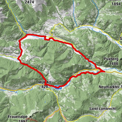
Tour data
30.16km
742
- 1,110m
223hm
248hm
02:00h
- Difficulty
-
easy
- Rating
-
- Route
-
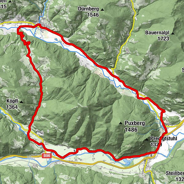
StadtPfarrkirche hl. Martin0.0 kmOberwölz0.0 kmFilialkirche hl. Sigismund0.1 kmJohannes-Nepomuk-Kapelle0.1 kmVorstadt0.2 kmWieden1.2 kmFilialkirche hl. Pankratius1.9 kmHinterburg5.5 kmKatsch an der Mur10.5 kmUnterdorf10.9 kmFrojach12.9 kmPux15.9 kmNiederwölz19.7 kmPfarrkirche hl. Maximilian19.7 kmAnnenkapelle19.9 kmPachern23.3 kmFresen23.7 kmRaiming26.5 kmBromach29.6 kmLeitnerkapelle29.7 kmStadt30.1 kmPfarrkirche hl. Martin30.1 kmOberwölz30.1 km
- Best season
-
JanFebMarAprMayJunJulAugSepOctNovDec
- Description
-
From Oberwölz via Hinterburg to Katsch (W4) and along the Römerweg to Teufenbach (W3).
From Teufenbach a small piece along the main road to Niederwölz and back to Oberwölz (W6).
Alternatively: Or from Teufenbach on the bike path to Scheifling(N1) from there to Niederwölz and then further to Oberwölz.
- Highest point
- 1,110 m
- Ticket material
GPS Downloads


Surfaces
Asphalt
(20)
Gravel
(10)
Forest
Mountain paths
Single trails
Trial
Traffic
Other tours in the regions