


- Brief description
-
From the banks of the Mur to Naturpark Almenland. Impressive mountain views of the Rote Wand and Röthelstein are the reward for the climb up and there is no shortage of swimming fun. The start and finish is in picturesque Frohnleiten – don't miss it: city tour and break with culinary treats.
- Difficulty
-
medium
- Rating
-
- Starting point
-
Frohnleiten Volkshauspark
- Route
-
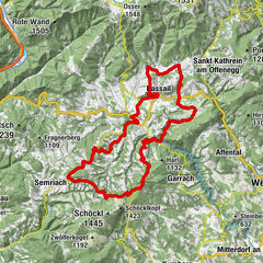
MauritzenFrohnleiten0.0 kmBrunnhof0.2 kmLandhaus Rois1.6 kmSchrems bei Frohnleiten3.3 kmGschwendt3.5 kmTyrnau8.7 kmSeepavillon17.0 kmRöthelstein17.9 kmLaufnitzdorf22.1 kmGasthaus Schweizerhof22.1 kmRothleiten24.0 kmLembacher24.2 kmKühau24.8 kmLorenz Born Tatkraftsquelle25.1 kmSchönau25.7 kmFrohnleiten26.1 kmMariä Himmelfahrt26.3 kmRabenstein29.4 kmKapellenhöhle34.4 kmBadl34.5 kmGasthof Grabmayer36.2 kmSchrauding36.5 kmUngersdorf38.0 kmMauritzen40.1 kmFrohnleiten40.4 km
- Best season
-
JanFebMarAprMayJunJulAugSepOctNovDec
- Description
-
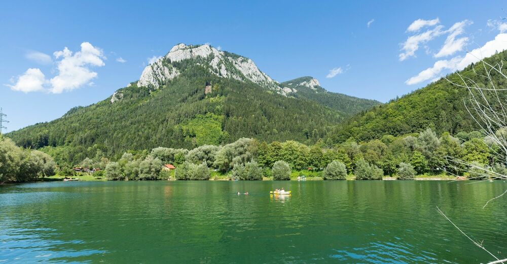
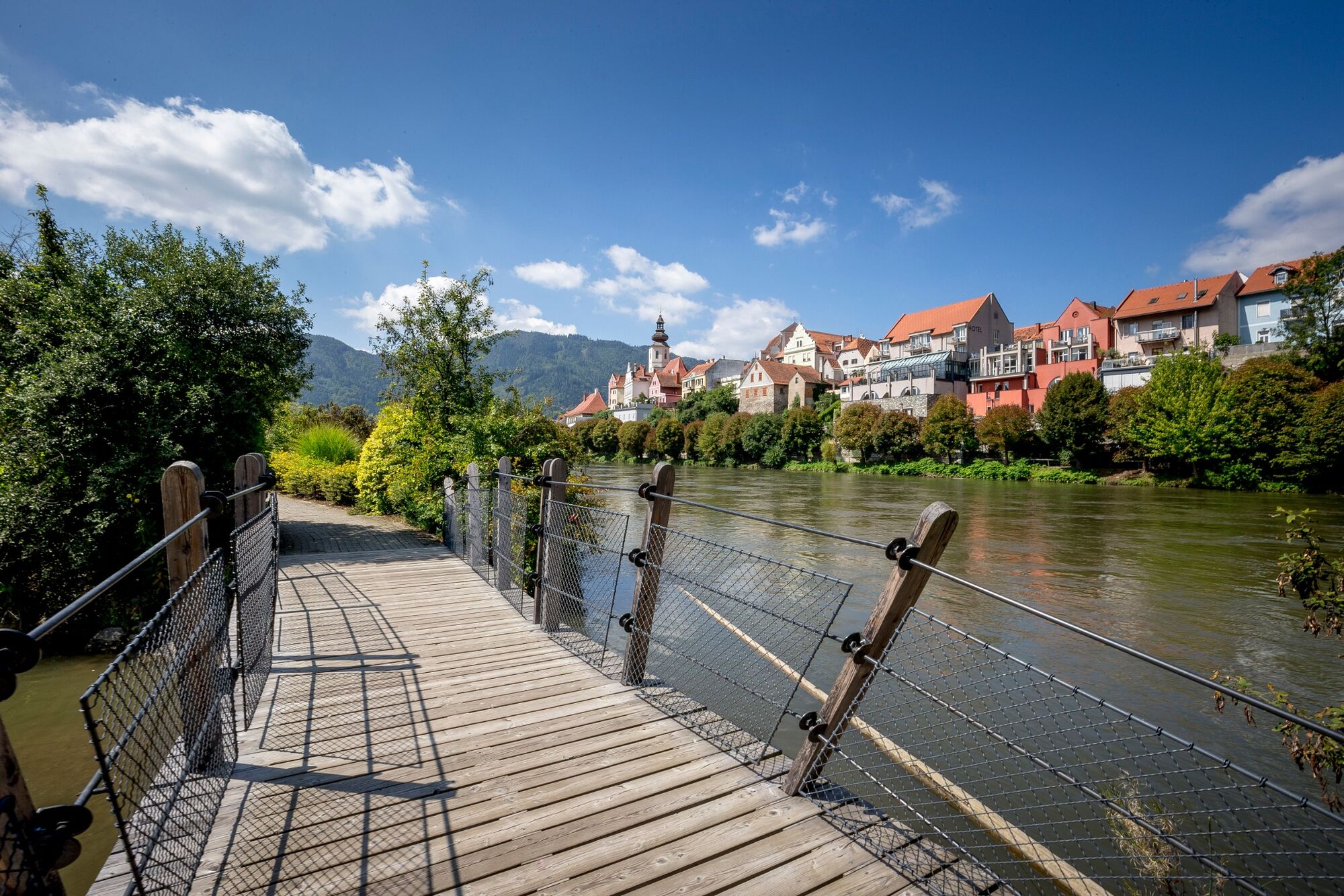
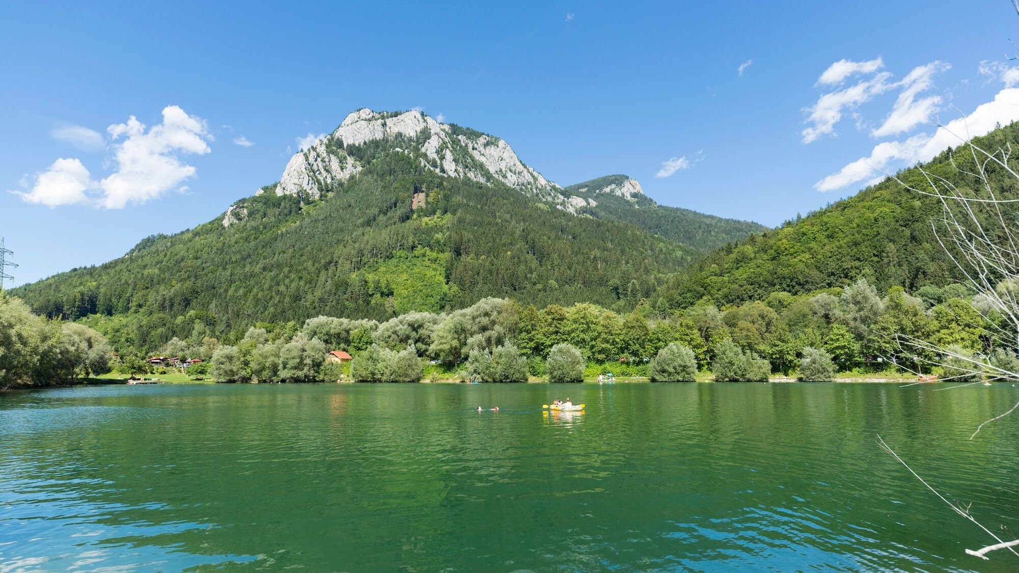
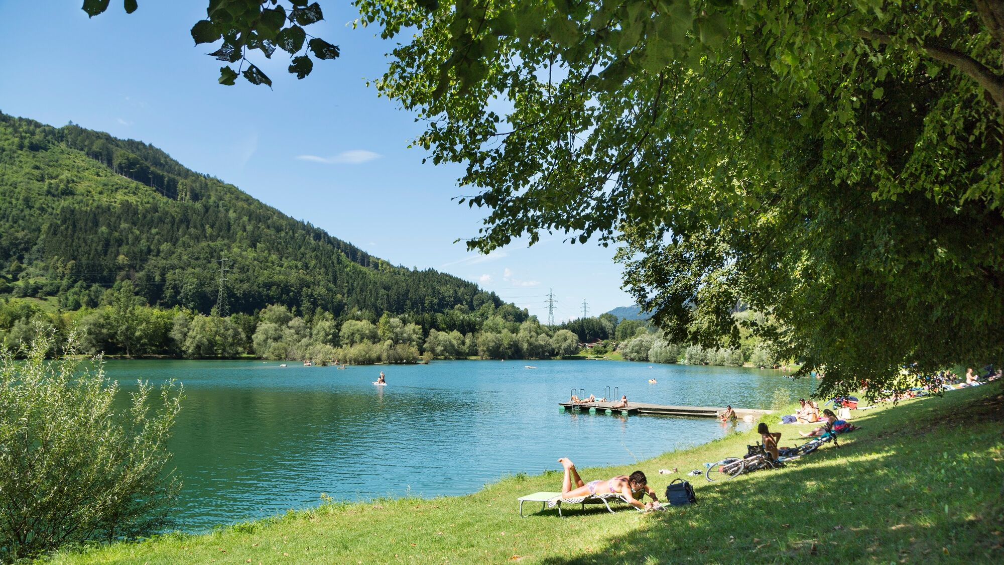
We start at the Volkshauspark in Frohnleiten, a park on the banks of the Mur that is really worth seeing, and from here we cycle along the beautifully laid out GU4 cycle path to Schrems. Then we head along the stream constantly slightly uphill to the small village of Tyrnau. After a bridge we follow the signposted dragon mountain bike tour on a beautiful forest path with some hairpin bends up to the Heuberg. The mountain stage is done, from now on it is downhill, following the dragon route. Impressive views of the Rote Wand and the Mur valley reward the effort. After a short stretch on the R2 Mur Cycling Path, we branch off to the Tieber See lake and arrive at the beautiful swimming pond via the new Mur cycle bridge and the village of Röthelstein. How about a dip in the water and a fine snack?
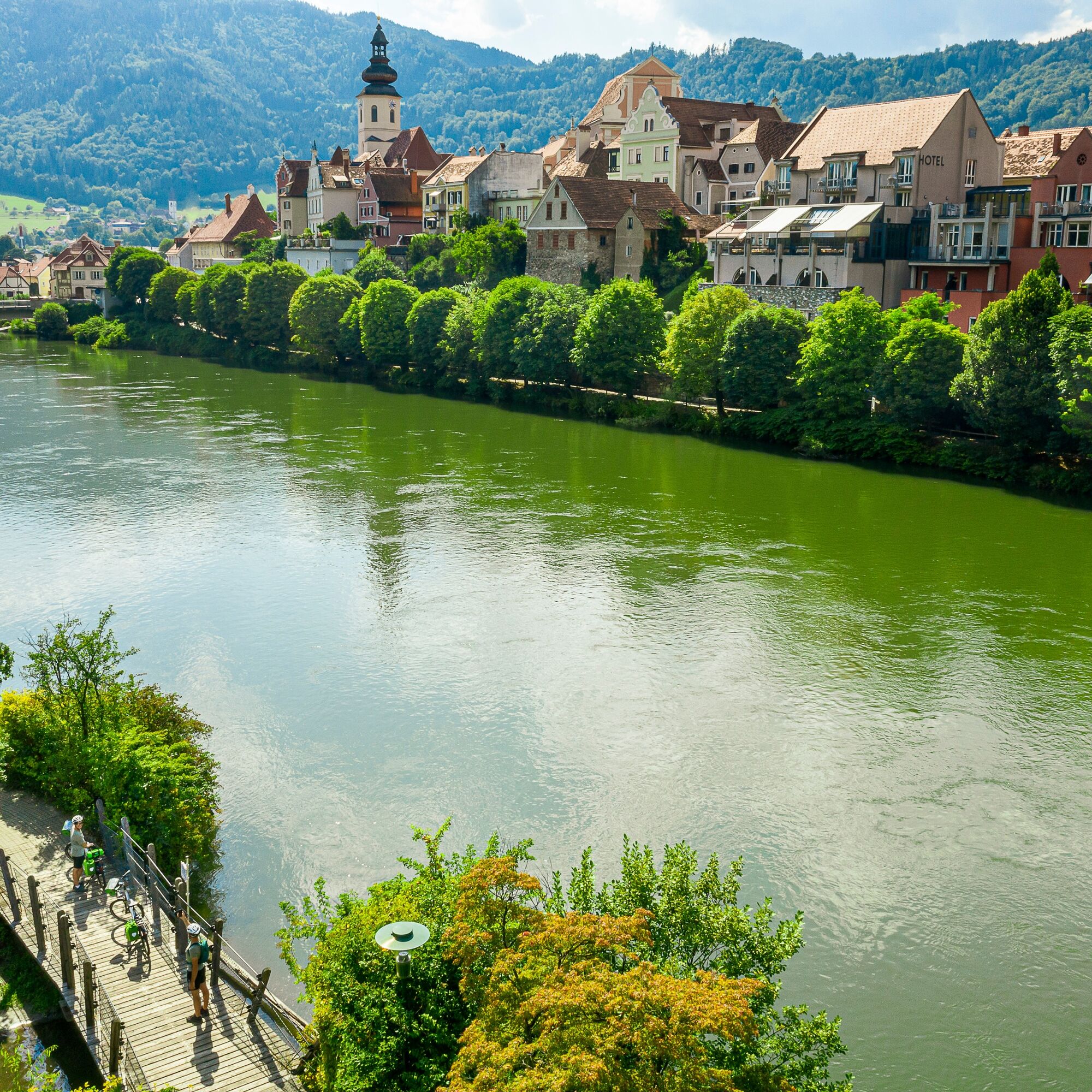
On the Mur Cycling Path version to the right of the Mur we reach our starting point Frohnleiten again via Laufnitzdorf and Rothleiten. A walk through the pretty town is definitely recommended – detailed information boards on numerous buildings bring its eventful history to life. If you are still fit and in the mood, a detour to Rabenstein Castle and the Murhof (one of the most beautiful Styrian golf clubs) is a good idea.
- Directions
-
Frohnleiten Volkshauspark - GU4 Schremser cycle path - Schrems - Tyrnau - (Drachen Tour) - Heuberg - Heuberggraben - R2 Mur cycle path - Mur cycle bridge - Röthelstein / Tieber lake - on the right / western bank of the Mur R2 variant (or R2 Mur cycle path left / east bank of the Mur ) - Rothleiten - Frohnleiten main square - Römerpark (or variant via Adriach) - Rabenstein Castle - Mur Bridge near Badl - on the left / east bank of the Mur / R2 variant - Schrauding - Frohnleiten Volkshauspark
Connection from Graz R2 Murradweg (26 km/66 m from Graz center)
Cycle paths, back roads, forest roads, gravel and nature trails
- Highest point
- 794 m
- Endpoint
-
Frohnleiten Volkshauspark
- Height profile
-

- Equipment
-
Roadworthy bicycles (e-bike, trekking or mountain bike) with prescribed equipment. Corresponding gear shift for uphill journeys (450 meters in altitude) and good brakes for downhill journeys. Partly gravel and nature trails with steep passages! Due to the altitude, we recommend e-trekking bikes or an appropriate level of fitness and endurance.
- Safety instructions
-
Bike helmet, drink, suitable sportswear, rain protection, sun protection and, depending on the season, warm sportswear are a prerequisite for every safe bike tour.
Partly gravel and nature trails with steep ascents and descents ! - Tips
-
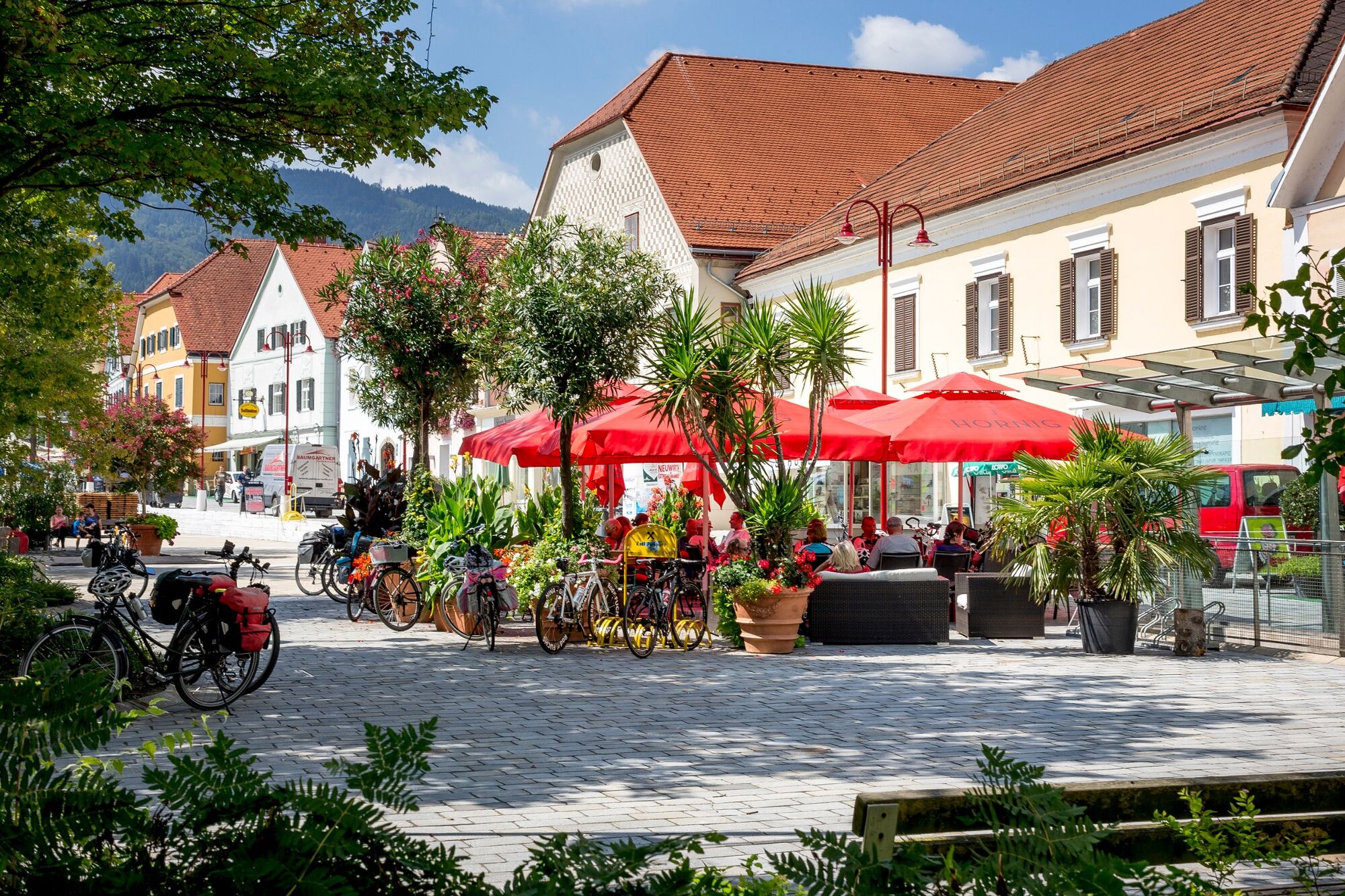
A culinary stop – perhaps at the main square in Frohnleiten – is a worthy conclusion to this beautiful tour.
- Additional information
- Directions
-
by car: motorway S35 exit Frohnleiten Süd
by bike: by S-Bahn or R2 Murradweg
- Public transportation
-
ÖBB S1 from Graz to Bruck an der Mur
- Parking
-
Volkshauspark or P&R at Frohnleiten station, free of charge


-

-
AuthorThe tour Uphill and Downhill Ride - Frohnleiten is used by outdooractive.com provided.


General info
-
Erlebnisregion Graz
261
-
OberGraz
88
-
Frohnleiten
18