
- Brief description
-
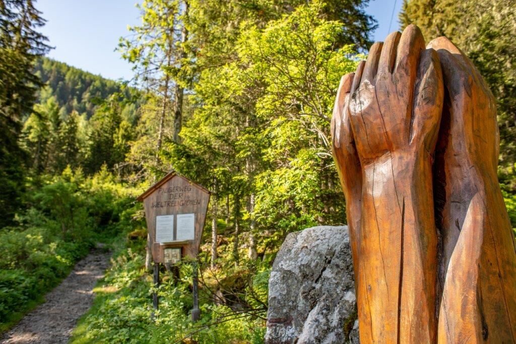
The theme trail of the world religions from the cable car valley station to the Globockensee is a family-friendly
family-friendly, varied, beautifully designed and culturally highly interesting hike!
At the start of the tour there is a flyer describing all the stations and you can find all further information at: http://www.pilgerweg-der-weltreligionen.at/
- Difficulty
-
medium
- Rating
-
- Starting point
-
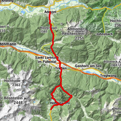
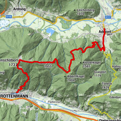
Parkplatz Rottenmanner Hütte
- Route
-
Rottenmanner Hütte1.6 km
- Best season
-
JanFebMarAprMayJunJulAugSepOctNovDec
- Description
-
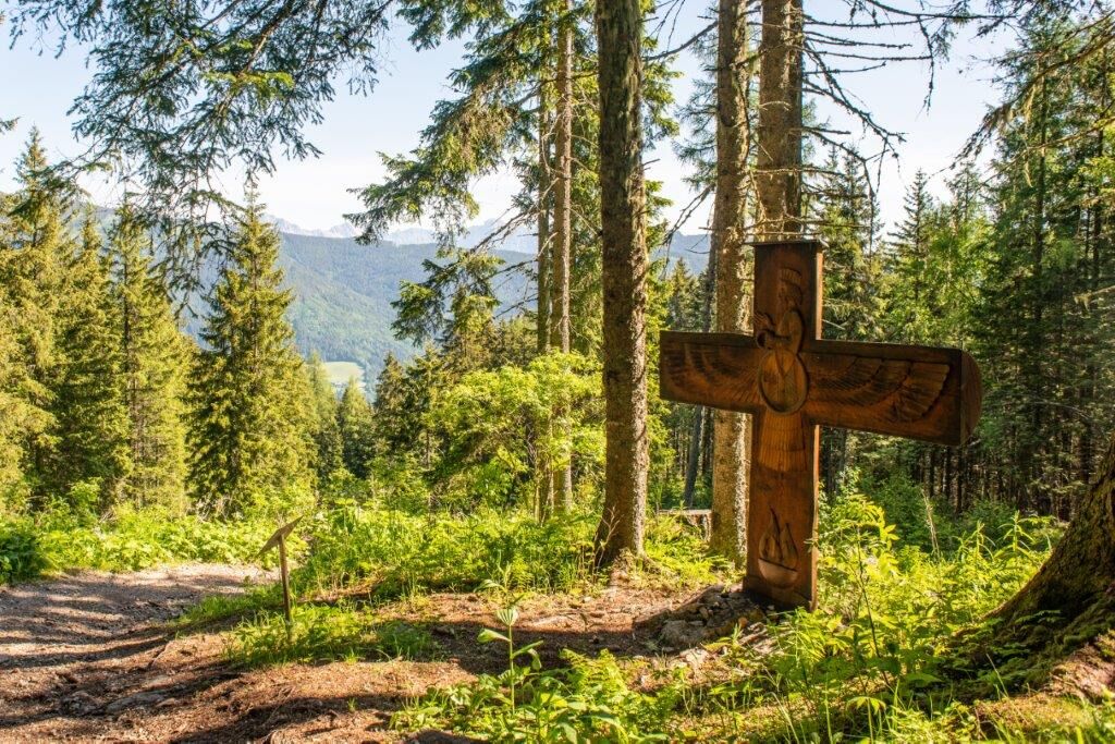
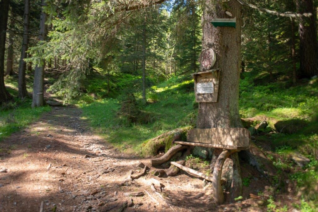
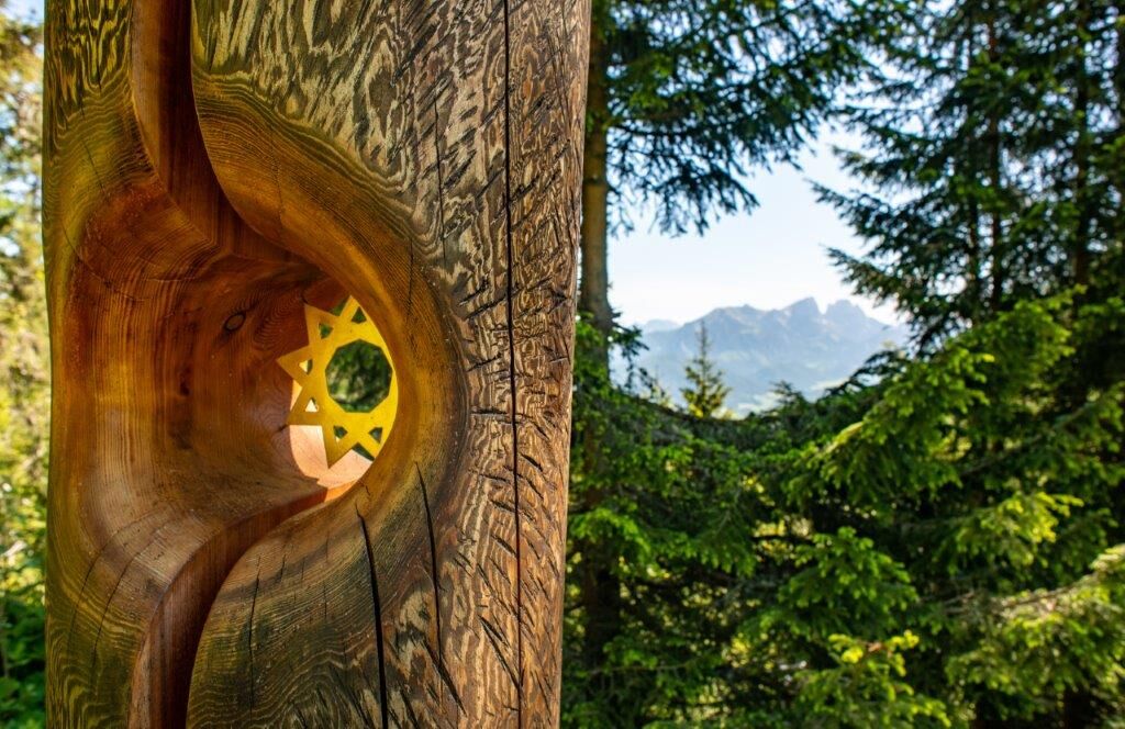
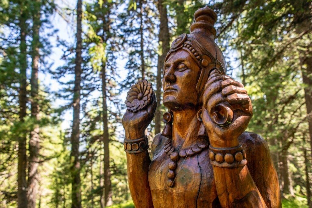
The focus is on the five major world religions, but the inclusion of smaller faith communities and nature religions was also considered important. Commonality and mutual tolerance are to be shown by the example of this pilgrimage path, differences are accepted.
Thus, ten artists and one artist from France, Poland, Armenia, Slovakia, Iraq, Israel and of course Austria participated to support this idea with their contribution. The exhibition sites were carefully selected in cooperation with the nature conservation authority so as not to interfere with the landscape.
An explanatory sign refers in each case to one of the basic ideas of this faith, in order to make visitors aware of the diversity of religious content. It is planned to install more sculptures.
- Directions
-
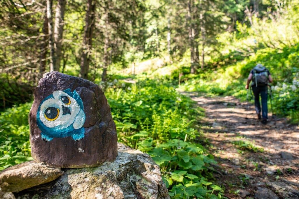
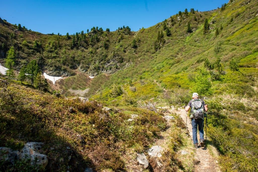
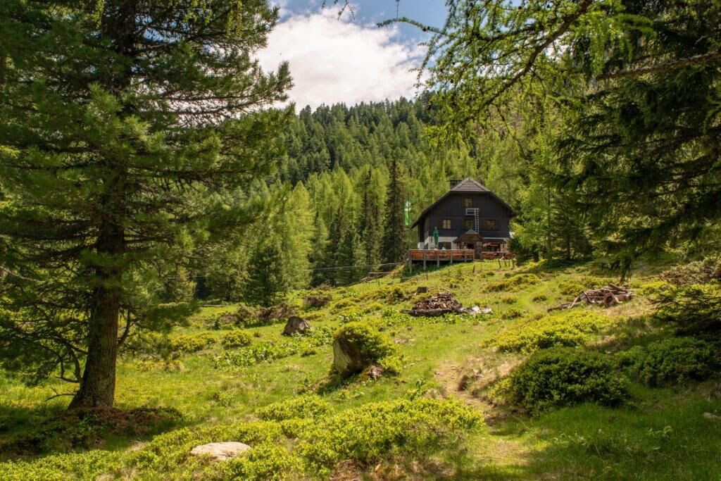
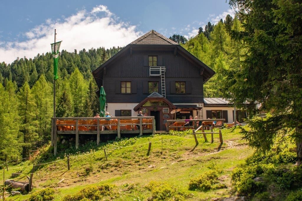
Right at the car park to the Rottenmannerhütte begins the Pilgrims' Way of the World's Religions, the somewhat steep footpath no. 944 .
The path leads to the Rottenmannerhütte and then continues towards the Glohbuckensee. The small lake invites you to take a rest.
On the way back, you can enjoy some excellent refreshments at the Rottenmannerhütte.
- Highest point
- 1,770 m
- Endpoint
-
Parkplatz Rottenmanner Hütte
- Height profile
-

- Equipment
-
Sturdy mountain boots or good trekking shoes, as well as a hiking rucksack with appropriate contents (water bottle, first aid, hiking map, sun protection, snack, etc.). You should also be well equipped for a change in the weather. Mobile phone for emergency calls.
As little as possible, as much as necessary
- Safety instructions
-
Emergency call mountain rescue: 140
Emergency reporting tip - give answers to the six W-questions: What happened? How many injured? Where did the accident happen (possibly GPS coordinates)? Who reported the accident (call-back number)? When did the accident happen? Weather at the accident site?
- Tips
-
A visit to the Rottenmannerhütte is an absolute must. Very friendly and fantastic food!
You should definitely climb one of the peaks around the hut!
Stein am Mandl, Seegupf, Hochheide
- Additional information
-
Tourismusverband Gesäuse
Hauptstraße 35, 8911 Admont, Österreich
Tel. +43 (0) 3613 21160 10
Email: info@gesaeuse.at
www.gesaeuse.at
http://www.pilgerweg-der-weltreligionen.at/
https://www.rottenmannerhuette.at/
- Directions
-
A9 Rottenmann exit
Follow the sign "Rottenmanner Hütte" to the edge of the forest and continue to the car park at the valley station of the material cable car.
Note: The last stretch is partly on a steep gravel road.
Now it is an almost 1h50-hour climb (480 metres in altitude) along the "Pilgrims' Path of World Religions" via the Rottenmanner Hütte to the Globuckensee.
- Public transportation
-
By train: stop Stadt Rottenmann
By bus: Rottenmann/Landeskrankenhaus bus stop (near the railway station).
From there you reach the valley station of the material cable car along hiking trail no. 944 in about 1h50.
Now it is an almost 1h50-hour climb (480 metres in altitude) along the "Pilgrims' Path of World Religions" via the Rottenmanner Hütte to the Globuckensee.
-

-
AuthorThe tour Pilgerweg der Weltreligionen - Rottenmann is used by outdooractive.com provided.


General info
-
Gesäuse
2222
-
Grimming - Donnersbachtal
976
-
Rottenmann
229