- Brief description
-
A beautiful Nordic-Walking tour passing meadows and forests on the Vorberg plateau.
- Difficulty
-
easy
- Rating
-
- Starting point
-
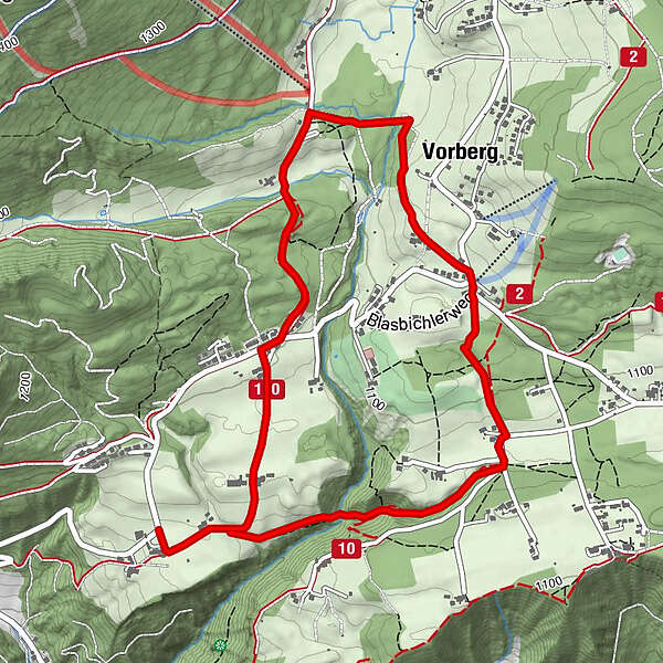
Hiking trail head Vorberg-Steirerhof
- Route
-
Jausenplatzl Astlhof0.6 kmVorberg2.7 km
- Best season
-
JanFebMarAprMayJunJulAugSepOctNovDec
- Description
-
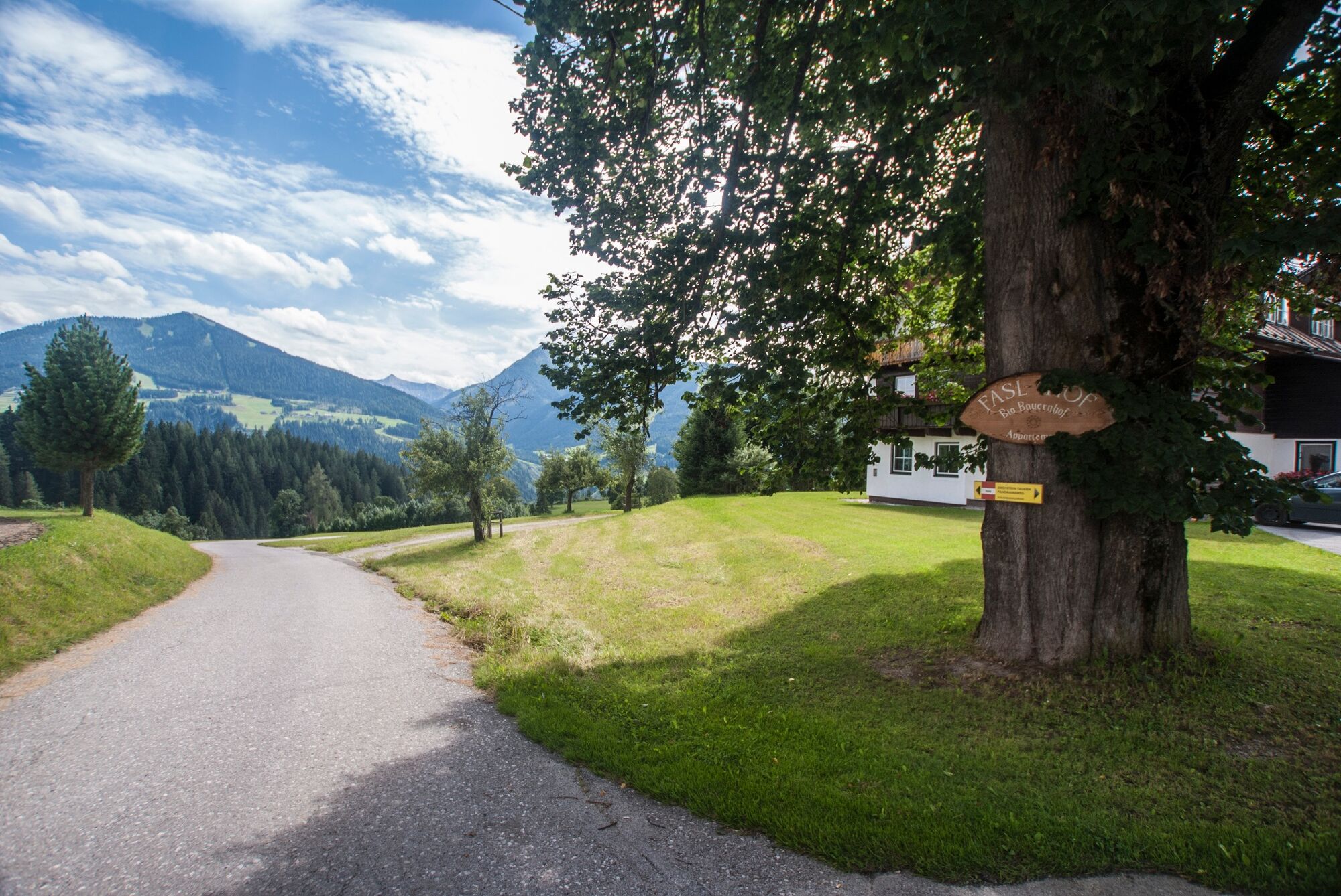
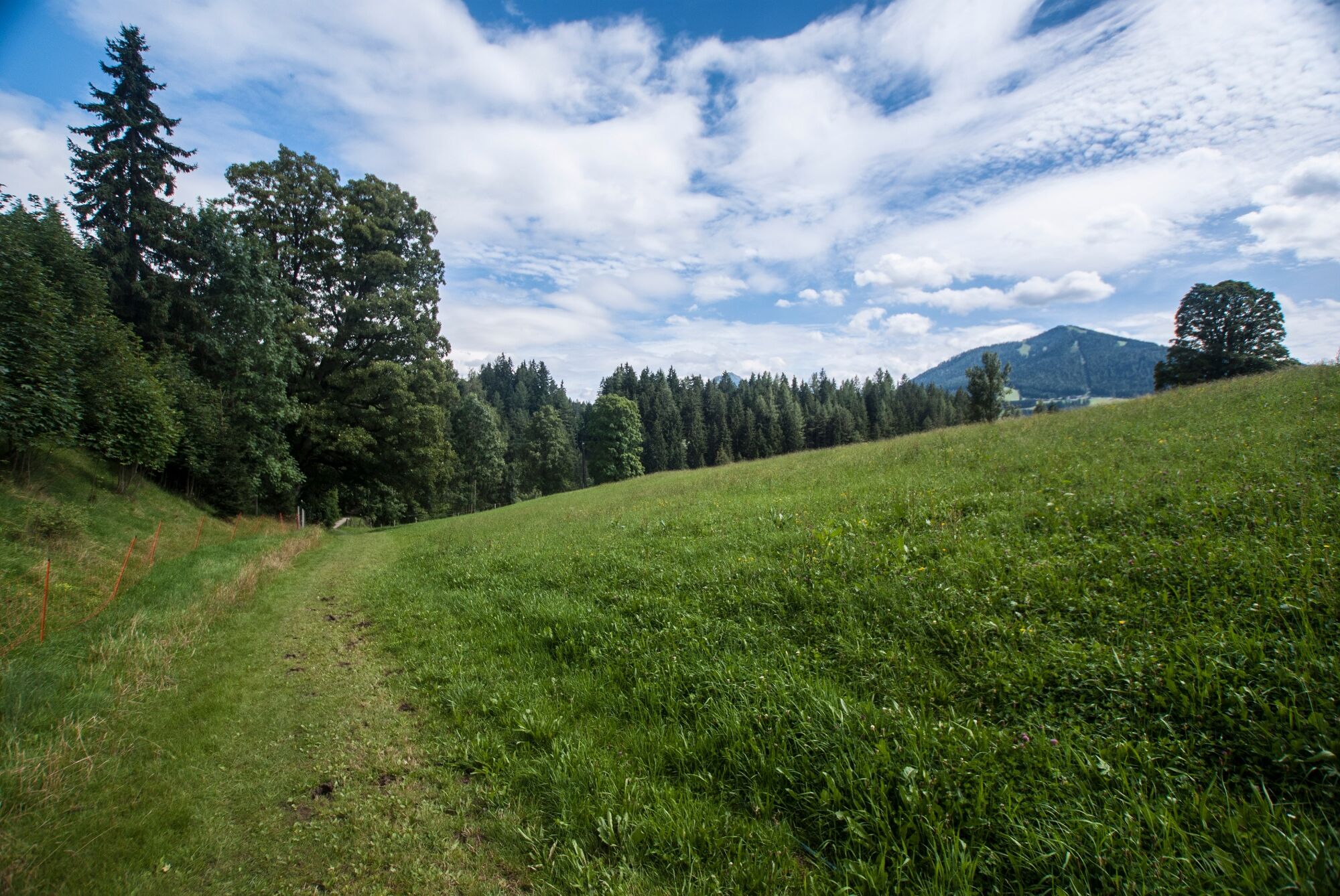
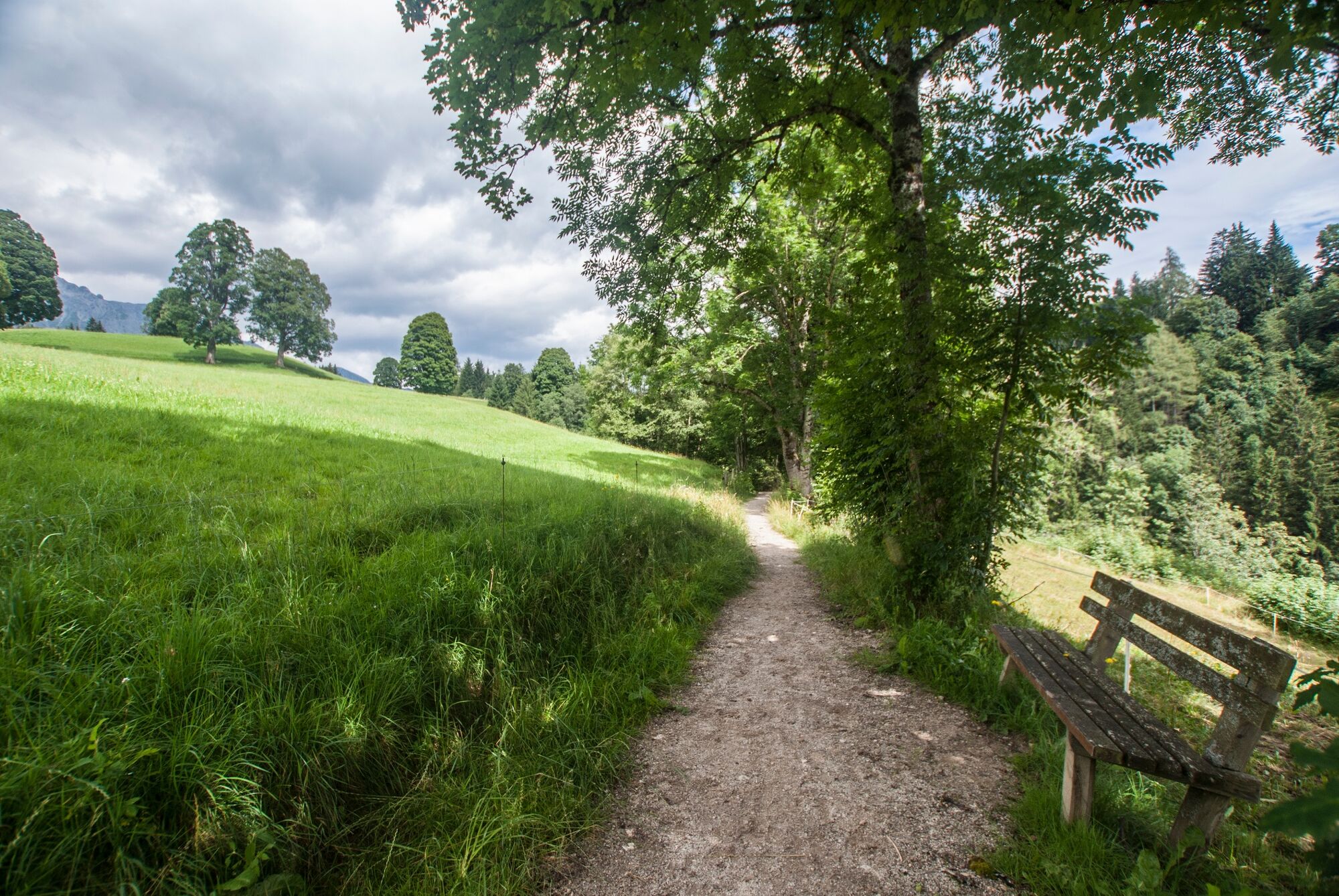
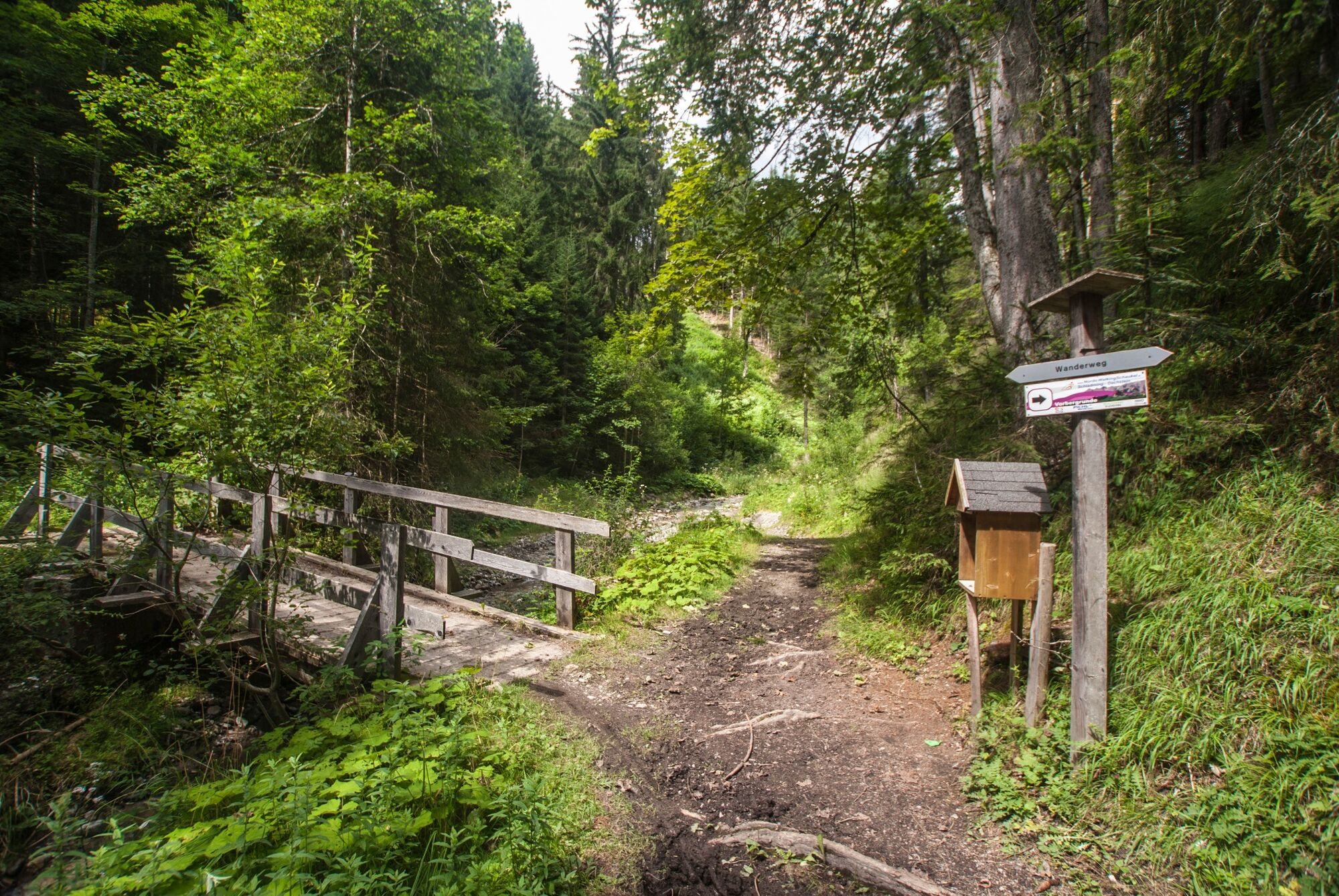
The path leads gently and wild romantically through the Wolfschlucht towards Ramsau-Vorberg, always with a view to the Dachstein and the Schladminger Tauern. At the high plateau we walk through meadows, forests and scattered settlements. The way back runs on an easy to moderate selected terrain and we have a wonderful view to the surrounding, impressive mountains. Via the farm way we come back again to the starting point.
- Directions
-
From the hiking trail head Vorberg-Steirerhof we start to the right and walk past Brandstätterhof farm along the panorama trail n° 100. This ones makes a left along the road towards North and passes the Fasl and Astl farms. Shortly after we reach the hiking trail head Vorberg-Arnika. Following trail n° 100 past pension Arnika we reach Greimelbacherhof farm. About 300 m after the farm we make a right and cross the river to Ramsau-Vorberg. After the crossing we make a right again and walk towards South, and later South-East. At the Vorberg intersection (Ramsau-Vorberg/Pichl-Vorberg) we walk on straight, crossing over a meadow and then through a short forest passage. After that we walk along the road for a short distance before we follow the edge of the forest to the right. We pass through Wolfsschlucht gorge and return to Brandstätterhof and the hiking trail head where we started.
- Highest point
- 1,141 m
- Endpoint
-
Hiking trail head Vorberg-Steirerhof
- Height profile
-

- Equipment
-
Good walking shoes and custom-fit Nordic Walking poles are the standard equipment. We also recommend a belt for carrying a drinking bottle.
- Safety instructions
-
Changes in weather patterns, quick falls in temperature, thunderstorms, wind, fog and snow are some of the dangers that can be encountered on a hiking tour. Hosts of alpine huts and mountain refuges have a lot of experience in the mountains and can give good advice about weather and the trails. Poor equipment, overestimation of one's own capabilities, carelessness, poor personal constitution and/or wrong judgement can lead to critical situations. In case of thunderstorms: avoid summits, ridges and steel ropes.
GPS data and orienteering
Available GPS data - just like hiking maps - is only a guidance for orientation and can never depict a trail exactly with all its details. Especially at dangerous spots it is essential to judge on site how to proceed.
In an emergency please call:
140 - for Alpine emergencies (all over Austria) 112 - European GSM emergency number - Tips
-
From the hiking trail head Vorberg-Steierhof you also have the access to Aberg Walking Tour, followed by the Village Walking Tour and the Mandling Walking Tour.
- Additional information
- Directions
-
Leave the highway B320 Ennstalbundesstraße in Pichl an der Enns and continue to "Vorberg" via the Vorbergstraße road until you reach hotel Steirerhof. The hiking trail head is situated straight ahead at the intersection.
- Public transportation
- Parking
-
The closest car parking is available at the trail head at pension Arnika.


-

-
AuthorThe tour Vorberg Walking Tour is used by outdooractive.com provided.