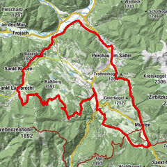

- Brief description
-
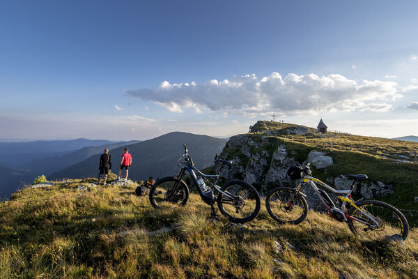
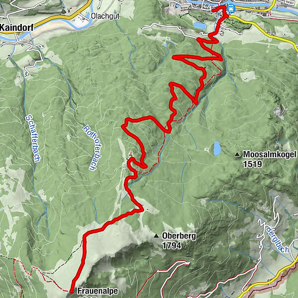
Challenging route that requires a lot of endurance and fitness. However, all efforts are rewarded with the view of the Frauenalpe.
- Difficulty
-
difficult
- Rating
-
- Starting point
-
Information pavilion in the Murau city park
- Route
-
Stadtpark0.0 kmMurau (829 m)0.2 kmSchlatting0.7 kmMurauer Hütte8.4 kmBernhard-Fest-Hütte (1,980 m)11.4 kmFrauenalpe (1,997 m)11.6 km
- Best season
-
JanFebMarAprMayJunJulAugSepOctNovDec
- Description
-
This wonderful mountain bike tour with distant views of the Niedere Tauern, Gurktal Alps and Karawanken begins in the district capital Murau and leads to the 1,997m high Murau local mountain, the Frauenalpe.
Due to the difficulty, this tour is only recommended for advanced mountain bikers.
- Directions
-
From the information pavilion in the Murau city park further across the Schlatting, follow the signs on the asphalted Frauenalpestraße uphill for about 9 kilometers to the large parking lot at the Murauerhütte. This is the start of the actual mountain bike route. From the Murauerhütte (1,583m) you cycle along the marked and signposted path past the cheese dairy hut (not managed) to the Bernhard Fest Hut (not managed) until you reach the summit cross. At the summit you can enjoy the fantastic all-round view.
The way back takes place on the route already known from the way there.
- Highest point
- 1,993 m
- Endpoint
-
Frauenalpe
- Height profile
-

- Equipment
-
Helmet Suitable footwear Sportswear Drinking bottle etc.
Even on a short tour, you should have the following basic equipment with you: repair kit, air pump, spare hose, a rag, suitable tools for gears, axles, saddle, stem and handlebar bolts.
- Tips
-
Take a break at the Apollonia Chapel just below the summit and enjoy the wonderful view
The panoramic board at the summit with a limitless all-round view describes the surrounding mountains
On the way back from the summit you can stop at the Murauer Hütte - Additional information
-
The ideal time for this tour is from April to October.
- Directions
-
Coming from Judenburg via Unzmarkt to Scheifling. Keep right here towards Murau. Keep left at the double roundabout in Murau.
Coming from Tamsweg via Ranten (or Stadl an der Mur) keep right at the double roundabout in Murau.
- Public transportation
-
With the BusBahmBim app from the composite line, timetable information is easier than ever before: all bus, train and tram connections in Austria can be queried by entering locations and/or addresses, stops or important points. The app is available as a free app for smartphones (Android, iOS) - on Google Play and in the App Store.
- Parking
-
Public parking spaces in the city of Murau, as well as near the Murau city park (note the parking duration of the individual spaces).


- Author
-
The tour Murau - Frauenalpe is used by outdooractive.com provided.