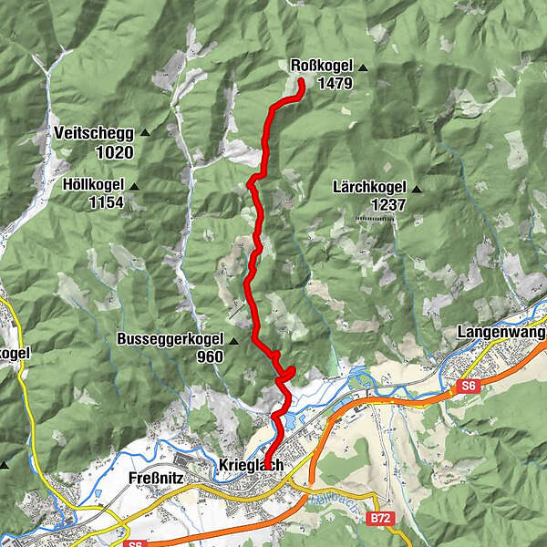
Tour data
9.31km
608
- 1,262m
653hm
01:00h
- Brief description
-
Auf- und Abfahrt auf der selben Strecke.
- Difficulty
-
easy
- Rating
-
- Starting point
-
Krieglach Ort
- Route
-
KrieglachMalleistenalm9.2 km
- Best season
-
JanFebMarAprMayJunJulAugSepOctNovDec
- Highest point
- 1,262 m
- Endpoint
-
Malleisten Alm
- Rest/Retreat
-
Malleistenalm Hütte
- Ticket material
-
Ortsplan/Wanderkarte Krieglach
- Info phone
-
+43(0)3855 2404
- Link
- www.waldheimat-steirischersemmering.at
- Source
- Maria Steindl
GPS Downloads


Surfaces
Asphalt
Gravel
Forest
Mountain paths
Single trails
Trial
Traffic
Other tours in the regions