
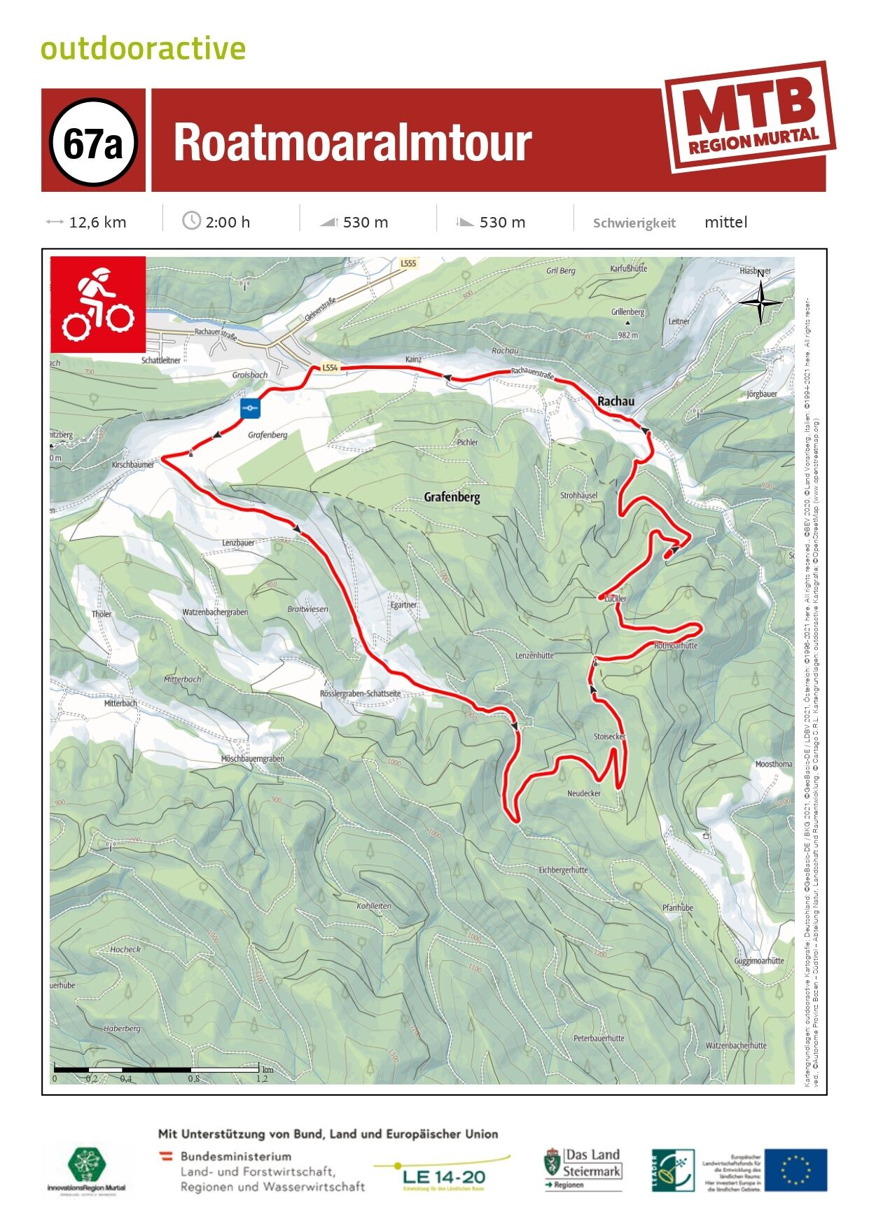
- Brief description
- Difficulty
-
medium
- Rating
-
- Starting point
-
Gobernitz in the municipality of St. Margarethen bei Knittelfeld
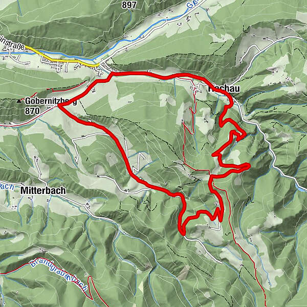
- Route
-
Fuchs und Henne0.0 kmRachau10.0 kmRachauer Hof10.1 kmPfarrkirche hl. Oswald10.2 kmFuchs und Henne12.5 km
- Best season
-
JanFebMarAprMayJunJulAugSepOctNovDec
- Description
-
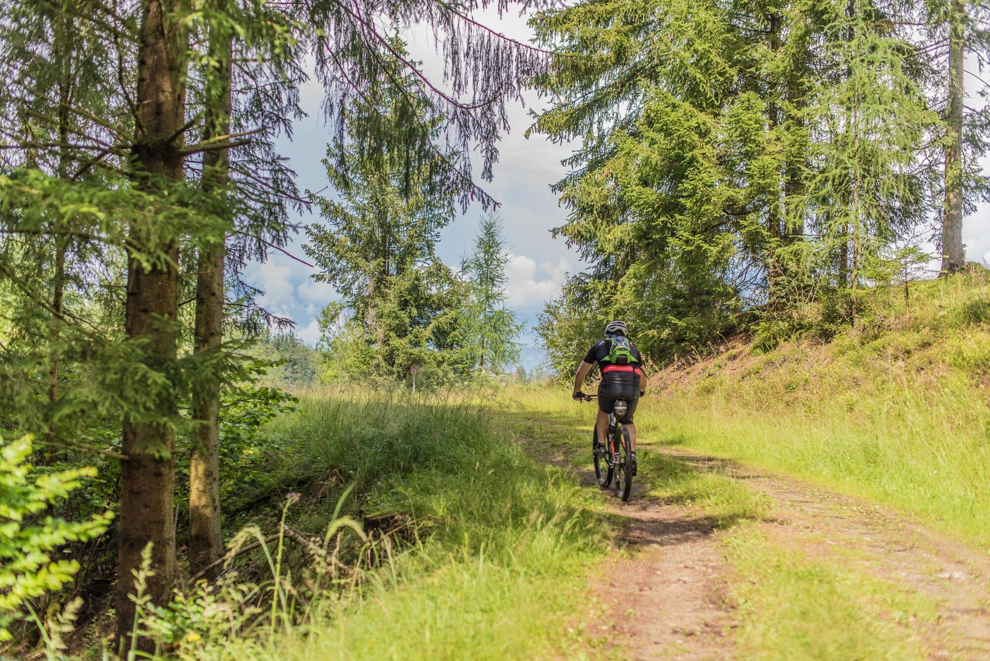
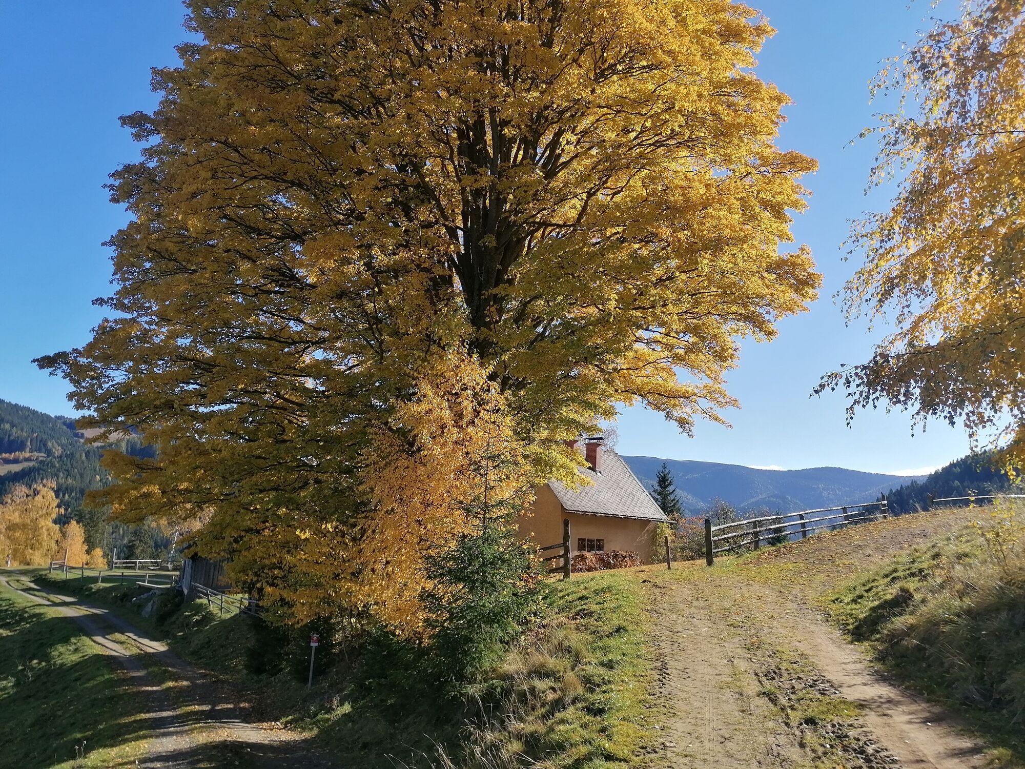
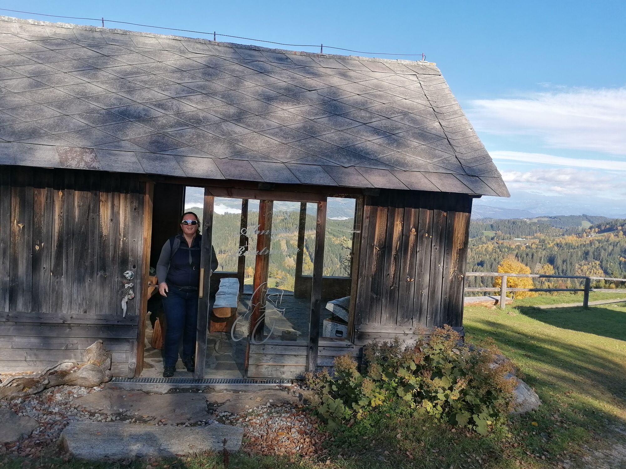
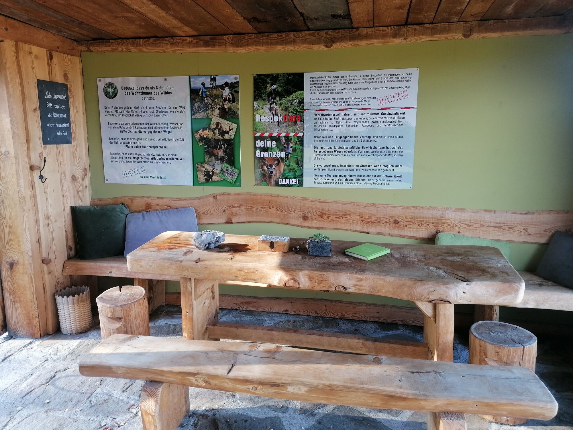
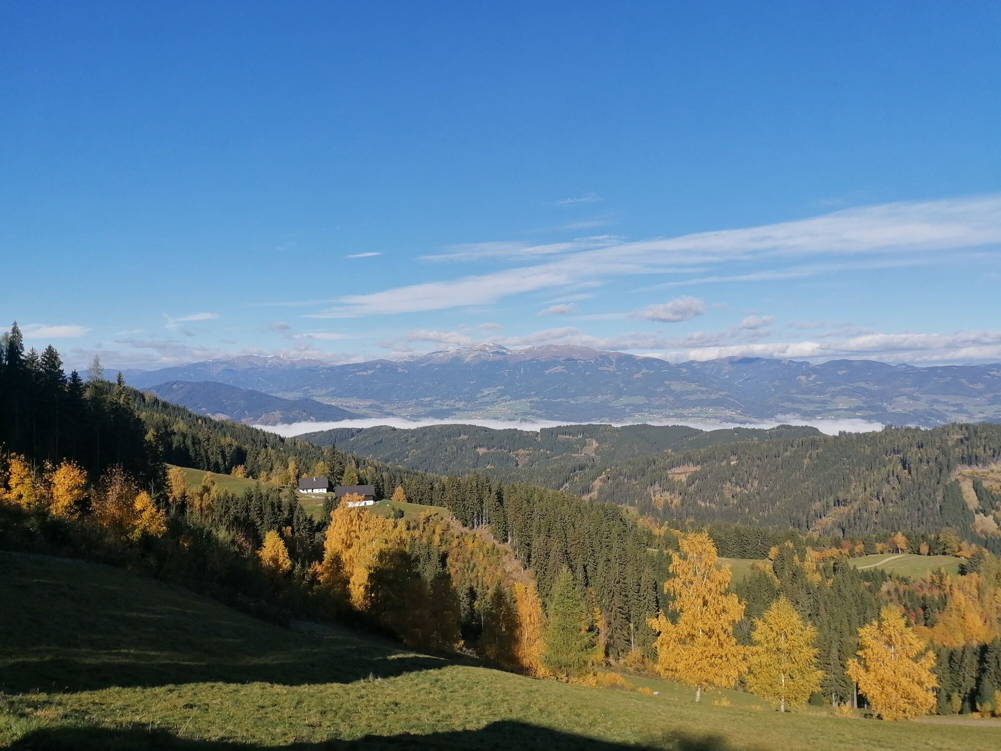
This Roatmoaralmtour starts at cycle junction 67 on the right in the direction of Gobernitz, continuing 600m on the tarmac road to the Kirschbauer crossroads and turning left towards Rösslergraben. The path branches off to the left and leads up a steeper forest road past the Lenzenkreuz up to the Roatmoaralm. There you can expect a really great view, mainly of the Eisenerz and Seckau Alps and the Mur Valley in Styria. You can take a break at the great self-service hut and enjoy the drinks that are available there for a fee. You can eat the snacks you have brought with you on the cosy bench with a great view through the window and sign the hut book. Now it's downhill on a rough gravel road over the bridge to the village of Rachau (tarmac) where you can stop for refreshments at the Italian restaurant Sempre in the Rachauer Stadl. Strengthened, the tour continues slightly downhill towards St. Margarethen and after 1.5 km the route turns left again with a final ascent to the car park.
- Directions
-
Starting point: Rachau
after 600m (Kirschbaumer crossing) turn left towards Rösslergraben
Rösslergraben straight ahead (tarmac) then gravel
Turn left in the direction of Roatmoaralmwe cycle along the gravel road until the turn-off to the left towards Roatmoaralm
here you have a particularly beautiful view of the Mur valley
we now pass the Lenzenkreuz and it doesn't take long to get back to the "Roatmoaralm" (drinks in the biker hut)After a well-earned break, we head downhill towards Rachau (gravel)
Before the village of Rachau, turn left over the bridgeTip: There is a refreshment stop here (Sempre Stadlcafe)
Continue in the direction of St. Margarethen After 1.5 km you will find the last ascent on the left towards Wipfelwander (asphalt) to the car park
At the starting and finishing point you will find the Fuchs & Henne restaurant - Highest point
- 1,105 m
- Endpoint
-
Gobernitz in the municipality of St. Margarethen bei Knittelfeld
- Height profile
-

- Equipment
-
This tour is passable with mountain bike or also trekking bike.
- Safety instructions
-
Walkers and hikers always have priority. A friendly and considerate approach to pedestrians is a prerequisite. In case of encounters, it is important to make yourself known with the bell and pass slowly. Walking paths and hiking trails may not be used by mountain bikes.
Our nature and landscape is as good as untouched and beautiful. To keep it that way, we ask vacationers to avoid litter and unnecessary noise. In order not to disturb the animals, the mountain bike routes should only be used during the day:
from June 1 to September 15 from 9.00 a.m. to 7.00 p.m.
from 16 September to 31 October from 9.00 a.m. to 5.00 p.m.
Ride only on cleared, marked trails and never off the beaten path. On the forest paths the road traffic regulations must be observed!
Just like driving a car, you should always ride on sight when mountain biking. On frosty roads, expect to see wood on the roadway and motor vehicles.
If you encounter grazing livestock on the trail, reduce your speed to walking pace to avoid any false reactions from the animals. Please always close grazing gates!
Proper self-assessment is necessary in any sport! Do not overstrain yourself in technique and condition. This also avoids accidents.
- Tips
-
Enjoy the view at the Roatmoaralm with a snack and a stop.
- Additional information
- Directions
-
Directions by car:
Exit motorway Knittelfeld Ost, direction St. Margarethen
Please always continue in the direction of Rachau or St. Margarethen bei Knittelfeld and then turn right onto Gleinstraße in St. Margarethen. We recommend that you always stay in the direction of Rachau bei Knittelfeld, as the access road to the Rachau treetop hiking trail (closed since 2022) is located near the Rachau town entrance/exit.
When entering "Mitterbach 25", most navigation systems will guide you to the car park via a somewhat longer and complicated route. We therefore recommend entering the address "Rachau 97" (= Rachau municipal office), as this will take you directly to Rachau and you will then be able to follow our signposts to Gleinstraße and the turn-off from there to the Rachau treetop hiking trail.
Travelling by bike:
Signposting to cycle junction 67 from Gobernitz and from St. Margarethen
- Public transportation
-
Take the train to Knittelfeld station. From there it is around 3 km to the starting point of the tour.
- Parking
-
There are also charging facilities for e-bike riders.
-

-
AuthorThe tour Tour 67a - MTB - Roatmoaralmtour is used by outdooractive.com provided.