- Brief description
-
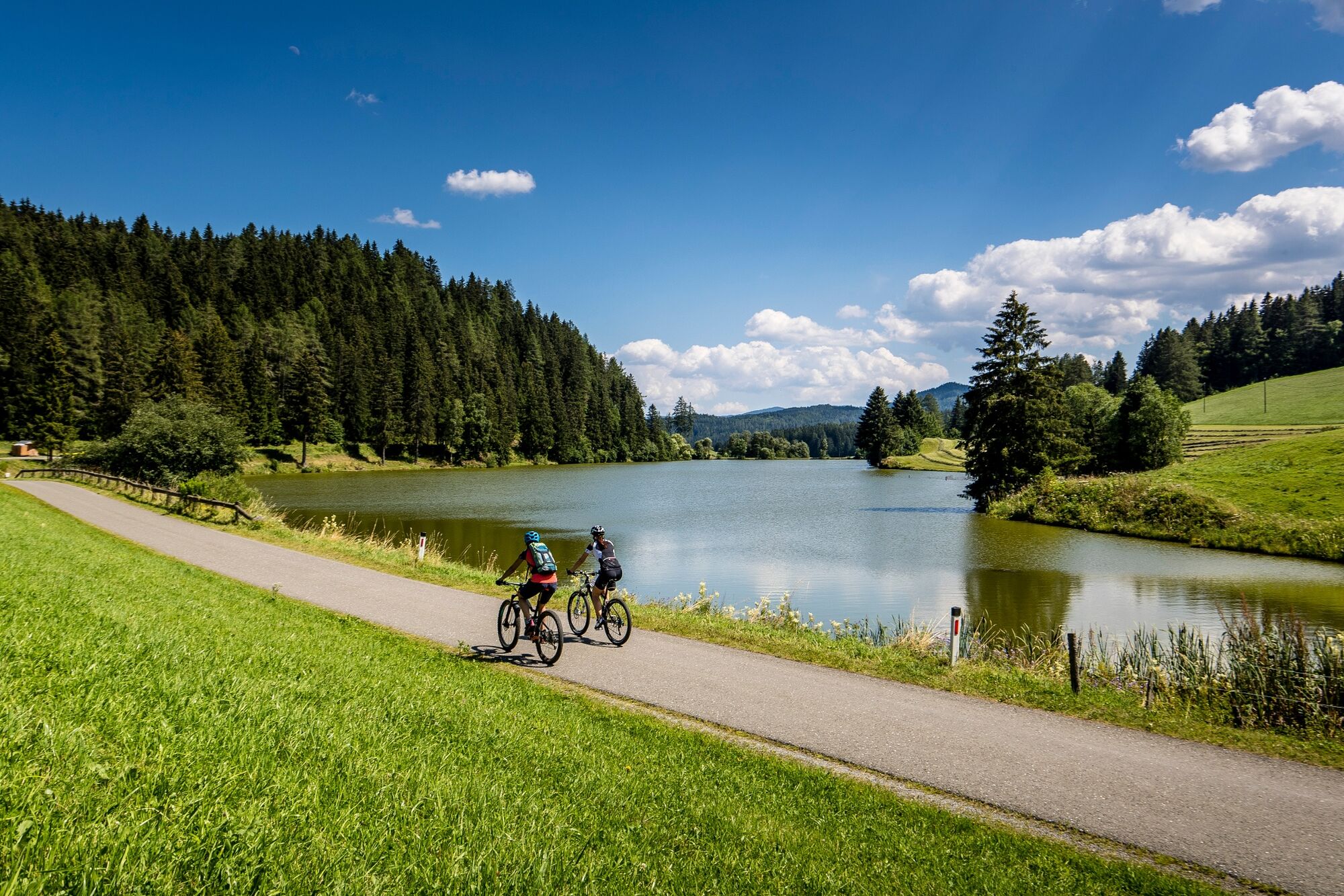
This is a beautiful mountain bike tour with many impressions of nature!
- Difficulty
-
medium
- Rating
-
- Starting point
-
Abbey Gate St. Lambrecht
- Route
-
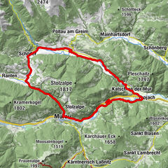
StifterlSankt LambrechtMarktcafé0.0 kmTorwirt0.0 kmHeiligenstadt1.8 kmStraussenhof Wallner2.5 kmVorderbach2.9 kmSankt Blasen3.0 kmThajagraben4.1 kmForst7.1 kmRußdorf8.6 kmMariahof - Ortsteil Bahnhof9.3 kmSchachen10.1 kmVockenberg11.6 kmGasthof Jera12.5 kmBaierdorf13.7 kmSankt Marein bei Neumarkt16.2 kmPöllau21.9 kmZeutschach26.9 kmPfarrkirche St. Ägidius27.0 kmFischerwirt27.9 kmGraslupp28.2 kmThajagraben34.9 kmSeppwirt36.6 kmSankt Lambrecht38.0 kmTorwirt38.3 kmMarktcafé38.3 kmStifterl38.3 km
- Best season
-
JanFebMarAprMayJunJulAugSepOctNovDec
- Description
-
The leisurely tour will reveal scenic, picturesque panoramas as well as some swimming opportunities. Thus, a fabulous Bike & Swim day is offered. Afterwards, the monastery of St. Lambrecht can be visited in St. Lambrecht. Sport and culture in one.
- Directions
-
After the start at the monastery, the route runs via Heiligenstadt to the Thajagraben to St. Blasen. From there is goes over forest roads and asphalt up towards Podoler. From there it rolls gently downhill towards Mariahof golf course. From here, after a short climb, the first cooling off already awaits us at the Furtnerteich. The rest of the route continues uphill via Mühldorf to Pöllau. Along the route there are further opportunities to stop for refreshments, before the route continues slightly downhill via Zeutschach to the Graslupp bathing pond. From here you cycle along the edge of the Kalkberg via the Muhrenteich and slightly uphill via the Podolerteich back to the Thajagraben. The developed cycle path leads from here always slightly uphill until back to the starting point.
TIP: In front of Neumarkt station, a shortcur can be taken directly up to the Graslupppond.
- Highest point
- 1,179 m
- Endpoint
-
Abbey Gate St. Lambrecht
- Height profile
-

- Equipment
-
Helmet
Suitable footwear
Sportswear
Drinking bottle etc. - Additional information
-
The ideal time for this round offer the months of May to October.
- Directions
-
Coming from Judenburg via Unzmarkt to Scheifling. Turn right here and drive to Teufenbach. In Teufenbach turn left towards Mariahof and then right to St. Lambrecht.
Coming from Tamsweg drive via Ranten (or Stadl an der Mur) to Murau. Turn right here and drive via Laßnitz to St. Lambrecht.
- Public transportation
-
With the BusBahnBim app of the Verbundlinie, timetable information has never been easier: all bus, train and streetcar connections in Austria can be queried by enteriing locations and/or addresses, stops or important points. The app is available as a free app for smartphones (Android, iOS) - on Goolge Play and in the App Store.
- Parking
-
Public parking is available at the St. Lambrecht Abbey, the market area or the market pond.
- Author
-
The tour Pond round is used by outdooractive.com provided.