- Brief description
-
Difficult bike tour - forest road 6 km to 16% slope - asphalt 14 km
- Difficulty
-
medium
- Rating
-
- Starting point
-
Information office Murau
- Route
-
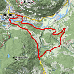
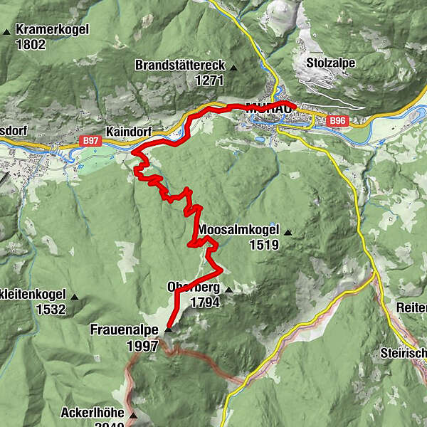
Schloßberg0.6 kmMurau (829 m)0.7 kmWalldorf4.3 kmKaindorf4.5 kmKaindorf-Süd5.4 kmMurauer Hütte11.0 kmBernhard-Fest-Hütte (1,980 m)13.8 kmFrauenalpe (1,997 m)13.9 km
- Best season
-
JanFebMarAprMayJunJulAugSepOctNovDec
- Description
-
Bike: Information office Murau - west to the double traffic circle direction Tamsweg - to the Red Cross - cross the main road - Murradweg R 2 to Kaindorf stop - railroad crossing left off - Pension Purgstaller left off - start forest road - now always along the Beschildernug to the asphalt road direction Murauerhütte.
Hike: Murauerhütte - Käsereihütte - Bernahrd Fest Hütte - Frauenalpe 1997 m.
Descent as ascent.Bike: Descent on the asphalt road to Murau.
- Highest point
- 1,583 m
- Alternatives
-
Route length : Bike 20 km ascent and descent/Hike 7 km ascent and descent
Height difference :Bike 820 m/ Hike 414 m
Time required : Bike 3 hrs. ascent and descent /Hike 1 1/4 hrs. ascent - 1 hr. descent - Rest/Retreat
-
Murauer Hütte
- Ticket material