
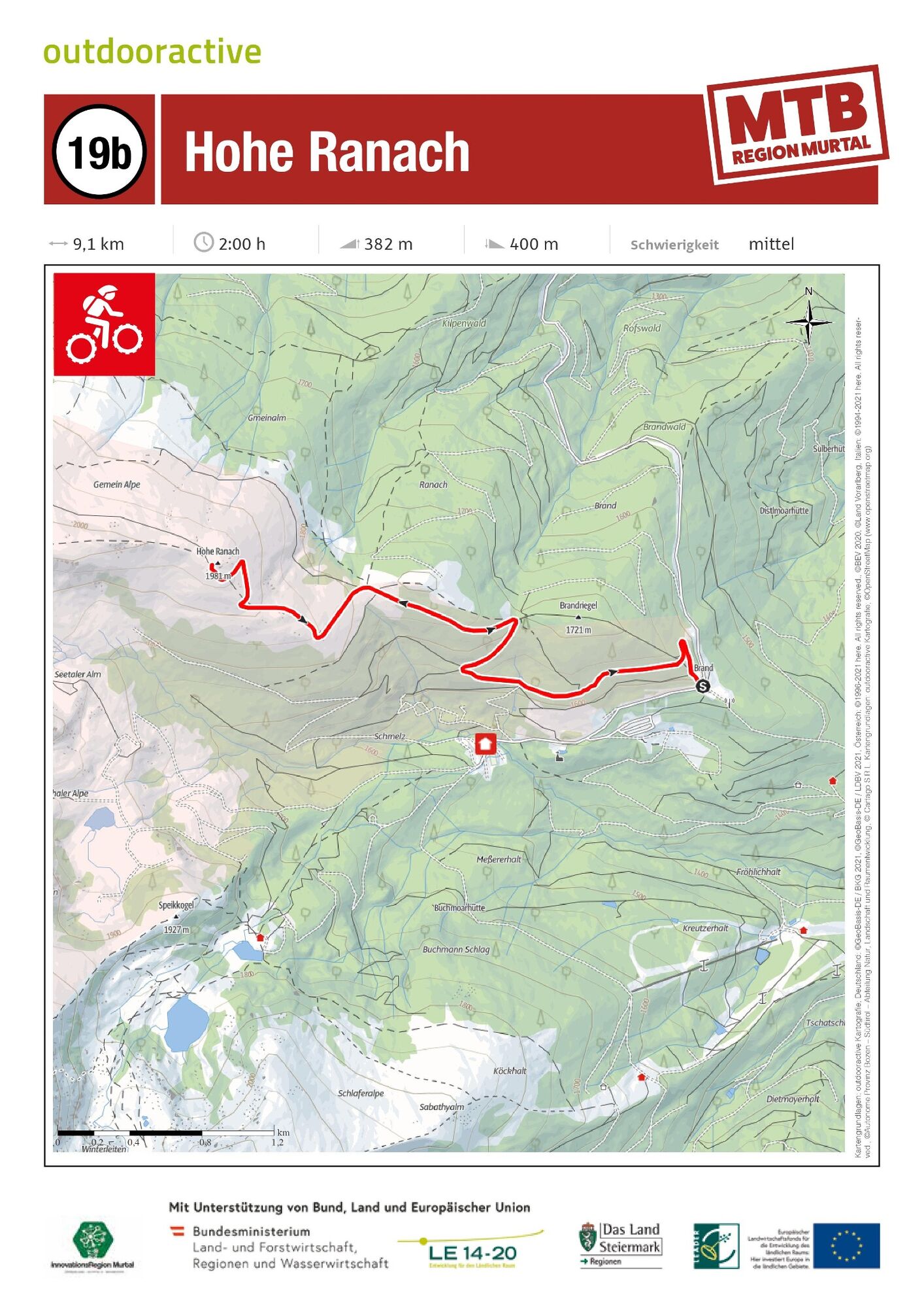
- Brief description
- Difficulty
-
medium
- Rating
-
- Starting point
-
Car park Brand Schmelz Seetaler Alpe
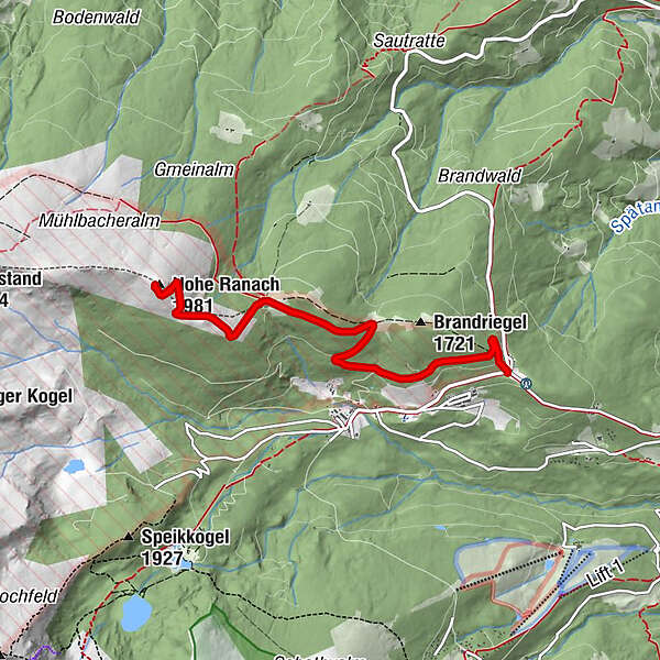
- Route
-
Hohe Ranach (1,981 m)4.6 km
- Best season
-
JanFebMarAprMayJunJulAugSepOctNovDec
- Description
-
The tour to the Hohe Ranach is a medium distance tour with refreshment stops and views on the way to the top.
- Directions
-
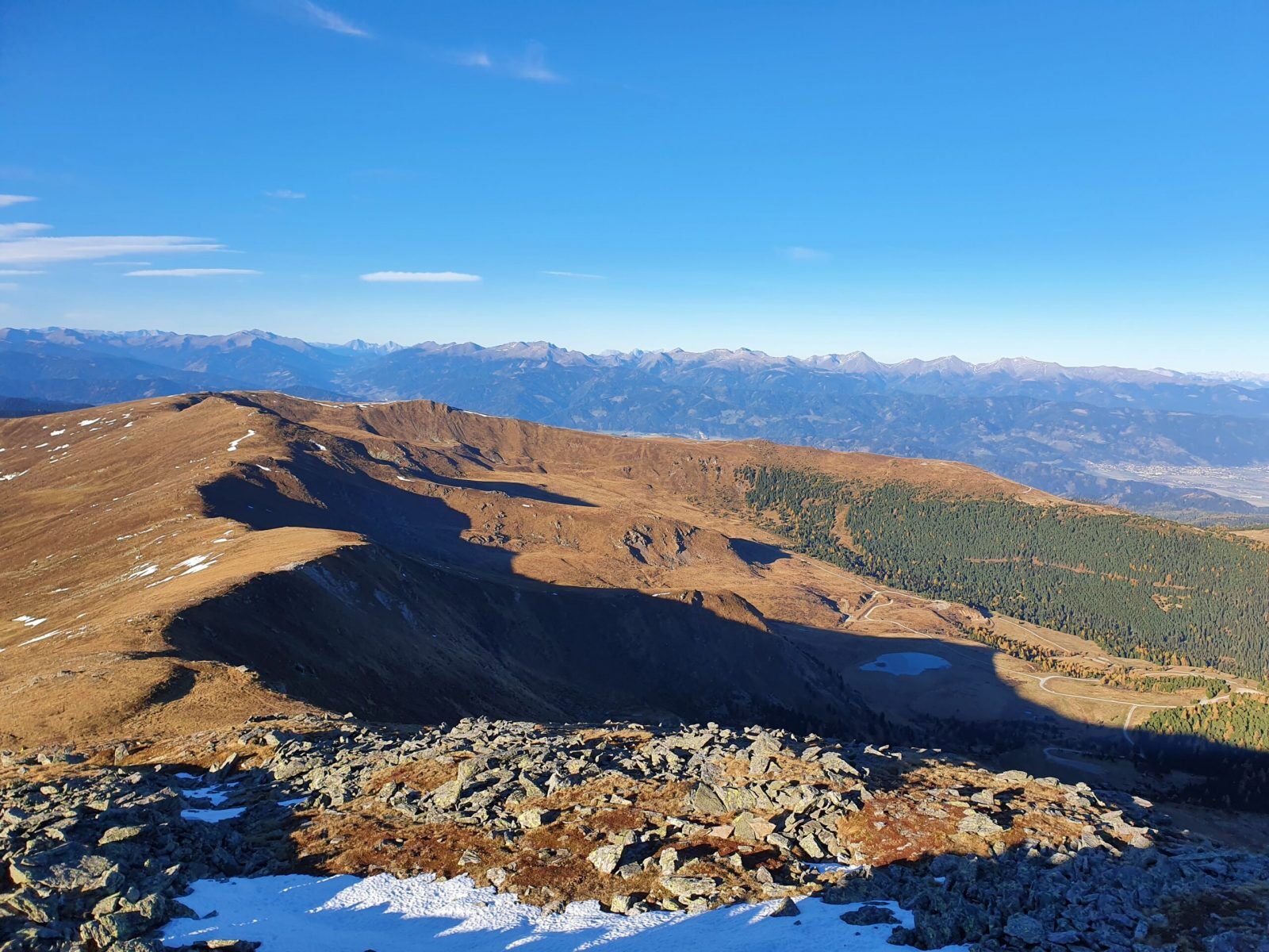
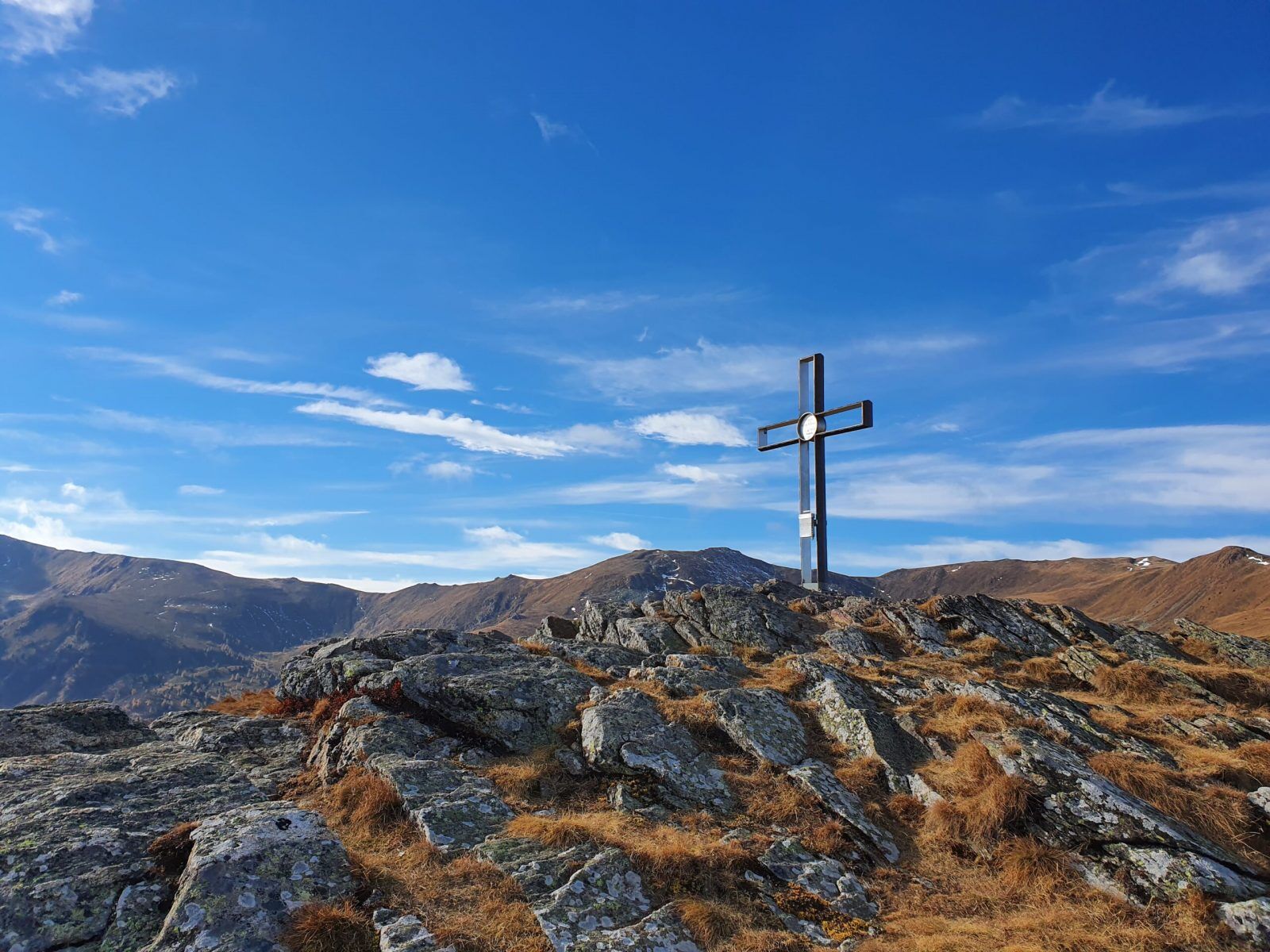
This Hohe Ranach tour starts at the Brand car park at the first junction on the Schmelz. Opposite the car park on the right-hand side, go straight past both gates and continue along the right-hand side until you reach the Forstweg (Bründl) junction. On one level you reach the popular hiking trail- gravel road and continue straight along uphill to the cross of the Hohe Ranach. From there you have a beautiful view of Judenburg and the Mur valley mountains in Styria. At the summit it is usually very windy and behind the cross on the left side there is a small hut with a viewing bench from the Austrian army, where you can take a comfortable rest. The descent follows the same route back to the car park, but we recommend continuing on to the Soldiers' Church with its small lake and to the Schmelzhütte with a good stop for refreshments.
- Highest point
- 1,970 m
- Endpoint
-
Car park Brand Schmelz Seetaler Alpe
- Height profile
-

- Equipment
-
It is usually very windy on the Hohe Ranach.
Mountain bike: roadworthy (e-)mountain bike with plenty of suspension travel, bicycle helmet, if necessary enduro or full-face helmet, if necessary elbow and knee protectors, if necessary back and shin protector, day bike rucksack (approx. 20 litres) with rain cover, mountain bike shoes with ankle protection, weather-adapted and hard-wearing clothing in multiple layers (e.g. functional shirt, cycling jersey, bib shorts, arm warmers and leg warmers). (e.g. functional shirt, cycling jersey, bib shorts, arm warmers and leg warmers), shatterproof cycling glasses, long-finger gloves, air pump, cycling tools, sun and rain protection, provisions and drinking water, water bottle and suitable holder, first aid kit, pocket knife, mobile phone, if necessary mobile phone holder for the handlebars, if necessary headlamp and reflectors, maps.
- Safety instructions
-
As this tour is located at the military training area of the Seetaler Alpe, please note the closing times.
Changes due to shooting or weather conditions are possible. For telephone information please call 0664 622 3401, 0664 622 3410 or 0664 622 3411.
- Tips
-
A great tour with great views through a beautiful Swiss pine forest, be sure to observe the closing times! If you want to extend this tour, you can drive up from Judenburg (swimming pool car park) or Obdach via St. Wolfgang.
- Additional information
- Directions
-
From Judenburg drive in the direction of Obdach, continue in the direction of St. Wolfgang. From there follow the road to Schmelz.
- Public transportation
-
This tour is NOT considered "accessible by train and bus" because there is no regular connection.
- Parking
-
Brand parking lot (crossroads, first warning sign).

- Author
-
The tour Tour 19b - MTB - Hohe Ranach is used by outdooractive.com provided.