Regeneration-fat burning round (Regenerations-Fettverbrennungs-Runde)


- Brief description
-
Flat circuit with ideal motivational indications along the route
- Difficulty
-
medium
- Rating
-
- Starting point
-
Dorfkreuz Wagerberg
- Route
-
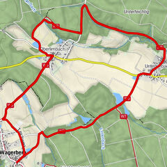
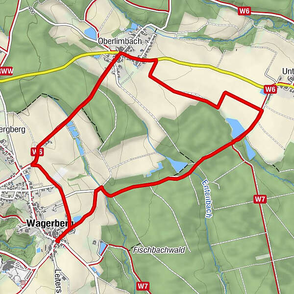
Wagerberg0.0 kmOberlimbach4.0 kmWagerberg6.1 km
- Best season
-
JanFebMarAprMayJunJulAugSepOctNovDec
- Description
-
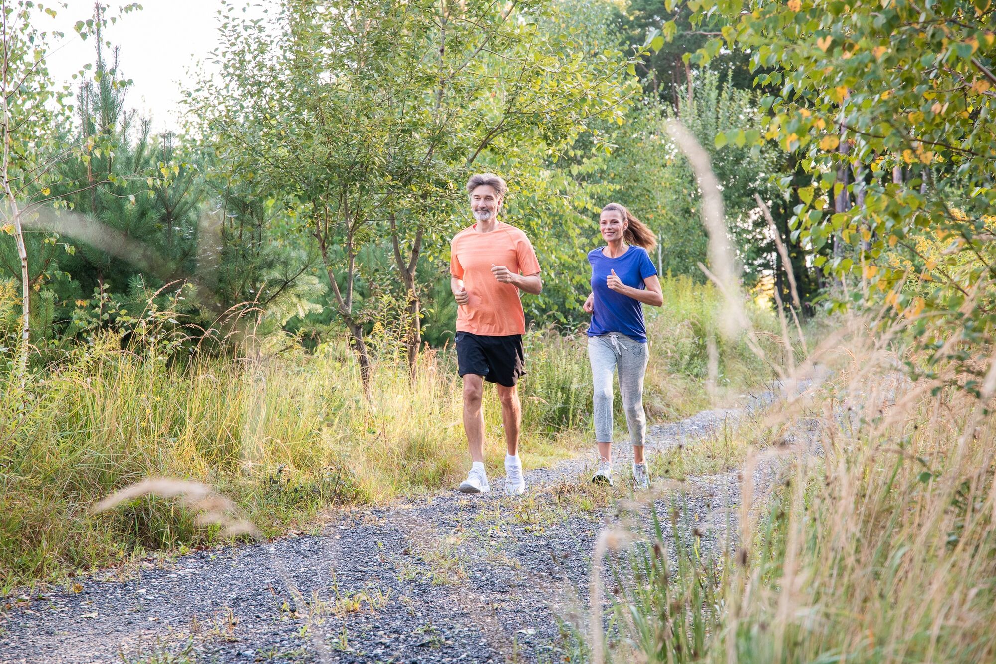
This 6 km route is a relatively flat circuit and pleasant to run. The loop has a stress-relieving effect, is ideal for burning fat and also offers the demanding runner a relaxed regeneration run after a hard workout.
- Directions
-
The starting point of the loop is the village cross in Wagerberg, right next to the village pond. First go straight towards the forest, then turn right and follow the gravelled path. After about 2,300 m you have to keep left at the fork in the direction of Oberlimbach. Walk until you reach the center of Oberlimbach and turn left at the crossroads. Then you walk along the slightly ascending road in the direction of Wagerberg until you turn left just before you reach the village. Return to the starting point and the round is done!
1.talk out in the direction of the forest
2.then right
3.along the gravelled forest path
4.after approx. 2300 m at the junction left in the direction of Obelimbach
5.continue to the center of Oberlimbach
6.turn left at the crossroads
7.follow the slightly ascending road in the direction of Wagerbeg
8.just before Ortberinn Wagerberg turn left
9.continue to the starting point the village cross or Dortteich of Wagerberg - Highest point
- 390 m
- Endpoint
-
Dorfkreuz Wagerberg
- Height profile
-

- Equipment
-
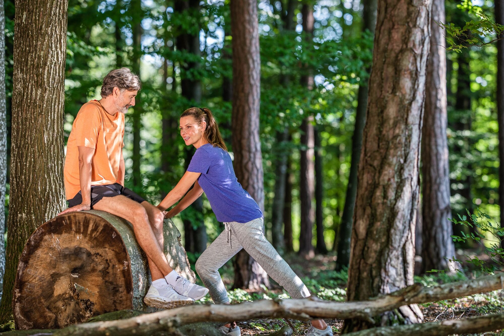
Proper backpack packing makes many things easier: Pack heavy things first. The water bottle should always be within reach in a side pocket. All the things that are often needed, such as sunglasses, camera or hiking map, belong on top. An emergency kit, including blister plasters, belongs in every rucksack and it is always advisable to dress in layers.
- Safety instructions
-
Emergency call mountain rescue: 140
ambulance: 144
European emergency call: 112
firefighters: 122
police: 133Tips when reporting an emergency – Answer these six WH questions: What happened? How many people are injured? Where did the accident happen (are there GPS coordinates)? Who is reporting the incident (callback number)? When did the accident happen? What is the weather like at the site of the incident?
- Tips
-
-GenussCard
- Additional information
-
The Styria Tours App, which is available for free on Google Play and in the App Store (Android, iOS), offers detailed first-hand information: short facts (length, duration, difficulty, ascent and descent in altitude meters, ratings), map, route descriptions, altimeter, compass, summit finder, navigation along the tour. In addition, you can create your personal favorites list of favorite tours and points, save tours and destinations offline, play social media channels and more.
Tourist office Thermen- und Vulkanland
Guest information Bad Waltersdorf
Hauptplatz 90
8271 Bad Waltersdorf
+43 3382 55 100-71
badwaltersdorf@thermen-vulkanland.at
www.therme-vulkanland.at - Arrival
-
Arrival by car from the direction of Vienna:
Freeway A2 direction Graz - you take the exit Sebersdorf/ Bad Waltersdorf
Arrival by car from the direction of Graz:
Freeway A2 direction Vienna - you take the exit "Sebersdorf/ Bad Waltersdorf
Arrival by train:
Austrian Federal Railways: TelNr. 0043 (0) 51717 or www.oebb.at
- Public transportation
-
Detailed information about arriving by ÖBB (Austrian Federal Railways) can be found at www.oebb.at or on the Verbundlinie Steiermark website www.busbahnbim.at
With Verbundlinie’s BusBahnBim route planner app, planning your journey has never been easier: simply enter towns and/or addresses, stop names or points of interest to check all bus, train and tram connections in Austria. The app is available free of charge for smartphones – on Google Play and in the App Store
- Parking
-
Kurpark Bad Waltersdorf
Parkplatz Pfarrhof
Bahnhof Bad Waltersdorf
Bründl Gasse


-

-
AuthorThe tour Regeneration-fat burning round (Regenerations-Fettverbrennungs-Runde) is used by outdooractive.com provided.