- Brief description
-
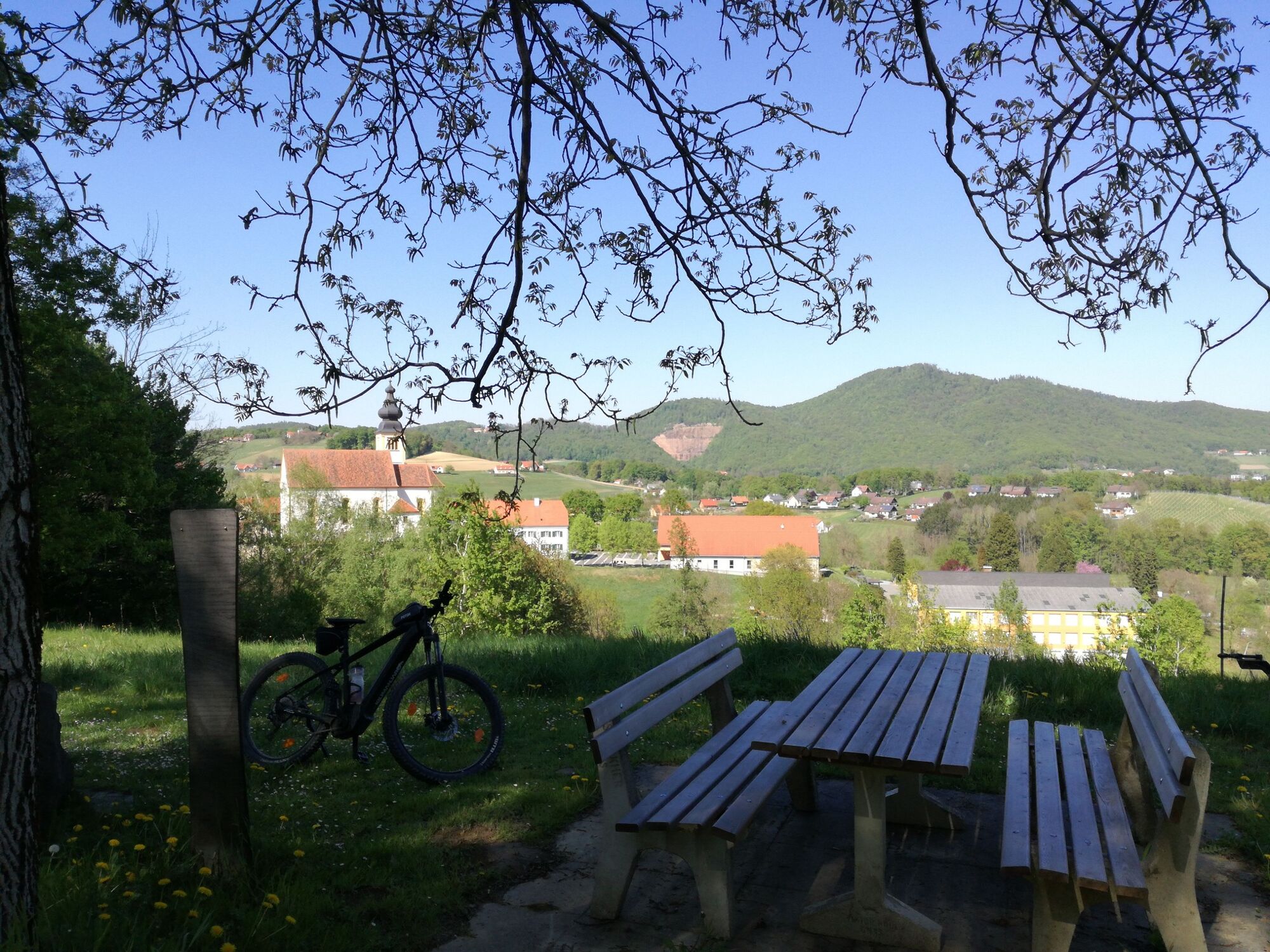
We are rewarded with beautiful views, but first we have to climb the hills. Wonderful viewpoints invite you to stop and rest along the way.
- Difficulty
-
medium
- Rating
-
- Starting point
-
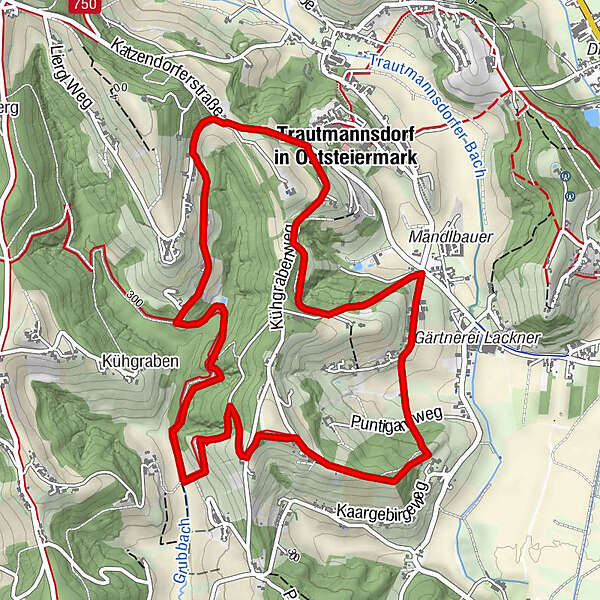
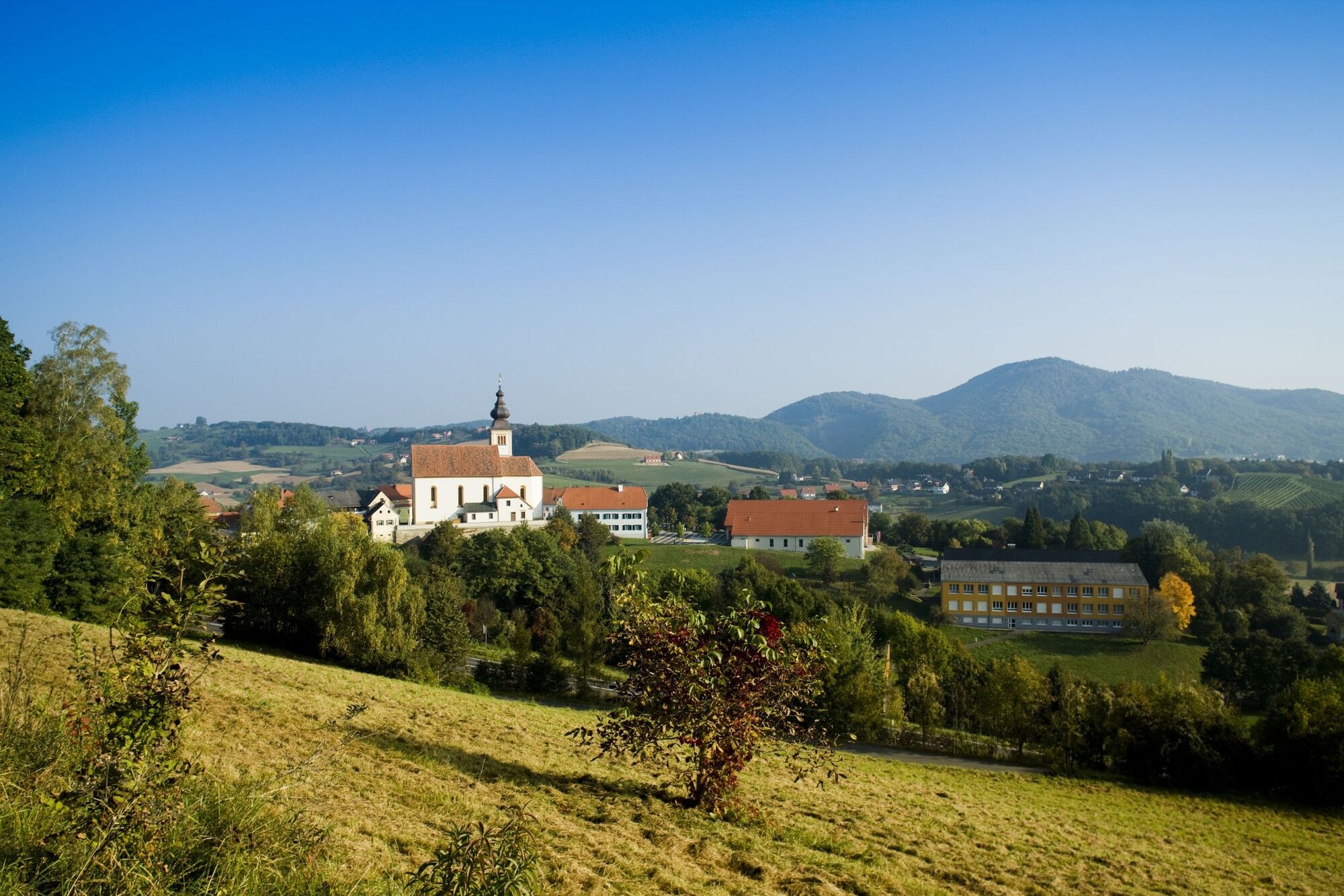
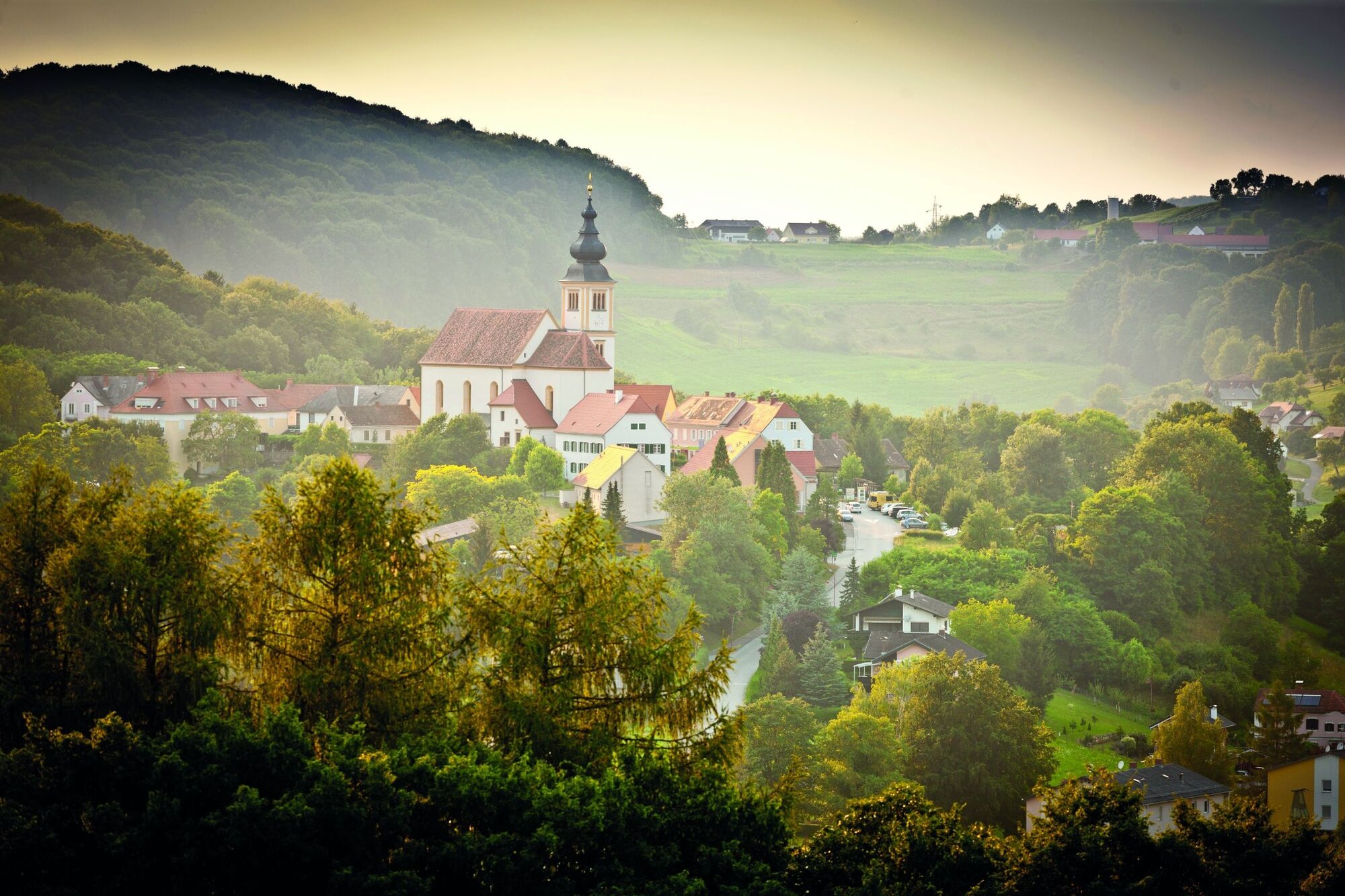
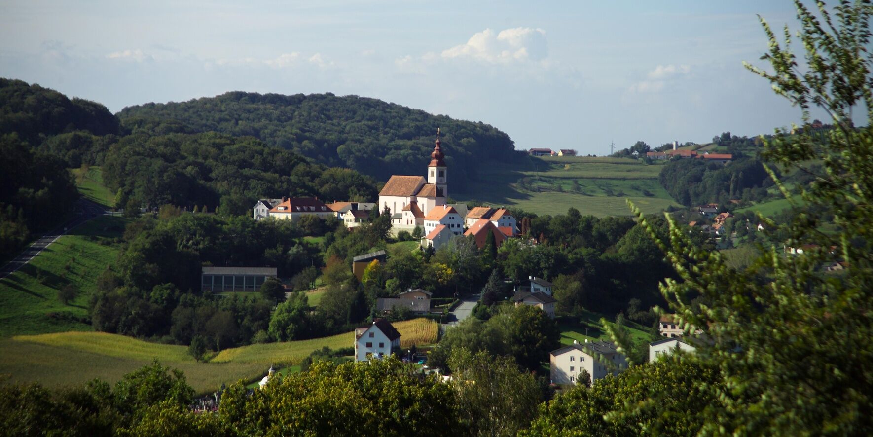
Church Trautmannsdorf
- Route
-
Trautmannsdorf in Oststeiermark0.1 kmBlödenbach1.6 kmTrautmannsdorf in Oststeiermark6.5 km
- Best season
-
JanFebMarAprMayJunJulAugSepOctNovDec
- Description
-
Start/finish: Parking lot above the parish church in Trautmannsdorf / intersection Bundesstraße. Because of quite steep ascents and descents, this round is more suitable for well-trained runners without joint problems, for Nordic walkers who like to be on the move in cropped terrain, and as a hiking trail.
Wonderful viewpoints invite you to take a break!
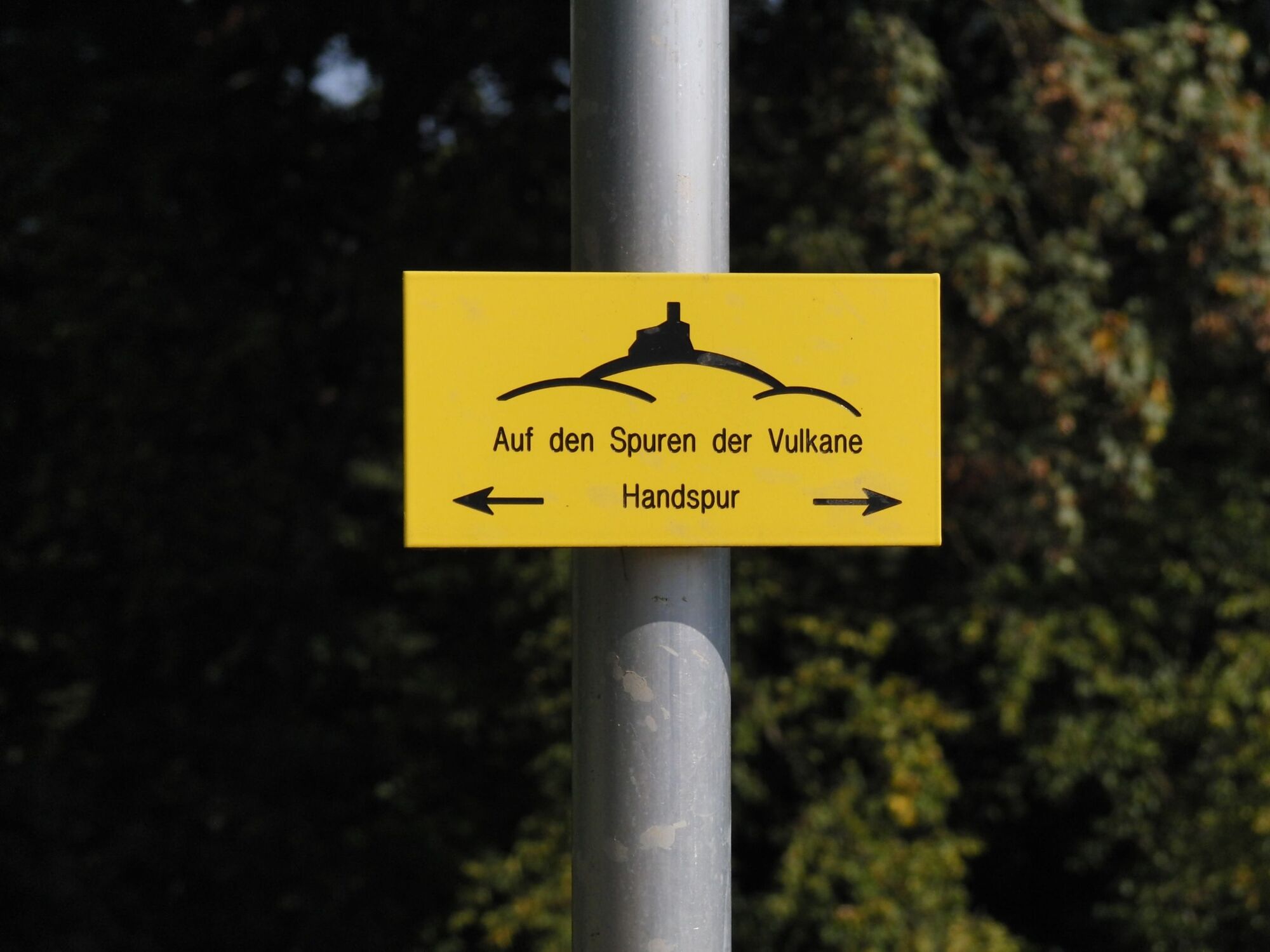
Do not get confused! You can find this trail with two different markings: Running & Walking "Trautmannsdorf Round" - board in dark green and On the trail of volcanoes "Art & Power" - board in yellow with black lettering.
- Directions
-
The Trautmannsdorf circuit leads you - starting from the parking lot above the parish church in Trautmannsdorf - over very varied terrain on mostly untraveled paths from the Kirchberg in Trautmannsdorf towards Blödenbach and further along the Kaargebirge and the Kühgraben via Liergl back to the starting point.
The Trautmannsdorf loop is suitable for well-trained runners without joint problems, for Nordic walkers who like to walk in rough terrain, or as a hiking trail.
Wonderful viewpoints along the way invite you to rest and enjoy.
- Highest point
- 361 m
- Endpoint
-
Church Trautmannsdorf
- Height profile
-

- Equipment
-
Proper backpack packing makes many things easier: Pack heavy things first. The water bottle should always be within reach in a side pocket. All the things that are often needed, such as sunglasses, camera or hiking map, belong on top. An emergency kit, including blister plasters, belongs in every rucksack and it is always advisable to dress in layers.
- Safety instructions
-
Emergency call mountain rescue: 140
ambulance: 144
European emergency call: 112
firefighters: 122
police: 133Tips when reporting an emergency – Answer these six WH questions: What happened? How many people are injured? Where did the accident happen (are there GPS coordinates)? Who is reporting the incident (callback number)? When did the accident happen? What is the weather like at the site of the incident?
- Tips
-
SteiraWirt - The inn of the Rauch family! Two cuisine lines to choose from: traditional inn cuisine and creative gourmet cuisine. Idyllic guest garden!
- Additional information
- Directions
- Public transportation
-
Detaillierte Informationen zur Anreise mit den ÖBB finden Sie unter www.oebb.at oder auf der Website der Verbundlinie Steiermark www.busbahnbim.at
Mit der BusBahnBim-Routenplaner-App der Verbundlinie ist die Reiseplanung so einfach wie noch nie: Einfach Orte bzw. Adressen, Haltestellennamen oder Sehenswürdigkeiten eingeben und alle Bus-, Bahn- und Straßenbahnverbindungen in Österreich abfragen. Die App ist kostenlos für Smartphones erhältlich - auf Google Play und im App Store - Parking
-
Parking lot above or below the parish church in Trautmannsdorf


- Author
-
The tour Trautmannsdorf round (Trautmannsdorf Runde) is used by outdooractive.com provided.


General info
-
Oststeiermark
111
-
Bad Gleichenberg
30
-
Bad Gleichenberg
14