- Brief description
-
Very long, but also very scenic and varied round that requires a lot of fitness.
- Difficulty
-
difficult
- Rating
-
- Starting point
-
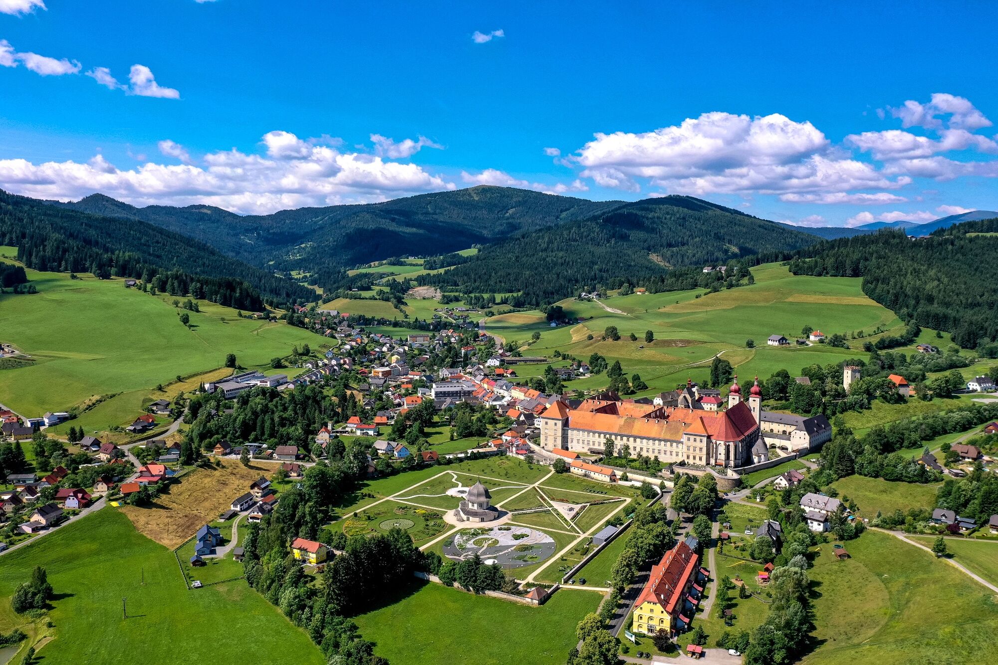
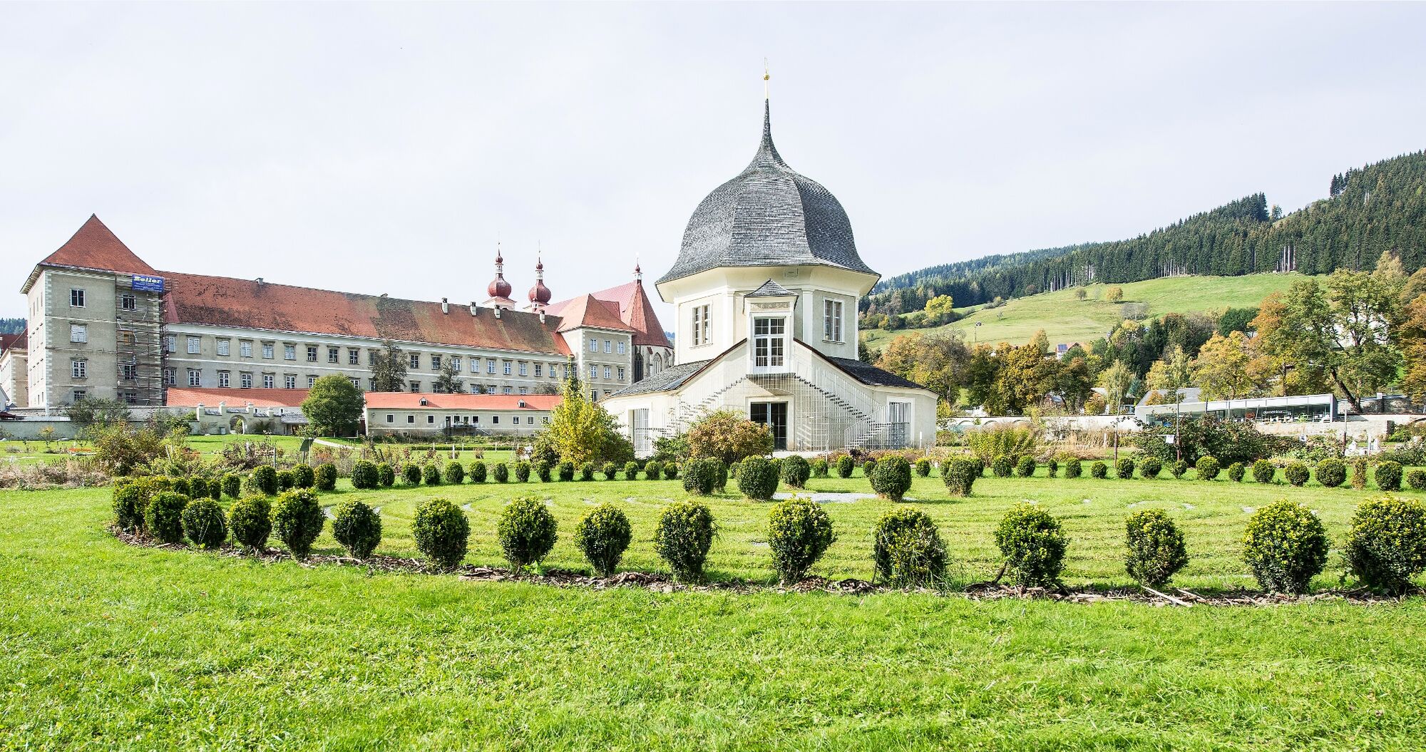
Abbey Gate St. Lambrecht
- Route
-
StifterlSankt LambrechtMarktcafé0.0 kmTorwirt0.0 kmEngelsbrunnen6.0 kmWeißenbach7.3 kmKupferdachl7.4 kmSeppwirt8.0 kmHeiligenstadt8.8 kmStraussenhof Wallner9.5 kmVorderbach9.9 kmSankt Blasen10.2 kmFilialkirche hl. Blasius10.6 kmKirchmoar10.7 kmHinterbach12.0 kmSpitalberg16.7 kmSankt Lambrecht18.6 kmMarktcafé18.9 kmTorwirt18.9 kmStifterl18.9 km
- Best season
-
JanFebMarAprMayJunJulAugSepOctNovDec
- Description
-
The Benedictine monastery of St. Lambrecht, which is the starting and ending point of this hike, tells a 900-year story. It shapes the place and the people in and around St. Lambrecht. Visitors can get to know the monastery on tours of the monastery, in the temporary monastery, the school of existence, tours of the monastery gardens or in the monastery and nature park shop.
- Directions
-
The route runs parallel to the Kapellen circuit to Heiligenstadt. From here you walk north and take beautiful paths and climbs up to St. Blase. After the town, the path leads very varied along the slope towards the west until you reach the road to Karchau shortly before the Seebauern. Here the route turns and leads over soft forest paths through the dense forests of the Koglerberg. As soon as the route leads out of the forest near Trattner, you will have a great panoramic view of the entire area surrounding St. Lambrecht. From here the route runs along the road down into the town to the starting point.
- Highest point
- 1,322 m
- Endpoint
-
Abbey Gate St. Lambrecht
- Height profile
-

- Equipment
-
Good running or Nordic walking shoes
Possibly catering - Tips
-
Relaxation and exercise points along the route and a stop at one of the restaurants on St. Lambrecher main square.
- Additional information
-
The ideal time for this round is from April to November.
- Directions
-
By car from Germany
From Munich via the A8 towards Salzburg. From Salzburg on the A10 Tauernautobahn to St. Michael im Lungau. On the B 96 to Tamsweg, then on the B 95 to Predlitz. The B 97 leads via Stadl/Mur to Murau. There at the roundabout towards St. Lambrecht to Murauer train station and further towards St. Lambrecht. You reach St. Lambrecht via Laßnitz near Murau. The monastery is located in the town center.Arrival from Eastern Austria/Hungary
At the motorway junction in St. Michael near Leoben, take the S 36 towards Klagenfurt. Past Knittelfeld and Judenburg to Scheifling. In Scheifling continue towards Klagenfurt to Neumarkt, via Unzmarkt and Perchau am Sattel you reach Neumarkt. Turn right there towards Mariahof and St. Lambrecht. In Mariahof, after the railway crossing, turn left towards St. Lambrecht. The monastery is located in the center of St. Lambrecht.Arrival from southern Austria/Italy
Via Klagenfurt on the S 37 past St. Veit/Glan, Treibach and Friesach. In Friesach continue towards Vienna, via Dürnstein and Wildbad to Neumarkt. After the town center of Neumarkt turn left towards Murau, in Mariahof turn left after the railway crossing towards St. Lambrecht. The monastery is located in the center of St. Lambrecht. - Public transportation
-
With the BusBahnBim app from the interconnected line, timetable information is easier than ever before: all bus, train and tram connections in Austria can be queried by entering locations and/or addresses, stops or important points. The app is available as a free app for smartphones (Android, iOS) - on Google Play and in the App Store.
- Parking
-
Public parking spaces are available at St. Lambrecht Abbey or along the Abbey Wall.
- Author
-
The tour Mountain and valley route is used by outdooractive.com provided.