© RUNNERSFUN Consulting GmbH - Felix Ettinger

- Difficulty
-
difficult
- Rating
-
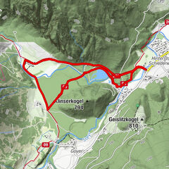
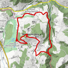
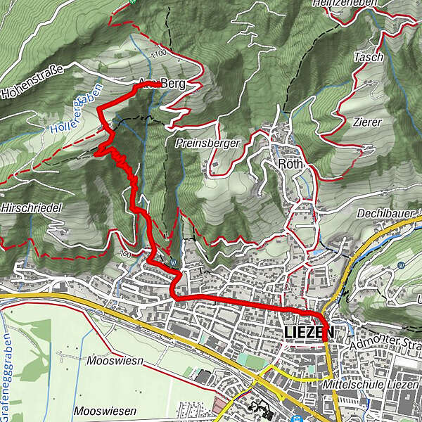
- Route
-
Am BergGasthof Schlagerbauer0.5 kmSt. Veit3.3 kmLiezen3.5 km
- Highest point
- 1,051 m
- Height profile
-


- Author
-
The tour KLAUSENSTEIG is used by outdooractive.com provided.
GPS Downloads


Other tours in the regions
-
Gesäuse
43
-
Grimming - Donnersbachtal
53
-
Liezen
14