- Brief description
-
Running in Stainz
The home course of the Stainzers. Here you will meet many a runner and walker.
- Difficulty
-
easy
- Rating
-
- Starting point
-
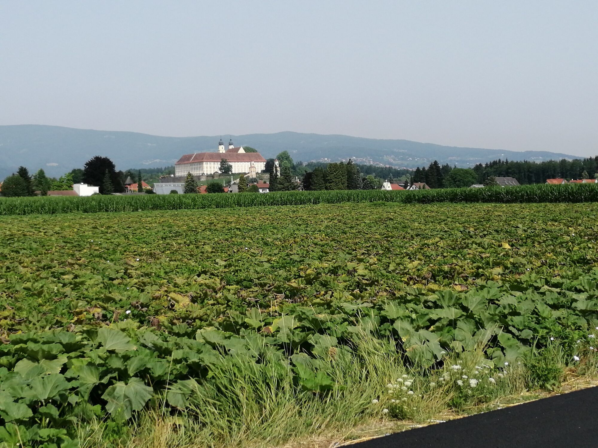
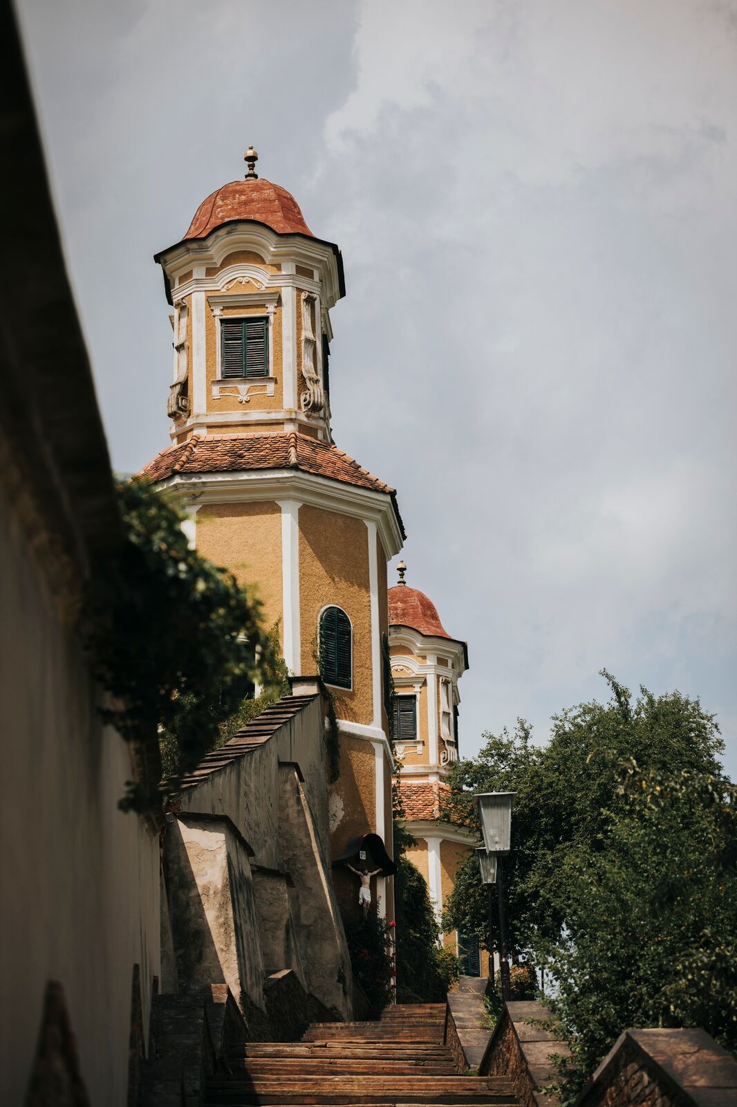
Stainz Castle
- Route
-
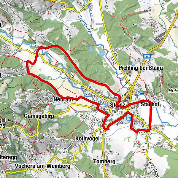
Pfarrkirche Heilige Katharina0.1 kmMarktkapelle Maria Himmelskönigin0.3 kmStainz0.6 kmStallhof1.7 kmEvangelische Kirche A.B. "Friedenskirche"3.4 kmNeurath6.7 kmWald in der Weststeiermark8.9 kmSchönegg10.0 kmStainz11.7 km
- Best season
-
JanFebMarAprMayJunJulAugSepOctNovDec
- Description
-
This running route starts at Stainz Castle, where there are plenty of free parking spaces. This 12 km long running route lets you explore Stainz from its most beautiful sides. You run on roads, through forests, past streams and on gravel paths. Enjoy the variety and diversity.
- Directions
-
The beautiful 12 km run can begin. There are two options for the start towards the main square in Stainz. You can run down the street of the Klosterhöhe or build in a stair run at the beginning by running down the Jakob-Rosolenz Staircase. Cross the main square and turn left at the crossroads at the end. This road leads you past the Buschenschank Samahof and takes you directly to Stallhof. As soon as you see a long, straight road on your right, turn off and follow it. At the end of this road, walk straight across the crossroads and take the first road on the right. Here you will pass through a quiet residential area towards Bahnhofpark. Take the narrow gravel path which leads you directly to the Flascherlzug grounds. A beautiful park with a new children's playground can be found on your right. The Meierei - a train wine tavern - is also unique. Here you can enjoy culinary delights in a special atmosphere. But perhaps you will have a meal after the run. Now it's time for a sporty run along the Gewerbeparkstraße. Run up this road to the JET roundabout, cross it and continue towards rehts. Turn left at the SeneCura social centre. After about 400 metres on Engelweingartenstraße, turn into Franz-Michael-Hangi-Straße. This is the beginning of a residential area. Take the first road to the left and you will be on your first dirt road. Follow this until you reach Neurath. In Neurath you can discover beautiful West Styrian houses. Stay on the Neurathstraße and refresh yourself at the Johannesbrunnen. You have now covered almost 9 km. The running route continues to "Wald in der Weststeiermark". Here you run straight across the crossroads of the voluntary fire brigade and follow the road, always keeping to the right. Now you have forests on both sides of you. Breathe in the fresh air and start the final sprint. Once you arrive in Schönegg, follow the gravel road through the Bründlwald forest, which leads you directly to the starting point, Stainz Castle.
- Highest point
- 410 m
- Endpoint
-
Stainz Castle
- Height profile
-

- Equipment
-
Running shoes and seasonal running clothes.
- Safety instructions
-
Suitable running clothes are an advantage.
Rescue: 144
Emergency reporting tip - give answers to the six W questions: What happened? How many injured? Where did the accident happen (possibly GPS coordinates)? Who reported the accident (call-back number)? When did the accident happen? Weather at the accident site?
- Tips
-
After about 1.5 km you will pass the Samahof in Stallhof. Make a note of it for a good snack after sport.
- Directions
-
Plan your journey via Google Maps to the starting point of the tour: www.google.at/maps
From the north: Motorway Munich - Salzburg - Eben - Schladming - Liezen onto the A9 towards Graz. Exit at Lieboch and follow the B76 towards Deutschlandsberg. In Stainz leave the B76 and follow the direction of Schloss Stainz.
A9 is subject to toll - Gleinalmtunnel. Alternative: at St. Michael take the S6 towards Bruck and in Bruck take the S35 towards Graz.
From the west: In Villach take the A2 towards Klagenfurt. Take the Steinberg exit and head towards Stainz.
From the east: A2: Vienna - Aspang - Hartberg - Fürstenfeld - Graz. From Graz continue on the A2 in the direction of Klagenfurt and take the Lieboch exit in the direction of Stainz/Deutschlandsberg/Eibiswald. Follow the B76 to Stainz.
From the south: A1 from Marburg to Leibnitz. Exit in Leibnitz (Gralla) and continue on the B74 in the direction of Deutschlandsberg (Heimschuh - Gleinstätten - St.Martin - Deutschlandsberg). Pass the LKH Deutschlandsberg, at each of the four roundabouts take the second exit in the direction of Stainz-Graz. Follow the B 76 in the direction of Stainz. Directly in Stainz, take the third exit at the JET roundabout and drive in the direction of Zentrum / Schloss Stainz.
- Public transportation
-
You can find timetables and travel information directly at
With the BusBahnBim app of the Verbundlinie, timetable information is easier than ever: all connections by bus, train and tram in Austria can be retrieved by entering places and/or addresses, stops or important points. The app is available as a free app for smartphones (Android, iOS) - on Google Play and in the App Store.
- Parking


-

-
AuthorThe tour Wald run is used by outdooractive.com provided.