- Brief description
-
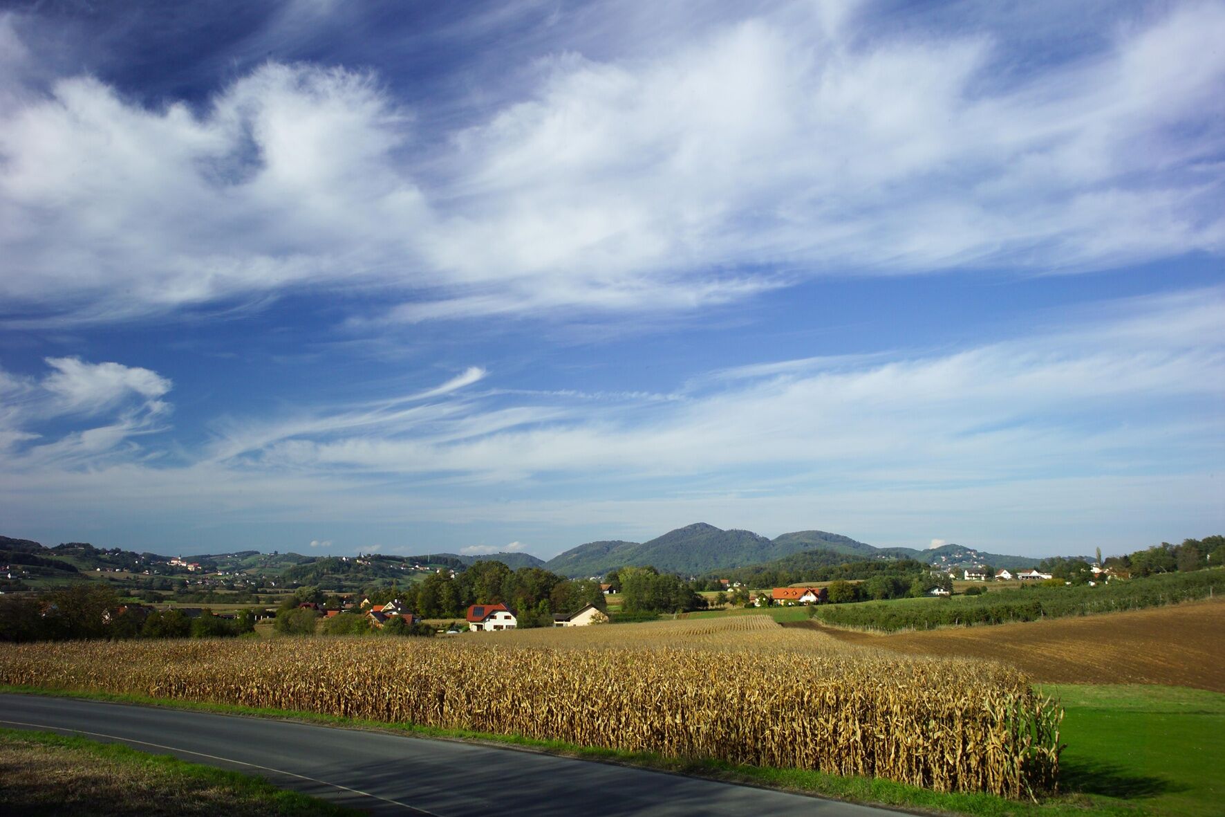
3 kilometers around Steinberg! Short, moderately difficult walking tour with a beautiful view of the Gleichenberger Kogel. A real feast for the eyes during an active activity for the experienced and motivated.
- Difficulty
-
easy
- Rating
-
- Starting point
-
Bus station in Steinberg
- Route
-
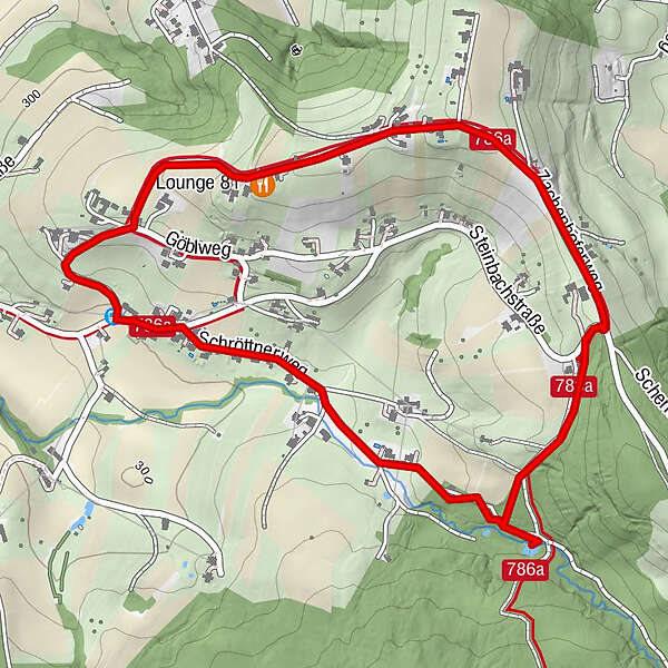
Lounge 812.3 kmSteinbach3.0 km
- Best season
-
JanFebMarAprMayJunJulAugSepOctNovDec
- Description
-
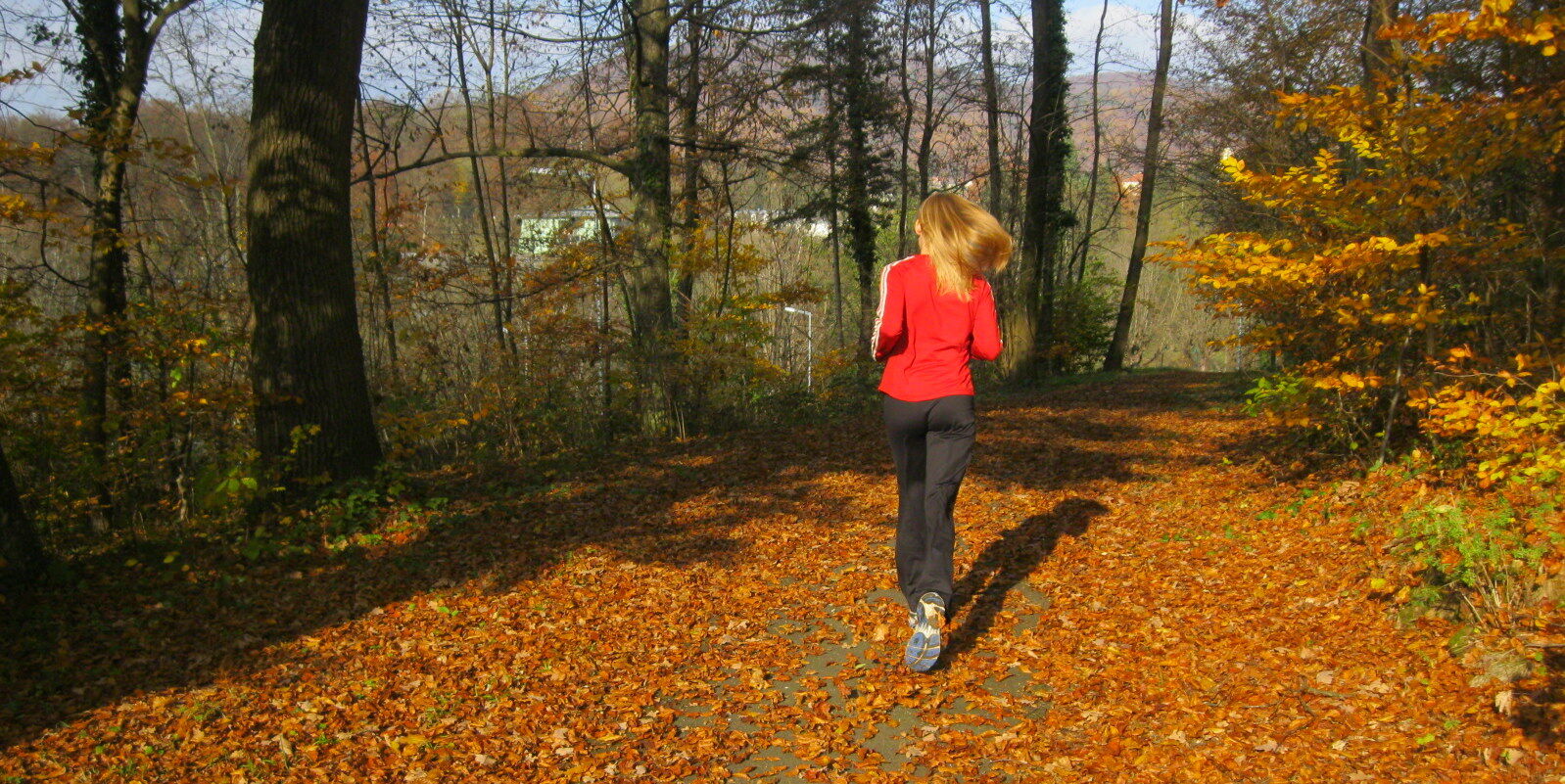
A short but promising walking or running route. Here you have a good opportunity to further train and prove your skills. The round is too short? Why not combine Merkendorf Round 1 with Round 2!
- Directions
-
The Merkendorf-Runde 2 has its starting and end point at the bus stop at the height of Mitte Steinberg and presents you with a minor challenge right at the beginning - overcoming a longer, steeper climb up the Steinberg. You will be rewarded with a beautiful view of the Gleichenberger Kogel and a relaxing, further course. A short section of the route takes you downhill along the edge of a forest - it could be a bit slippery here after bad weather - please make sure you are sure-footed!
Only 3000 meters long, but with a steep climb, the route is optimal for the experienced and motivated. It is short, but especially at the beginning very intense and can be extended by coupling with the Merkendorf round 1 as you like.
- Highest point
- 381 m
- Endpoint
-
Bus station in Steinberg
- Height profile
-

- Equipment
-
Proper backpack packing makes many things easier: Pack heavy things first. The water bottle should always be within reach in a side pocket. All the things that are often needed, such as sunglasses, camera or hiking map, belong on top. An emergency kit, including blister plasters, belongs in every rucksack and it is always advisable to dress in layers.
- Safety instructions
-
Emergency call mountain rescue: 140
ambulance: 144
European emergency call: 112
firefighters: 122
police: 133Tips when reporting an emergency – Answer these six WH questions: What happened? How many people are injured? Where did the accident happen (are there GPS coordinates)? Who is reporting the incident (callback number)? When did the accident happen? What is the weather like at the site of the incident?
- Tips
-
Enjoy the wonderful view!
- Additional information
- Directions
- Public transportation
-
Detailed information about arriving by ÖBB (Austrian Federal Railways) can be found at www.oebb.at or on the Verbundlinie Steiermark website www.busbahnbim.at
With Verbundlinie’s BusBahnBim route planner app, planning your journey has never been easier: simply enter towns and/or addresses, stop names or points of interest to check all bus, train and tram connections in Austria. The app is available free of charge for smartphones – on Google Play and in the App Store
- Parking


- Author
-
The tour Merkendorf round 2 (Merkendorf-Runde 2) is used by outdooractive.com provided.


-
Oststeiermark
111
-
Bad Gleichenberg
30
-
Bad Gleichenberg
14