


- Difficulty level
- D/E


- Brief description
-
Via ferrata enthusiasts get their money's worth in Eisenerz! Of the four via ferratas, the Kaiserschild is certainly one of the most demanding. Therefore not suitable for beginners and inexperienced. Many passages are C and D as well as D/E. For the approach you should plan 1 1/2 hours and good condition required.
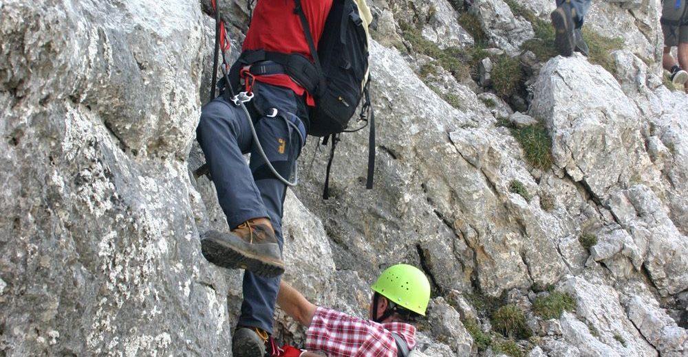
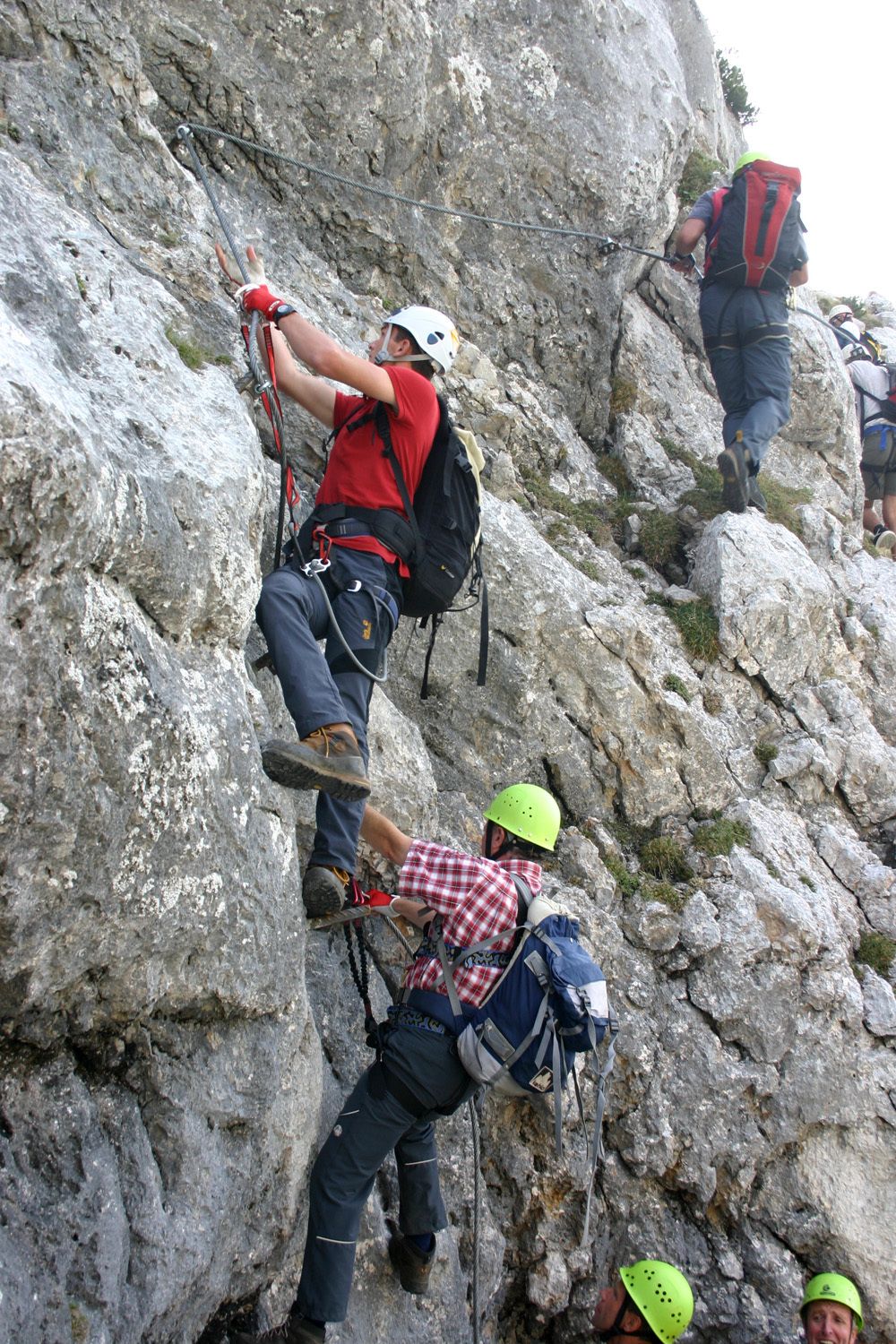
The Kaiserschild is an exciting and attractive via ferrata with an approx. 35 m long steel cable suspension bridge "Nepal bridge" and is located in the adventure region ERZBERG LEOBEN.
- Difficulty
-
difficultDifficulty level D/E
- Rating
-
- Starting point
-
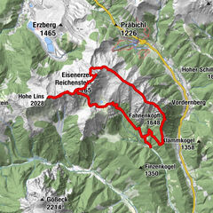
Eisenerzer Ramsau - Gemeindealm
- Route
-
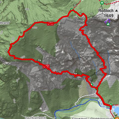
Ramsau0.0 kmKaiserschild (2,084 m)4.5 kmRamsau9.7 km
- Best season
-
JanFebMarAprMayJunJulAugSepOctNovDec
- Description
-
Approach: 680 HM, 3.3 km, 1.5 hrs.
Difficulty:
Very to extremely difficult. Fairly constant between C and D and a short passage D/E.
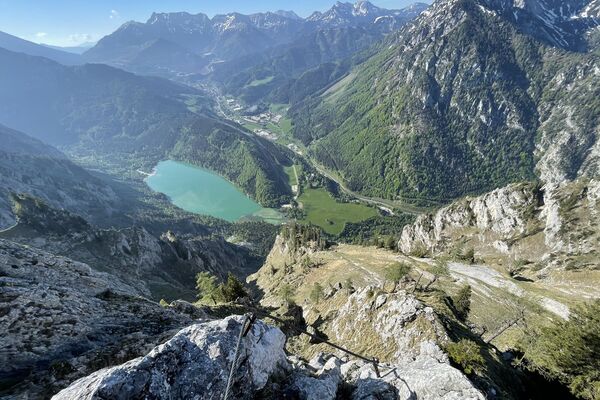
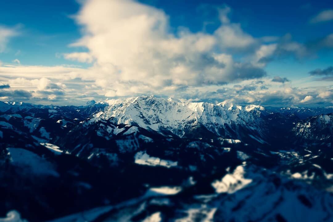
Character: The demands of the Kaiserschild via ferrata are higher than those of the Eisenerzer via ferrata. Fairly persistent in difficulty, almost always very steep and exposed, combined with a few really crunchy single passages up to D/E. Also scenically very beautiful and impressive! Not at all suitable for beginners and inexperienced.
Exciting and attractive is also the approx. 35 m long steel cable suspension bridge Nepal Bridge in the upper section of the climb.
Starting point: parking lot at the alpine inn Gemeindealm in the Eisenerzer Ramsau (afterwards no driving)
Access: 1.5 hours from the parking lot Gemeindealm on a forest road to a left turn and here follow the marked trail 683. Via serpentines through a beech forest and scree field to the foot of the wall. Via a partially secured ramp you reach the entrance of the via ferrata.
Route: 1,5 hours 300 HM
Shortly very steep C/D uphill to the entry crossing and keeping right B uphill C D to the beginning of the big slab ramp "Ramsauer Rampe" further to the chimney and Kaiserschild summit.
Descent: 2 hours 1065 HM.
At the marked normal path - west downhill into the beautiful high valley and left back to the start.
- Directions
-
Arrival: Coming from Leoben via the Präbichl on the B-115 after the Red Cross service Abbierung" Zentrum Stadtmitte". Through the Krumpental past the municipal office in the direction of Eisenerzer Ramsau to the inn Gemeindealm.
- Highest point
- 2,071 m
- Endpoint
-
Eisenerzer Ramsau - Gemeindealm
- Exposition
- Height profile
-

- Equipment
-
Buy your equipment in a "mountain sports store" (professional advice).combi harness (chest and seat harness) or waist belt, via ferrata set with additional loop (lazybones) and easy-to-use carabiners (sample the different models in the store or at the course), rockfall helmet, gloves, suitable mountain boots (also for access and descent on snow and ice), 2 rep cords, reserve clothing, food and plenty of drinks.
- Safety instructions
-
Put on helmet already at the beginning of the wire rope protection (during the approach)!!!
Very difficult via ferrata - good condition required!
Emergency call rescue: 144
Tip for emergency reporting - give answers to the six W-questions: What happened? How many injured? Where did the accident happen (possibly GPS coordinates)? Who is reporting (callback number)? When did the accident happen? Weather at the accident site?
- Tips
-
No water on the way! Danger of falling rocks in the area of the Bärenlochsteig (access and descent) near the entrance by climbers. In spring often still snow or snow remains on the access trail.
Maps: ÖK 100 Hieflau; F&B WK 041
Accommodation / inns in Ramsau and Eisenerz.
No campsite nearby; a camper site next to the indoor swimming pool and camping possibility at the Eisenerzerhof, Hieflauerstr. 17.
- Additional information
- Directions
-
On the S 6 to Leoben , continue via the B 115 or via Hieflau to Eisenerz. In the village you branch off to Ramsau (you drive through the narrow beautiful old town) and follow the road to the end of the driving possibilities.
- Public transportation
-
Timetables and travel information can be found directly at: Österreichischen Bundesbahnen (ÖBB), Steiermärkischen Landesbahnen (STLB), www.busbahnbim.at
With the BusBahnBim app of the Verbundlinie, timetable information has never been easier: all bus, train and tram connections in Austria can be queried by entering locations and/or addresses, stops or important points. The app is available as a free app for smartphones (Android, iOS) - on Google Play and in the
- Parking
-
Sufficient parking directly at the starting point


- Author
-
The tour Kaiserschild is used by outdooractive.com provided.


General info
-
Erzberg Leoben
39
-
Hochschwab
22
-
Eisenerz
15