- Difficulty level
- D
- Brief description
-
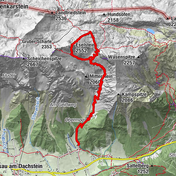
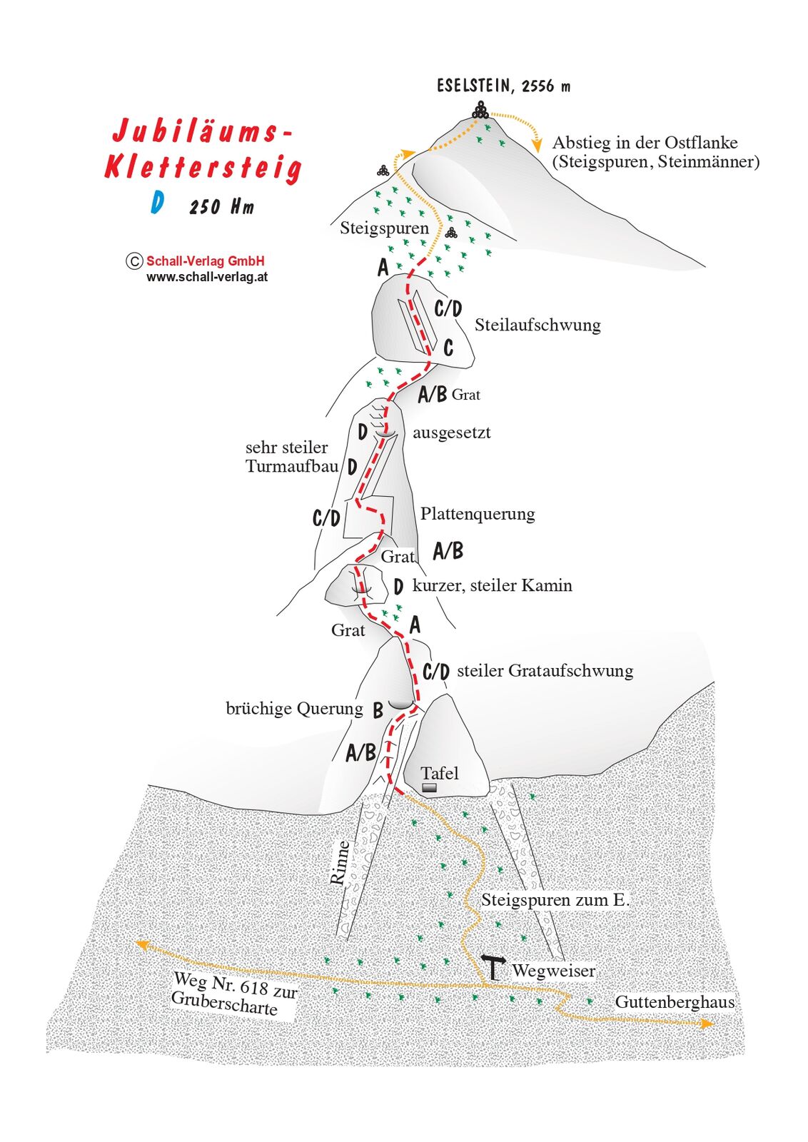
The Via Ferrata Jubiläums-Klettersteig was built in 1991 and leads through the south face of the Eselstein.
- Difficulty
-
difficultDifficulty level D
- Rating
-
- Starting point
-
Feistererhof
- Route
-
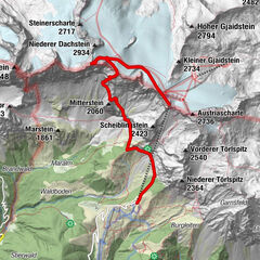
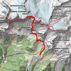
Bio- & Wellnesshotel feistererhofFischermauer (1,668 m)2.5 kmFeisterer Tiefkar3.4 kmFeisterer Hochkar4.2 kmEselstein (2,552 m)6.0 kmFeisterscharte7.4 kmGuttenberghaus7.9 km
- Best season
-
JanFebMarAprMayJunJulAugSepOctNovDec
- Description
-
The Jubiläum via ferrata was build in 1991 and its varied passages lead along: the ridge, very exposed spots, and easier terrain in between. Many mountaineers faced their limit on its steep cliff passage.
Comments:
A very well-designed via ferrata meeting every expectation, though not suited for inexperienced climbers or childer. Very strenous and exposed at some parts.
- Directions
-
Approach: from Gasthof Feistererhof, a well-marked and occasionally steep trail winds up to the Guttenberghaus (see King's Stage). Keep hiking in the direction of the Gruberscharte. After approx. 20 minutes, turn right (info board ‘Klettersteig’) and follow the footpath along the scree slope until you reach the entry point.
Descent: hike down the narrow, marked path at Eselstein's northern-slope until you reach the trail. Walk along Feistererscharte back to the Guttenberghaus (approx. 40 min) and take the trail you used for the ascent, back down. Or go down the Eselstein Westwand ferrata and back to the hut.
- Highest point
- 2,530 m
- Endpoint
-
Feistererhof
- Exposition
- Height profile
-

- Equipment
-
Via Ferrata equipment
- Safety instructions
-
Hiking Via Ferrata routes is a demanding sport in rugged terrain. For your safety, please observe the following rules:
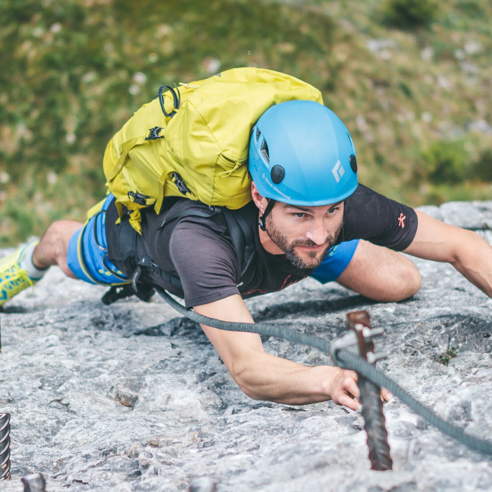
Via Ferrata routes are demanding and require a good level of fitness, no hight vertigo and sure-footedness. Always use a helmet and, a Via Ferrata kit to attach yourself to the safety rope. Many mountain rescue missions are a result of carelessness and bad weather conditions. Many routes require most of the day. When planning a tour, always include the possibility of a sudden change of weather. Be prepared: carry spare clothing and a good stock of food supplies. Always show respect towards fellow mountaineers. Inform them about possible dangers if need be. Take care of our environment. Only take photographs and memories with you - leave no trace.Alpine Emergency Numbers
Mountain Rescue 140
Euro Emergency Call 112
- Tips
-
Going down on via ferrata Eselstein Westwand.
- Additional information
- Directions
-
Arriving from the west:
From the west you can take the Munich-Salzburg motorway, continuing on the Tauern motorway (A 10) until the Ennstal junction. From here take the Ennstal A-road (the B 320) for around 30 km into the Schladming-Dachstein region, then take the Ramsau am Dachstein turn-off. Continue to the Ramsau plateau and about 1 km after Ramsau Kulm turn right to Rössing street (Rössingstraße) and continue junction (Abzweigung) Feistererhof.
Arriving from the north and east:
From the south-east take the Pyhrnautobahn motorway (A 9) to the Liezen junction and then the Ennstal A-road (B 320) into the Schladming-Dachstein region. Then take the Ramsau am Dachstein turn-off. Continue to the Ramsau plateau and about 1 km after Ramsau Kulm turn right to Rössing street (Rössingstraße) and continue junction (Abzweigung) Feistererhof.
- Public transportation
- Parking
-

-
AuthorThe tour Via Ferrata Eselstein is used by outdooractive.com provided.