Wenigzell hiking trail no. 918: Wetterkreuz - St. Jakob im Walde


- Brief description
-
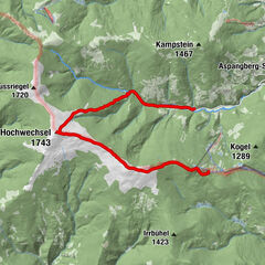
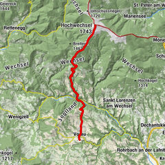
This stage of the long-distance hiking trail takes you from Wetterkreuz to the Wenigzell St. Jakob border
- Difficulty
-
easy
- Rating
-
- Best season
-
JanFebMarAprMayJunJulAugSepOctNovDec
- Description
-
This short hiking trail starts at the Wetterkreuz and leads after a short stretch of country road through the beautiful countryside of Wenigzell.
- Directions
-
From the Wetterkreuz we hike via "Auf der Halt" and Leitenbauer to St. Jakob im Walde.
- Highest point
- 1,050 m
- Endpoint
-
Ortsgrenze Wenigzell - St. Jakob im Walde
- Height profile
-

- Equipment
-
Small backpack with water bottle (+ provisions)
Sturdy shoes
Appropriate clothing - if possible several layers - "onion principle".
Rain and sun protectionWalking sticks as required
Mobile phone
Small first aid kit
Route description
Before starting the hike, check the possibilities for refreshments, including opening times, or pack appropriate food and drink.
- Safety instructions
-
European emergency call: 112
Emergency call mountain rescue: 140 (if possible please provide GPS data)
Rescue: 144
Fire brigade: 122
Police: 133
A few tips on correct and fair behaviour in the forest: (Source: www.bundesforste.at )
Hikers should avoid visits to the forest about 1.5 hours before sunrise and after sunset, as wild animals are particularly active during this time.
Plastic bottles, handkerchiefs, cigarette butts etc. have no place in the forest! Please make sure that you do not leave any rubbish in the forest.
Camping and lighting fires are strictly forbidden in the forest!
In principle, every person is allowed to pick 2 kg of mushrooms and berries per day for personal use. It is only prohibited if the forest owner expressly forbids it.
- Tips
-
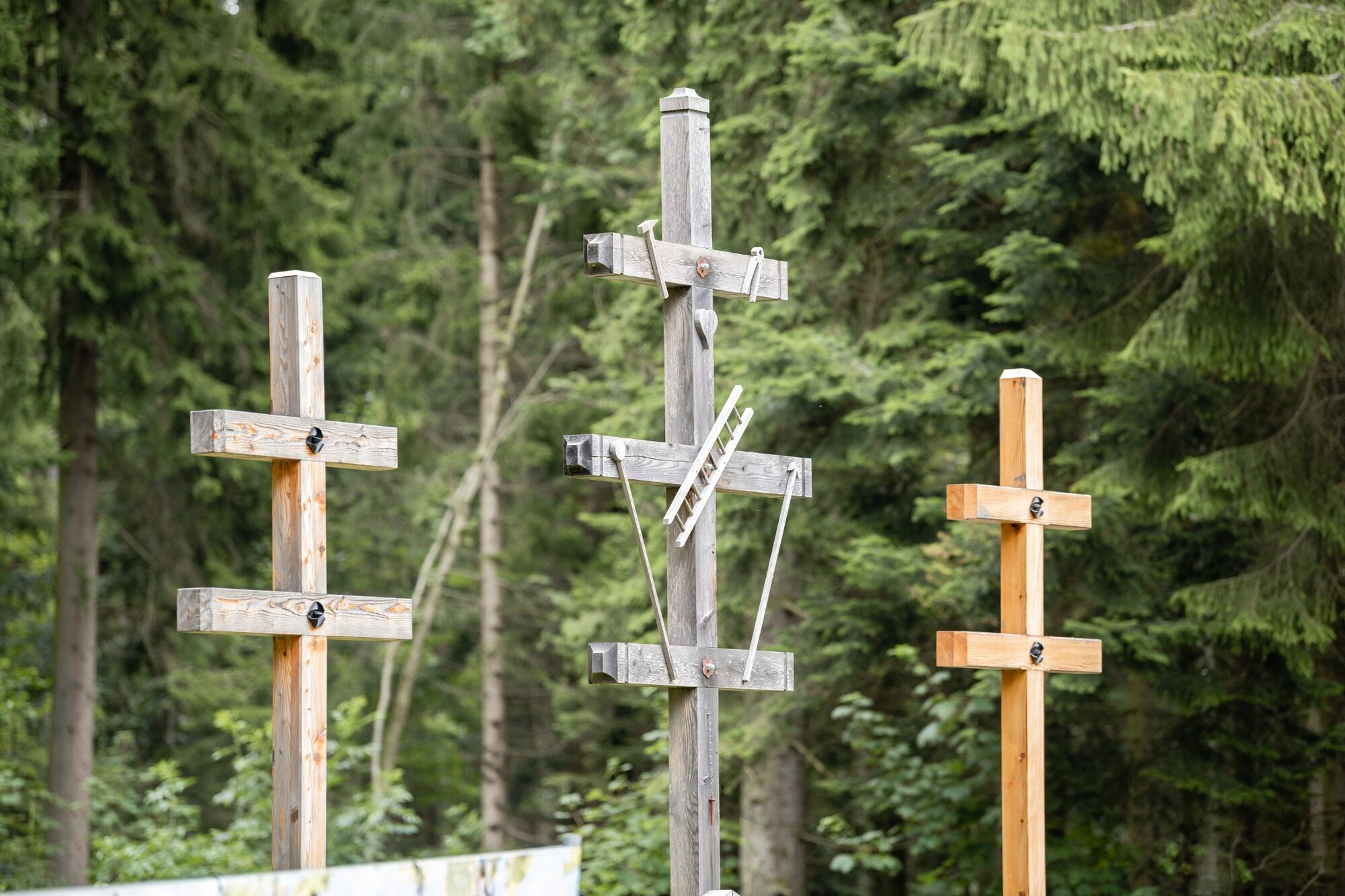
Take a step back and admire the weather crosses
- Additional information
-
You can find information about the region, places to stop and stay overnight, excursion destinations, etc. here:
Eastern Styria Tourism Association
Joglland-Waldheimat office
8255 St. Jakob im Walde
Tel.: 03336/20255
info@joglland.at
www.joglland-waldheimat.at
Eastern Styria
current weather
Mobility Eastern Styria with shared taxi SAM
- Directions
-
From Vienna: via the A2, exit Pinggau - Friedberg, Rohrbach an der Lafnitz, Mönichwald, Waldbach, Wenigzell From Graz: via the A2, exit Gleisdorf, Kaindorf, Pöllau bei Hartberg, Schloffereck, direction Vorau, left after the Kreuzwirt to Wenigzell Further information on arrival: municipality, Wenigzell
- Public transportation
- Parking
-
Parking possible throughout Wenigzell


- Author
-
The tour Wenigzell hiking trail no. 918: Wetterkreuz - St. Jakob im Walde is used by outdooractive.com provided.


-
Hochsteiermark
4066
-
Joglland - Waldheimat
1506
-
Wenigzell
287