North South Long Distance Trail 05 through Styria


- Brief description
-
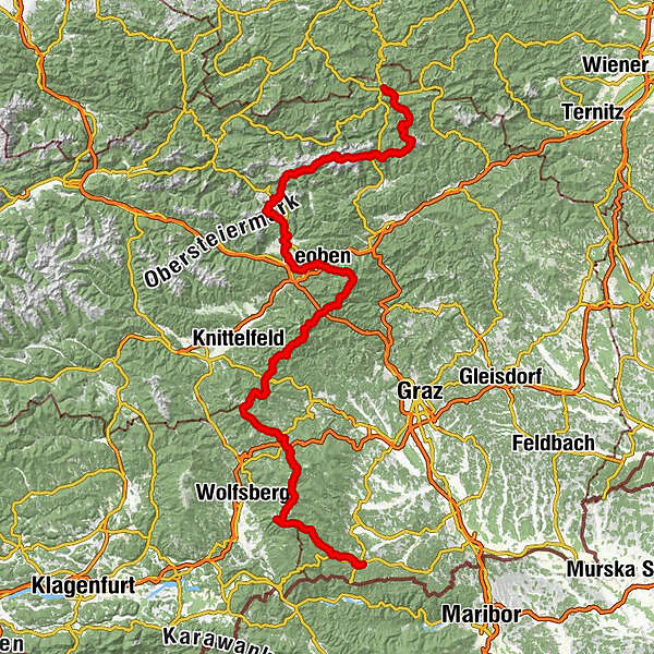
The North-South Long Distance Trail 05 was opened in 1970 and is one of the oldest long distance trails in Austria. It starts at the 1,017 m high Nebelstein in the upper Waldviertel and runs largely in a southerly direction into the Styrian wine country to Eibiswald. On its way it touches the manifold landscape forms and encounters cultural assets of Austria. Except for the area of the Hochschwab and the Eisenerzer Reichstein (here, surefootedness and a head for heights are required in some places), it can be considered a long-distance hiking trail for the whole family.
- Difficulty
-
difficult
- Rating
-
- Starting point
-
Mariazell
- Route
-
Mariazell0.1 kmMichaelskapelle0.2 kmSt. Josef0.2 kmGasthaus "Zur Weinperle"2.6 kmMooshubenwirt5.3 kmHerrenboden (1,402 m)13.2 kmHalterhütte Ochsenboden14.7 kmWeißalm15.9 kmWetterl16.9 kmWetterinalm Sennhütte17.5 kmBerggasthof Plodererhof18.4 kmHohe Veitsch (1,981 m)24.6 kmGraf Meran Haus25.0 kmTeufelssteig25.7 kmRotsohlalm27.4 kmGöriacher Alm34.6 kmStrobl-Hütte34.7 kmSeebergalm37.5 kmKatholische Pfarrkirche St. Leonhard Seewiesen39.7 kmSeewiesen39.8 kmHotel Restaurant Seeberghof40.1 kmFlorlhütte (1,284 m)45.3 kmHöllkampl (1,449 m)46.4 kmVoisthalergasse47.5 kmKleiner Hochschwab (2,248 m)52.1 kmHochschwab (2,277 m)52.4 kmG'hacktkogel (2,213 m)53.4 kmHäuslalm Hütte59.5 kmSackwiesenalm (1,450 m)60.0 kmSonnschienhütte62.6 kmHörndlalm65.0 kmKulmalm66.9 kmHirscheggsattel (1,699 m)72.5 kmLeobner Hütte73.2 kmPolsterkar Höhle73.4 kmKnappensteig Alm74.6 kmPräbichl (1,226 m)76.4 kmPräbichlerhof76.9 kmReichensteinhütte81.3 kmReichenhals82.1 kmKrumphals (1,700 m)83.5 kmKrumpenbachfall84.8 kmTauchendsattel (950 m)90.0 kmKrumpen91.6 kmKranewitter Kapelle92.9 kmHafning93.6 kmKurzheim94.9 kmJausenstation Gößbachstüberl95.5 kmTrofaiach97.9 kmObergausendorf98.7 kmGausendorf99.0 kmWaasen113.0 kmLeoben113.5 kmSt. Alfonskirche113.6 kmSpitz Christi118.5 kmMugelschutzhaus123.6 kmMugel (1,630 m)123.6 kmTrasattel (1,304 m)125.8 kmHochalm (1,580 m)128.6 kmAlmwirt (1,170 m)131.9 kmPöllasattel (1,270 m)133.6 kmFensteralm (1,642 m)137.3 kmPolsterkogel (1,608 m)140.1 kmPolstersattel (1,505 m)140.5 kmEiblkogel (1,831 m)142.4 kmKreuzsattel (1,583 m)144.4 kmLärchkogel (1,894 m)146.2 kmSpeikkogel (1,988 m)148.8 kmGleinalm Schutzhaus150.0 kmMaria Schnee150.1 kmScherzberg (1,624 m)167.0 kmDr.Otto-Koren-Hütte (1,550 m)170.2 kmGaberl170.4 kmGaberl (1,551 m)170.7 kmGaberlhaus170.7 kmAltes Almhaus173.7 km1580175.5 kmRappoldkogel (1,928 m)177.9 kmHirschegger Sattel179.7 kmSalzstiegelhaus179.8 kmPeterer Sattel (1,745 m)183.3 kmHirschegger Alm (1,871 m)187.6 kmBernsteinhütte191.5 kmKnödelhütte194.2 kmSamerkreuz198.1 kmPack198.7 kmPfarrkirche hl. Martin198.9 kmFichtenhof und Hebalmranch206.0 kmWildbachsattel (1,605 m)214.7 kmWeberkogel (1,805 m)215.8 kmPauluskapelle217.7 kmWeinofenblick218.0 kmWeinofen (1,726 m)219.0 kmHühnerstütze (1,989 m)223.3 kmSeespitz (2,066 m)225.2 kmGroßer Speikkogel (2,140 m)226.0 kmKoralpenhaus226.8 kmKleiner Frauenkogel (1,861 m)231.6 kmDie Kramerin235.6 kmBrendlhütte237.4 kmSankt Oswald ob Eibiswald247.5 kmHöchwirth Kapelle252.1 kmAussichtsturm Garber254.8 kmBuschenschank Garber254.8 kmKreuzkirche258.4 kmPizzeria & Kebaphaus MEMO258.6 kmEibiswald258.9 kmHasewend’s Kirchenwirt259.2 kmPfarrkirche Maria im Dorn259.2 km
- Best season
-
JanFebMarAprMayJunJulAugSepOctNovDec
- Description
-
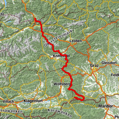
The Styrian part of the 05 trail reflects the diverse landscapes of Styria. We start in the Marian pilgrimage site of Mariazell in the midst of the mountain landscape of Upper Styria, cross alpine mountain massifs such as the Hochschwab, visit the second largest city in Styria, Leoben, and finally land in the midst of the wine country in the southwest of Styria in Eibiswald in Schilcherland. Here, as already in the area of the Hochschwab or the Koralm, we meet the hiking route "From Glacier to Wine", which leads on a north and a south route from the Dachstein glacier to the Styrian wine country.
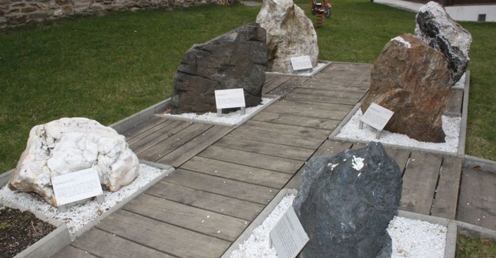
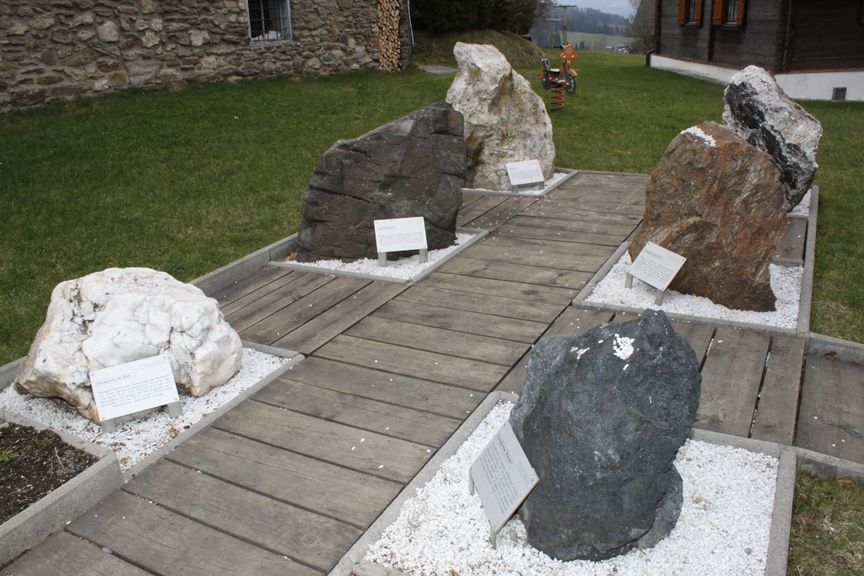
Before we start, a visit to the Mariazell Basilica is almost a must. Then we start towards Hochschwab, which we cross and thus the highest peak on the tour is already behind us. Especially in spring and summer, the Hochschwab impresses with its abundance of flowers, but also the largest occurrence of chamois in Europe. We continue via the city of Leoben, which due to its location on the Mur cycle path is also dedicated to cyclists and culture lovers, to the Koralm area, where we come across the Koralm Kristall Trail of the same name. At the summit of the Großer Speikkogel with its 2,140 m, we branch off to Eibiswald, the long-distance hiking center of Austria par excellence, since several trails converge here, including the well-known Mariazeller Weg 06.
- Directions
-
The following stage division is only one of many variants - our tip: Just hike and let yourself be driven and guided by the impressions, whether landscapes or culinary temptations. And if you particularly like it in one place, settle down. However, since we are traveling in alpine terrain throughout, good planning and, especially in the high season at the refuges, advance reservation of your accommodation the following evening is essential.
1st day stage
Mariazell (868 m) - Mooshuben (899 m) - Niederalpl (1.224 m) - Graf Meran Haus (1.836 m)
At the beginning of our tour through Styria we move along the well-known Mariazell trail - only in the opposite direction. From Mariazell we pass the popular ski touring mountain Tonion and reach the Niederalpl in the nature park Mürzer Oberland. From here it is now almost the entire time uphill towards the Hohe Veitsch summit to the Graf Meran Haus just below the summit. Depending on the weather, however, a visit to the summit at sunset or sunrise is an absolute must.
Length: about 27 km
2nd day stage
Graf Meran Haus (1.836 m) - Turnauer Alm (1.385 m) - Seewiesen (974 m) - Voisthalerhütte (1.654 m)
From the Hohe Veitsch, the route first leads across beautiful alpine pastures to Seewiesen, the eastern gateway to the Hochschwab massif. In the face of the Aflenzer Staritzen in the north, we hike through the Untere Dullwitz into the middle of the mountain range with the most chamois in Europe, the Hochschwab, and soon reach our destination for today, the Voisthalerhütte.
Length: about 25 km
3rd day stage
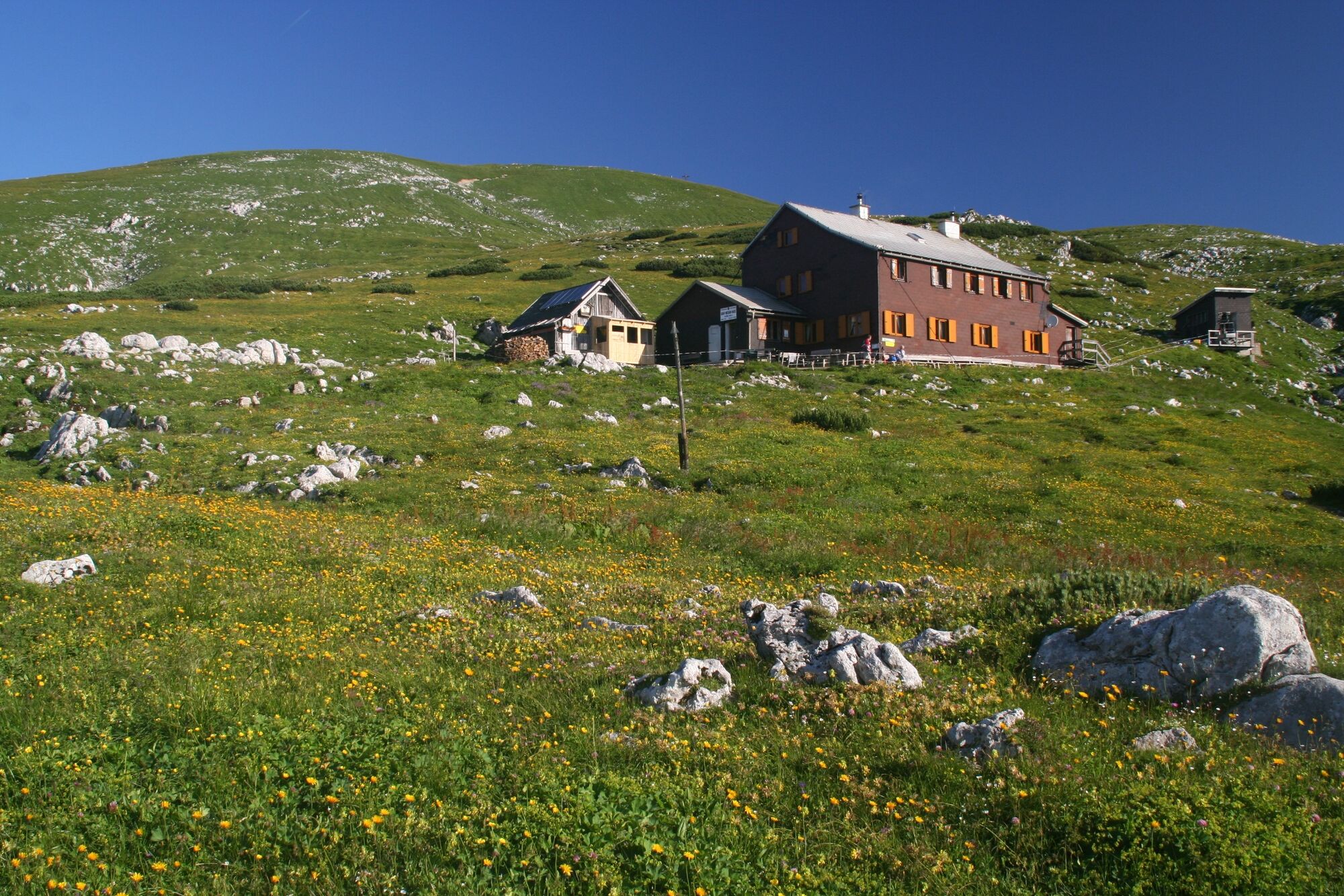
Voisthaler hut (1.654 m) - Schiestlhaus (2.153 m) - Hochschwab (2.277 m) - Sonnschienalm / hut (1.523 m)
Today, the highlight of the entire North-South long-distance hiking trail certainly awaits us, the summit of the Hochschwab. After a short stretch through the Obere Dullwitz we branch off onto the Graf Meran Steig and reach the ridge with the Schiestlhaus, the highest passive house in the Alps. From here it is only a short distance to the Hochschwab summit, whose panorama is unparalleled. Via the Fleischer bivouac, a bivouac box as emergency accommodation, and the Hundsböden we reach the Häuselalm, whose huts invite us to stop for a break. The trail continues across the impressive high plateau with its hundreds of peaks via the Sackwiesensee to the Sonnschienalm with its hut of the same name.
Length: about 17 km
4th day stage
Sonnschienalm / hut (1,523 m) - Kulmalm (1,424 m) - Neuwaldeggsattel (1,575 m) - Leobner hut (1,582 m) - Präbichl (1,232 m)
Shortly after the Sonnschienalm, the 05 trail and the Northern Alpine Trail 01, which has accompanied us for some time, separate. We walk over the Hörndlalm below the Hörndlmauer to the Kulmalm. The further way leads us past the Frauenmauerhöhle, which can also be visited in the company of a guide, to the Leobner Hütte. From here it is not far to the Präbichl, a saddle that separates the Mur and Enns valleys and offers several restaurants and accommodation facilities.
Length: 15 km
5th day stage
Präbichl (1.232 m) - Reichensteinhütte (2.128 m) - Krumphasl (1.700 m) - Hirnalm (934 m) - Trofaiach (658 m)
The Präbichl not only separates the two valleys, but is also the transition from the Hochschwab massif to the Eisenerz Alps. First, the ascent to the Reichensteinhütte at the foot of the Eisenerzer Reichenstein awaits us, a beautiful panoramic mountain, which, however, also requires alpine experience for the ascent. From here, the trail descends via serpentines to the Krumpensee and the Krumpenalm. The rest of the route takes us across alpine pastures and finally to the town of Trofaiach, which invites us to take a stroll after the lush nature experiences.
Length: about 23 km
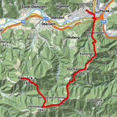
6th day stage
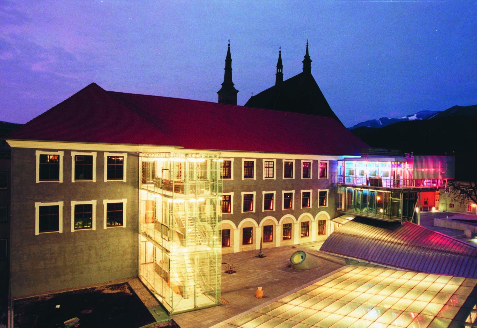
Trofaiach (658 m) - Lake Traboch (637 m) - lowland (880 m) - Leoben (541 m) - Schmollhube (1,150 m) - Mugel (1,630 m)
At the beginning there is an easy uphill and downhill between the cities of Trofaiach and Leoben on the program. Leoben, the second largest city in Styria impresses with a beautiful main square, an impressive museum center and the famous Gösser beer brewery, which you can also visit including a museum. Afterwards it goes for us again uphill, partly quite steeply, on the house mountain of the Leobner, the Mugel with its shelter.
Length: 30 km
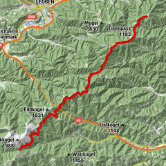
7th day stage
Mugel (1,630 m) - Trasattel (1,304 m) - Hochalm (1,642 m) - Fensteralm (1,642 m) - Lärchkogel (1,894 m) - Speikkogel (1,988 m) - Gleinalm (1,586 m)
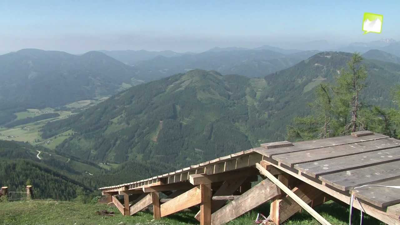
Today a steady up and down awaits us on a tour over alpine pastures and through shady forests. The unwooded hilltops of the Gleinalm are particularly beautiful and offer great views, bringing us to our stage destination, the Gleinalm Schutzhaus. Trail companion on a large part of our today's stage is also the Central Alpine Trail 02, which continues to the Schladminger Tauern.
Length: about 29 km
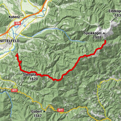
8th day stage
Gleinalm (1.586 m) - Roßbachalm (1.780 m) - Oskar Schauer Sattelhaus (1.394 m) - Turneralm (1.480 m) - Gaberl (1.547 m)
At the start, the beautiful Maria Schnee church welcomes us. The path leads us further out to the Roßbachalm, where the summer pastures of the Lipizzaner horses are located in the immediate vicinity. Via the Terenbachhütte and the Oskar Schauer Sattelhaus we reach the Turneralm, where the Zentralalpenweg 02 leaves us. Passing the Ofnerkogel we soon reach the Gaberl with its inns.
Length: about 22 km
9th day stage
Gaberl (1,547 m) - Altes Almhaus (1,620 m) - Salzstieglhaus (1,543 m) - Peterer Sattel (1,745 m) - Hirschegger Alm (1,871 m) - Pack (1,116 m)
Today the route leads us over comfortable alpine pastures without big differences in altitude to the tranquil village of Pack on the Styrian-Carinthian border. The panoramic views in the direction of Styria and Carinthia are beautiful, as are the opportunities to stop for refreshments at the Bernsteinhütte or the Knödelhütte.
Length: about 29 km
10th day stage
Pack (1,116 m) - Hebalm (1,294 m) - Handalm (1,840 m) - Weinebene (1,668 m) - Großer Speikkogel (2,140 m) - Koralpenhaus (1,966 m)
From the village of Pack, almost the entire very long stage goes slightly uphill with a few short somewhat steeper intermediate climbs to the Koralm. Mostly we move on comfortable alpine pastures, which are crossed by paths and we can enjoy the views to the Karawanken as well as already with good distant view to the Styrian wine country.
Length: about 31 km
11th day stage
Koralpenhaus (1.966 m) - Brendlalm (1.566 m) - St. Oswald ob Eibiswald (747 m) - Eibiswald (651 m)
On the last stage the path leads us almost exclusively downhill. At first there are still alpine pastures, but then more and more often forests and meadows are our companions on our final tour, which also brings us to the village of St. Oswald, where a very short climb awaits us beforehand. Soon we are greeted by the first wine taverns until we reach our destination, Eibiswald, a beautiful village in the middle of the Schilcherland, which is also called the long-distance hiking center of Austria.
Length: about 33 km
- Highest point
- 2,263 m
- Endpoint
-
Eibiswald
- Height profile
-

- Equipment
-
Proper backpack packing makes many things easier: Pack heavy things first. The water bottle should always be within reach in a side pocket. All the things that are often needed, such as sunglasses, camera or hiking map, belong on top. An emergency kit, including blister plasters, belongs in every rucksack and it is always advisable to dress in layers.
- Safety instructions
-
Emergency call mountain rescue: 140
Tips when reporting an emergency – Answer these six WH questions: What happened? How many people are injured? Where did the accident happen (are there GPS coordinates)? Who is reporting the incident (callback number)? When did the accident happen? What is the weather like at the site of the incident?
- Additional information
-
Steiermark Tourismus
Tel. +43 316 4003
If you would like to hire a tour operator, simply book with Steiermark Touristik, the official travel agency of Steiermark Tourismus:
Tel. +43 316 4003 450,
The Steiermark Touren app, available free of charge on Google Play and the App Store (Android, iOS), offers detailed first-hand information: brief facts (length, duration, difficulty, ascent and descent/elevation gain, ratings), map, route descriptions, altimeter, compass, peak finder, navigation along the tour. You can also create your own personal lists of favourite tours and sites, store tours and destinations offline, use social media channels, and much more.
- Public transportation
-
Accessible by train and bus.
Detailed information about arriving by ÖBB (Austrian Federal Railways) can be found at www.oebb.at or on the Verbundlinie Steiermark website www.busbahnbim.at
With Verbundlinie’s BusBahnBim route planner app, planning your journey has never been easier: simply enter towns and/or addresses, stop names or points of interest to check all bus, train and tram connections in Austria. The app is available free of charge for smartphones – on Google Play and in the App Store
- Parking
-
Around Mariazell there are numerous parking facilities such as at the valley station of the mountain railroads. Please note that there are short term parking zones in the center area.


-

-
AuthorThe tour North South Long Distance Trail 05 through Styria is used by outdooractive.com provided.