Etappe 06: BergZeitReise - von Neuberg an der Mürz auf die Schneealm


- Brief description
-
Stage 6 - at a glance:
Start: Neuberg an der Mürz, tourist information, overnight accommodations: Tel.: +43 3857 8321, www.muerzeroberland.at
Cab services: Nature Park Hiking Taxi Tel.: +43 3857 20170
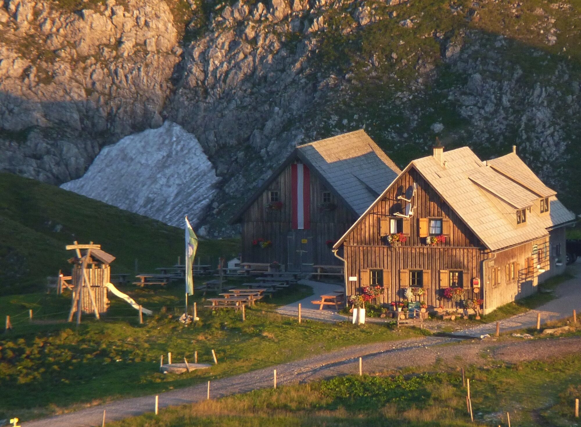
GPS grid N 47° 39' 47,5" E 15° 34' 44,3"Destination / overnight stop: Schneealpenhaus or alpine pastures on the Schneealm,Tel.: +43 3857 2190, www.schneealpenhaus.com
GPS grid N 47° 41' 46,8" O 15° 36' 34,6"
Stage length: 11 kilometers
Total walking time (without breaks): 5 ½ hours
Vertical meters ascent: 1,280 vertical meters
Meters of altitude descent: 255 meters of altitude
Difficulties: classic mountain hike, on the Schneealm plateau in bad weather / fog orientation not quite easy!
- Difficulty
-
difficult
- Rating
-
- Route
-
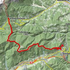
DorfMünster Neuberg0.0 kmNeuberg an der Mürz0.0 kmGasthof Schäffer0.1 kmAlpl0.5 kmSiebenquelle3.4 kmKarlbrunn (1,422 m)6.4 kmWindberg (1,903 m)10.2 kmSchauerkogel (1,788 m)12.0 kmSchneealpenhaus12.0 km
- Best season
-
JanFebMarAprMayJunJulAugSepOctNovDec
- Description
-
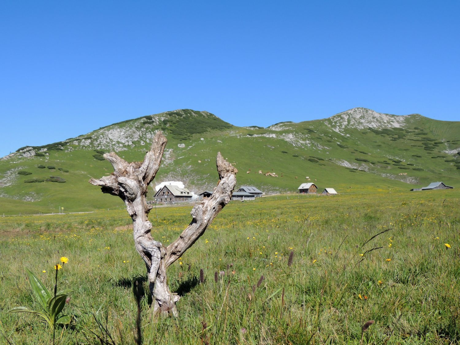
From the monastery of Neuberg, which is of enormous historical importance for the region, we climb steeply uphill to the heart of the Mürzer Oberland Nature Park - to the beautiful Schneealm with its (nomen est omen) numerous, mostly managed alpine pastures.
Here we are also on a stage of the hiking route From Glacier to Wine, which leads from Dachstein to the wine country and thus invites you to a journey of discovery through Styria.
- Directions
-
The main focus of this stage is the beginning and the end of the tour. At the beginning we have to reach the Neuberg district "Schlapfen" and there the Rudolfssteig. Our path then leads us directly to the Karlgrabensteig, which leads up to the Schneealm.
We first walk from the Neuberger Stift along the main road in a northwesterly direction. At a prominent rock standing directly to the right of the road, our path branches off to the right of the main road behind this rock and leads us uphill to the Schlapfen district. We follow the small road uphill to the last settlement houses and there keep left along the edge of the forest on a path that leads directly to the beginning of the Karlgraben.
Through this (marked) a partly quite steep path brings us to the high plateau of the Schneealm. At Karleck we keep to the right (towards the east) and soon reach the Michlbauerhütte. Across the wide plateau (beware of fog) we now walk leisurely to the already clearly visible Schneealpenhaus.
- Highest point
- 1,901 m
- Endpoint
-
Schneealm / Schneealpenhaus
- Height profile
-

- Equipment
-
Normal hiking gear, sturdy shoes, sun protection, jacket, hood and gloves. Do not forget a water bottle and a snack box! And just in case, pack a small pharmacy with blister plasters.
- Safety instructions
-
Difficulties: Classic mountain hike, on the Schneealm plateau in bad weather / fog orientation not so easy!
- Tips
-
In 1327, a Cistercian abbey was founded by Duke Otto the Happy in the present-day village of Neuberg an der Mürz. The gothic hall church of the abbey could only be completed in 1446. Today, the wooden roof truss with more than 1100 m³ of larch wood is considered the largest and most important in the German-speaking area . In 1786 Joseph II abolished the monastery and as a result the monastery church became the Neuberg parish church.
Emperor Franz Joseph I had the monastery adapted as a hunting lodge after 1850 and used it regularly for hunting stays. In addition, he had his own hunting lodge built in Mürzsteg in 1870, which has served as a summer retreat for the respective Federal President since 1947. When the Neuberg Railway was opened in 1879 as a standard-gauge branch line to the southern railroad line, the imperial family often traveled by train to Neuberg in the upper Mürz Valley. Passenger service was discontinued in 1996. In 2011, the Mürzzuschlag-Neuberg section was opened on the disused line as part of the R5 cycle route.
As early as the 15th century, the Neuberg monastery had started mining and iron production in the area. This reached its peak in the Neuberg ironworks in the 19th century with the largest steam hammer in the monarchy at that time . However, with the exhaustion of iron deposits in Altenberg, where mining had already been going on for centuries, the industry increasingly lost its basis; in 1924, the steel and rolling mill in Neuberg was shut down.
In the monastery there was already centuries ago briefly a glassworks . Since the summer of 2010, the "Kaiserhof" glass manufactory has once again been producing high-quality and artistic colored glass, and for many years the "Neuberg Culture Days" have formed one of the most important cultural initiatives in the region.
- Additional information
-
www.bergzeitreise.at, www.steiermark.com/wandern The Styria Tours app, available for free on Google Play and in the App Store (Android, iOS), offers detailed first-hand information: short facts (length, duration, difficulty, ascent and descent in altitude meters, ratings), map, route descriptions, altimeter, compass, summit finder, navigation along the tour. In addition, you can create your personal favorites list of favorite tours and points, save tours and destinations offline, play on social media channels and more.With the BusBahnBim app from Verbundlinie, timetable information has never been easier: all bus, train and streetcar connections in Austria can be queried by entering locations and/or addresses, stops or important points. The app is available as a free app for smartphones (Android, iOS) - on Google Play and in the App Store.
- Public transportation
-
With the BusBahnBim app from Verbundlinie, timetable information has never been easier:All bus, train and streetcar connections in Austria can be queried by entering places and/or addresses, stops or important points.The app is available as a free app for smartphones (Android, iOS) - on Google Play and in the App Store.
- Parking
-
Several parking possibilities in Neuberg an der Mürz.
- Author
-
The tour Etappe 06: BergZeitReise - von Neuberg an der Mürz auf die Schneealm is used by outdooractive.com provided.


General info
-
Hochsteiermark
4082
-
Naturpark Mürzer Oberland
1936
-
Neuberg an der Mürz
433